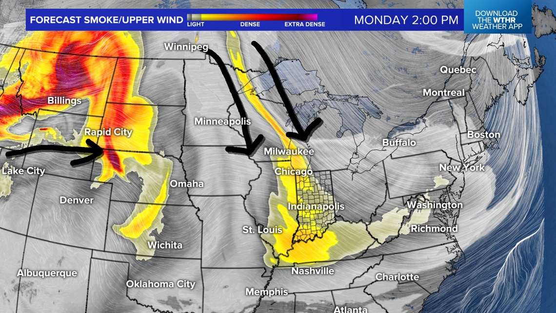
INDIANAPOLIS — Another stellar weather day in central Indiana. Pleasantly cool temperatures in the 40s this morning quickly warmed well into the 70s. The Muggy Meter remains very comfortable with dewpoints well in the 30s and 40s. You've probably noticed a hazier sky the past couple of days compared to the cobalt blue sky from Saturday.
This is result of remnant wildfire smoke from Manitoba/western Ontario getting blow southward due to the upper-level flow configuration. This layer is modeled to remain aloft and at this time we're not expecting widespread issues to air quality.
However, we do expect more elevated smoke remnants to arrive Tuesday into Wednesday from numerous wildfires in the western U.S.

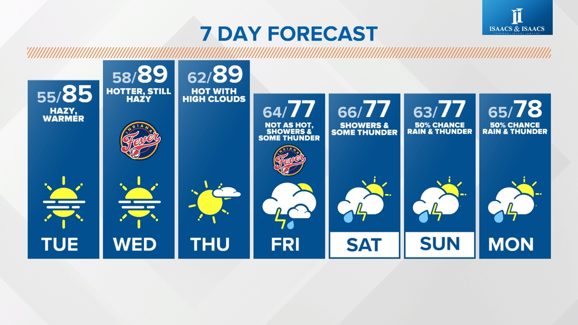
Heat Builds Into Mid-Week:
Highs today flirted with 80° as dry air and early September sun angle expected to do their job in the warming process in the days ahead. Descending air away from Francine's center of circulation adds until warmth from "compressional warming" and can result in highs being 3°-5° above modeled sometimes.
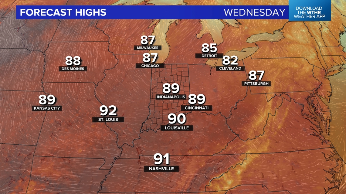
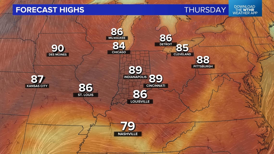
That's why we're bullish on Wednesday and Thursday potentially reaching/exceeding 90°. It's not record-breaking, but will be significantly hotter than this past weekend.


Francine Heading This Way?
This smoke layer may eventually "put on the brakes" due to the upper-level wind getting stalled and becoming variably in direction in response to the wind flow around Francine drifting northward later this week. So, an even hazier, milkier sky may evolve the next 48 hours.
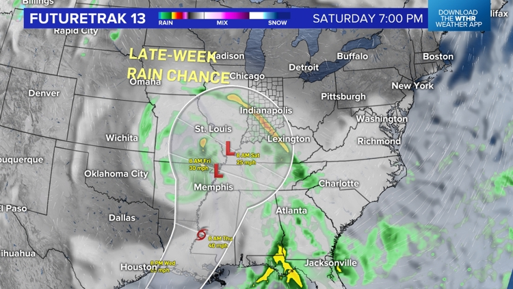
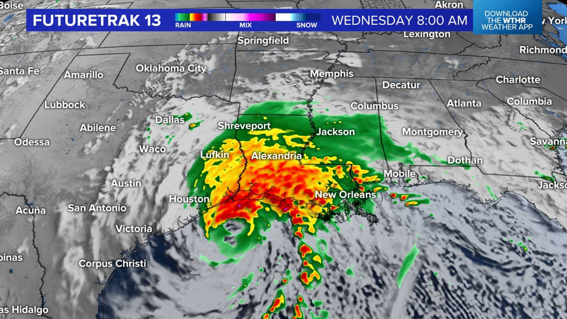
At the time of posting, Francine is now a Tropical Storm in the western Gulf of Mexico where it likely intensifies (possibly rapidly) the next 48 hours. We're expecting it to reach Hurricane status before a mid-week (sometime Wednesday) landfall... most likely somewhere along the Louisiana.


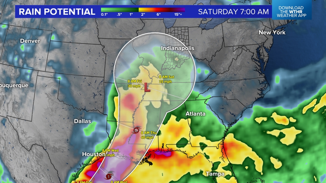
Modeling continues to trend toward the remnant circulation creeping north-northeast and arriving into the Ohio Valley on Friday into Saturday. While there remains a good deal of uncertainty on the track, strength, and specific local impacts remain highly uncertain this far out...the trends are our friend for some MUCH-needed rain in central Indiana.
At minimum, cloud cover lowers temperatures into the 70s beginning Friday...though the air gets more humid into the weekend. If you have outdoor plans Friday into the middle of next week you'll want to follow our updates closely as a potential scenario is for the circulation to become stalled and bring a daily chance of rain. Updates to come.