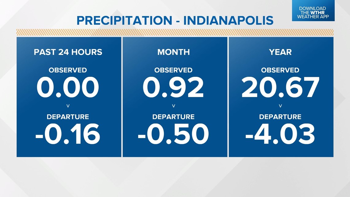
INDIANAPOLIS — As dry air returns to central Indiana Sunday, the rainfall deficit for Indianapolis grows to 0.5" for the month of July and returns to over 4" for the year.

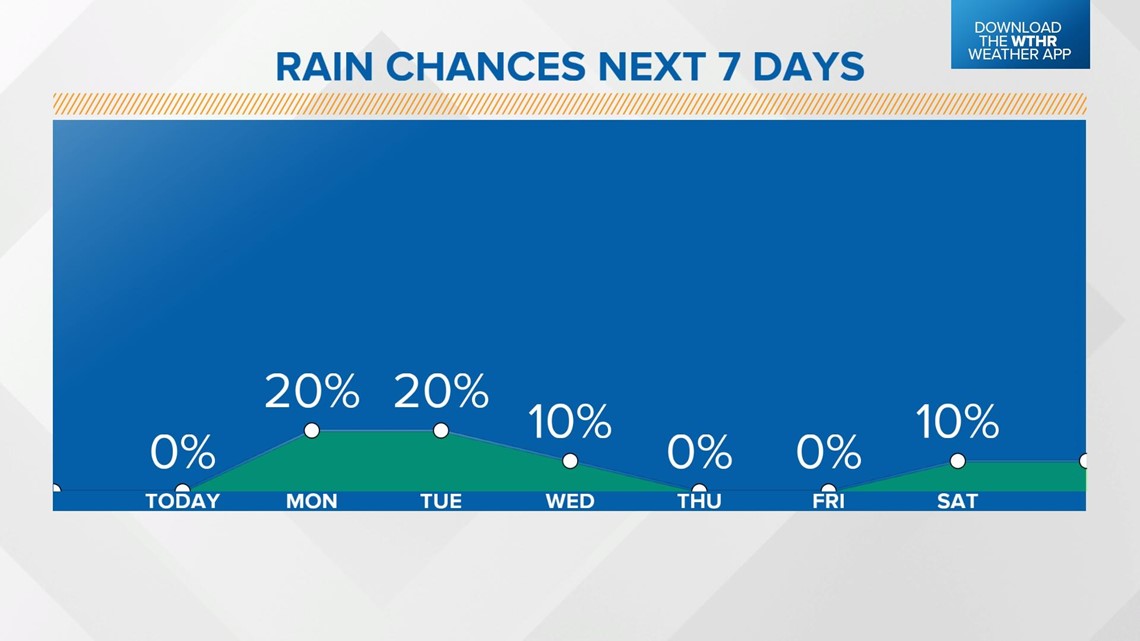
The lone chance for possible rainfall this week arrives late Monday. We have plenty of sunshine through the morning hours Monday as temperatures climb slightly above average to near 90 in the afternoon. A weak frontal boundary will track through the state starting in the late afternoon and will spark spotty storms across the northern tier of the state.

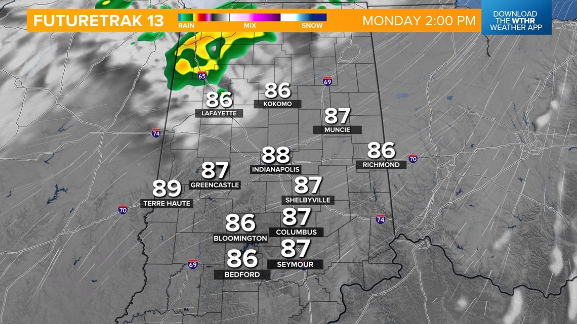

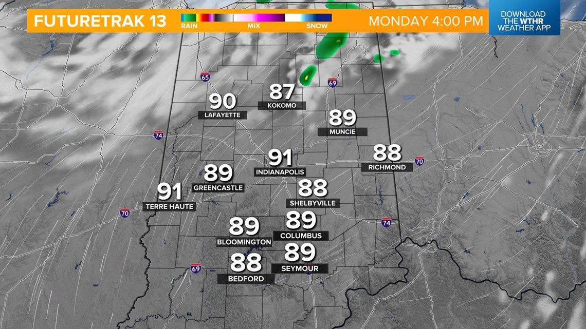
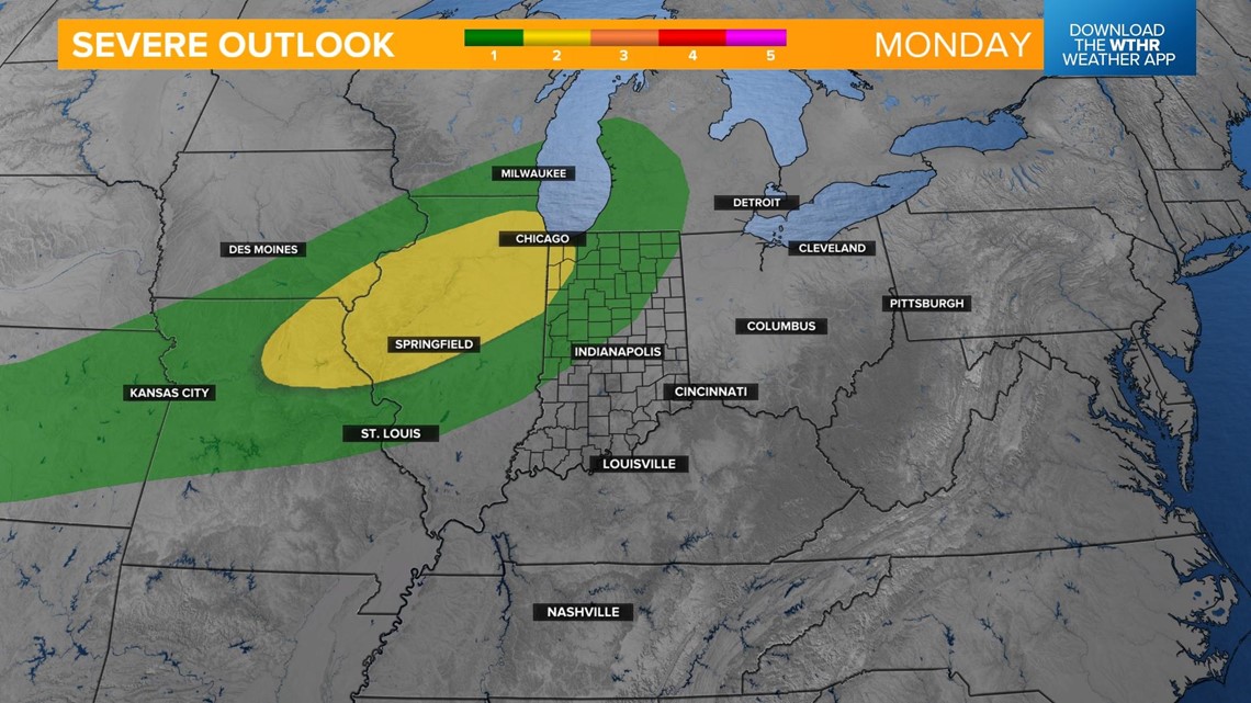
The Storm Prediction Center is watching this zone in northwest Indiana for the potential of a few stronger storms. The better chance for more widespread severe weather will be in northern Illinois.


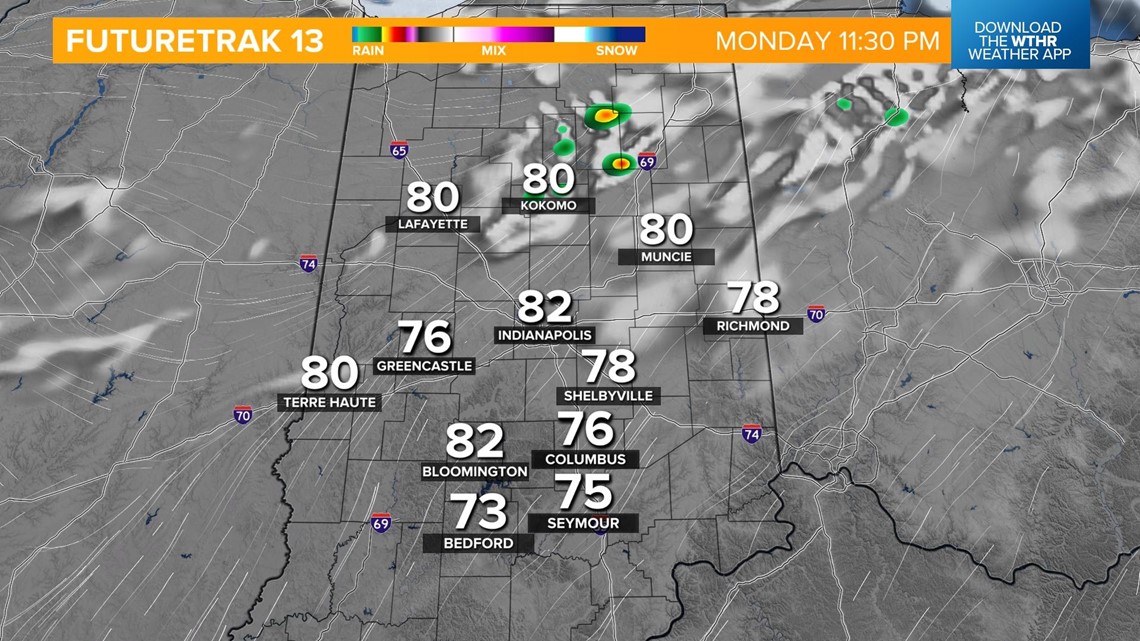
The rain will wrap-up in the pre-dawn hours Tuesday with clearing skies in the afternoon. Temperatures won't be quite as hot as Monday with highs in the mid 80s.
More seasonal conditions return for the rest of the week with highs in the mid 80s. The pattern remains rather quiet as well with mainly sunny skies through the remainder of the work week. No significant rain chances are in the extended forecast which will possibly worsen drought conditions throughout central Indiana.

