
INDIANAPOLIS — Central Indiana is in the midst of our first wintry storm system of the season. Temperatures hold steady just above freezing through the early afternoon around the Indy metro and south keeping this storm system mainly rain.
Along and north of the freezing line we'll see snow as the primary precipitation type between Lafayette and Kokomo.

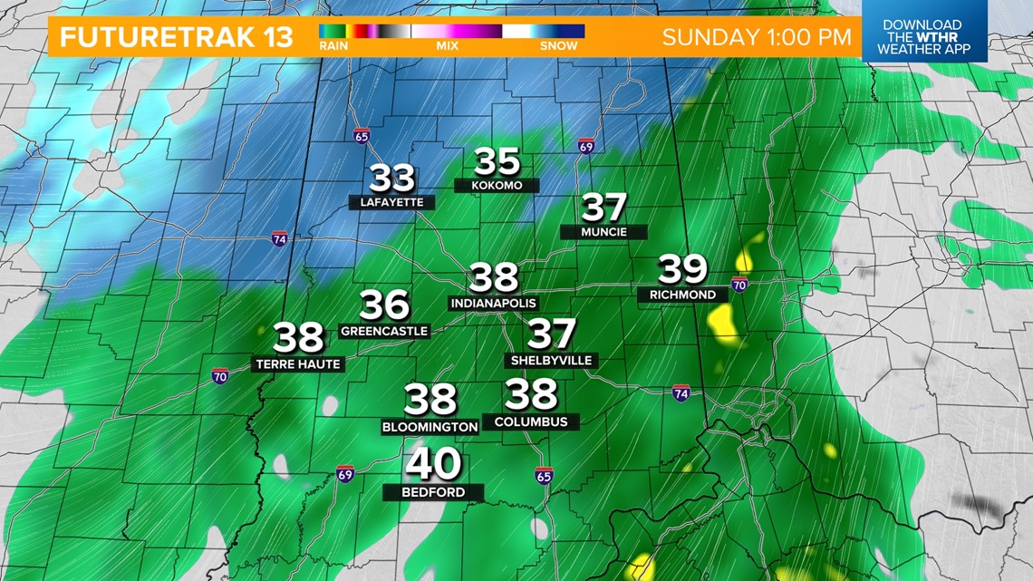
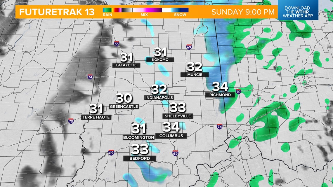
As temperatures start to drop this afternoon, we'll see the potential of a wintry mix. This system will taper off after 5 p.m. with gradually clearing skies late.

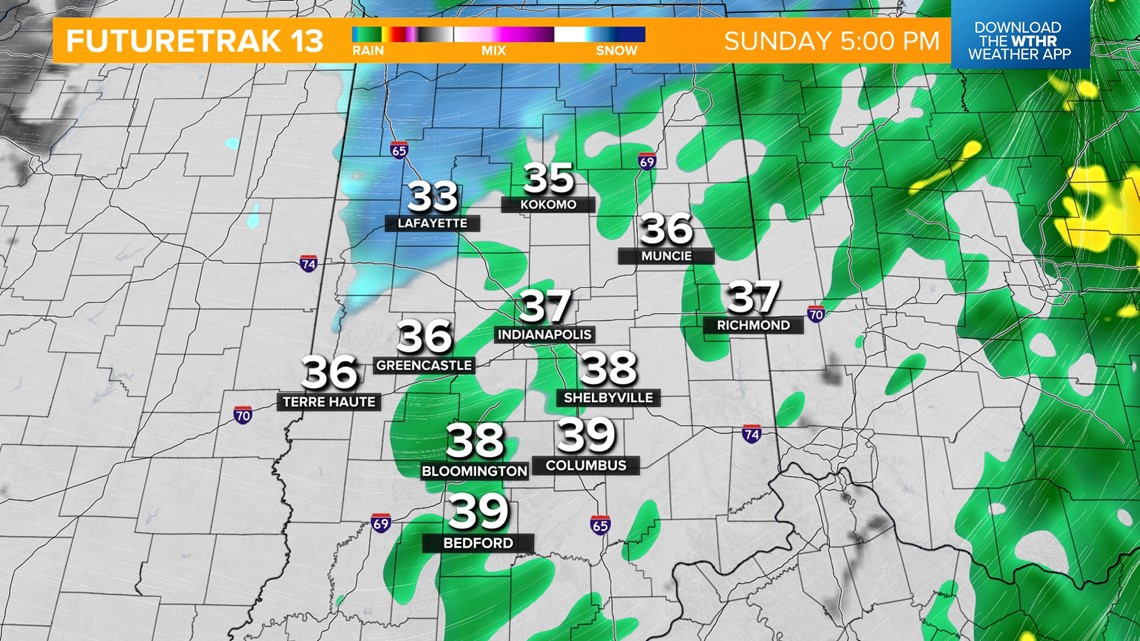

Any accumulation out of this system will be limited to the far northwestern tier of the state but travelers should be aware of slippery spots developing especially on bridges, overpasses, and elevated surfaces.
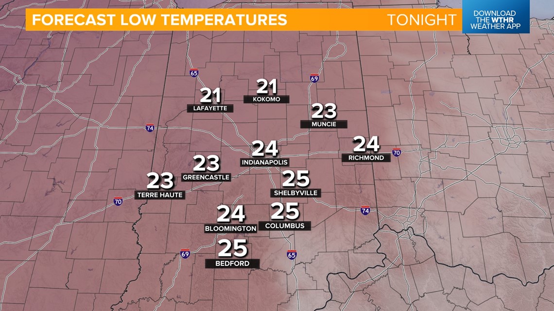
Arctic air will settle in tonight with overnight lows in the mid 20s. Use extra caution when traveling as refreezing/slick spots are possible.

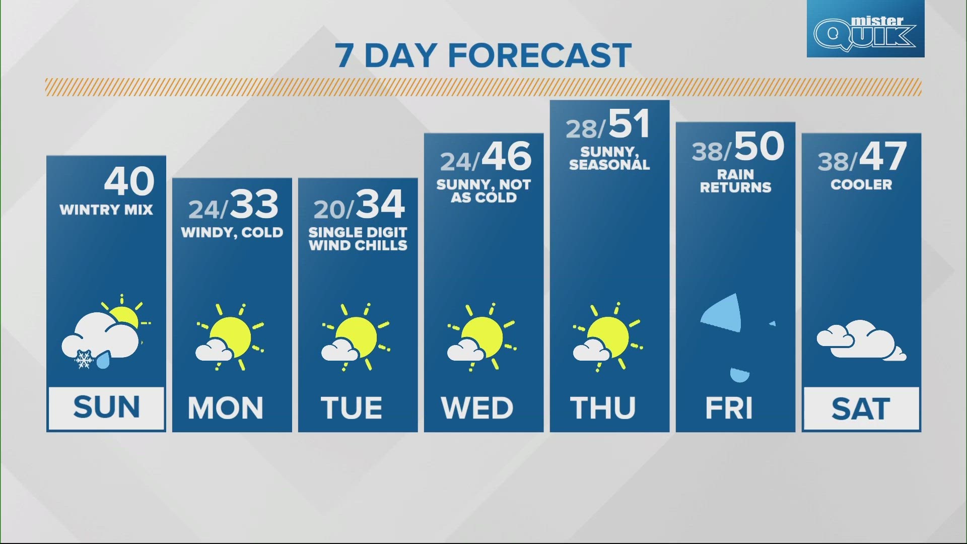
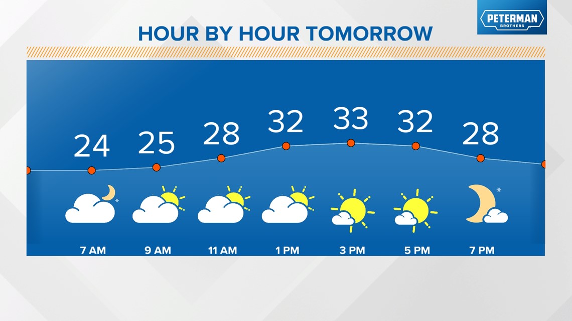
While sunshine returns for Monday afternoon, highs will barely make it above the freezing mark.

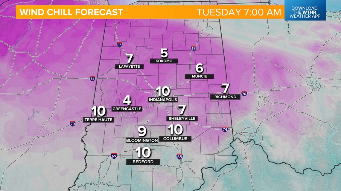
The coldest temperature in this stretch will be Tuesday morning when wind chills drop into the single digits. Highs again Tuesday will only be in the low 30s.

Temperatures will return to more normal levels by Wednesday with highs in the mid 40s. Thursday will be the warmest day in the extended forecast with highs in the low 50s ahead of our next storm system that brings rain back into the forecast by Friday.

