INDIANAPOLIS — The first winter storm of the season will create significant impacts Wednesday morning through Thursday night.
With the strong winds out of the south today, deep moisture is arriving, helping set the stage for precipitation. Rain will move in by late day today, if not before. As colder air arrives, rain will change over to snow.

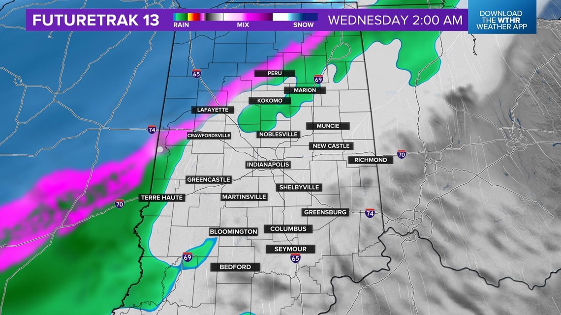

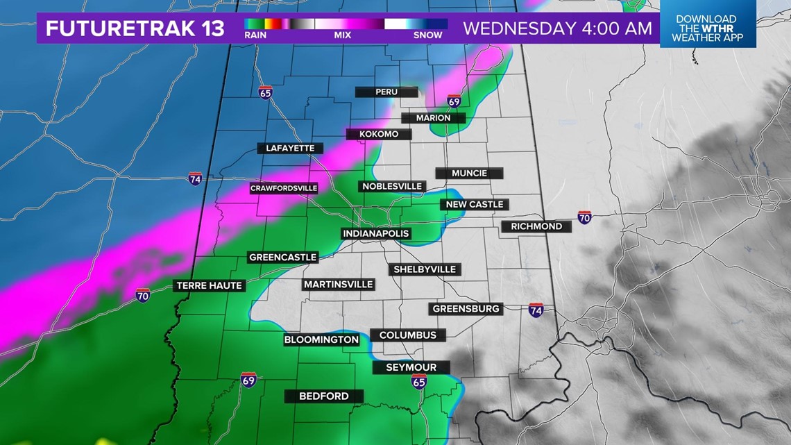
Steady snow will be likely in northwest central Indiana on Wednesday. A change over of rain to sleet to snow will be likely too, however, it should be short-lived. As the colder air wraps in on Wednesday afternoon, rain will change over to all snow, from northwest to southeast by late day.

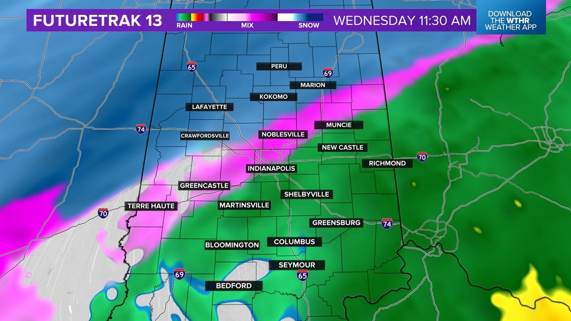

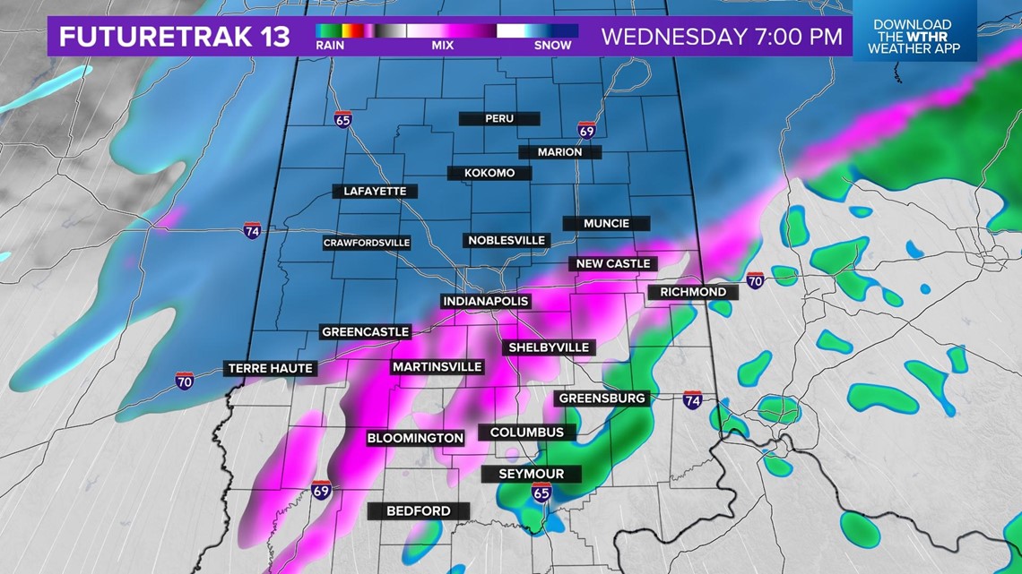
As the colder air arrives, this will be the time frame of light ice accumulation.

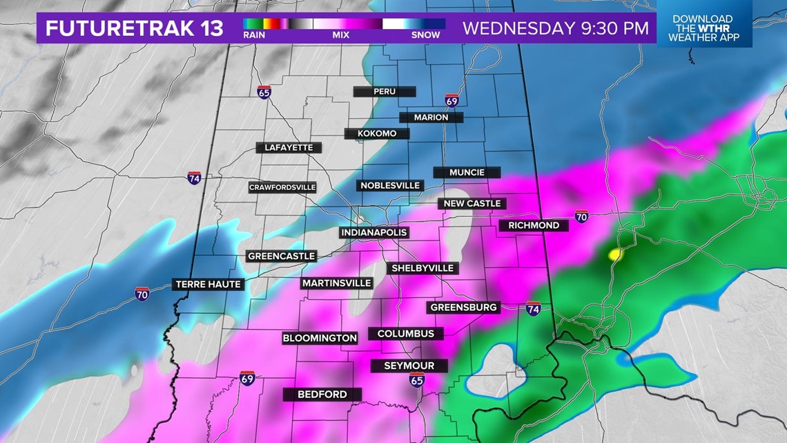
There will be a couple of hours of a lull in the the precipitation for most areas, from about 11 p.m. Wednesday through about 1 a.m. Thursday. By sunrise on Thursday, heavy bands of snow will be likely.

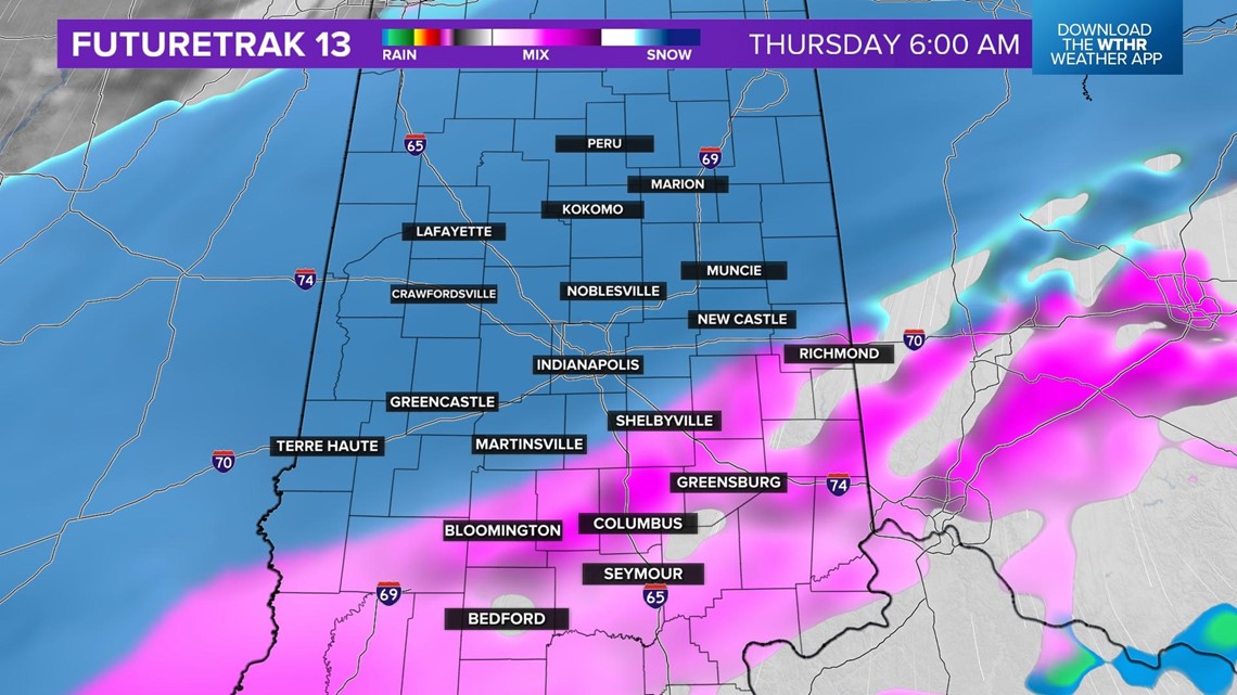
The snow will start to taper off by late afternoon from northwest to southeast.

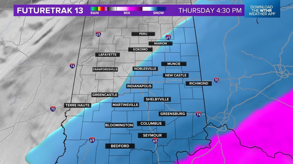
There is higher confidence now that this will be a significant event. Travel will be difficult or impossible in some locations during and likely after this storm. Here is the current snowfall map from the Live Doppler 13 Team.

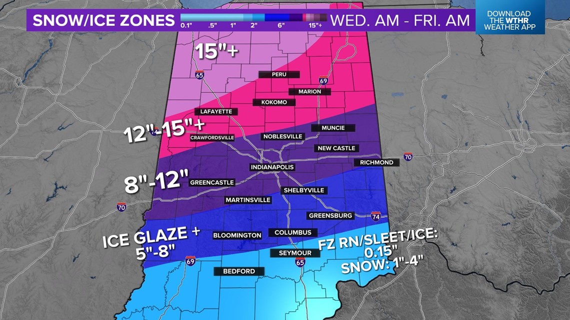
Northern and north central Indiana will get the highest snow amounts, as this area will be in snow for the duration of the storm. This map shows the potential snow depth through Thursday evening.

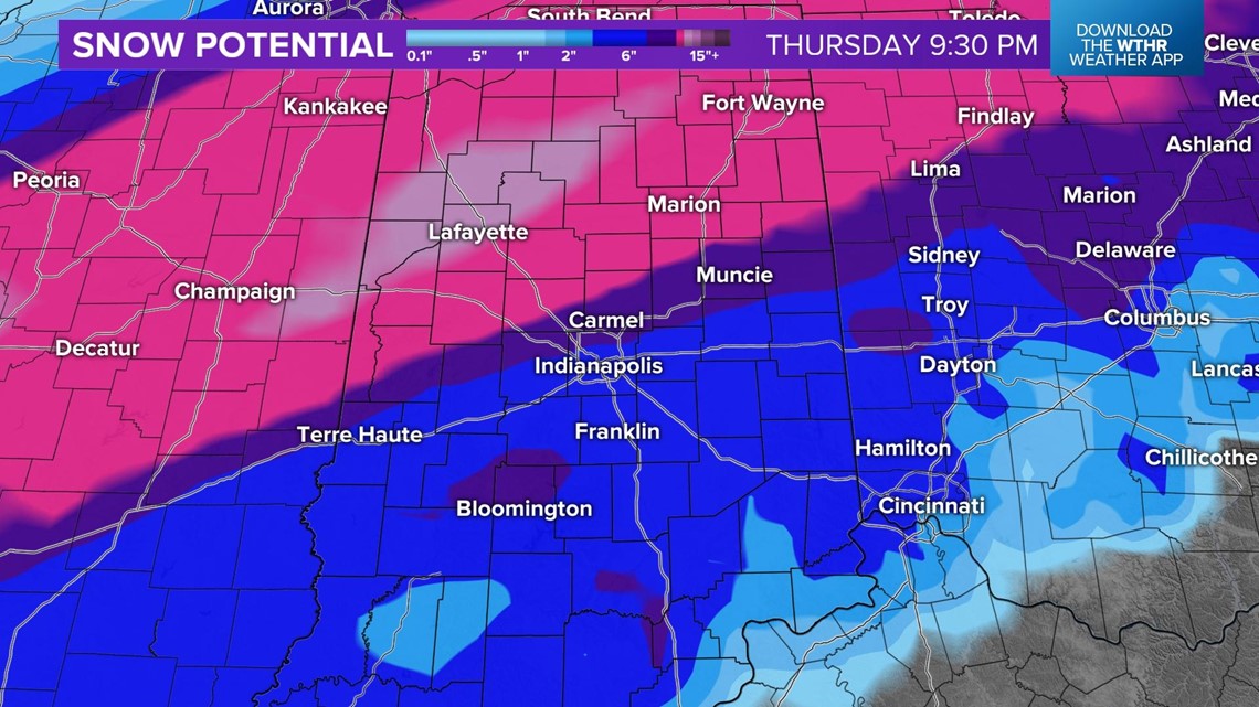
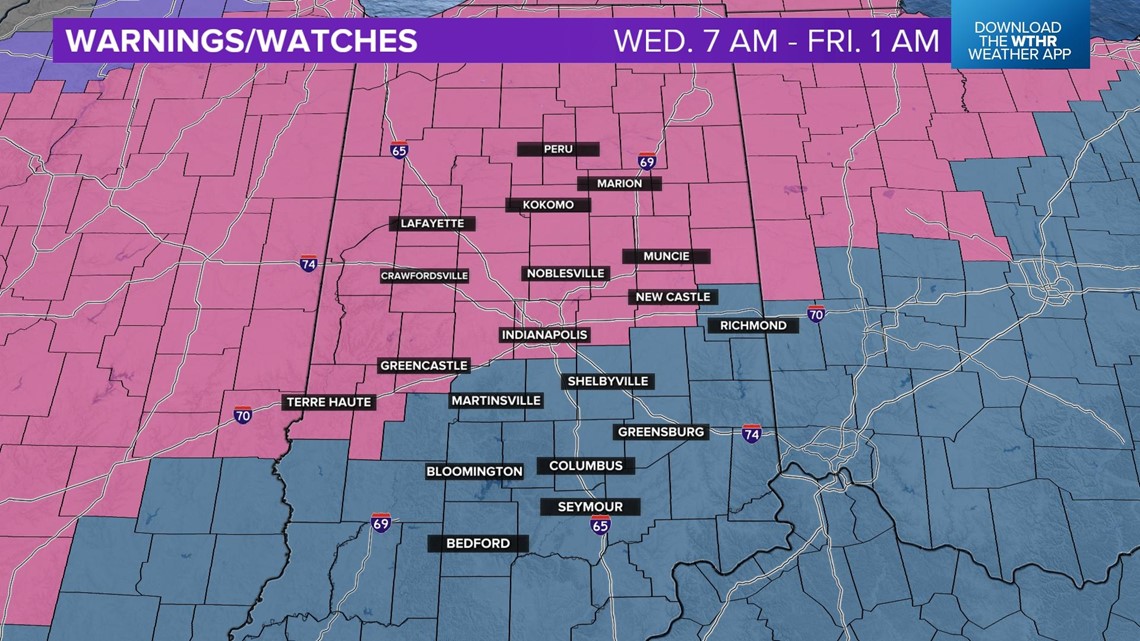
Winter Storm Warnings are already issued for much of central and northern Indiana, highlighted in pink, from the National Weather Service.

Please make considerations on your travels Wednesday, Thursday and even Friday, as the roads will likely be treacherous. Be safe!

