

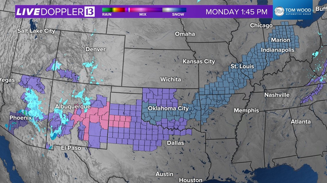
INDIANAPOLIS — Monday is a fairly benign weather day in central Indiana with a few peeks of sunshine in the afternoon mixing with some stubborn areas of flurries and light snow. We're expecting a near repeat performance Tuesday in advance of a winter storm that will bring a swath of heavy, wet snow over parts of central Indiana.
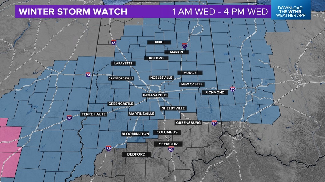
As expected, a Winter Storm Watch was issued for a good portion of central Indiana for the incoming storm. Over the next 24 hours, this becomes a Winter Storm Warning for some and Winter Weather Advisory for others as the forecast picture and confidence in track/amounts becomes clearer.


Main points

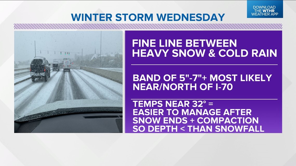
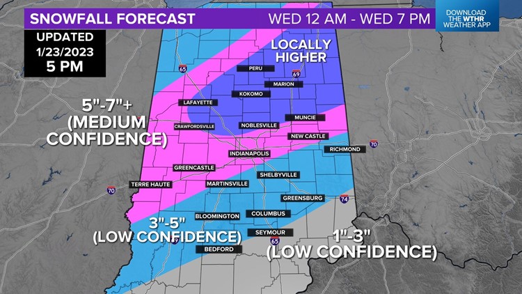
Heavy snow and difficult travel conditions are the main impacts, primarily between 1 a.m. and midday Wednesday and especially near/north of I-70 (though this could slide farther south in coming forecast updates).
Wind won't be much of a factor, which mitigates blowing/drifting.
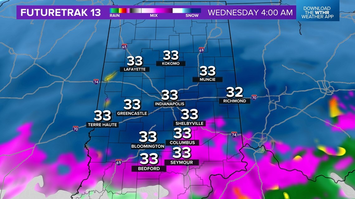
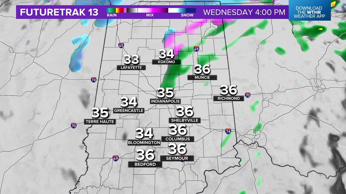
Temperatures hover around 32° during the duration of precipitation. This makes the snow more manageable for road crews after the heaviest snow rates depart.

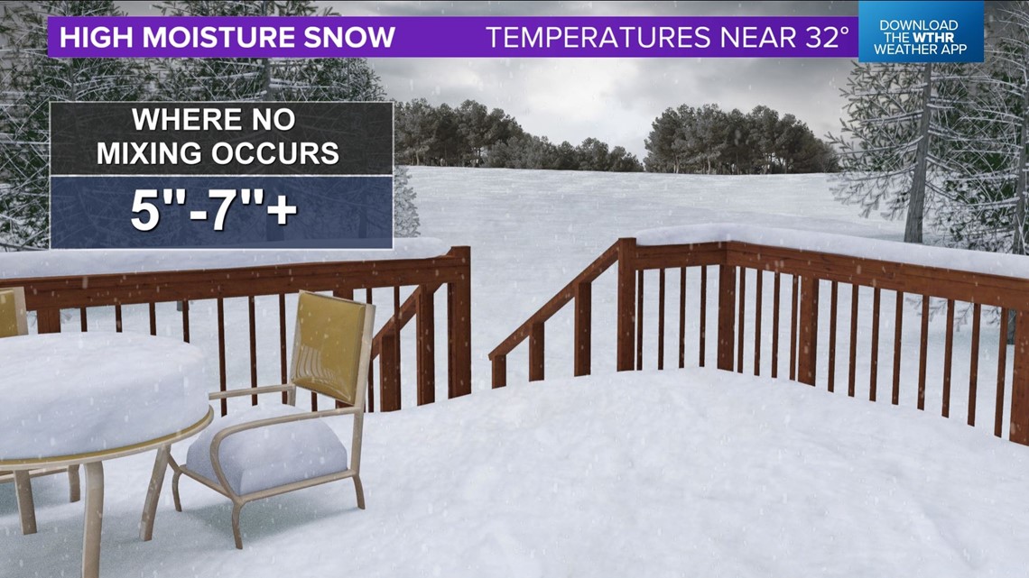

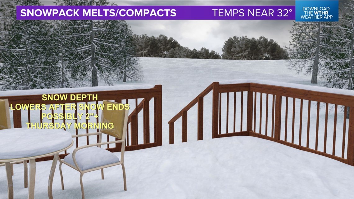
Due to the "warmer" temperature profile and high moisture content of the snow, it means there will be significant compaction and melting of the snowpack after the system departs. It's conceivable snow depth will be 2"-3" less than what actually falls from the sky.
There's a high degree of uncertainty on how far north the "mixing bowl" gets. That would be the area where there's a fine line between heavy snow and cold rain.

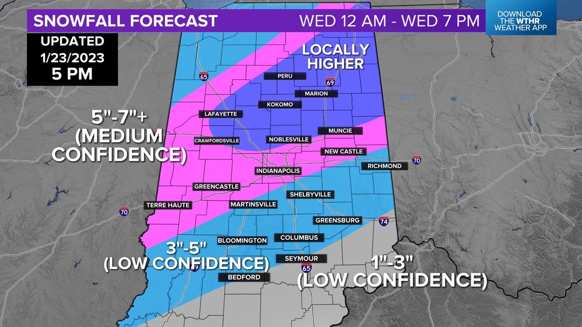
At this time, areas south of I-70 are most likely and what complicates the forecast in southern Indiana a great deal. Less mixing means more snow and vice-versa. South of I-70 is where we have the lowest confidence in precipitation-type and snow amounts.
Areas that don't have rain mixing (most likely near/north-northwest of Indy) are most likely to maximize the average modeled liquid equivalent of .70"+. That equates to 5"-7"+ snowfall within the main snow band.


Latest timeline
Timing: leading edge of precipitation crosses the Ohio River by 1 a.m. and bulk of heaviest precipitation quickly departs between 12 p.m. - 4 p.m.
Conclusion: plan on challenging travel conditions for the Wednesday morning commute but improving roads from south to north after midday.
This forecast remains subject to changes as we get closer and subtle shifts to the storm track. Please follow our forecast for updates.
Stay tuned with the latest updates on WTHR.com and on our WTHR news and weather apps.
