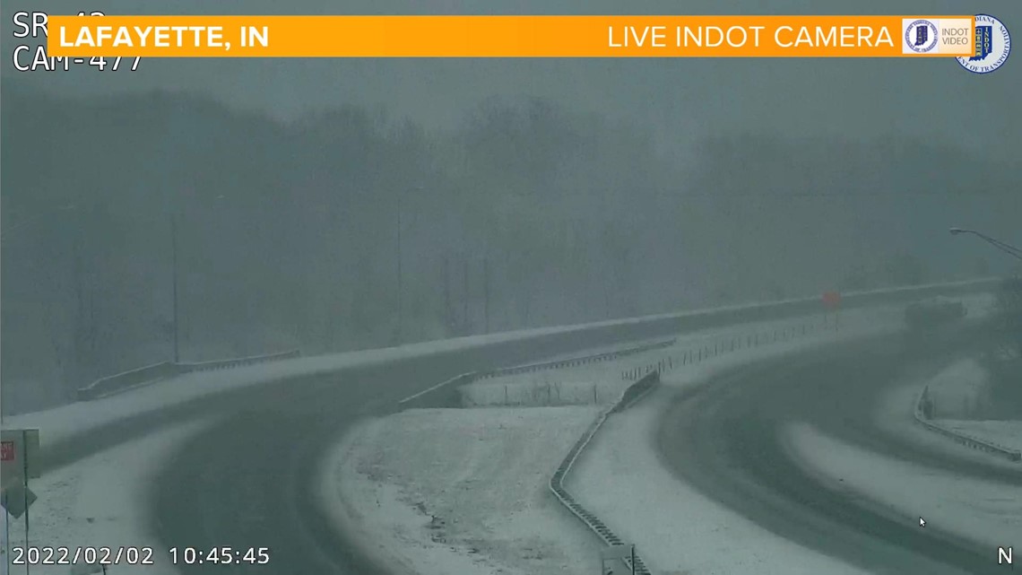
INDIANAPOLIS — The rain to snow transition in northwestern Indiana is playing out as anticipated with snow now falling from Lafayette to Peru.

The freezing line will work south through the day, with snow becoming the primary precipitation type around 3 p.m. for the Crawfordsville-Tipton line. Heavy bands of snow continue north.
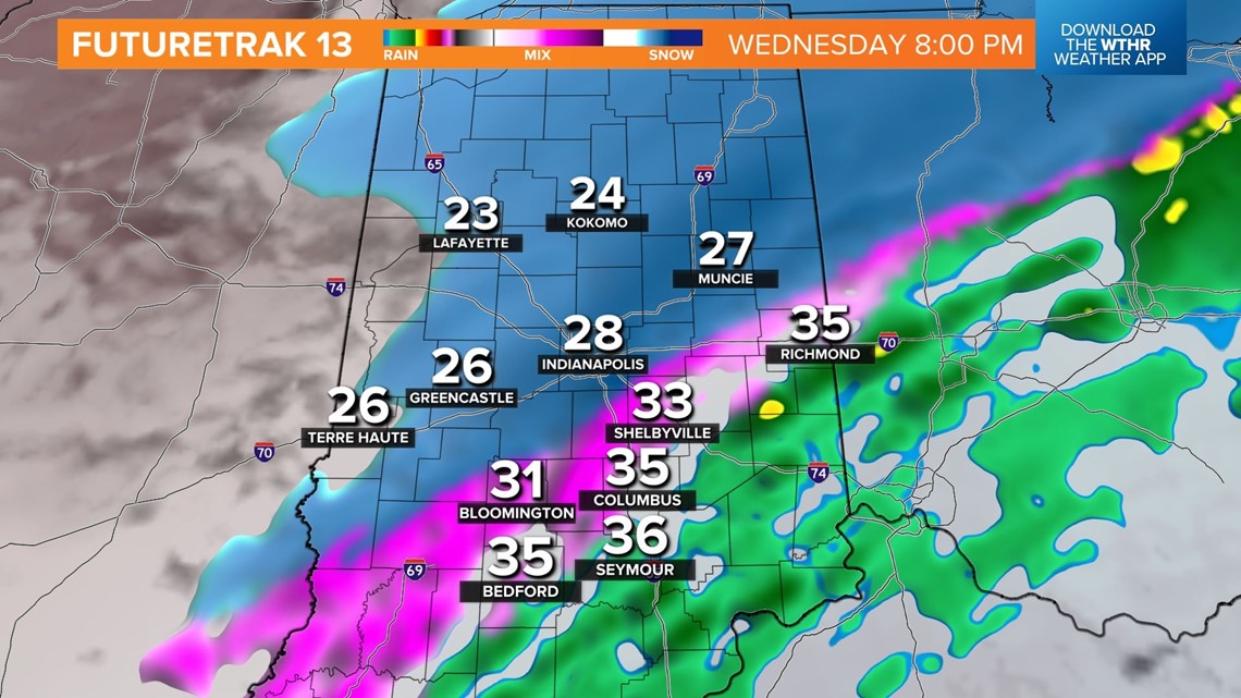
We do expect temperatures to fall from northwest-to-southeast across the metro area into the afternoon, with a range of 20s north of I-465 to the mid-30s south of I-465. So while roads may get slick in Boone and Hamilton counties with a wintry mix before 3 p.m., it will take longer for sub-freezing air to impact roads south of Indy into Wednesday evening.

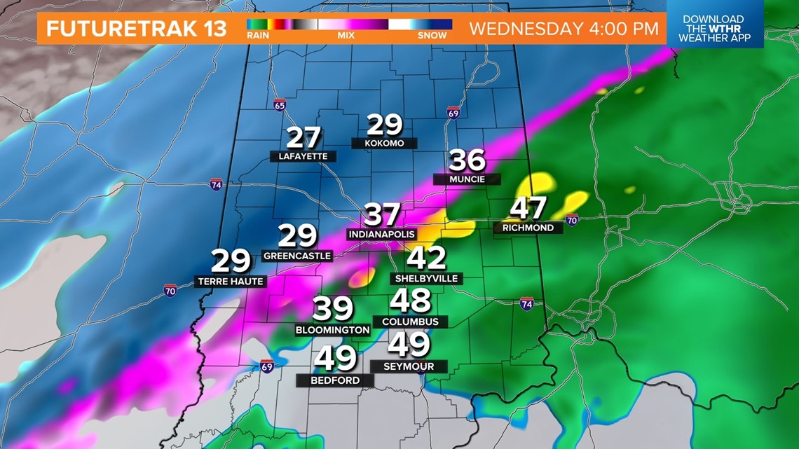
By 8 p.m., sub-freezing temperatures set up from Bloomington to Shelbyville will put a glaze on most roadways. We'll also see the transition to all snow through the metro.


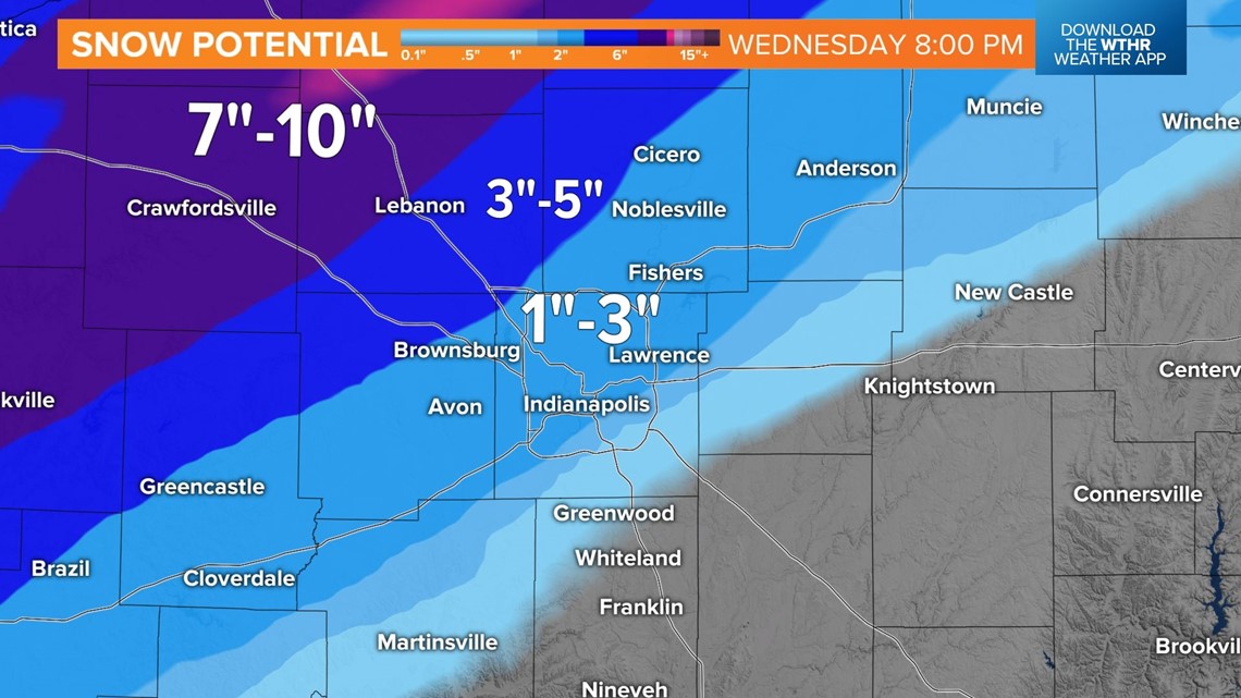
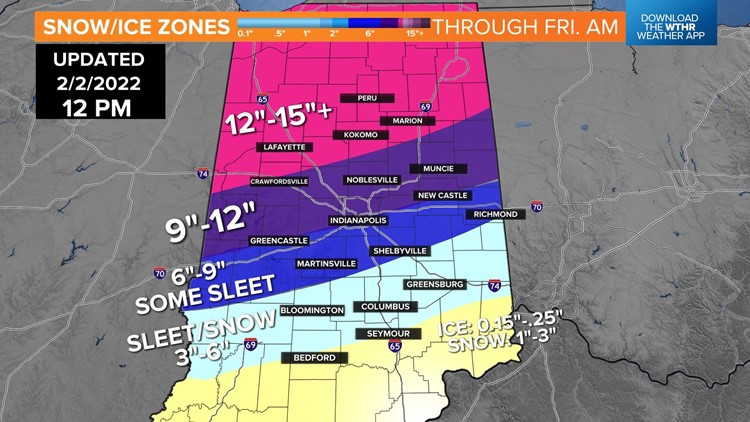
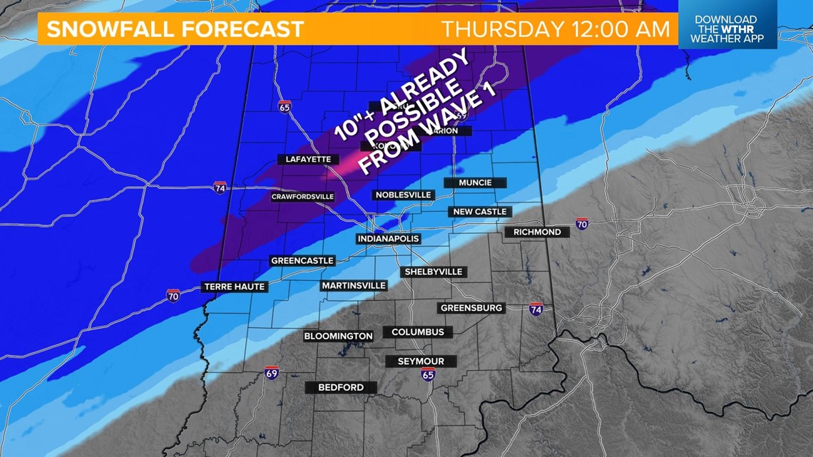
By the time this first wave wraps up and we get a lull in snowfall around midnight early Thursday, we're expecting potentially 10+ inches far north-northwest of Indianapolis from Kokomo to Lafayette.


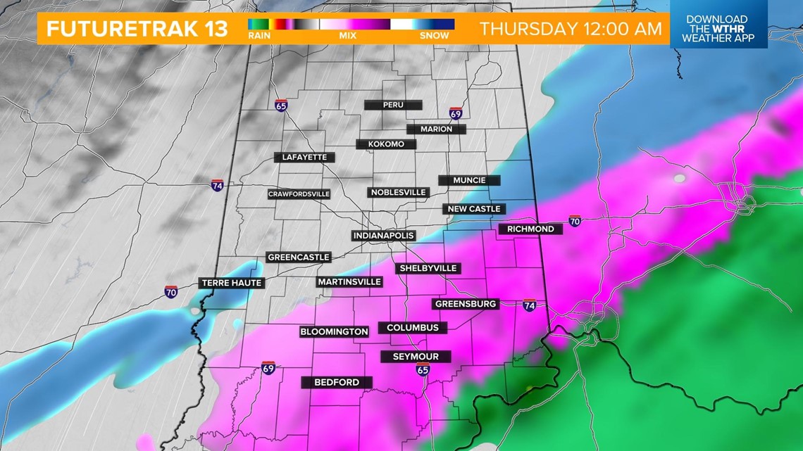
Snow fills back in, including the Indy metro, by 3 a.m. Thursday.

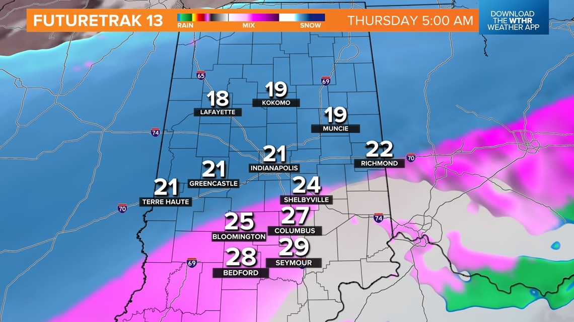
Snow and sleet, in addition to freezing rain over southern Indiana, continue overnight into Thursday morning, creating dangerously slick conditions. Heavy snow will be likely in areas north of the ice and travel becomes difficult as well.

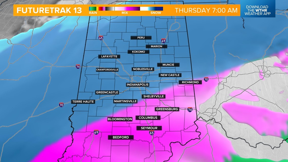
Snow will be heaviest along and north of I-70 in the morning and through the afternoon Thursday and begin to wrap-up closer to 7 p.m.

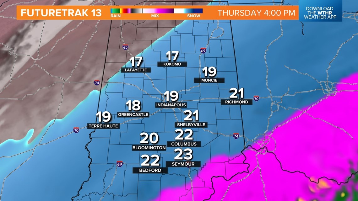

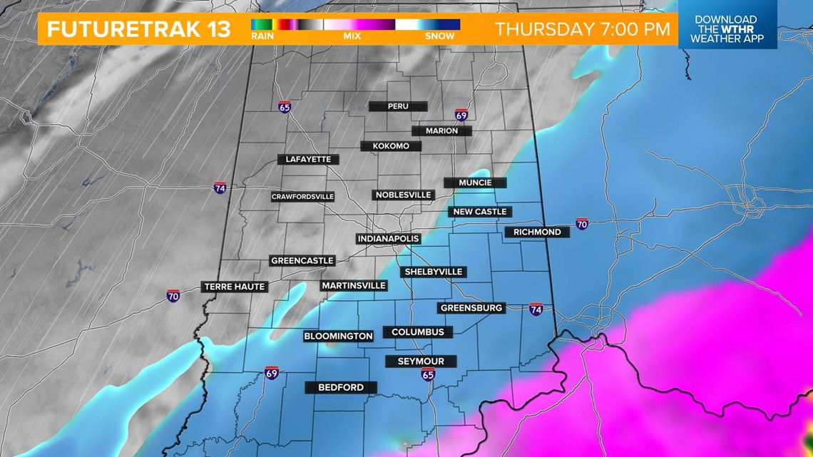
Our highest forecast confidence remains north of I-74, where snow will be the dominant precipitation type. Our greatest uncertainty is along I-70/74 (and south) due to potential for sleet.


Either way, travel will be difficult or impossible at times on Thursday into Friday due to bitter cold air following up the departing storm.
Stay tuned to WTHR for the latest storm updates and you can always get the latest information on the Live Doppler 13 Weather App.