INDIANAPOLIS — Dangerous heat and humidity have arrived in central Indiana – the hottest air in a decade, in fact.
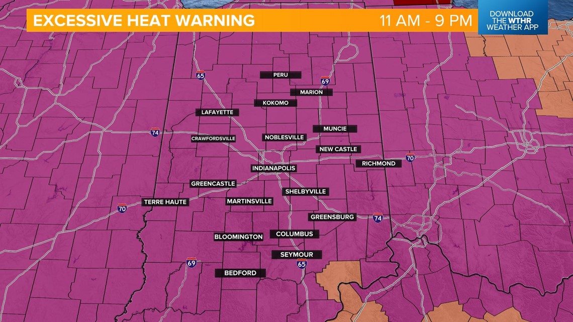
An Excessive Heat Warning will be in effect today from 11 a.m. to 9 p.m.
Take all those precautions to stay safe, including limiting outdoor time, staying well hydrated, and wearing lightweight, loose clothing if you have to be outside.

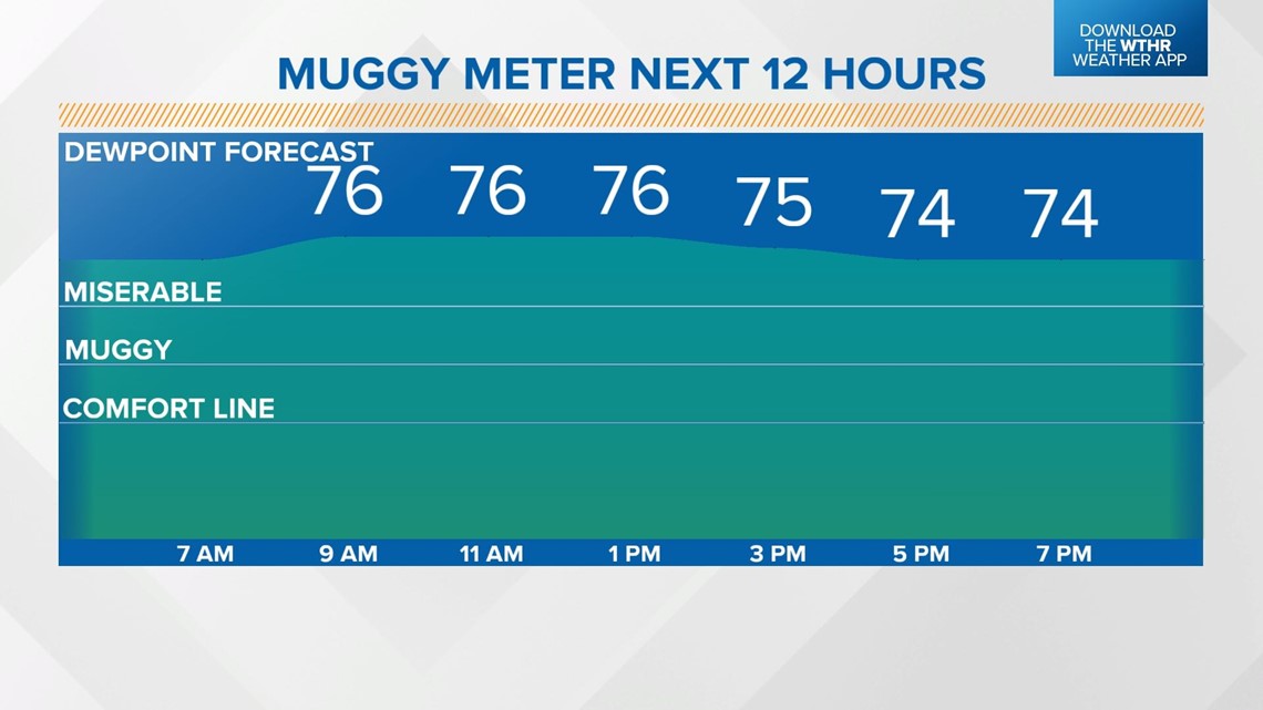
Our "muggy meter" has been in the miserable category all morning long and will stay that way this afternoon with dew point temperatures in the mid-70s.

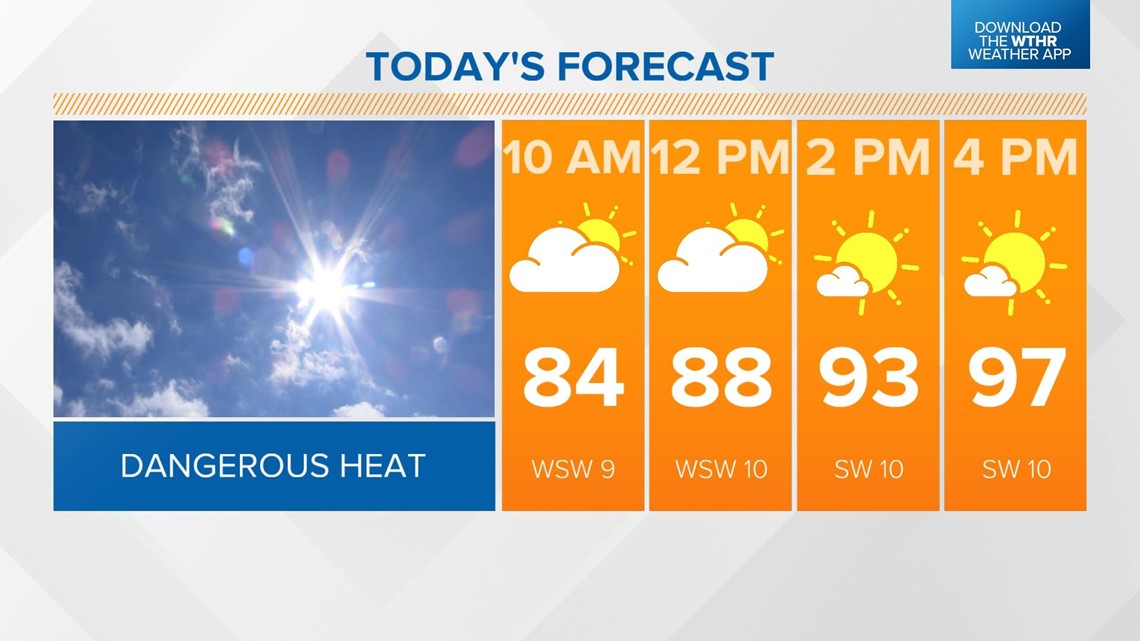
Air temperatures are set to reach the upper 90s, which means a record will likely be broken. That stands at 94 degrees from 1954.

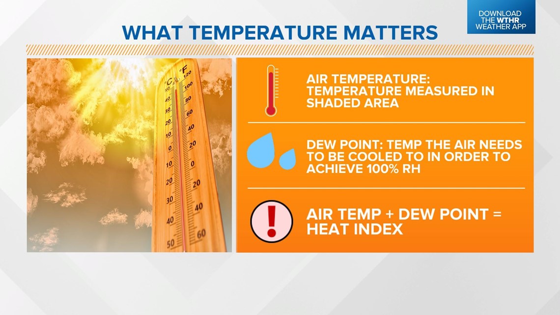
The most impressive numbers of the day though are the heat index indices. The heat index is a combination of the dew point temperature (air temperature if relative humidity is 100% or the measure of moisture in the atmosphere) and the air temperature (ambient temperature actually measured in a shaded area).
It is essentially the air temperature adjusted based on the moisture content in the air, which has the greatest impact on our bodies.
The more moisture in the air, the harder it is on our bodies to cool off, increasing the risk of heat-related illness.

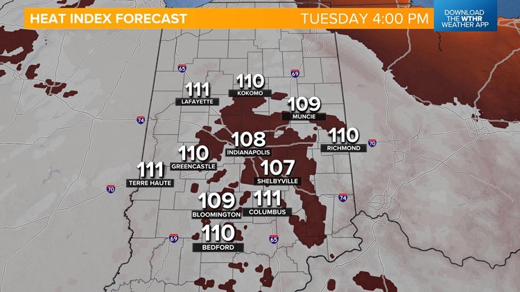
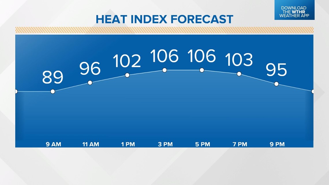
Today's heat indices will be in the triple digits from the late morning through sunset, with peak heat indices in the 107-111° range through central Indiana.



It will stay clear, warm, and muggy overnight with lows in the mid to upper 70s.
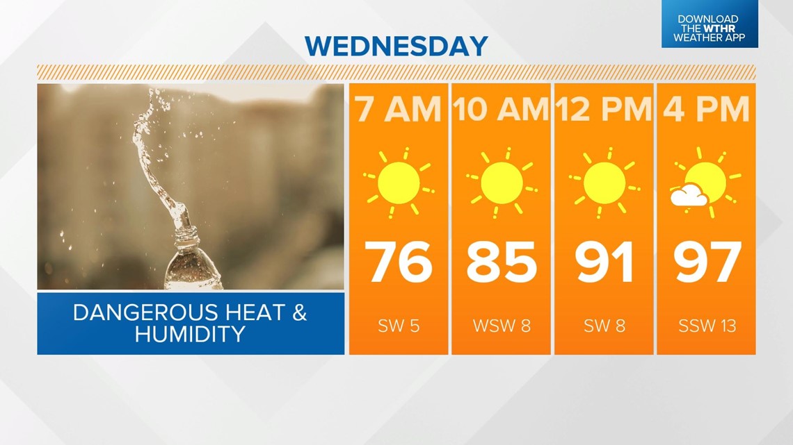
A record will likely be broken again Wednesday with temperatures topping out near 97 degrees. The standing record is 94 degrees from 1952. Heat indices will again be in the 100-105° range under a sunny sky.

Thursday will still be hot and humid, but a weakening cold front will arrive in the evening and could spark a few strong storms. After highs in the mid-90s Thursday afternoon, drier air will begin to take over.

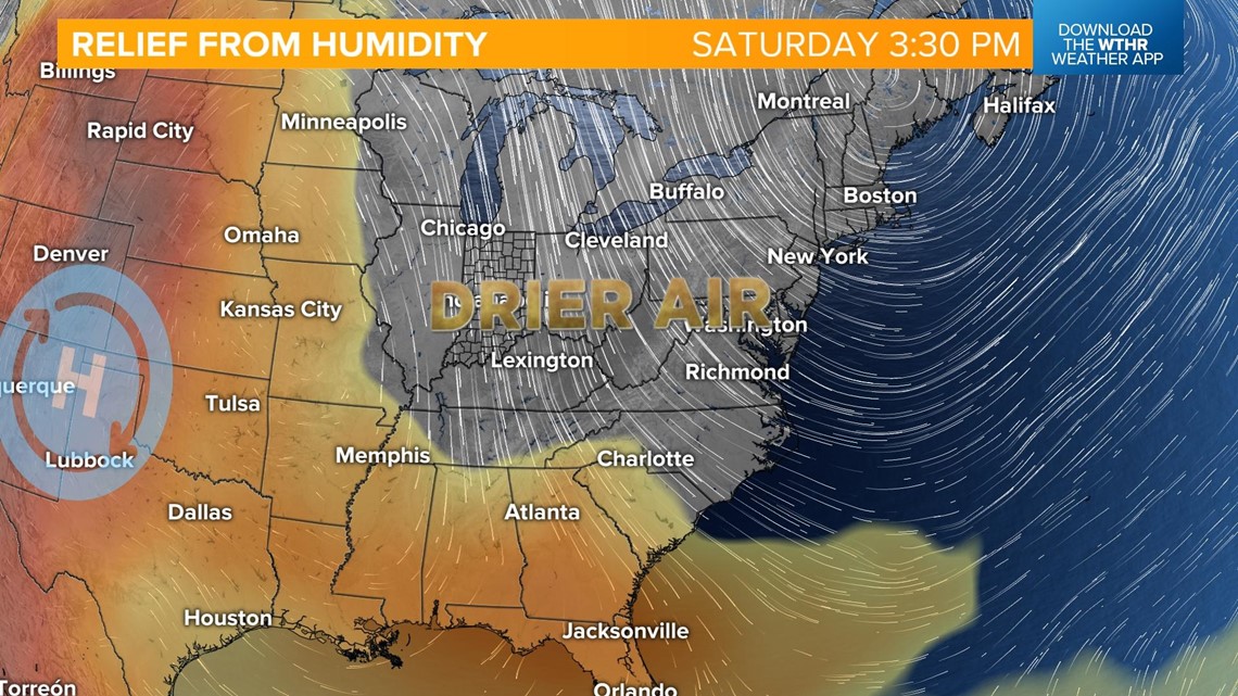
This brings relief from the humidity by Friday. Temperatures will still be in the upper 80s, but the muggy meter will fall into a more comfortable zone. This leads us into a more pleasant weekend with seasonal highs in the low 80s returning.

