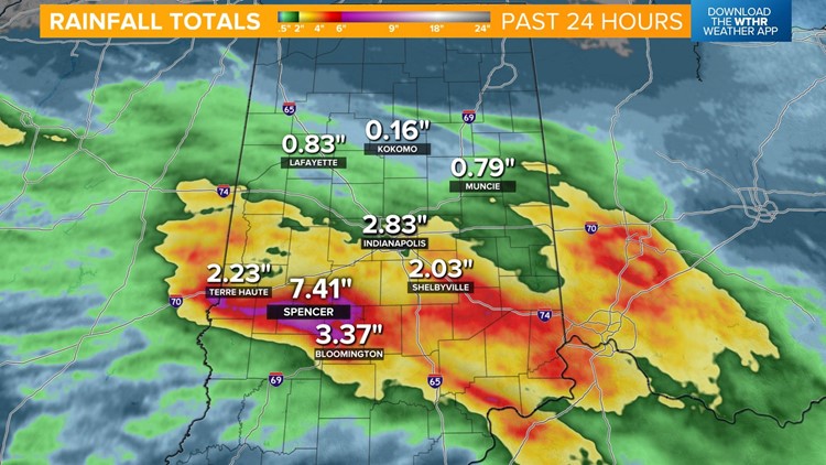
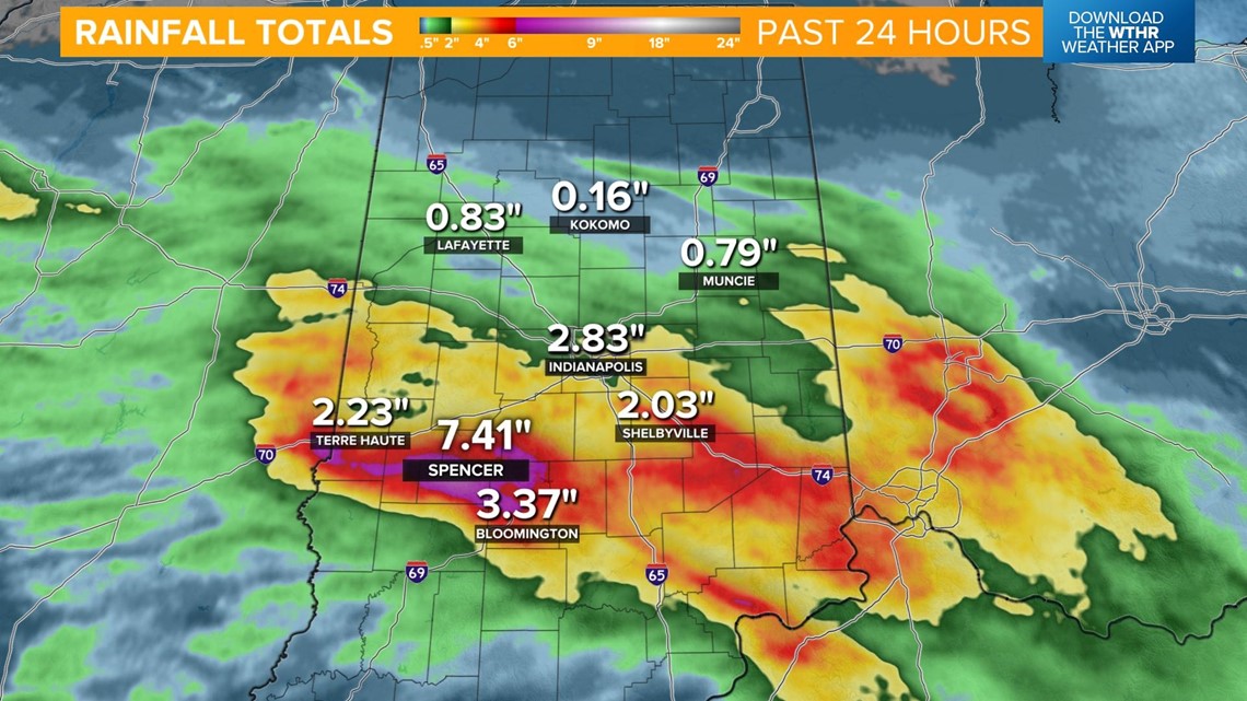
INDIANAPOLIS — Most areas in central and southern Indiana have picked up 2-4" of rainfall in the past 24 hours. The highest report of 7.41" was reported in Spencer in Owen County. Flash flood waters will begin to recede as the morning rain moves out but always remember to turn around and find an alternate route if you come to a flooded roadway.

One more cluster of storms will impact the western side of the state through mid-morning before we see a clearing this afternoon.

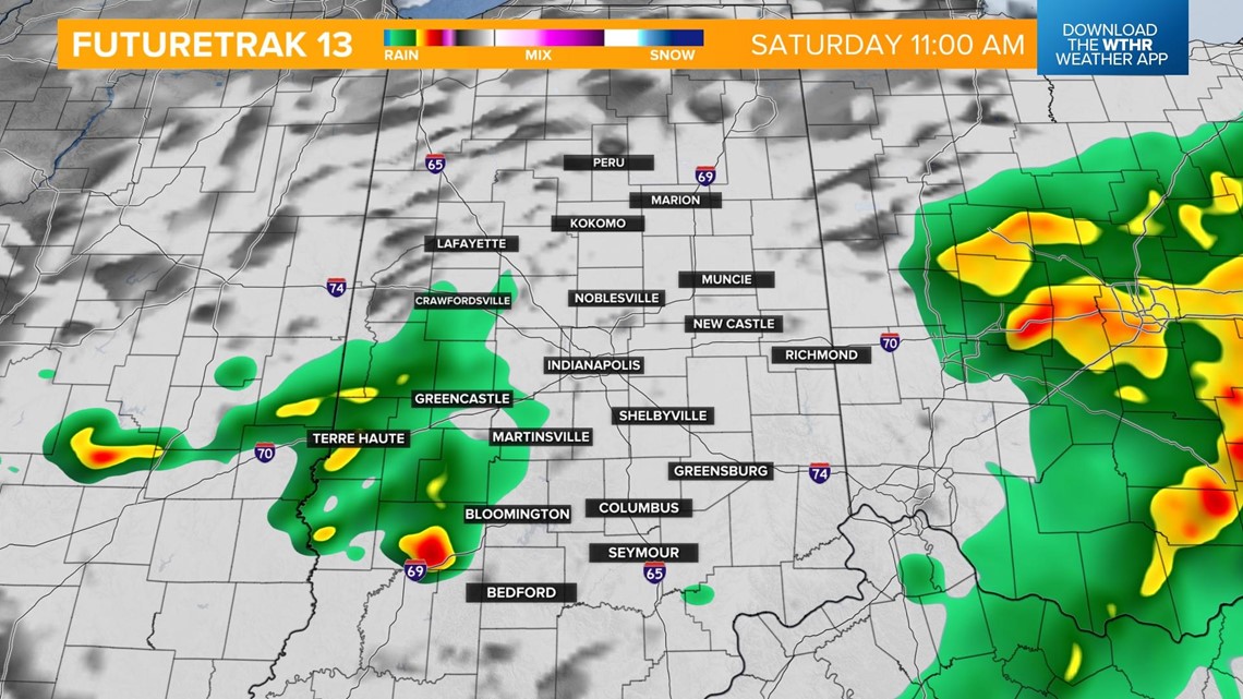
We'll see some dry time this afternoon as temperatures top out in the mid 80s.

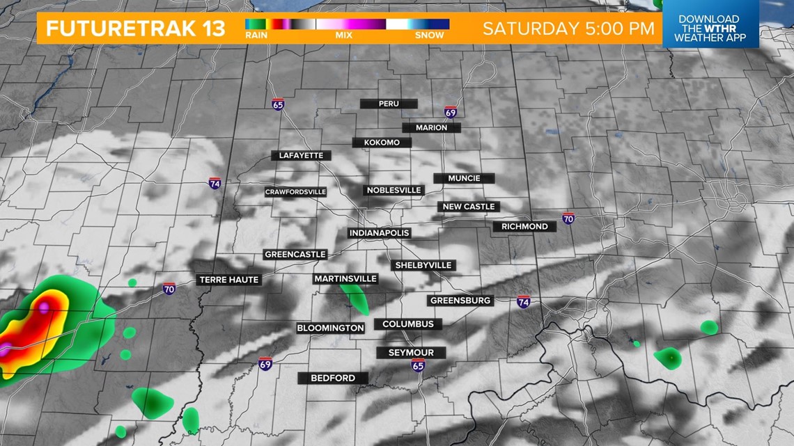
Isolated storms are still possible in the early evening, especially south of I-70 closer to a stalled boundary. A few storms could be on the strong side with damaging wind gusts but it won't be nearly as impactful as yesterday evening's storms.

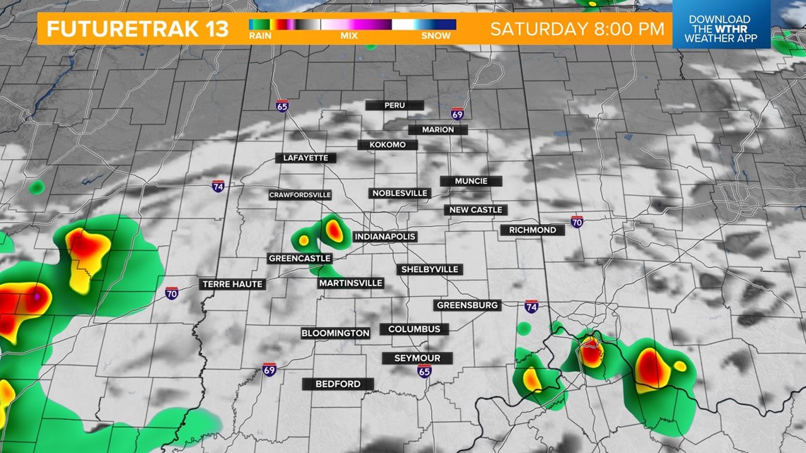

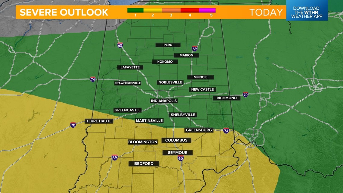
Scattered storms will linger through the overnight with lows in the upper 60s. Widespread severe storms are not expected, but again, a few could be on the strong side. Remember, lightning is a threat in any thunderstorm.

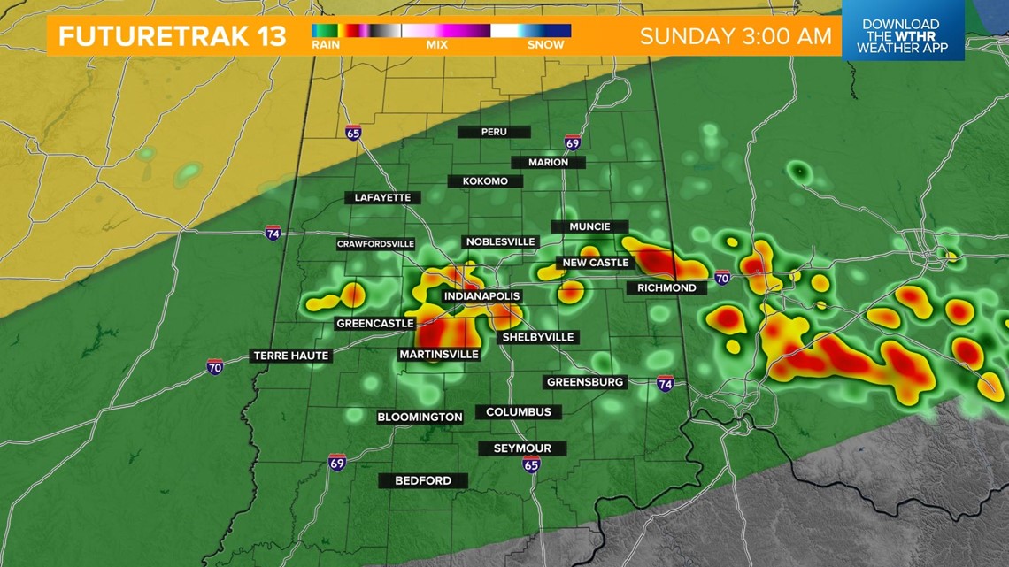
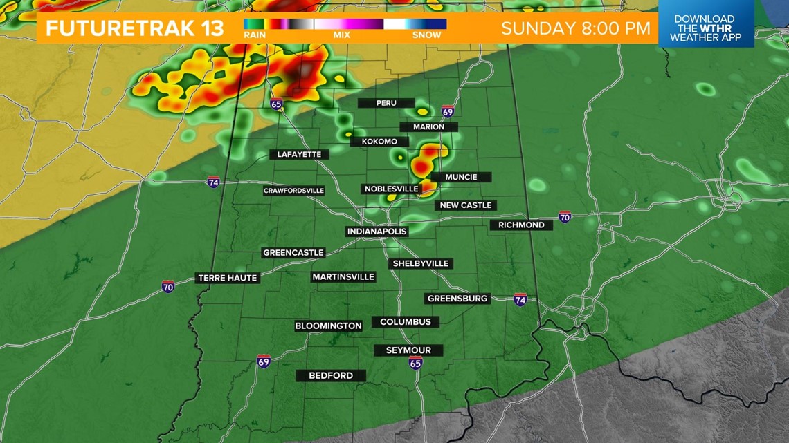
As the boundary stalls in northern Indiana on Sunday, most of the central part of the state remains dry for Father's Day.

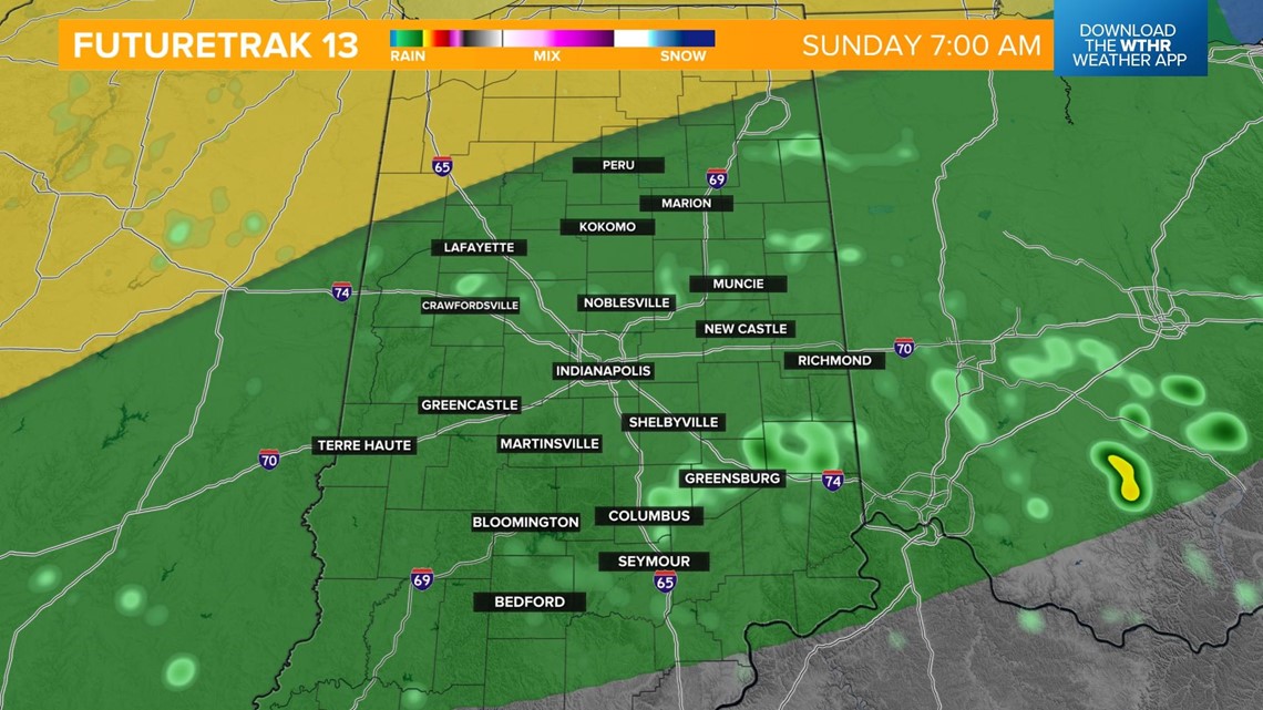
A few scattered storms develop well north but the rest of us see partly cloudy, hot and humid conditions with highs in the upper 80s.

This system will finally exit on Monday as a cold front pushes through. This will bring fairly widespread showers and storms Monday morning and into the afternoon before clearing in the evening. We'll go from overnight lows in the low 70s Monday morning to highs in the low 70s by Tuesday.

