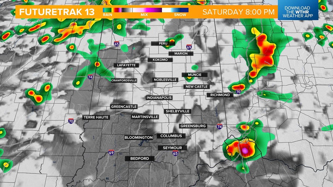
INDIANAPOLIS — Spotty storms have developed through central Indiana and will continue to track northeast through the afternoon as a warm front lifts through the area.

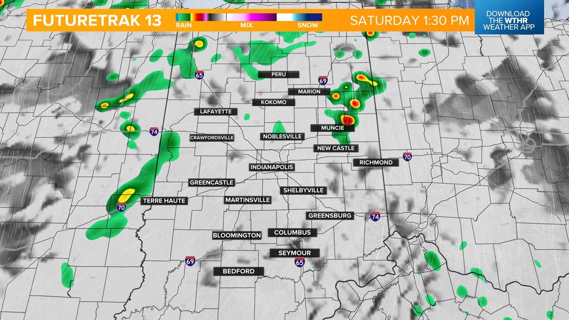

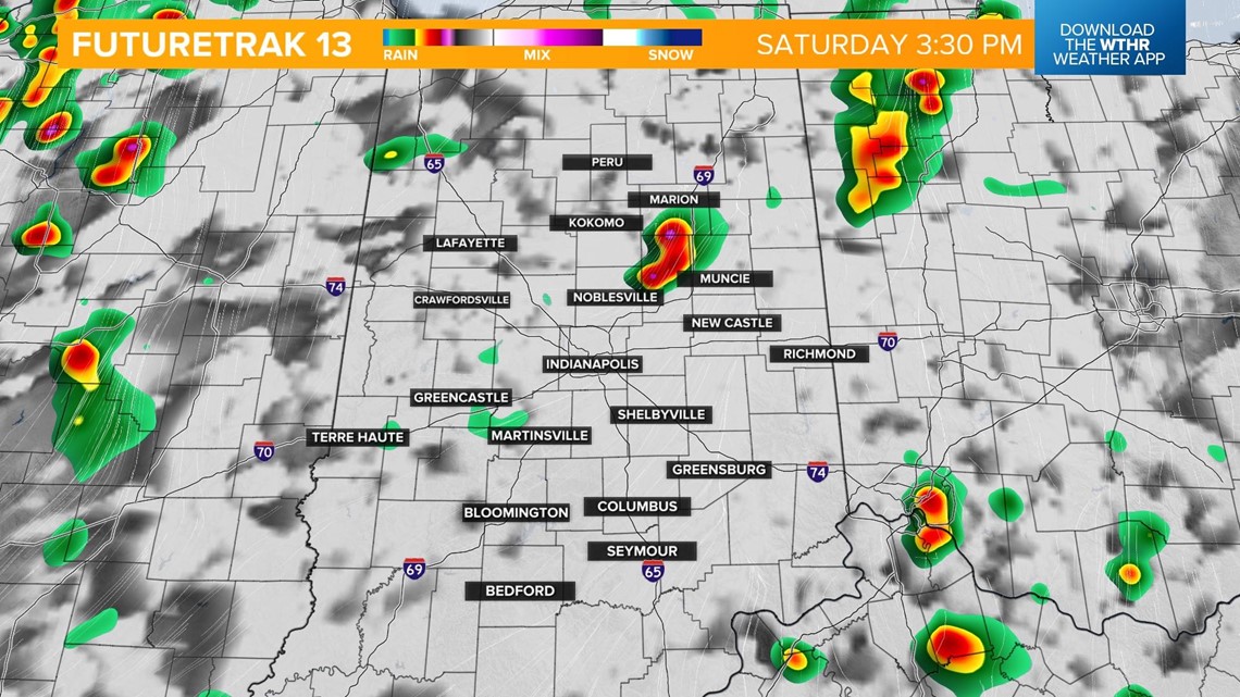
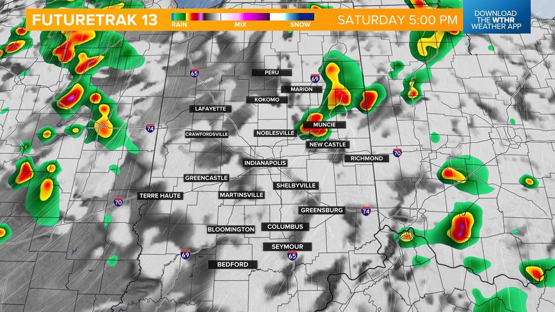
A few isolated storms will linger in the eastern portion of the state, but we will get a decent break from the storms during the evening hours, mainly after 5 p.m.


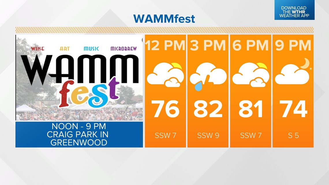
Temperatures recover to the mid 80s for highs and fall into the 70s this evening. With many outdoor events going on this weekend including the WAMMFest in Greenwood, have a "Plan B" in case a storm moves into your area.

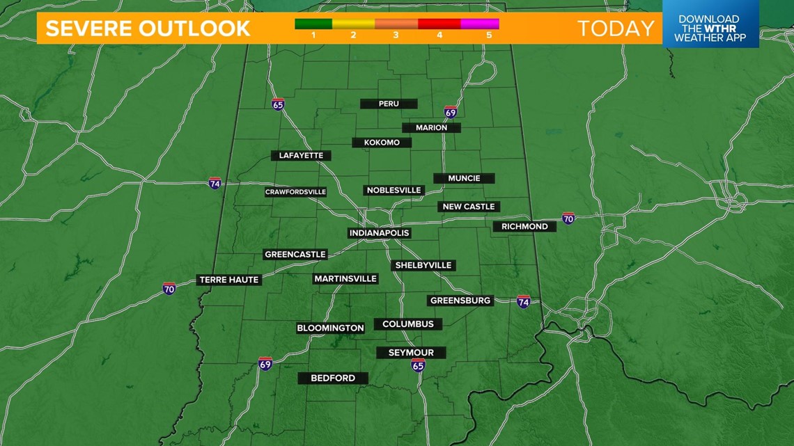
Storms that do initiate could potentially be strong to severe with a damaging wind threat. This won't be a widespread severe risk as the Storm Prediction Center has the entire state under a level 1 of 5 severe risk.

The better chance of widespread showers and storms will return late tonight into early Sunday morning as a cold front passes through the state. Overnight lows in the mid 60s.

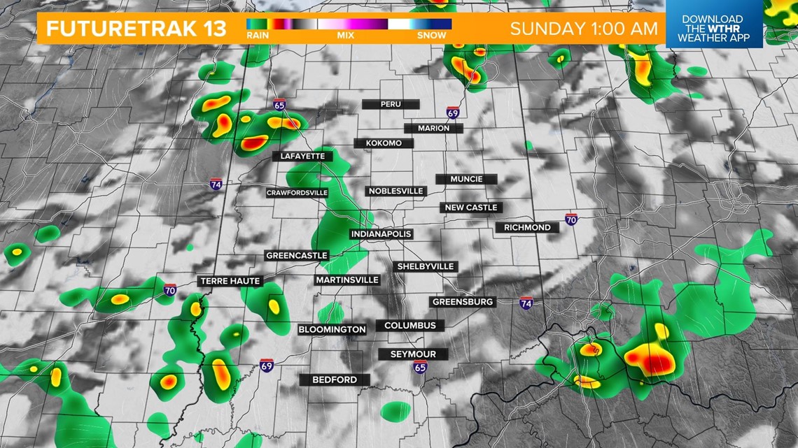

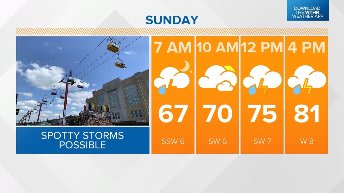
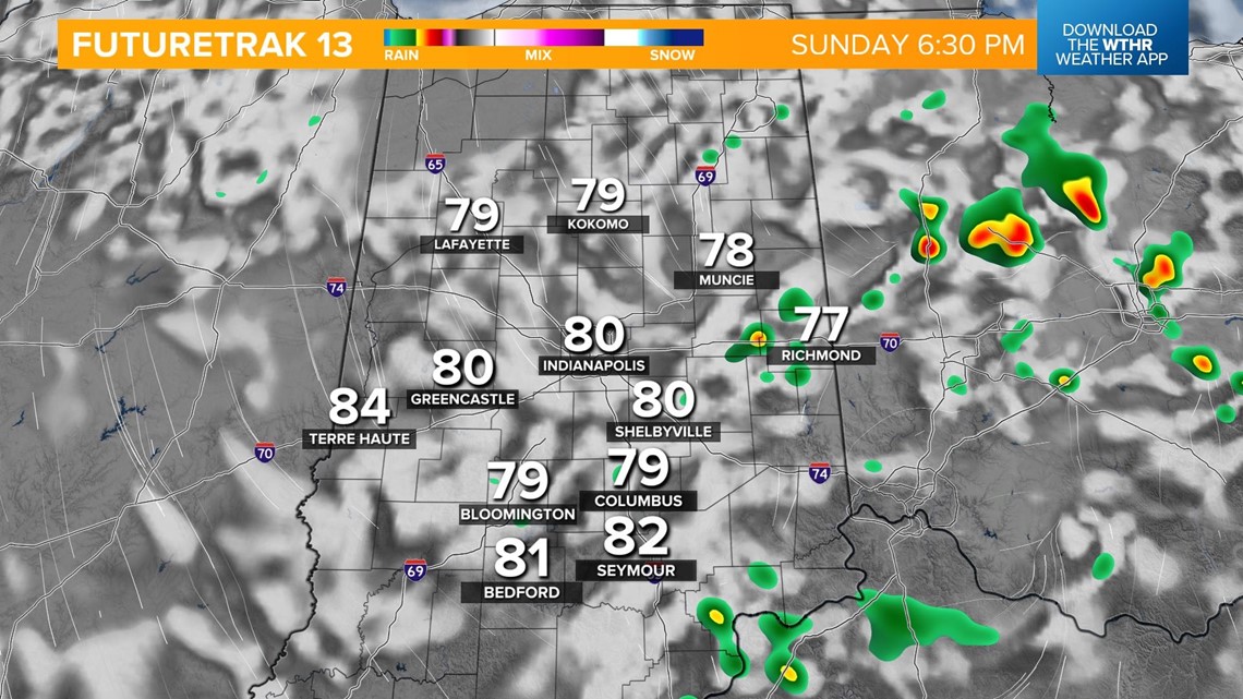
Widespread rain dwindles with lots of dry time to start the day on Sunday. As the front stalls on the eastern side of the state, pop-up storms will develop in the afternoon.

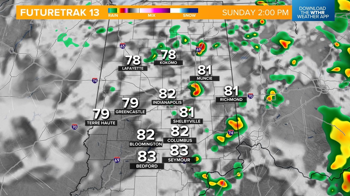
Severe weather is not expected but a few cold air funnels will be possible, given the changing air mass and spin in the atmosphere. Highs will be in the upper 70s/low 80s.
Most storms will taper off in the evening as the front continues to track east out of the state.