
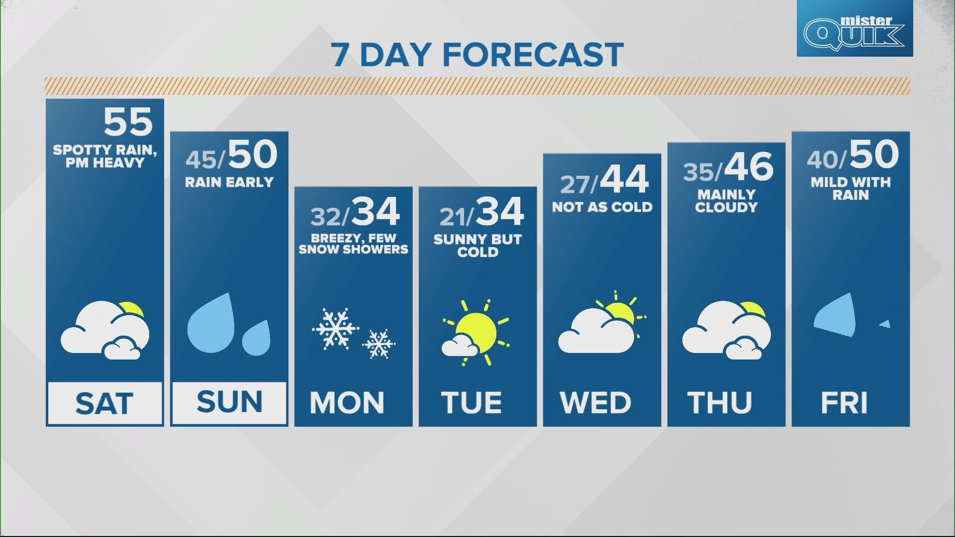
INDIANAPOLIS — Our next storm system has brought clouds in keeping temperatures more mild to start our weekend. Look for well above average highs this afternoon in the mid 50s.

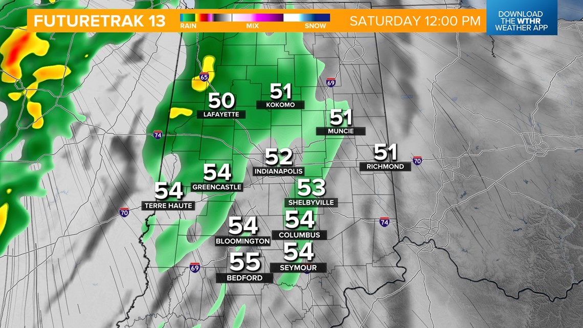
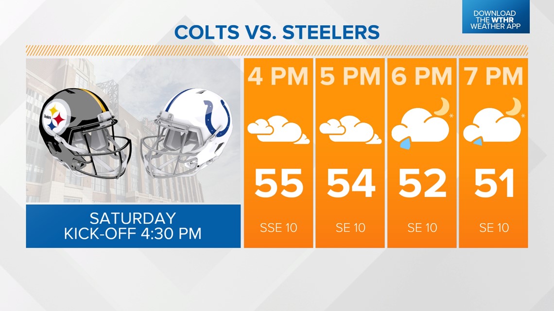
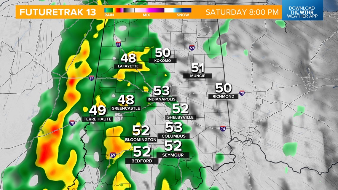
This storm complex will also bring rain chances today with spotty showers mainly west through the early afternoon. If you're headed downtown for the Colts game, stay rain gear ready as more widespread rain sets up across central Indiana after 8 p.m.


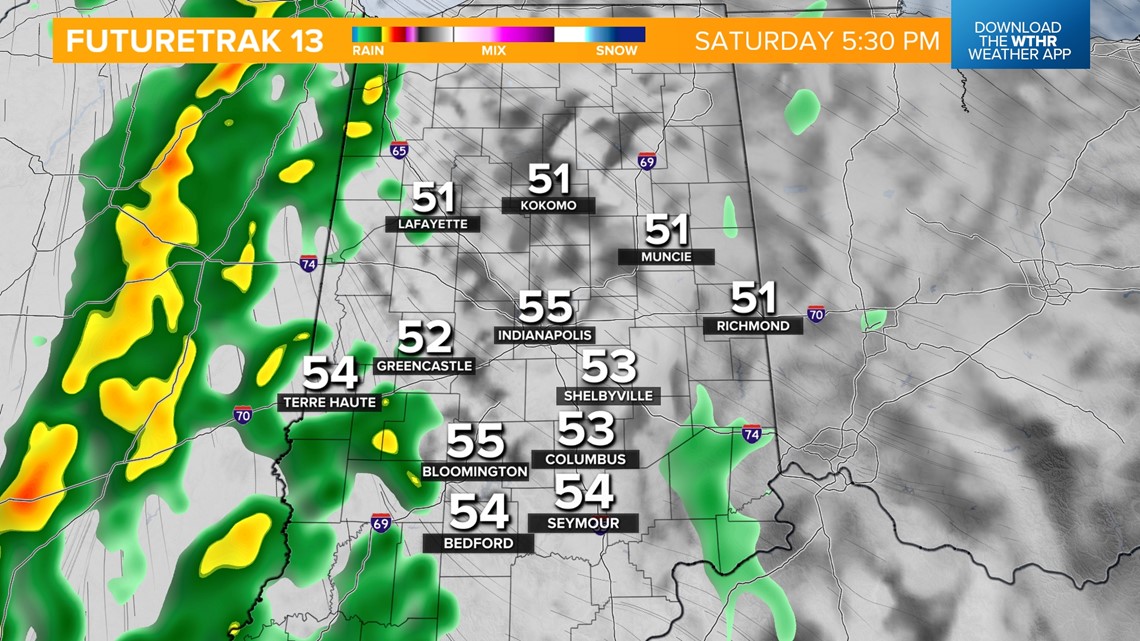

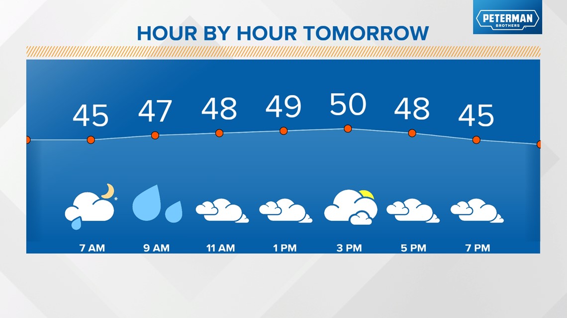
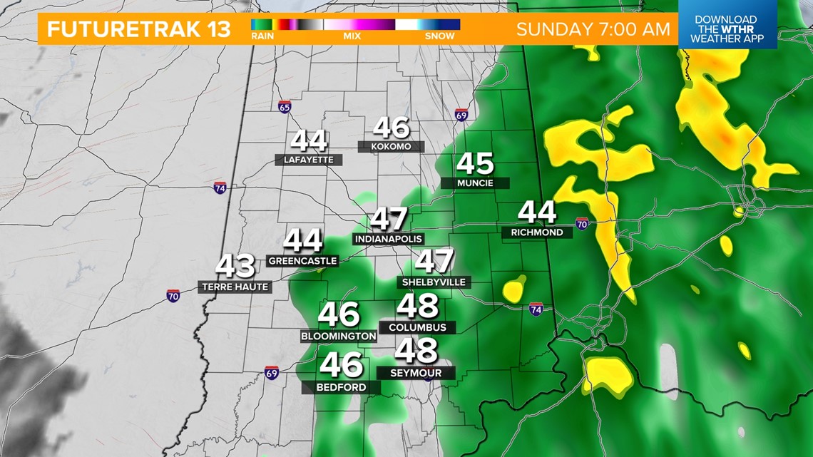
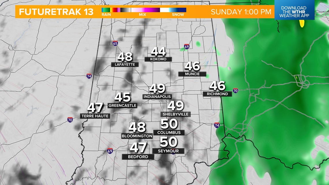
Widespread rain will continue overnight into tomorrow morning. Showers begin to taper off by midday Sunday as this storm system pulls east of the area. Temperatures hold steady between 45-50 degrees.


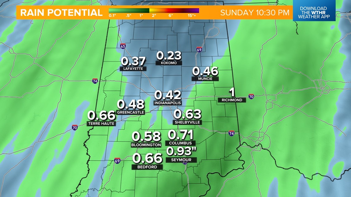
With most of the area now in drought conditions, any rain is welcomed. Most spots see 0.25-0.75 inches out of this system.

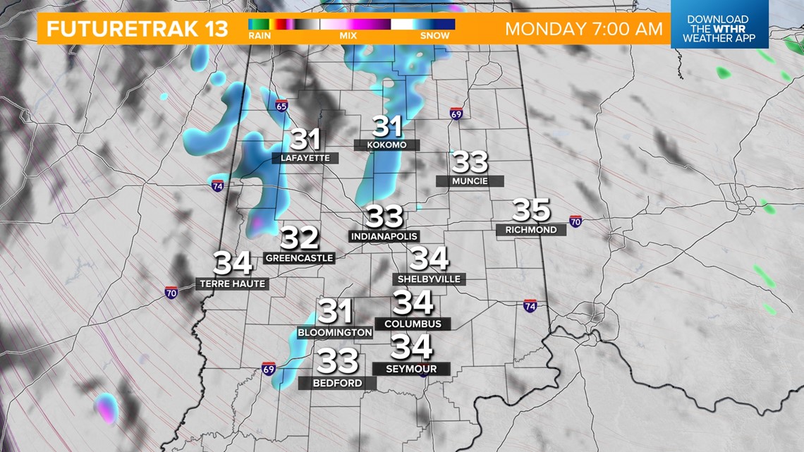
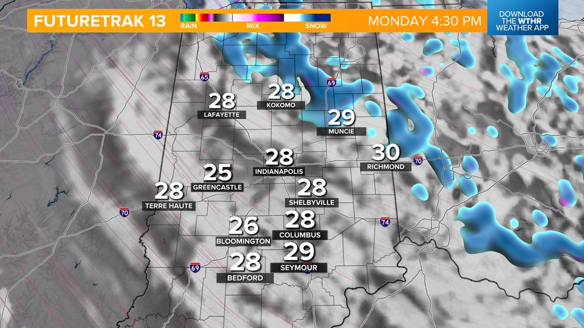
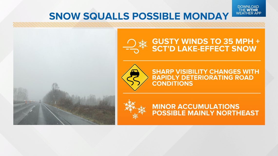
Much colder air settles in to start next week. Temperatures will hold steady in the low to mid 30s on Monday. A cold northwest wind gusting to 35+ mph at times will also bring lake-effect snow showers, especially across the northeastern tier of the state. The combination of gusty winds and snow brings the potential snow squalls which could rapidly reduce visibility causing travel issues and minor snow accumulations up to 0.5 inches.


Highs will be cold in the mid 30s again on Tuesday as sunshine returns. Temperatures will become more seasonal by mid-week with highs back in the mid 40s. The next rain chance returns late Thursday into Friday.

