INDIANAPOLIS — It's been another spectacular February day in central Indiana as we cap off the weekend with sunshine and above-average temperatures in the mid to upper 50s.
A quiet evening is ahead with relatively pleasant air to enjoy as clouds increase with the approach of a quickly strengthening storm system over the next 12 hours.
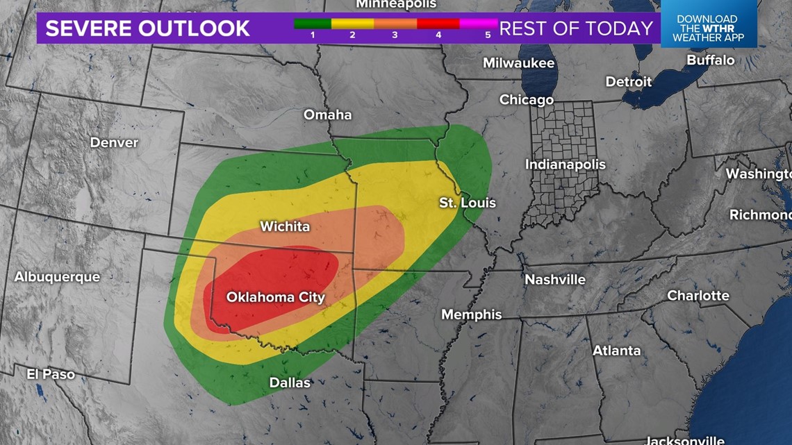
Severe weather is getting underway in the central Plains at the time of this posting, where moisture, instability and wind shear will be maximized for a high-end wind event over parts of Oklahoma. While this is our weather player for Monday, it will be in a different atmospheric environment in the Ohio Valley that lowers - but not completely eliminates - the severe wind/rotating storm probability.

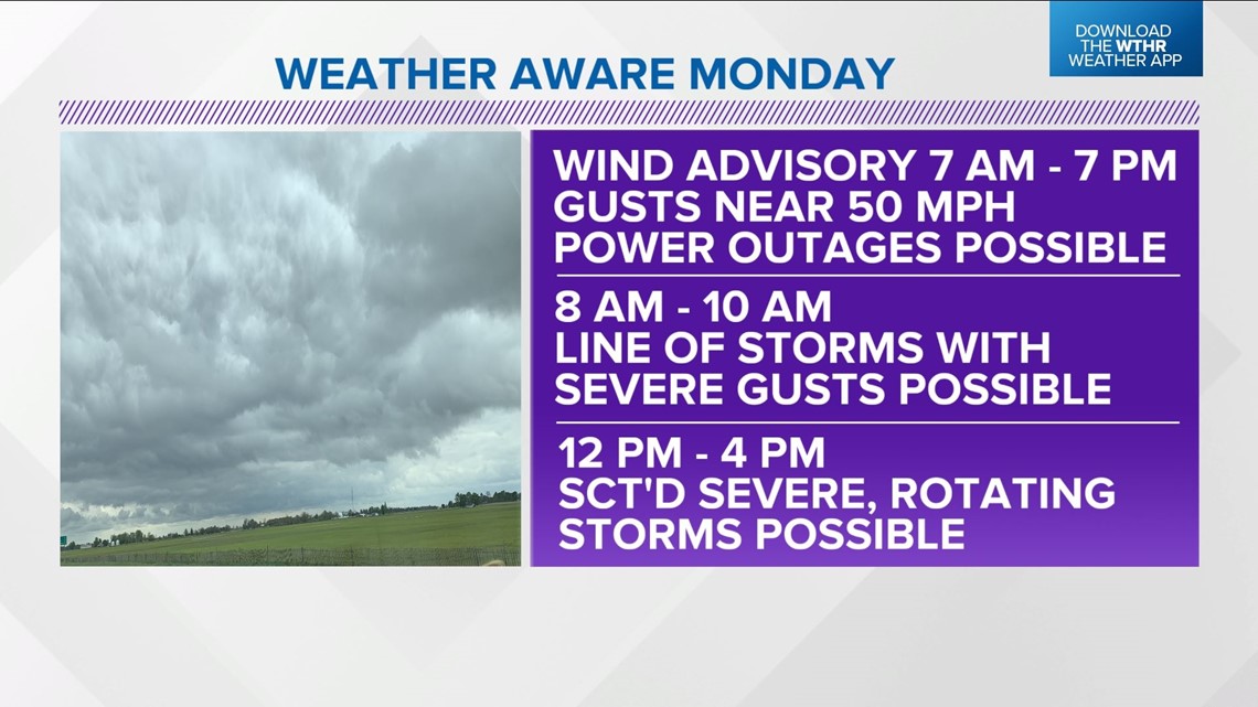


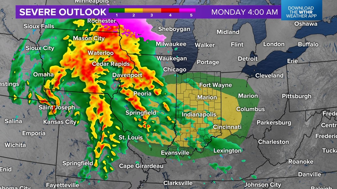
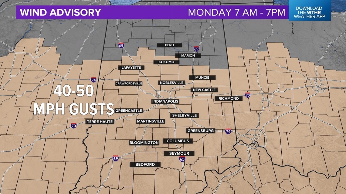
In advance of the storm center, areas of rain begin to develop over central Indiana after midnight and should be wind-whipped in areas by 7 a.m. Monday, with a wind advisory for most of central Indiana. Non-thunderstorm gusts up to 50 mph are possible, if not likely, during the day and could be enough to cause areas of wind damage and/or power outages.

Modeled simulated radar shows a quick-moving line of downpours/thunderstorms moving across central Indiana between 8 a.m. and 10 a.m., posing a threat of severe gusts of 60-plus mph as the wind field increases over the area. Be advised of quickly-changing weather during the morning commute and school/bus-stop drop-off.




Coverage diminishes a few hours before an expectation of scattered thunderstorms developing in a destabilizing atmosphere around midday. These storms could rotate and/or produce severe wind before 4 p.m. with watches and/or warnings in the WTHR viewing area during that time.
The storm show is over by 4 p.m. but windy conditions likely linger a few hours into the evening.


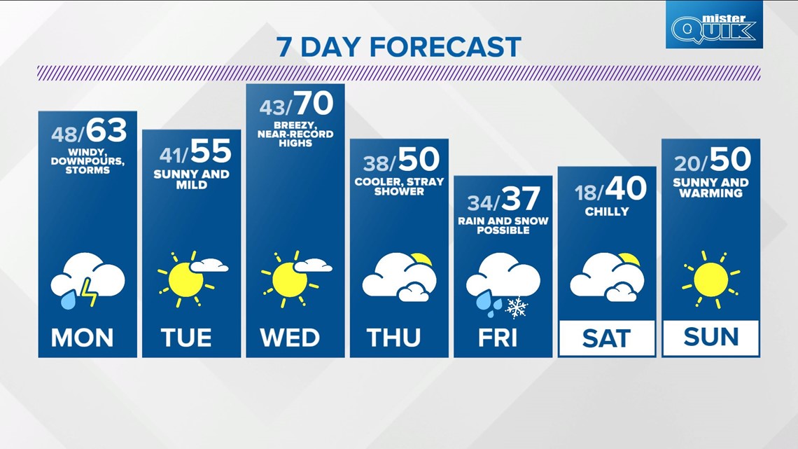
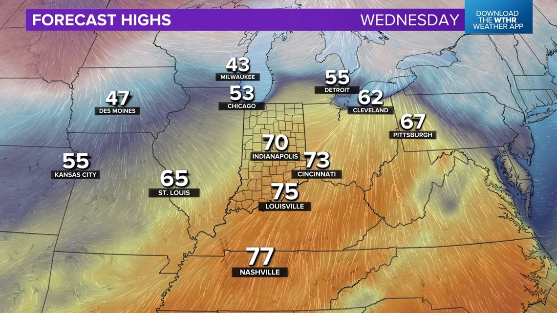
Quieter weather mid-week with another surge toward near-record highs on Wednesday. We're forecasting 70 degrees, which would be just shy of tying a daily record high of 71 degrees for March 1 set in 1976. With or without a record, temperatures will be some 25 degrees above average Wednesday.

Yet another moisture-laden windy storm system takes aim on the Ohio Valley and brings potential of heavy rain/storms and possibly a band of heavy, wet snow on the north-northwest side of its track. That track is highly uncertain, but we'll be updating all week long.

