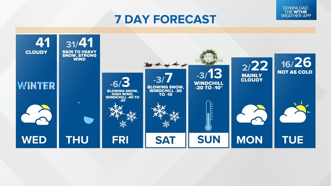
INDIANAPOLIS — We're now less than 36 hours away from the much-discussed winter storm and its Arctic front slamming into central Indiana. The main impact takeaways remain high wind, dangerous cold, periods of heavy snow rates Thursday into early Friday morning, the potential of power outages/wind damage, and very slick roads into Christmas morning.
The notable change in the forecast is the initial timing of rain changing to snow. This does look to happen slightly quicker (by 2-3 hours) than the arrival time of the strong front.

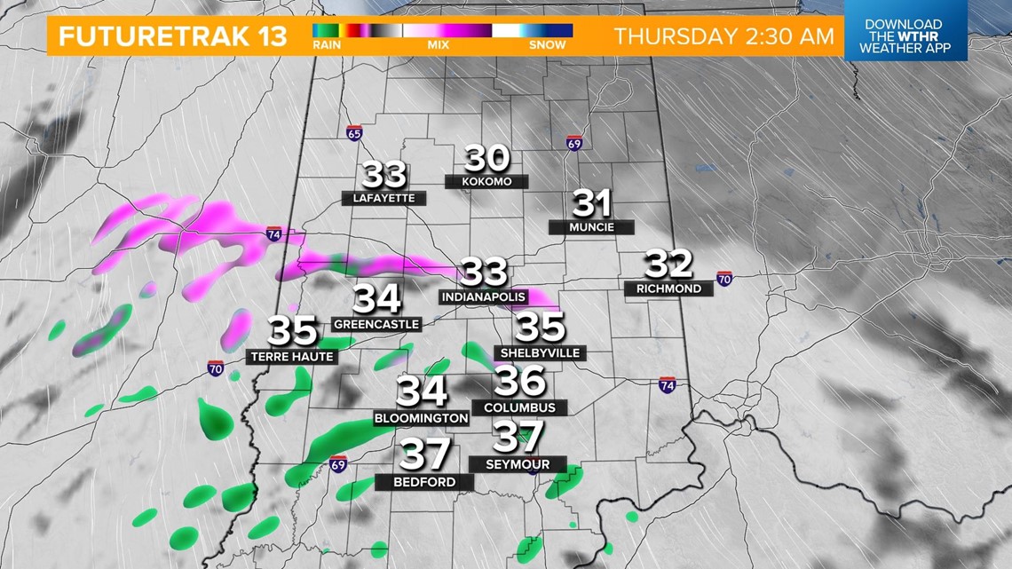

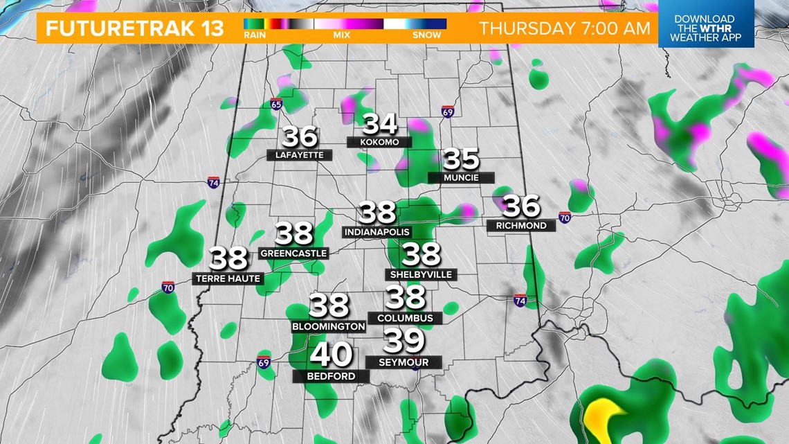
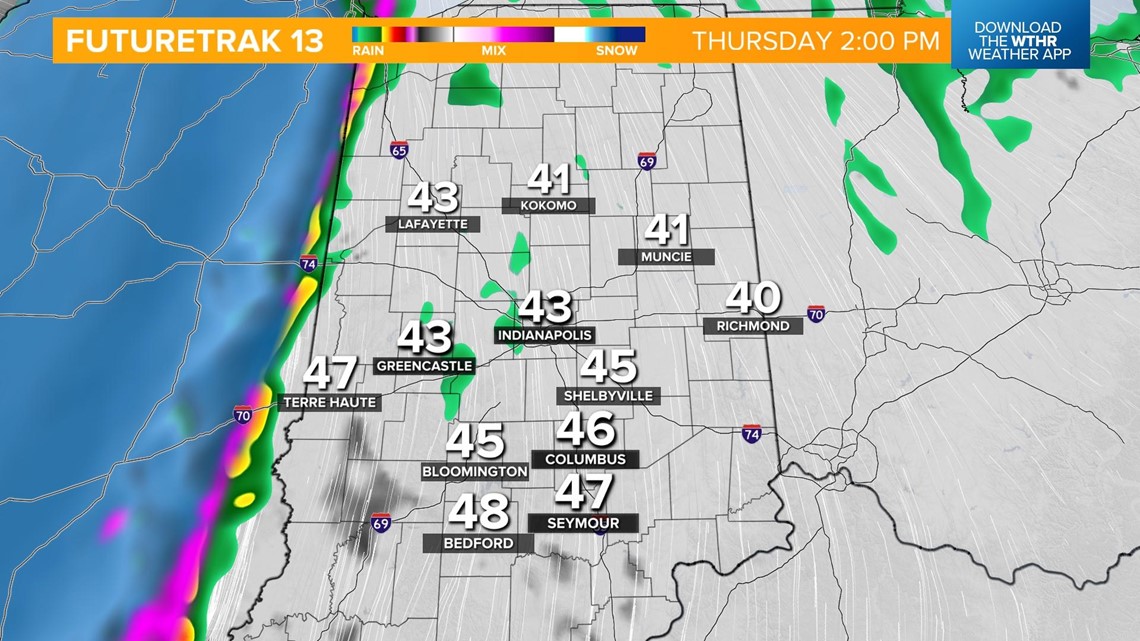
Thursday begins with a light wintry mix that quickly becomes rain for mid-to-late morning. The front reaches the Illinois/Indiana border around 1 p.m. where the transition to snow occurs first.
It should reach Indy between 4 p.m. and 6 p.m. That means it's a good idea to be at your destination by the time it arrives around the metro area and even sooner for areas well west of I-65.


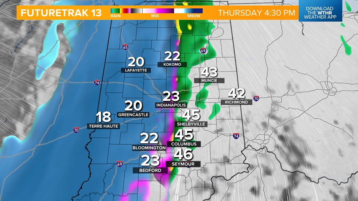

Temperatures will rapidly drop some 30 to 40 degrees in a matter of a few hours to cause a "flash freeze" of the residual moisture of rain on sidewalks and roads.
Roads will become icy rapidly Thursday evening, and travel will be dangerous from that point on into Christmas Eve.

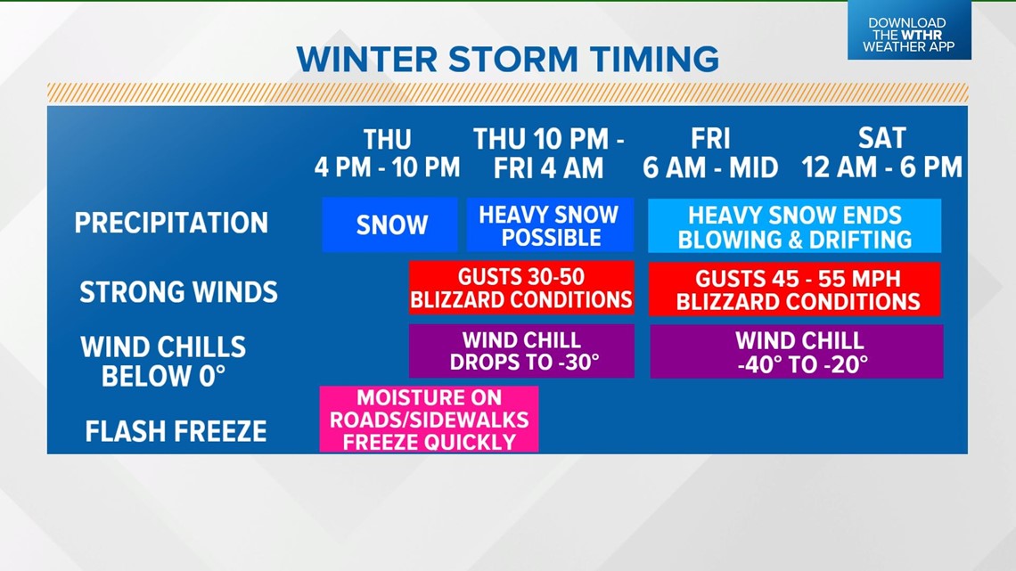
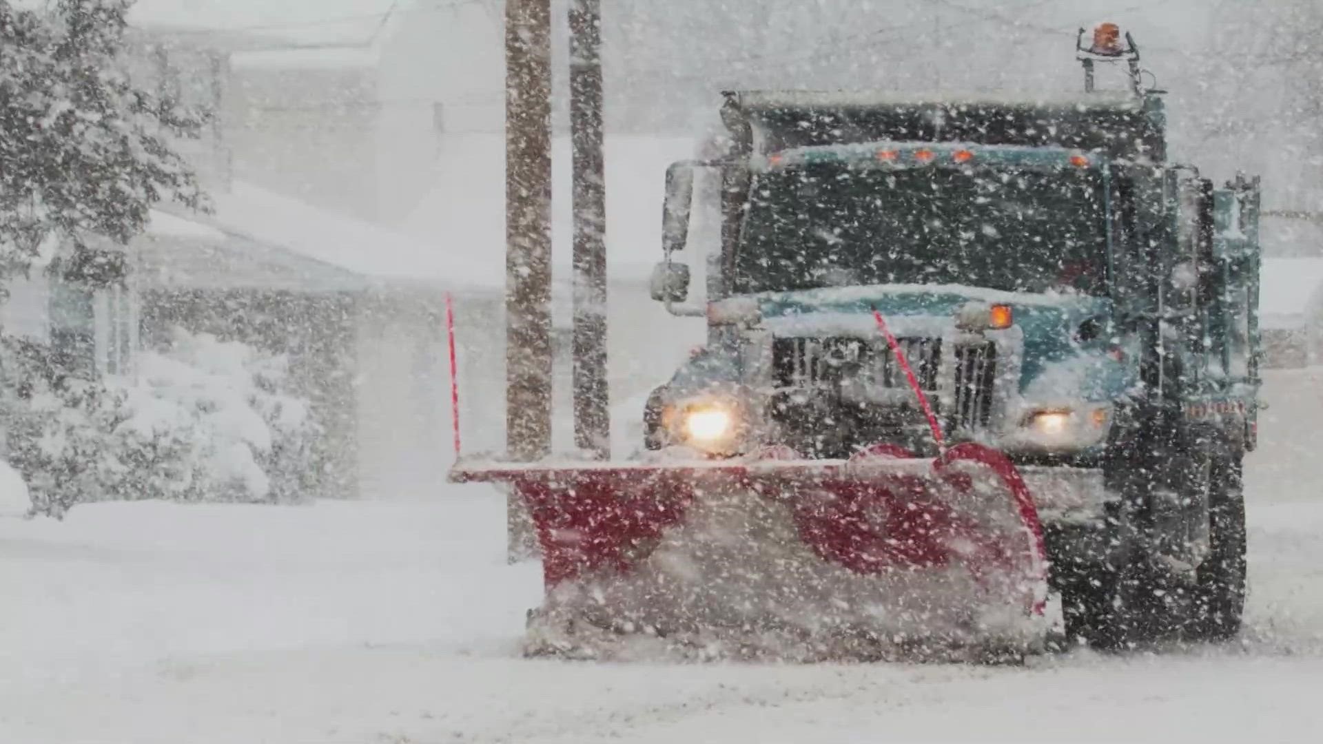
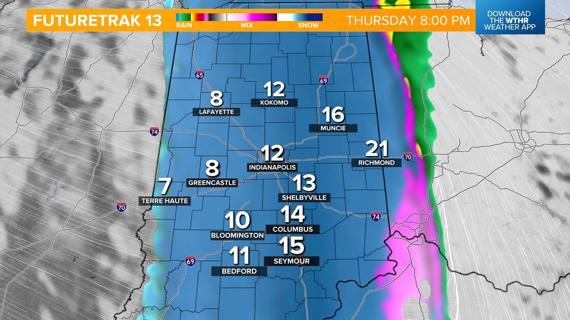
In the wake of the front, there will be a quick changeover to snow and possibly a period of heavy snow at times with the potential of 1 to 2 inches per hour snow rates before 4 a.m. Friday. This will lead to a quick "thumping" of snow for central Indiana with amounts ranging from 2 inches to locally 6 inches in play.
Admittedly, the confidence in the snowfall portion of the forecast remains low, and we'll adjust over the next 24-36 hours. Wind and cold remain much bigger impacts than snowfall with this storm.
Confidence remains very high that central Indiana will get slammed with strong and dangerously cold temperatures.


Early Friday morning, blizzard conditions become possible with 30-60 mph wind. This will cause whiteout conditions and blowing/drifting snow. Unfortunately, we'll experience a prolonged period of strong wind from Friday into Saturday. The high wind duration ups the odds of power outages and/or wind damage until the system's strongest wind fields exit to finish the Christmas weekend.

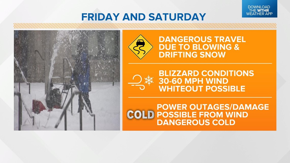
Christmas morning will be white and bitter. We're forecasting sub-zero temperatures for our coldest Christmas low in over 20 years. Please plan your travels accordingly. Power outages will be likely with this storm. Make sure you have a winter survival kit for your home and your car.
Winter storm timeline:
- Thursday, 2 a.m. - 7 a.m.: A light mix of sleet and rain will be possible briefly in the morning, but we don't anticipate any travel issues.
- Thursday, 7 a.m. - 1 p.m.: A cold rain for the remainder of the early afternoon.
- Thursday, 1 p.m. - 3 p.m.: Rain changing to snow in western Indiana.
- Thursday 4 p.m. - 6 p.m.: Rain to snow around the Indy metro area.
- Thursday 6 p.m. - 8 p.m.: Flash freeze that quickly changes any rain on roads/sidewalks into ice.
- Thursday 6 p.m. - Friday 4 a.m.: Heavy snow rates of 1 to 2 inches per hour possible.
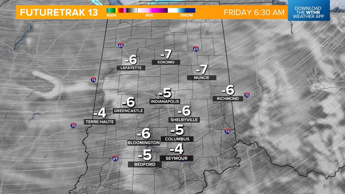
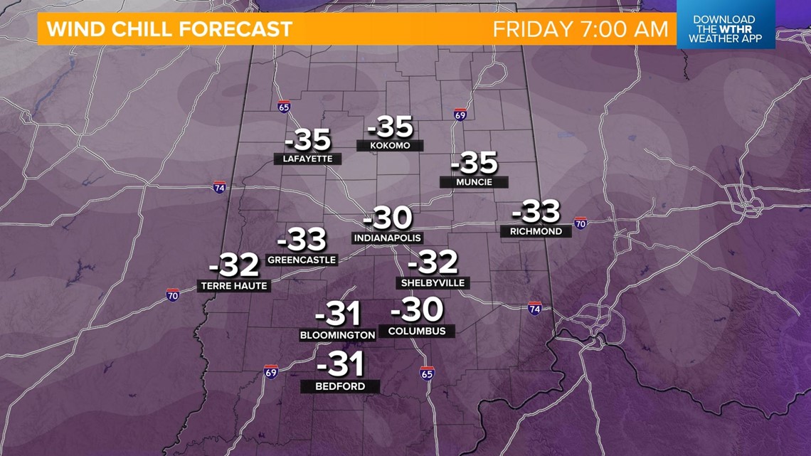
- Friday 6 a.m. - Christmas: Dangerous wind chills -20 to -35 degrees, strong winds with gusts 45 to 55 mph, blizzard conditions, steady light snow/snow showers, hazardous travel.
- Christmas Day: Bitter cold with flurries.