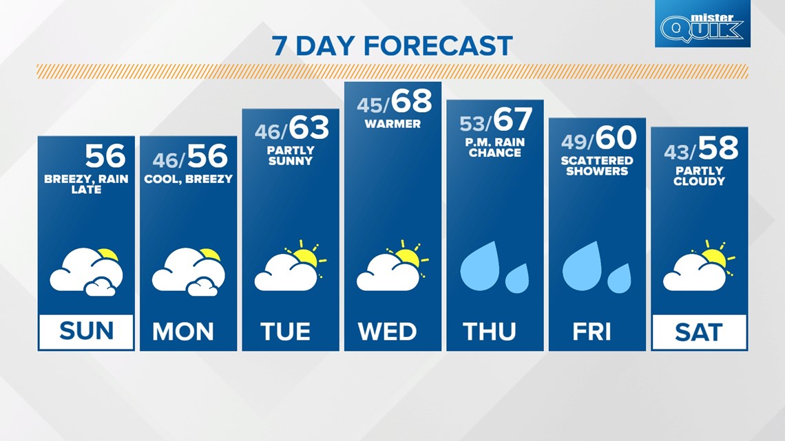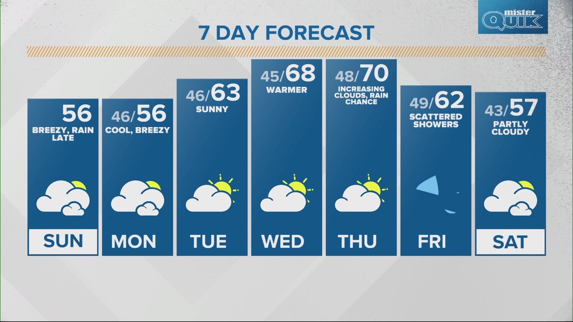
INDIANAPOLIS — Unseasonably cool air sticks around today with afternoon high temperatures only in the mid to upper 50s.
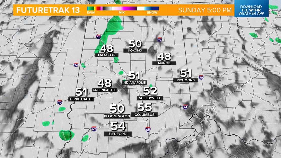
Average highs this time of year are in the mid 60s. Clouds will stick around throughout the day as we also tap into some upper-level moisture coming in off of Lake Michigan. This will bring lake-effect rain showers across the northern and western sides of the state starting in the afternoon.
Scattered showers will then become likely this evening and overnight across the state.

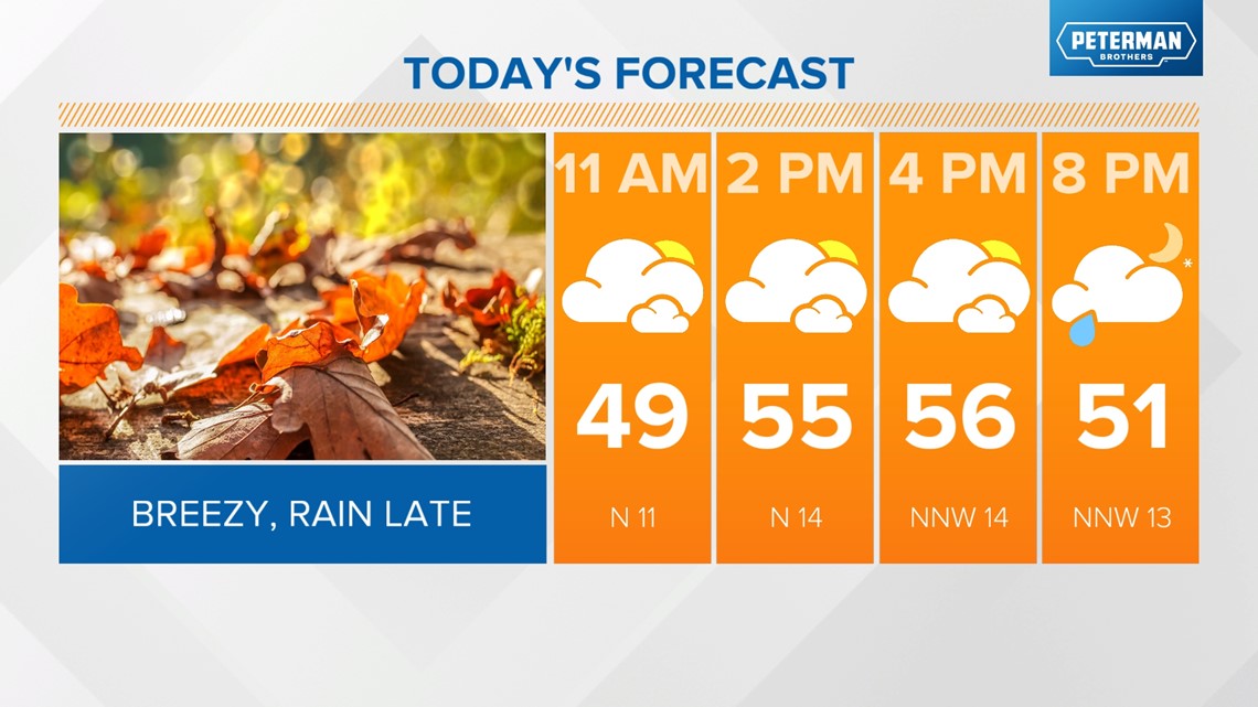


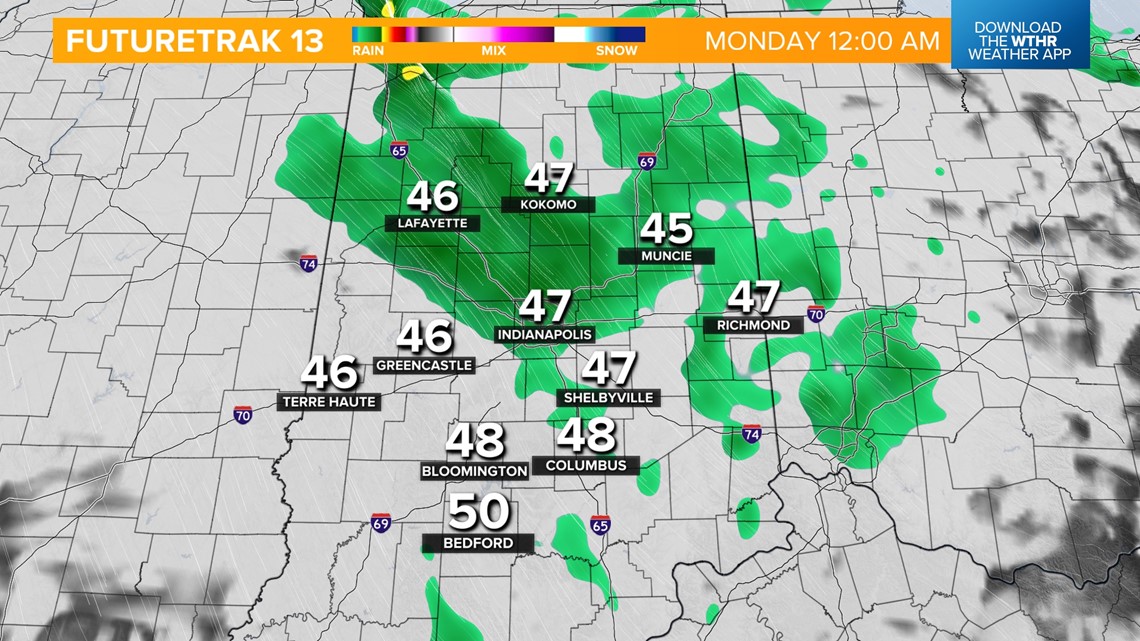
Temperatures drop into the mid 40s overnight with most of the rain activity wrapping up by the morning rush hour Monday.
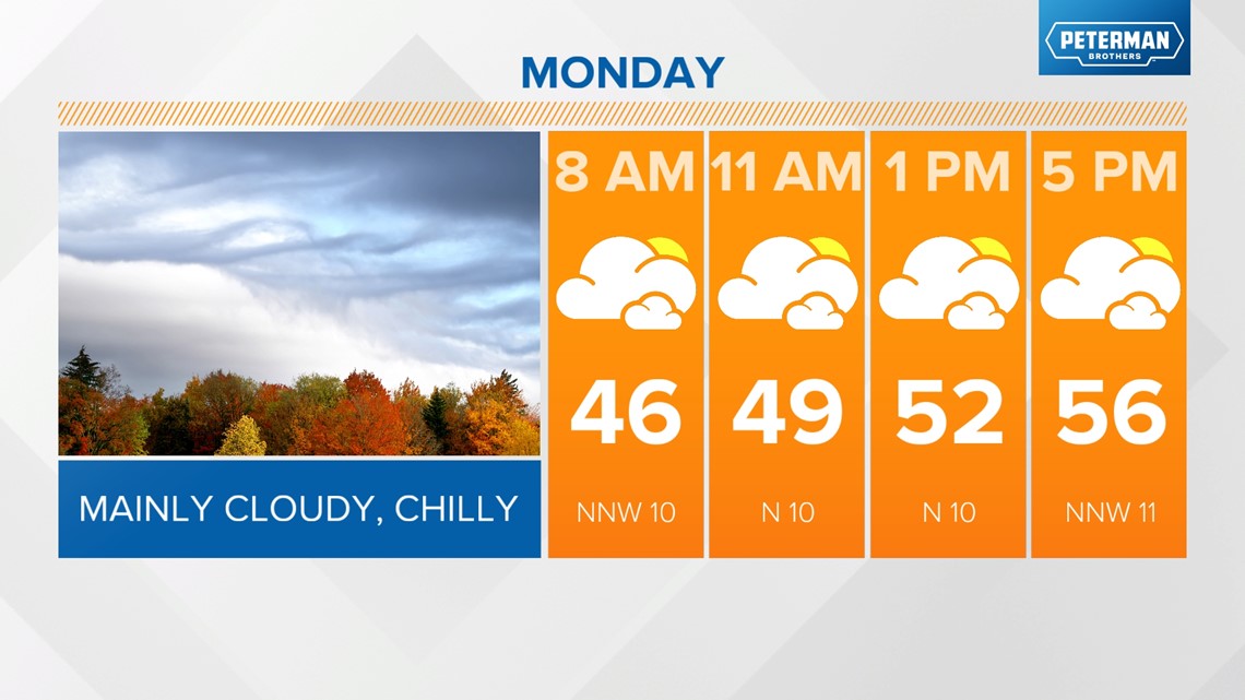
We'll still be stuck under this upper-level system keeping clouds around and limiting temperatures to the mid 50s for highs Monday afternoon.

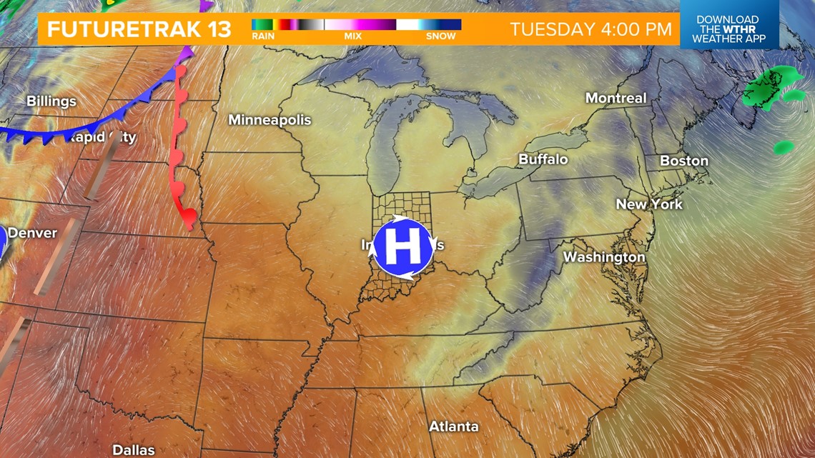
High pressure will then begin to win out by Tuesday helping to clear the sky out and warming up temperatures. Look for highs in the low 60s under a partly sunny sky by Tuesday afternoon.

The bigger warming trend will begin Wednesday with highs returning to the upper 60s.
A low pressure system associated with this warmer set-up will arrive Thursday bringing rain chances back into the forecast for the latter part of the work week.
Temperatures will fall on when this system passes on Friday with highs dropping from the upper 60s Thursday to near 60 Friday, and into the upper 50s to start next weekend.