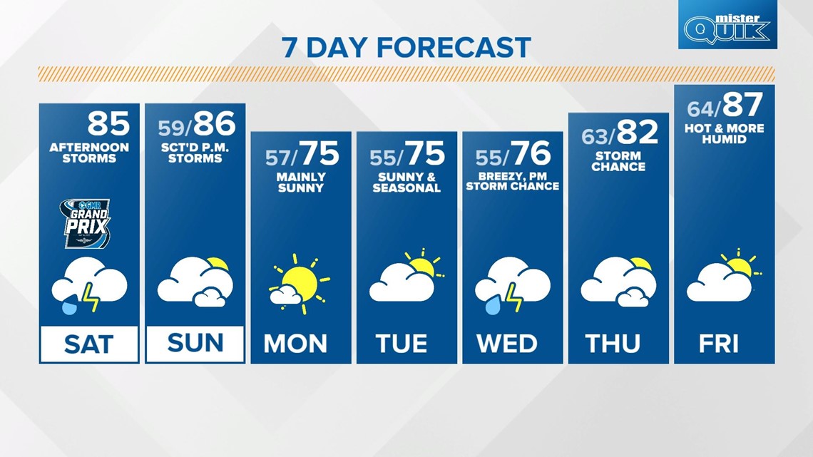
INDIANAPOLIS — We have a warm May weekend ahead with a few rounds of storms possible.
Temperatures will warm into the mid 80s this afternoon as clouds develop along a frontal system. A few isolated storms are possible ahead of the main system during the first part of the day.
This boundary will prompt storms to develop in northwestern Indiana after 2 p.m.

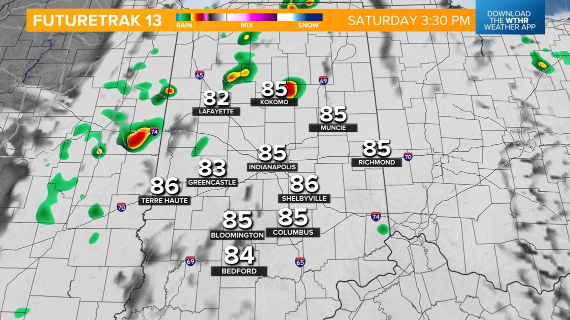
The line will track southeast bringing a risk of more widespread storms into the Indianapolis metro area after 5 p.m.

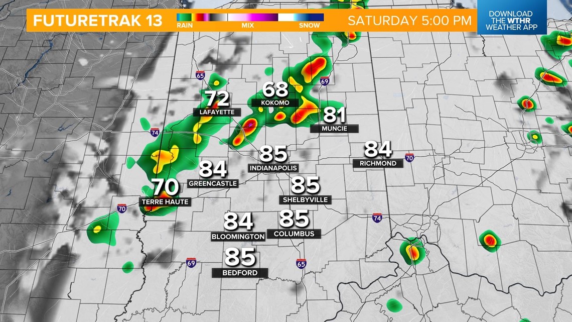
The line will then continue to track south into southern Indiana by 7 this evening.

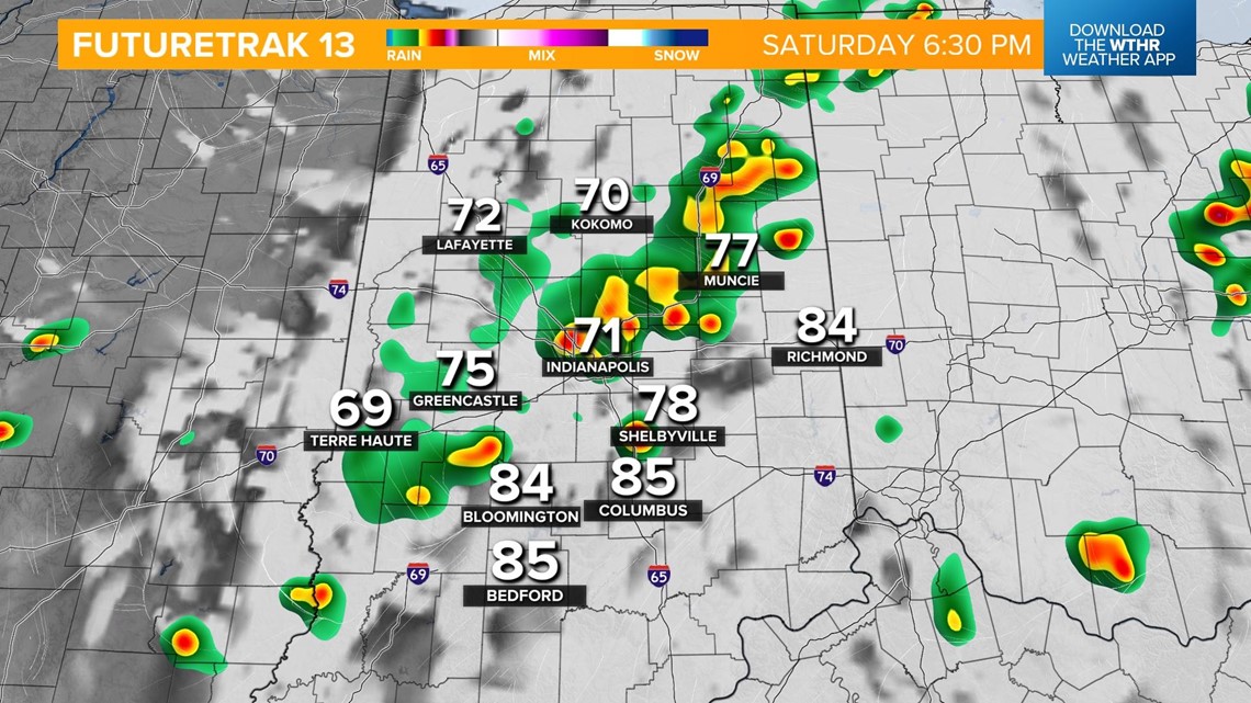

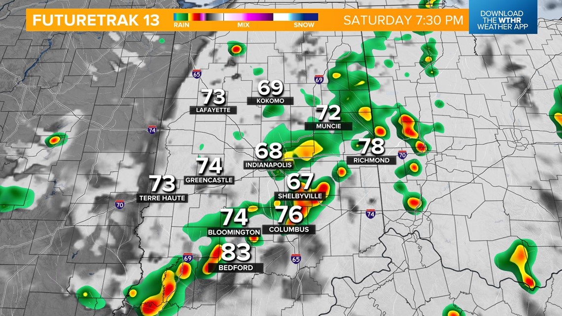
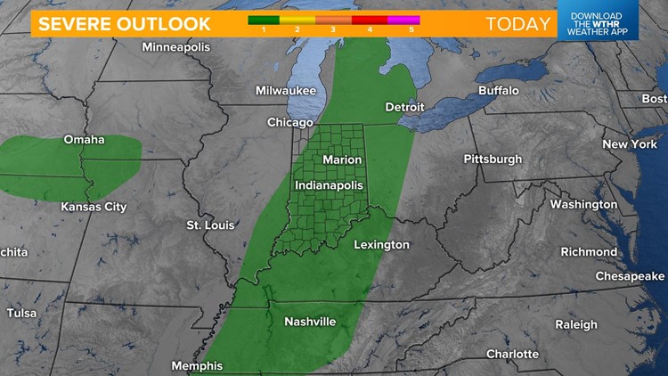
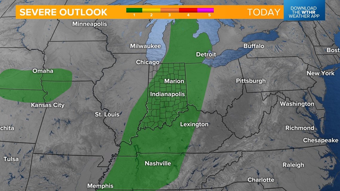
All of central Indiana is under a level 1 of 5 from the Storm Prediction Center for the risk of isolated severe storms.

The primary threat today will be large hail as these will be slow-moving storms as well as damaging wind gusts.

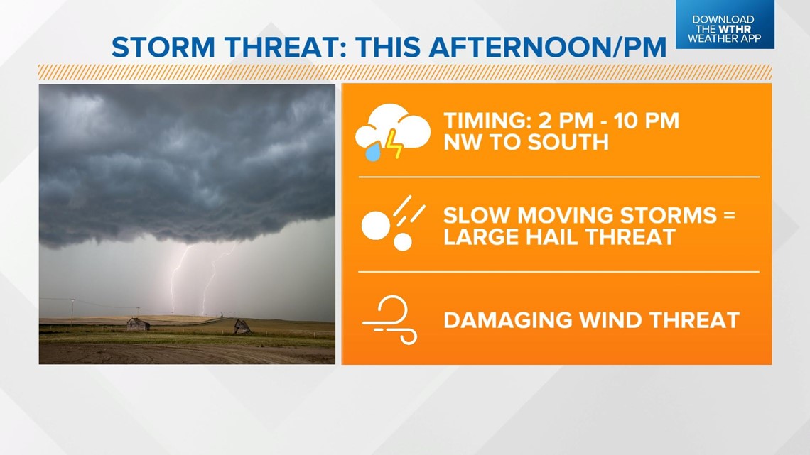
The severe threat will come to an end from north to south by 10 p.m.

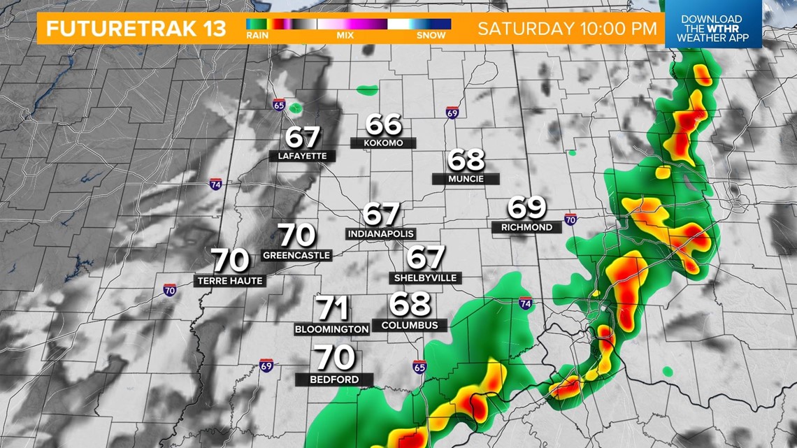
Skies clear overnight as temperatures cool into the upper 50s.
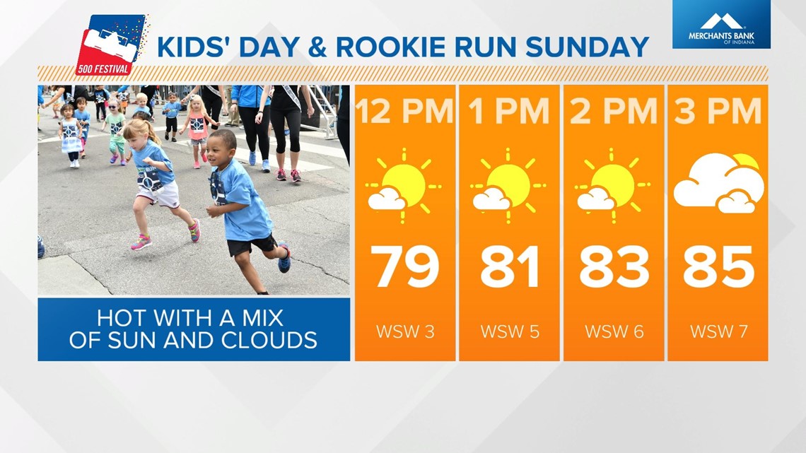
Quiet weather with lots of sunshine starts the day on Sunday. Temperatures rebound to the mid 80s in the afternoon as a secondary cold front arrives in the early evening.
That means it'll be a hot one downtown for the 500 Festival Kids' Day and Rookie Run.

More storms develop, mainly after 5 p.m. Sunday, and some could be on the strong to severe side with damaging wind gusts as the primary threat. The Storm Prediction Center has most of central Indiana under a level 2 of 5 for scattered strong to severe storms.

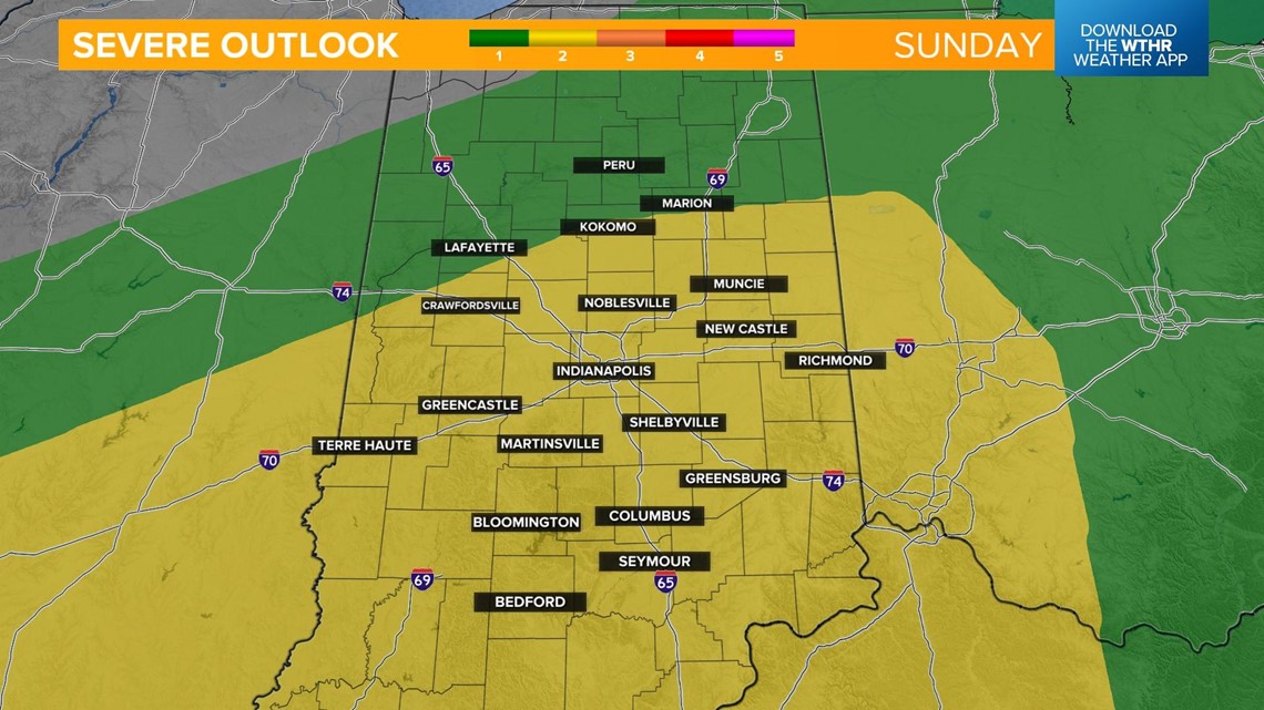

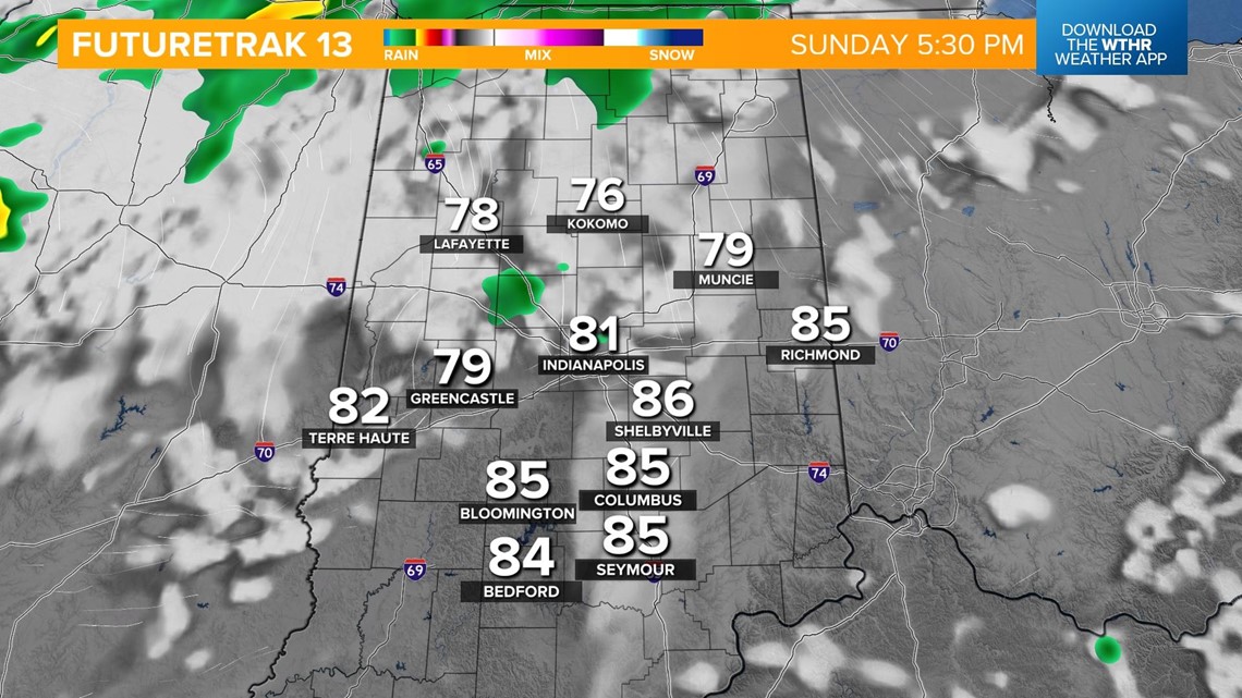
The risk of severe weather continues through the evening as more storms develop along the passing frontal boundary.

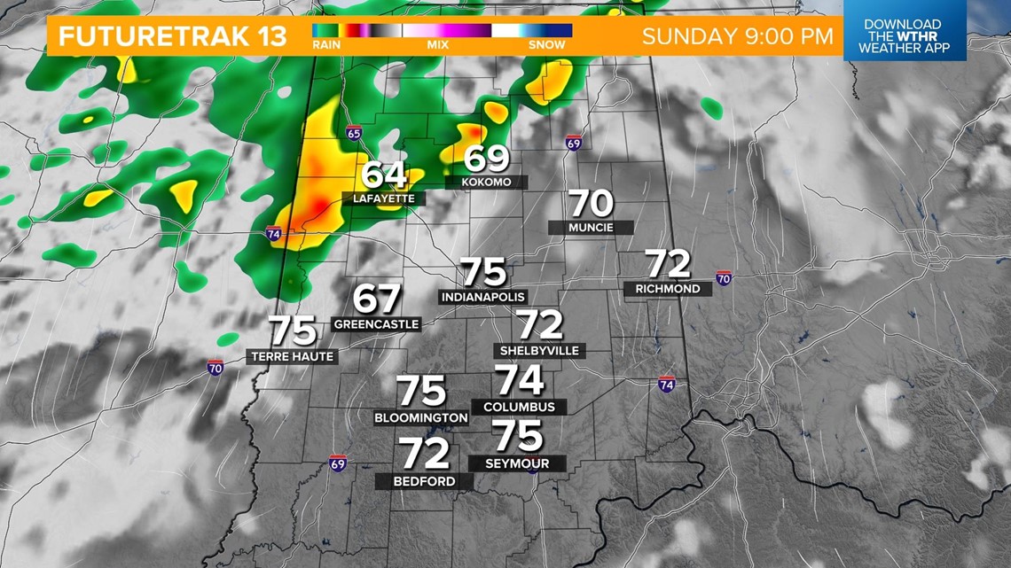

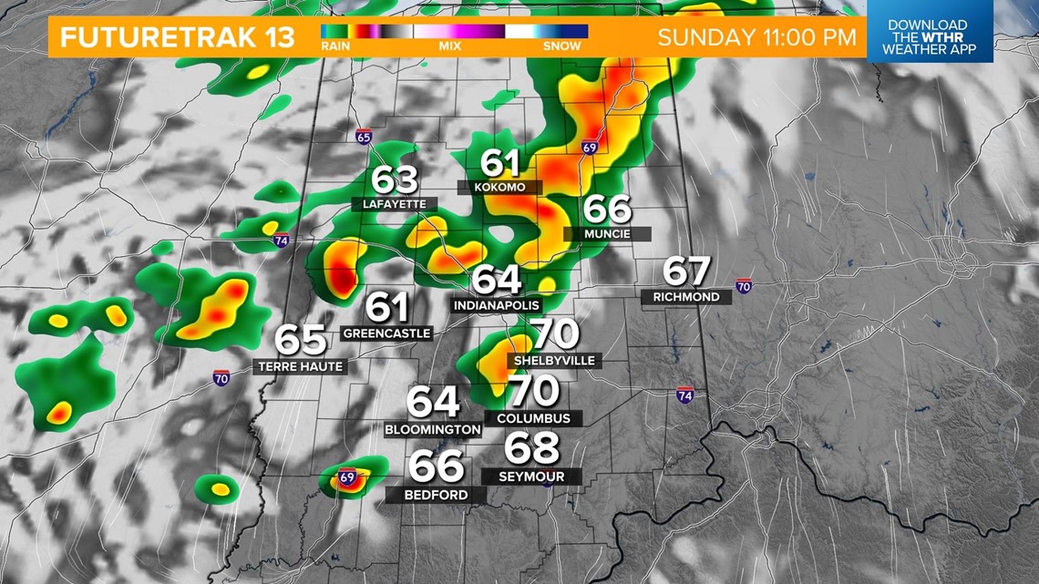
The line will exit the state and clear out by 4 a.m. Monday.
More quiet weather returns to start next week with sunshine and more seasonal temperatures with highs in the mid 70s through mid-week.

