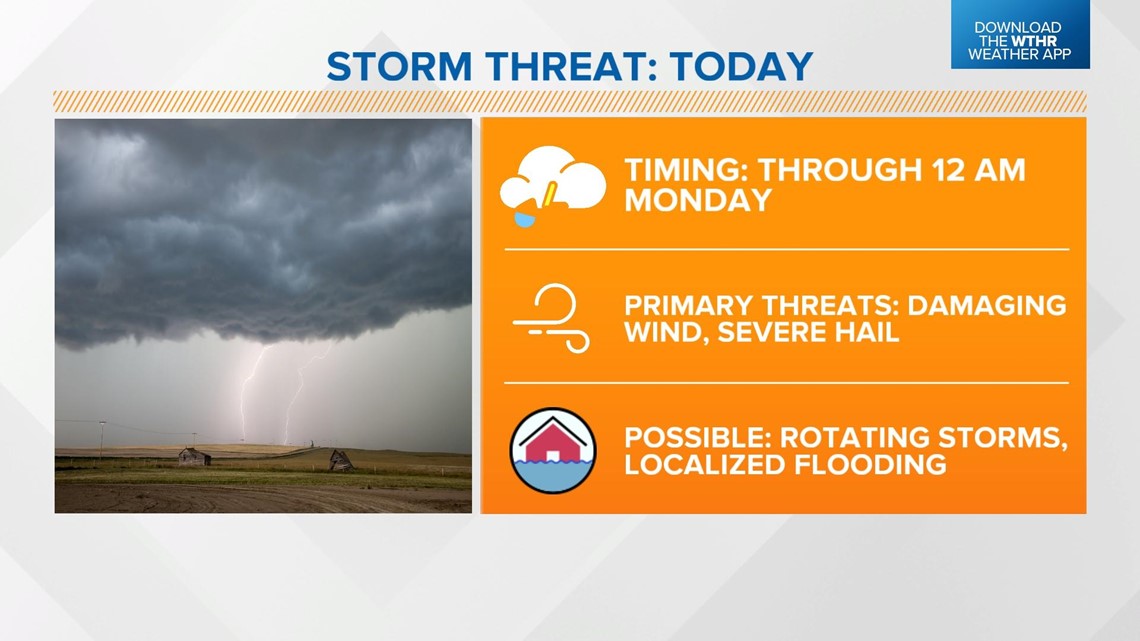
INDIANAPOLIS — Today will be the transitional day to heat and humidity as a warm front stalls out through central Indiana. This will also trigger scattered storms. Some could be strong to severe.
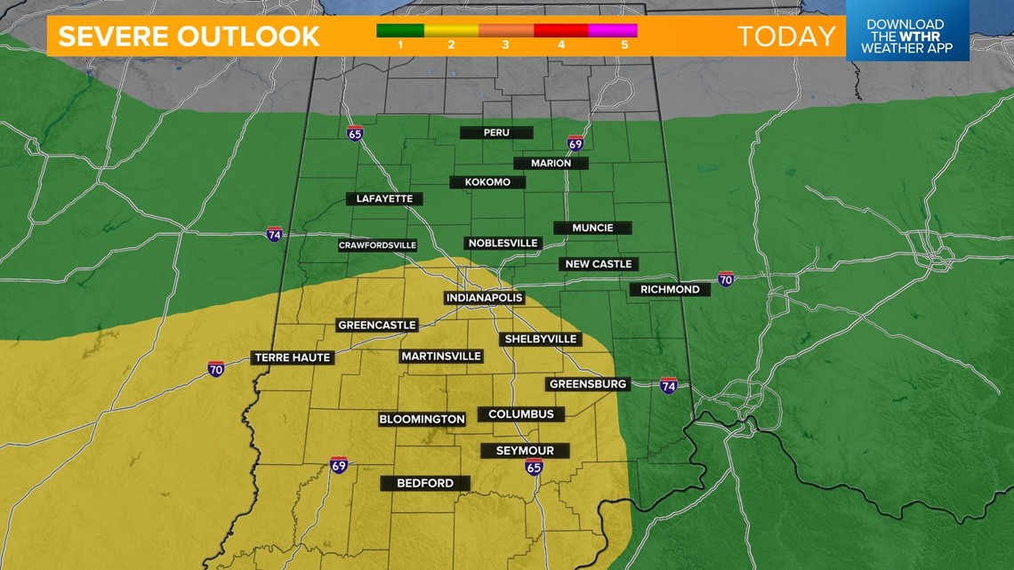
The Storm Prediction Center has placed most of central and southern Indiana under a level 2 of 5. Damaging wind gusts and severe hail are the primary threats.
A few rotating storms can't be ruled out through the afternoon into the early evening.


Scattered showers and storms will continue to initiate through the afternoon.

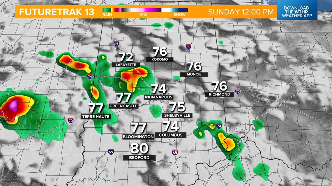

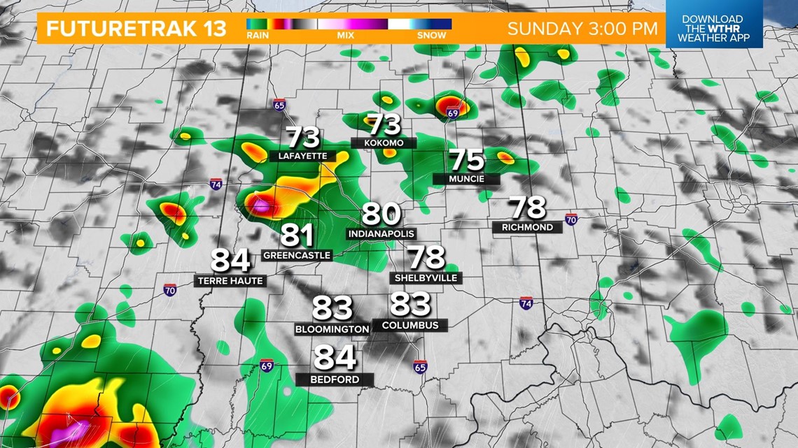

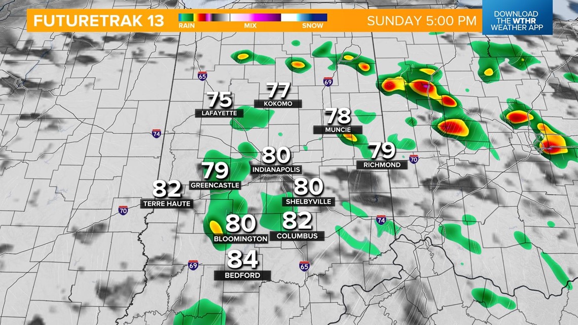
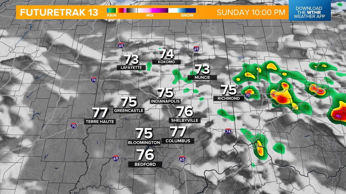
Temperatures surge into the low 80s in the late afternoon. We'll also feel a lot more humid today with dew points nearing 70 which puts us in the "miserable" category. Storms will dwindle as we near sunset just after 9 p.m.

The heat is on for next week, and it could be dangerous heat at times.

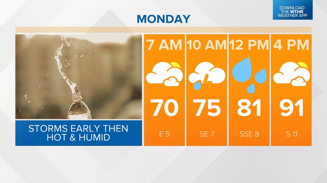
Monday's weather event starts with a round of storms that pops up during the first part of the day.
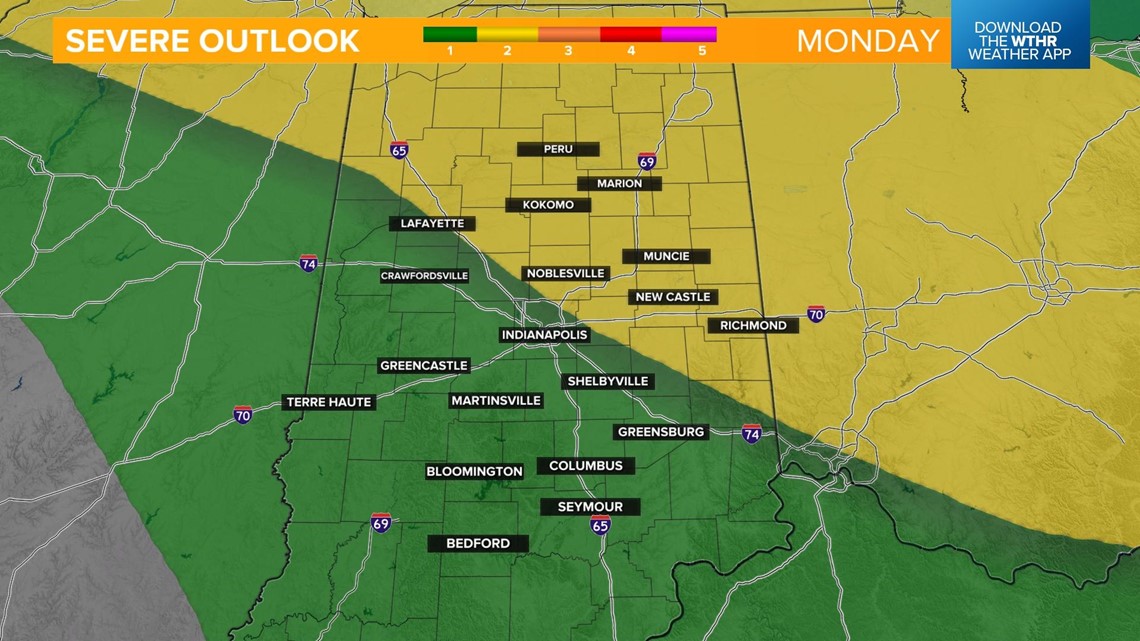
There is a risk of some storms reaching severe limits as this complex moves through, which has prompted the Storm Prediction Center to place northeastern parts of the state under a level 2 of 5.

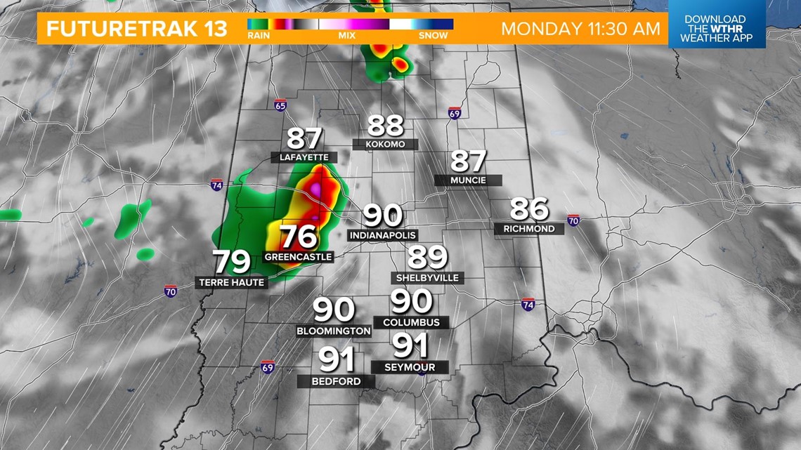


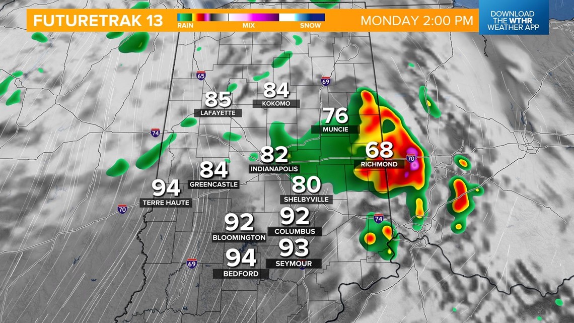
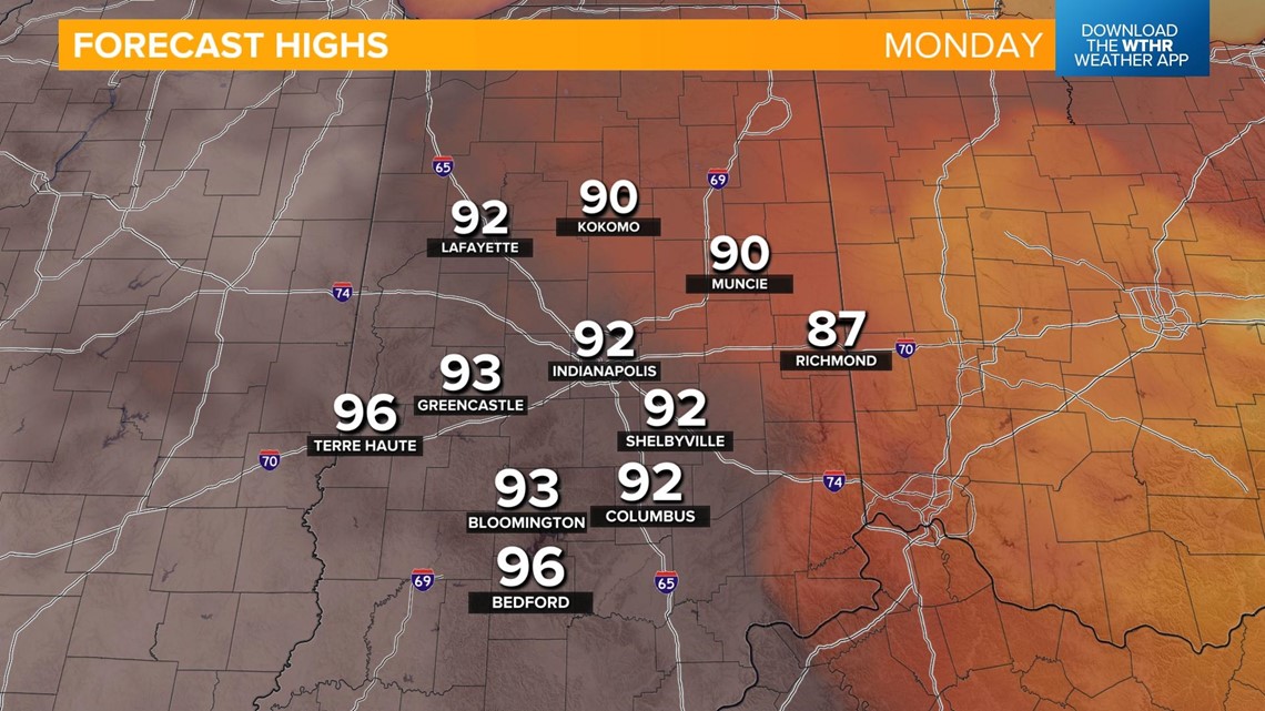
Conditions then turn hot and humid with highs in the low 90s and miserable dew points in the mid 70s.

Tuesday will be the hottest day of the week with highs threatening to break a record.
We are forecasting 97, while the standing record is 94 set in 1954. Heat indices could range anywhere from 105-110°.
We'll be knocking at the door of another record high on Wednesday with a forecast temperature of 95.

