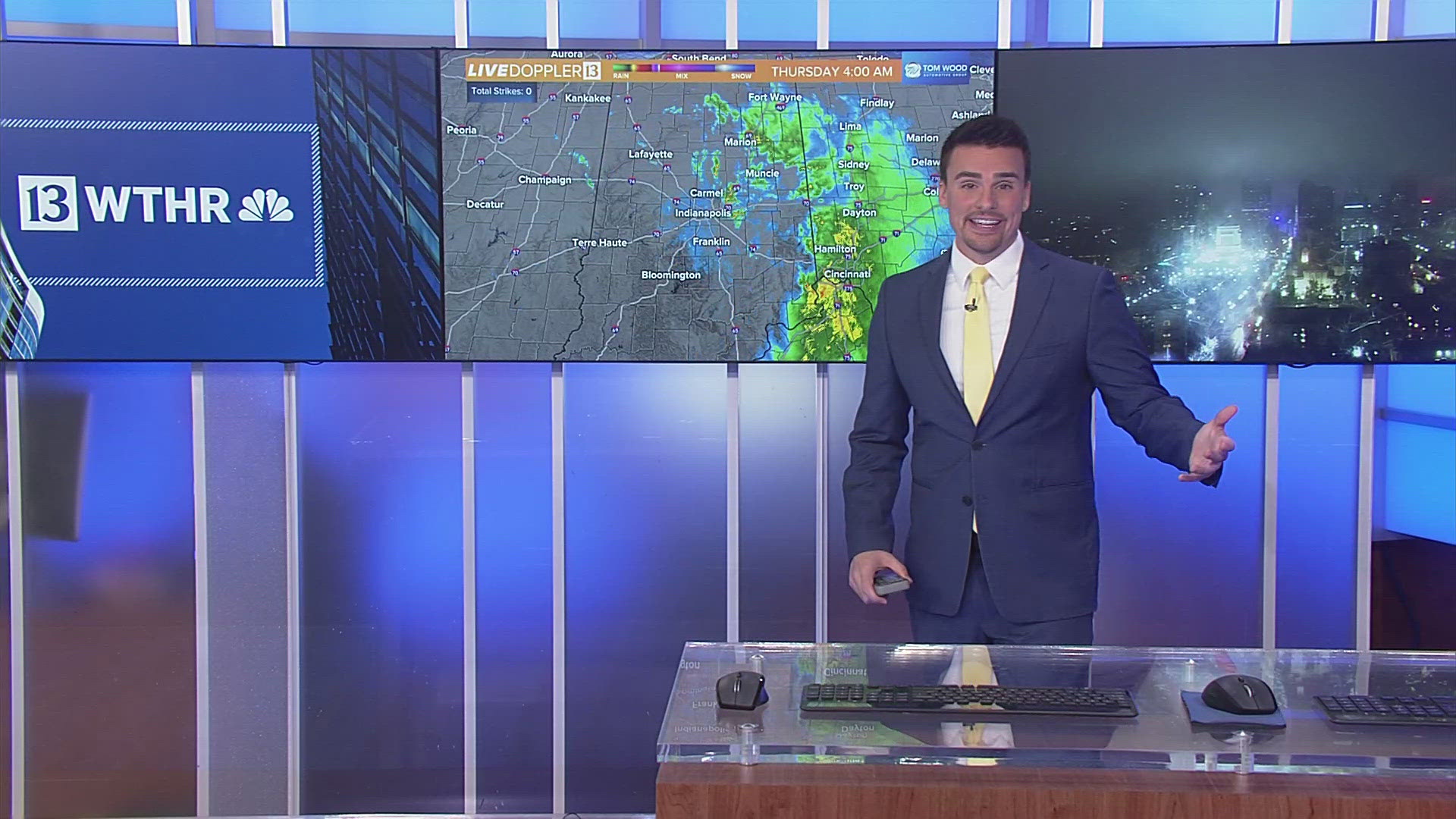
INDIANAPOLIS — A winter storm is on track to impact the area over the next few days.
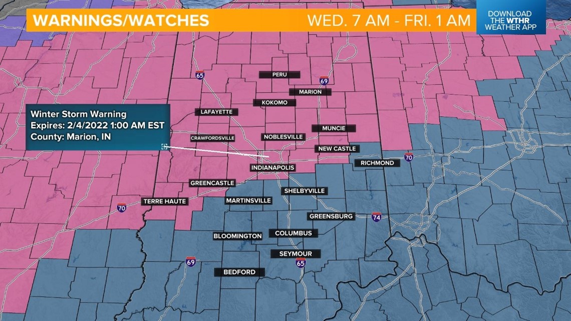
A Winter Storm Warning will be in effect from 7 a.m. on Wednesday through 1 a.m. on Friday for all counties along and north of the I-70 corridor, including Vigo, Marion, and Henry counties. The remaining counties south are still in a Winter Storm Watch but will likely be updated to a Winter Weather Advisory.

Latest timeline
The leading edge of precipitation moves into northwest Indiana after 5 p.m. Tuesday.

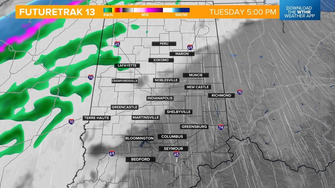
Precipitation becomes widespread through the northern tier of the state overnight as colder air takes over. This will start the transition from rain to snow from Lafayette to Peru around 2 a.m.

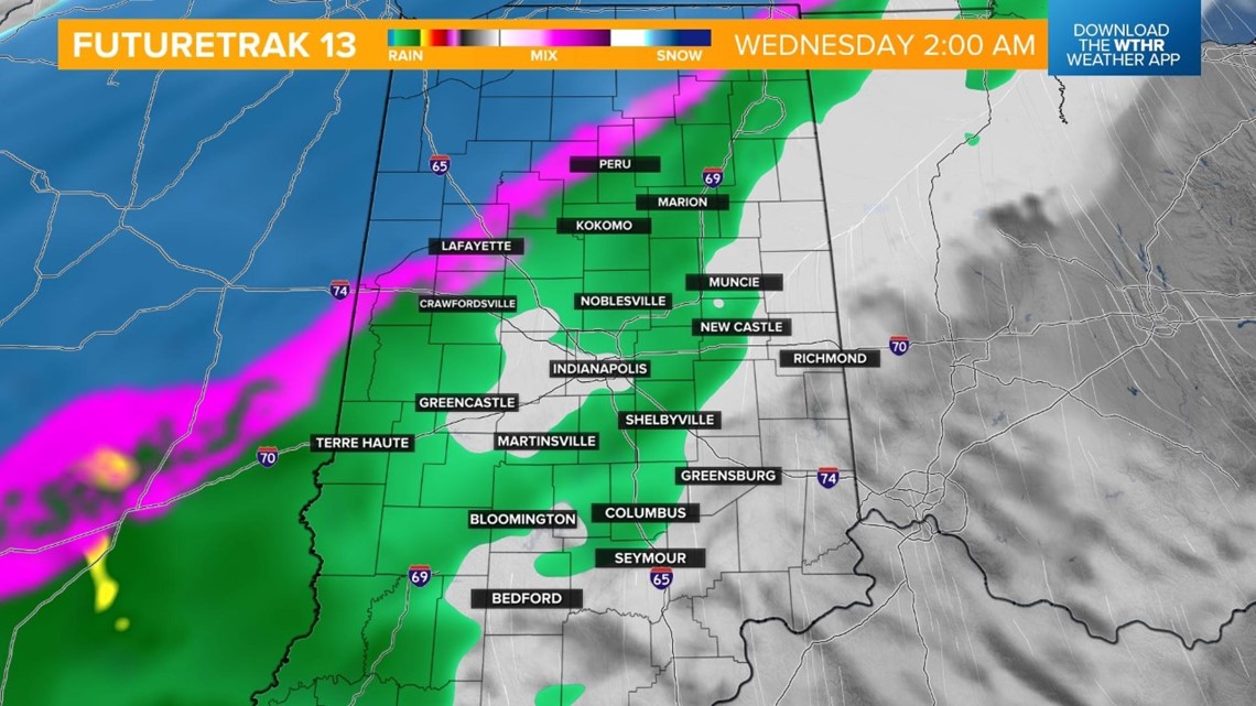
Most of the impactful snowfall will stay north of the I-70 corridor through Wednesday morning. North and northwestern portions of the state should be aware of potential school closures and deteriorating road conditions. The Wednesday morning rush through the Indy metro shouldn't see much of an impact other than wet roads.

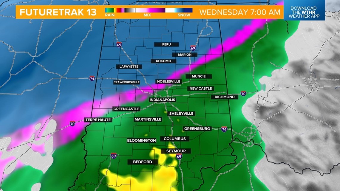
Colder air will progressively push south through Wednesday afternoon with a wintry mix becoming likely just north of the I-70 corridor.

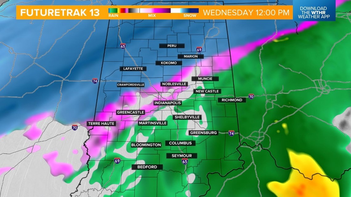
Through the afternoon, the metro will start to see a wintry mix with icy road conditions developing. This will be a tough time to travel since crews won't have much time to pretreat the roads with this preceding morning rainfall. Rain will still be the primary precipitation-type in the south.

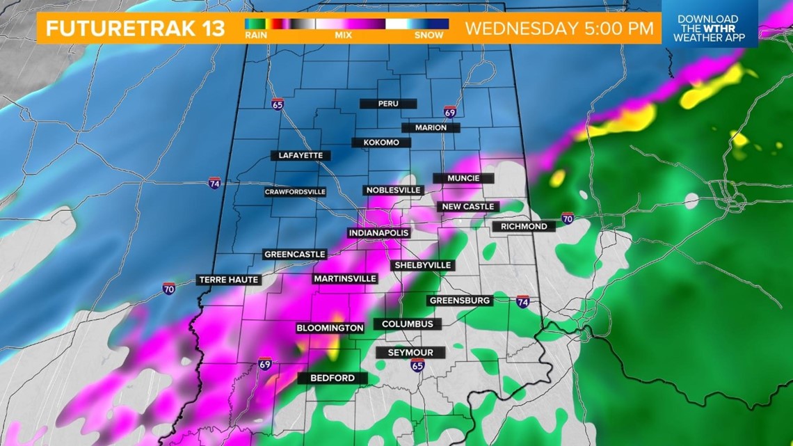
Wednesday evening into Thursday morning will be the timeframe that conditions really begin deteriorating through the metro as the wintry mix transitions into snow. A light ice glaze will potentially be covered by the fresh snowfall during the Thursday morning commute.

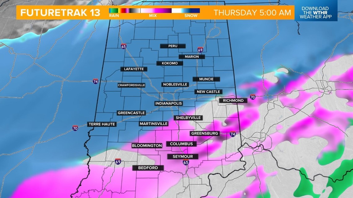
Snow rates begin to intensify Thursday through the morning and afternoon with the heaviest snowfall accumulation likely at this point, making roads very difficult and nearly impassable across northern Indiana.
The southern tier of the state will be dealing with ice accumulations of up to 0.25 inches before the transition to snow.

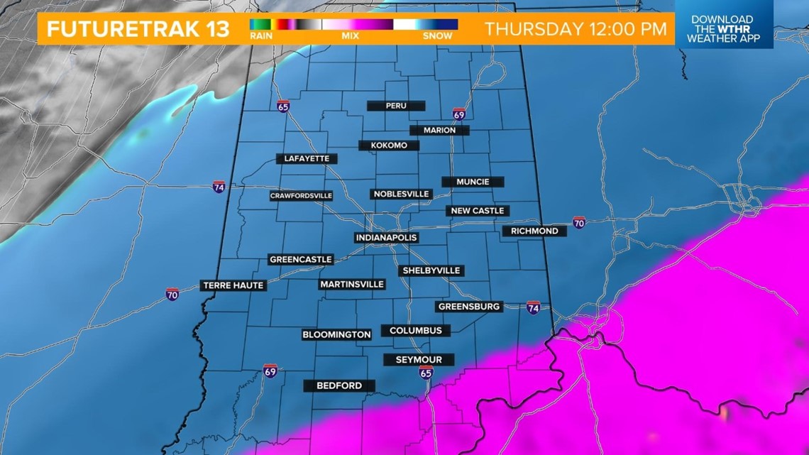
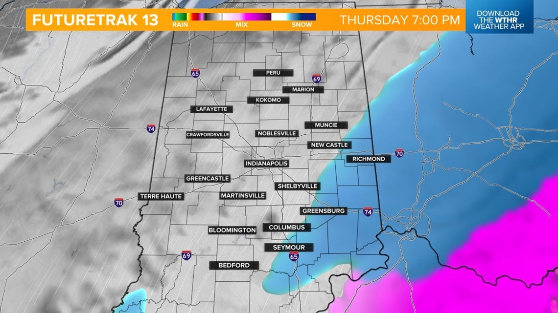
The system is still on track to exit the state between 5 p.m. and 7 p.m. Thursday.
Keep in mind: wind gusts will begin gusting to 30-40 mph Thursday evening, creating blowing and drifting even once the snow ends. This will make visibility difficult when traveling and hard to keep roads clear.

Ice and snow potential
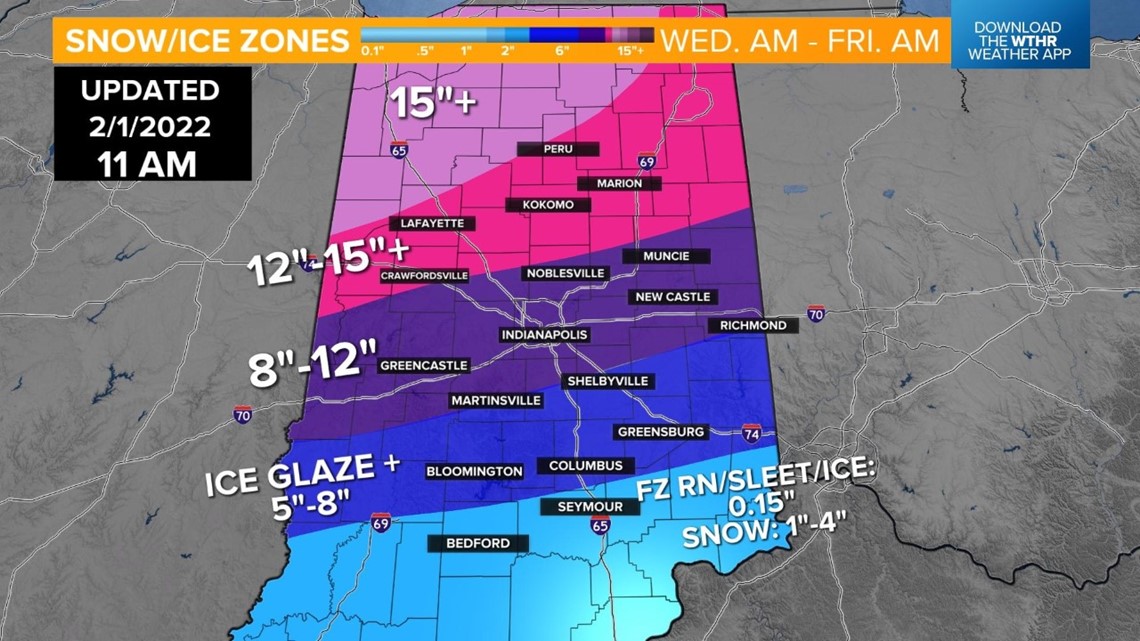
Northwestern Indiana will see the highest snowfall potential — many in the double digits with 15+ inches possible. The rest of northern Indiana, including Lafayette, Kokomo, Peru, and Marion, will likely see at least a foot of snow up to 15+ inches. Keep in mind: A lot of northern Indiana will start seeing high snowfall accumulation during the day on Wednesday.
Along the I-70 corridor, including the Indianapolis metro, snow will likely be the primary form of precipitation by Wednesday evening, which is earlier than anticipated with earlier model runs. This ups the snowfall potential for the metro to 8-12 inches.
Impressive snowfall numbers are still likely from Martinsville to Shelbyville and south with a total of 5-8 inches possible by Thursday evening over a glaze of ice that falls Wednesday afternoon.
Finally, our southernmost counties, including the cities of Bedford and Seymour, will see the potential of 0.15 inches of ice accumulation, prompting isolated power outages, with a few inches of snow possible Thursday afternoon and evening.

Stay tuned to WTHR for the latest storm updates and you can always get the latest information on the Live Doppler 13 Weather App.


