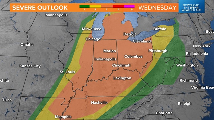
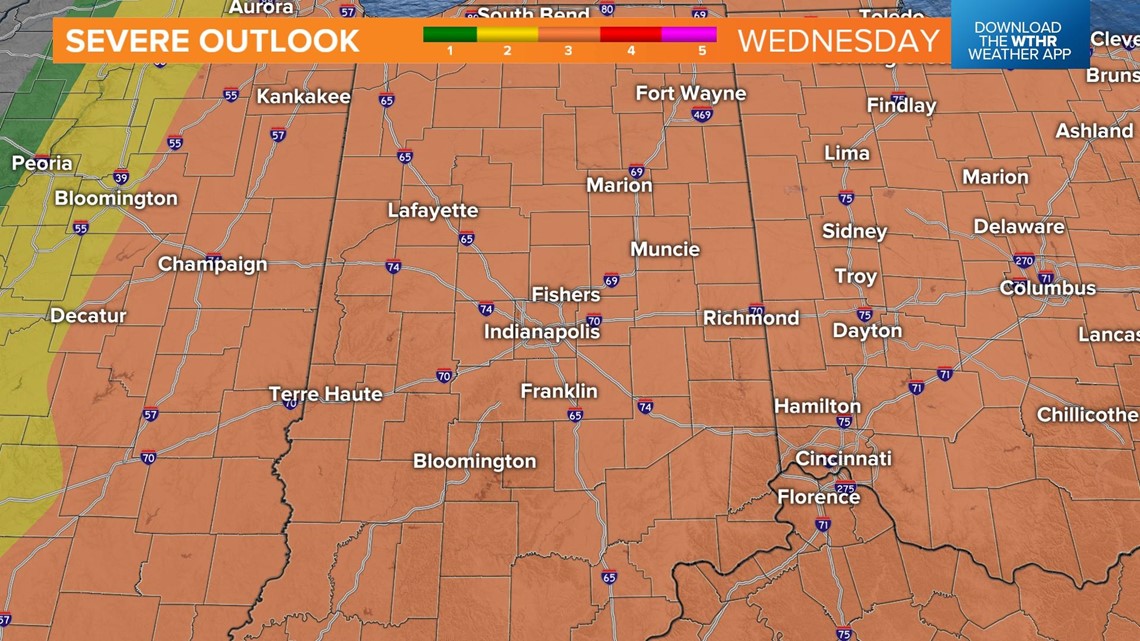
INDIANAPOLIS — Strong to severe thunderstorms are likely Wednesday. The Storm Prediction Center has put all of central Indiana in an enhanced risk of severe weather.

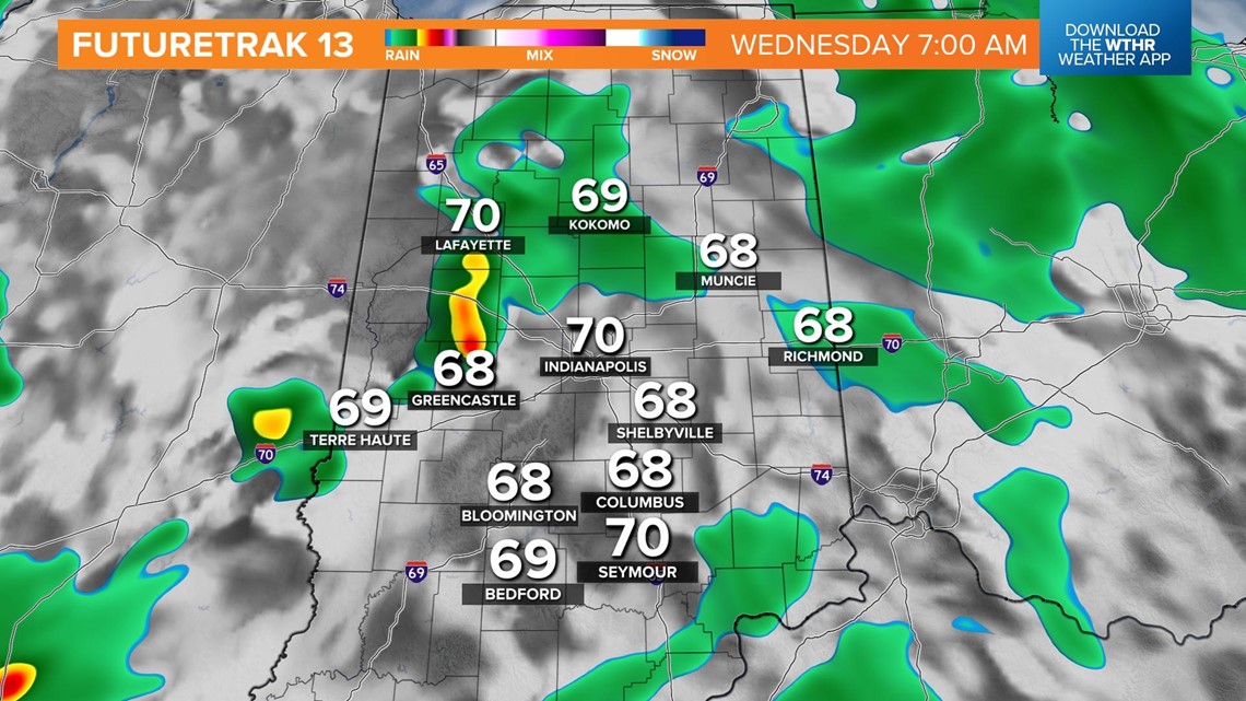
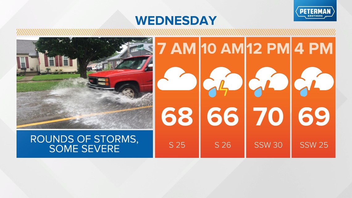
There will be at least two rounds of thunderstorms Wednesday. The first round will arrive by 7 a.m. and continue through noon.


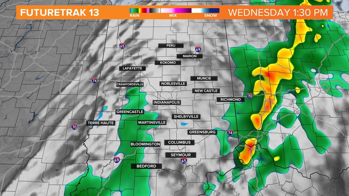
The second round will arrive between 3 p.m. and 7 p.m.

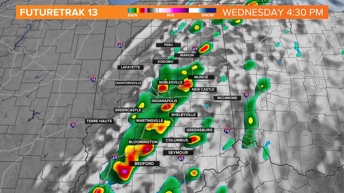

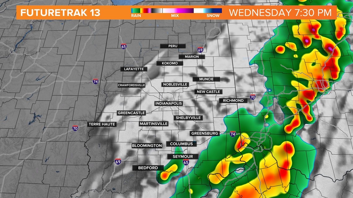
There will be the potential of severe thunderstorms during both rounds. However, the second round could pack a bigger punch, with more instability and dynamics in the atmosphere. All severe parameters are on the table, including tornadoes, damaging winds and large hail.
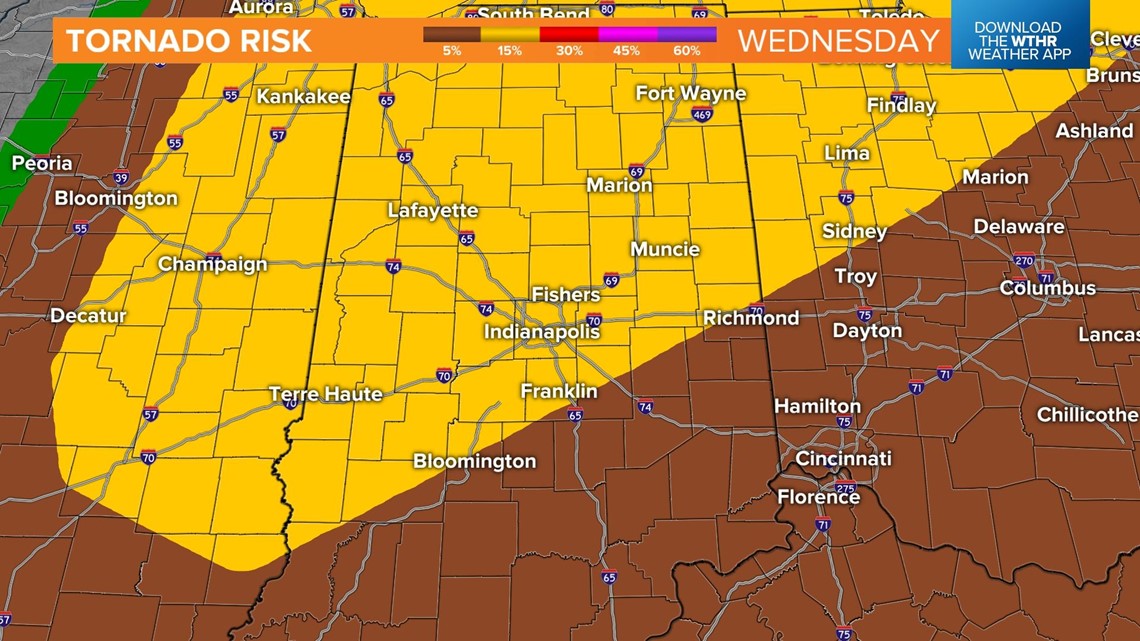
There is a 15% chance of a tornado in the area in yellow below.

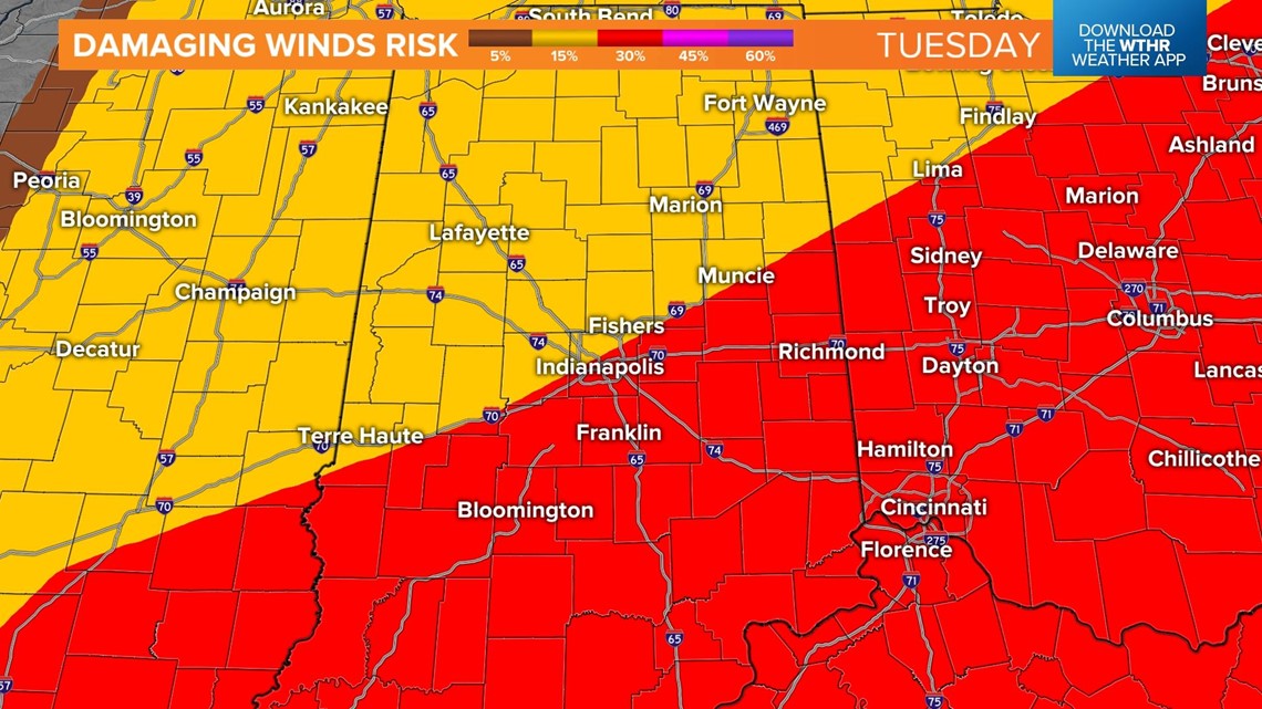
There is a 30% chance of winds exceeding 58 mph or higher in the area in red.

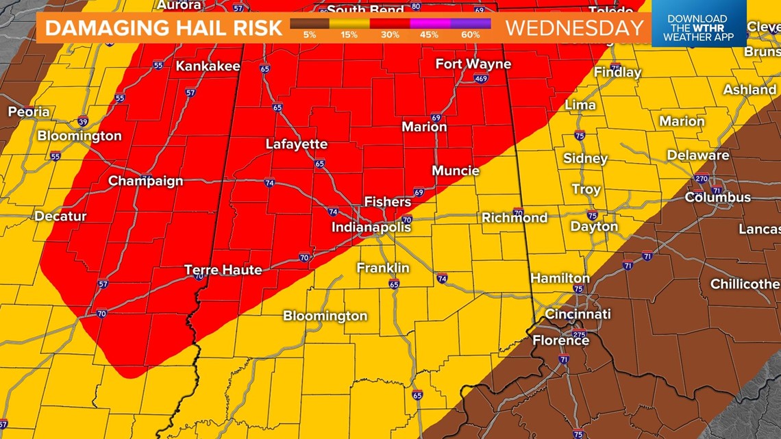
Large hail is also possible, with a 30% chance of hail in the area in red.

It will be windy outside of storms, with gusts around 45 mph. Over an inch of rain is possible with temperatures holding near steady in the upper 60s to near 70°.

Storms should be out of the area by mid-evening. The cold front will usher in much colder air for Thursday. Temperatures will fall into the low 40s Thursday morning, with highs in the mid 50s.


