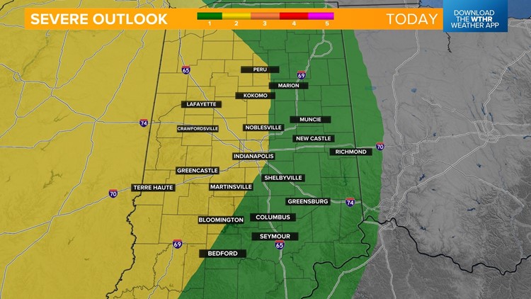
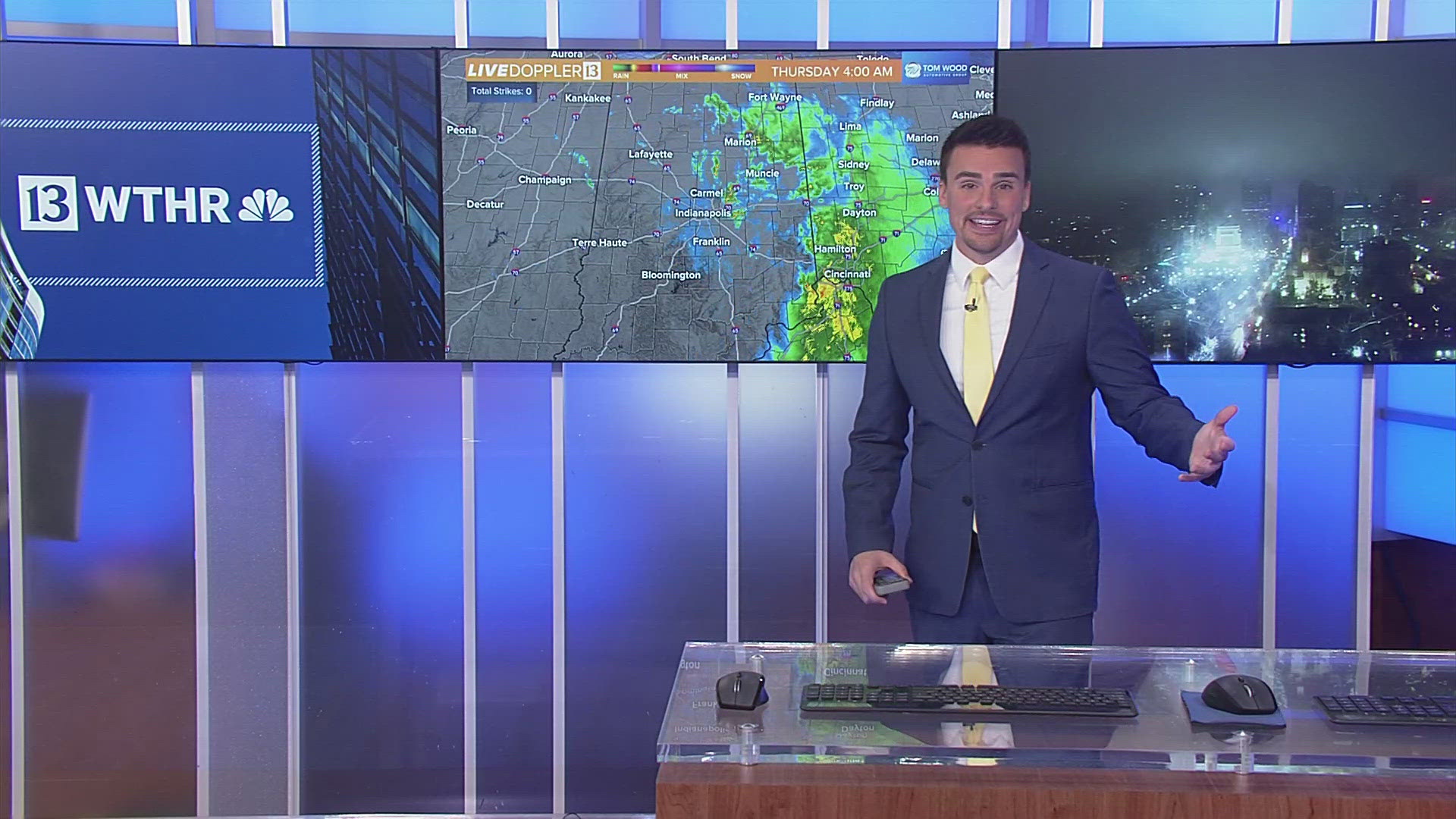
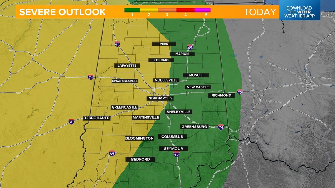
INDIANAPOLIS — Strong to severe storms will be possible late this afternoon and evening. The Storm Prediction Center has placed the western side of the state under a level 2 of 5 for the risk of scattered strong to severe storms and the eastern half of the state under a level 1 as the line weakens as it tracks from west to east.
All of central Indiana should be prepared to receive storm alerts between 4 p.m. and midnight. The primary threat would be damaging wind gusts with the potential of large hail and rotating storms along the line.

A warm front is lifting through the state this morning and will prompt a few scattered rain showers and isolated storms. It'll be warm, windy, and humid in the afternoon while central Indiana sits in the "warm sector" of this weather system as temperatures approach the upper 70s near 80.

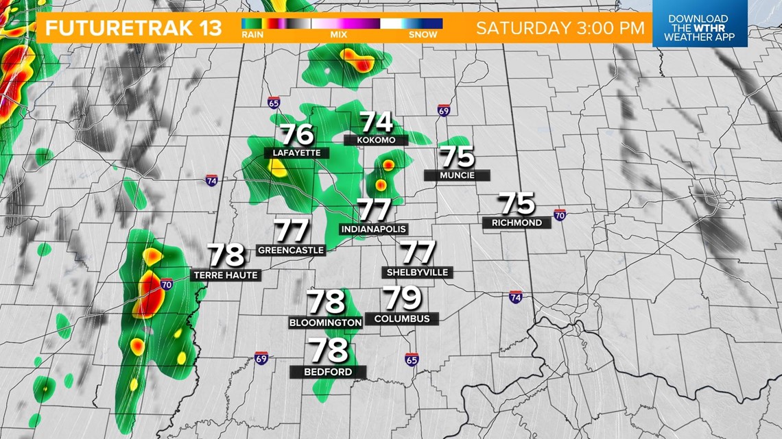
A few things will impact storm development today. The first driver is how widespread the morning rain will be and if thick clouds linger into the afternoon. Both would hinder storm development. If we see breaks in the clouds and more sunshine, storms could use that fuel to become stronger.

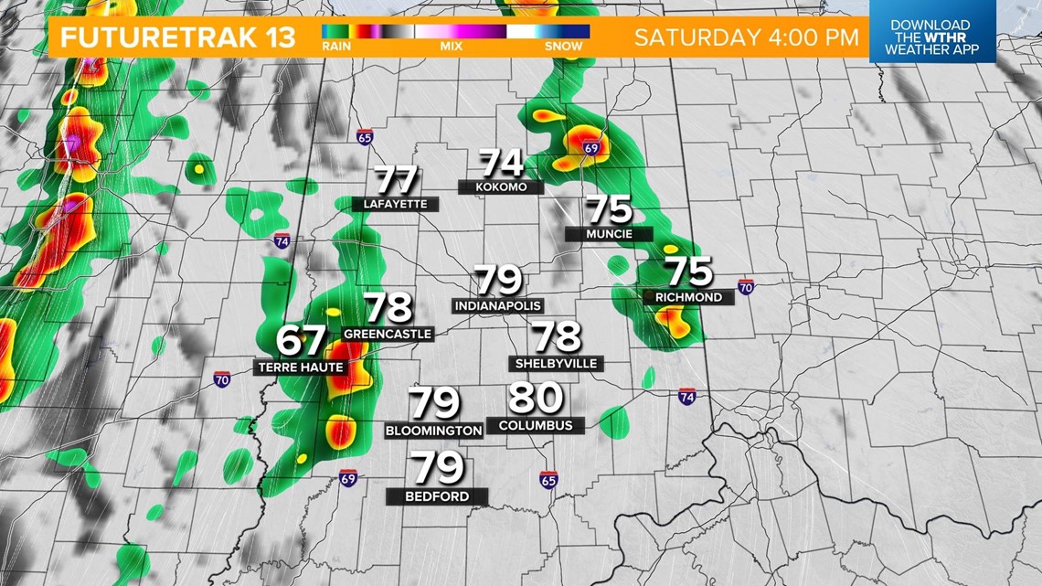
The line of storms will be associated with a cold front and will advance through Illinois in the late afternoon. The line begins to cross into the western side of Indiana after 4 p.m. This zone will be at the higher risk of more widespread strong to severe storms.

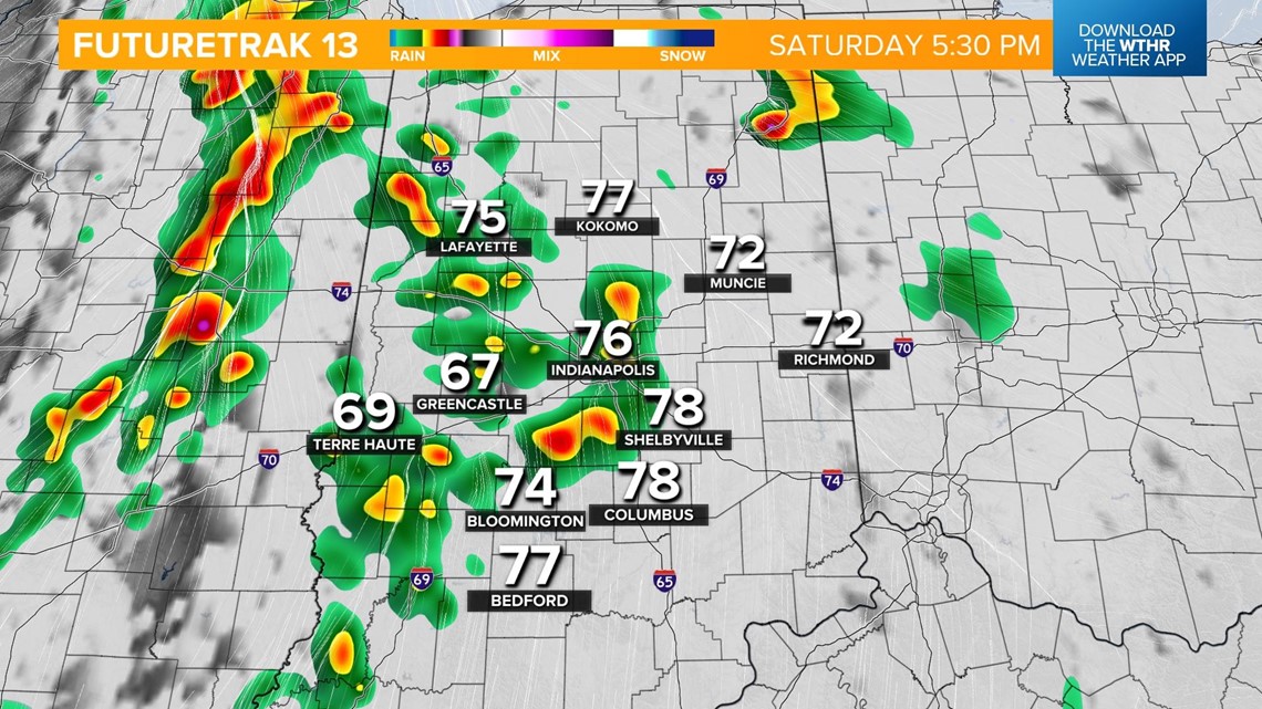
The line will then track east over the next few hours arriving in the Indy metro area between 5 and 7 p.m.

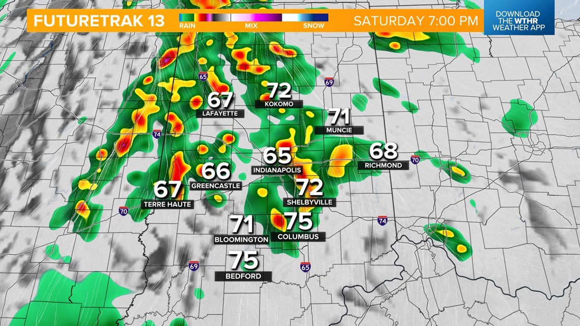
Storms impact the eastern half of the state from 7 to 9 p.m.

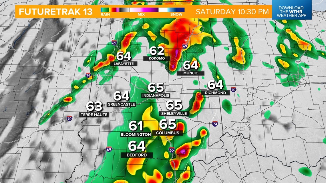
The severe threat comes to an end for most of Indiana by midnight and by 2 a.m. for the eastern portion of the state.
Skies clear overnight with temperatures in the upper 50s.

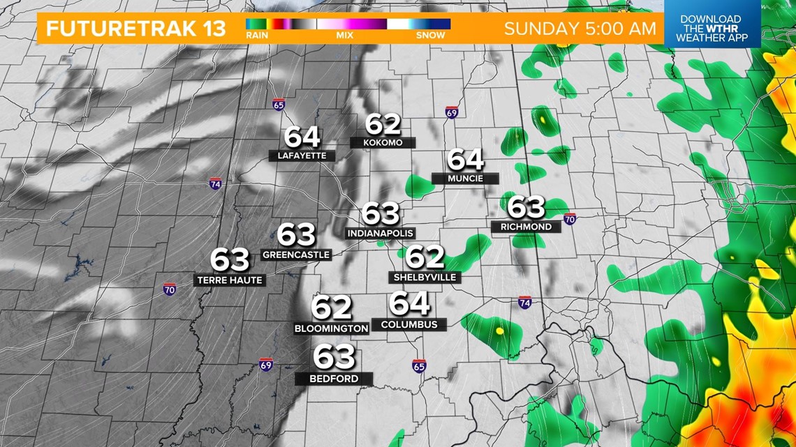
Sunday will be a more quiet day but still breezy with gust winds from the south. Temperatures recover to the low 70s under a mostly sunny sky in the afternoon.

