INDIANAPOLIS — As expected, it's a relatively quiet weather day in central Indiana. There are increasing clouds from south-to-north but they'll have more bark than bite with only a slight chance of showers and/or a storm much later today. Highs reach the upper 60s this afternoon.
There is a chance in far southern/southwestern Indiana that any storms forming along an approaching warm front could rotate. We'll monitor, but the more likely area of severe weather today will be in the central U.S. and centered over eastern Texas and Iowa.

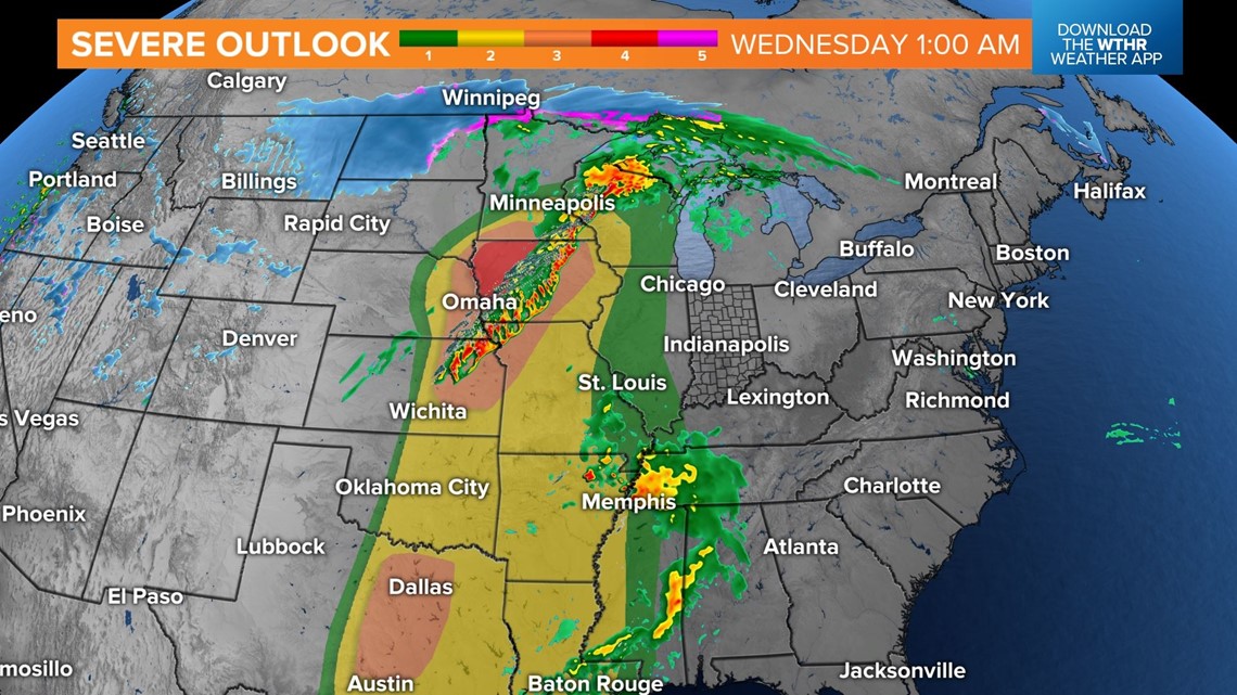
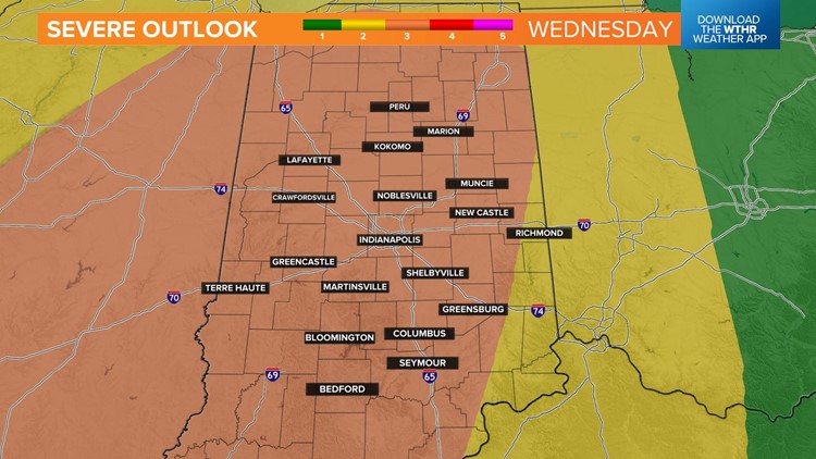
This is the same system that brings a Level 3 (out of 5) risk of severe storms for central Indiana Wednesday. The remnants of the storms that fire up to our west today will arrive here Wednesday morning in a weakening state but possibly borderline severe as wind fields start to ramp up locally.

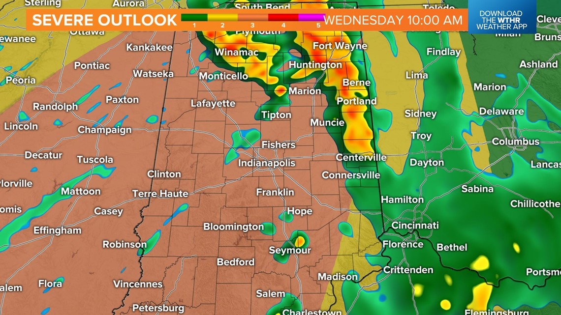

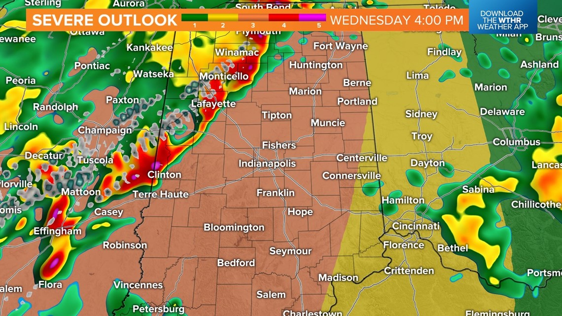
Storms that occur in the morning toward midday will have an impact on the potential instability in the atmosphere for storms later in the day. If these storms depart quickly to allow for some sunshine, that ups the potential of great instability and possibility of supercells. If they linger longer into the afternoon with their remnant cloud cover, that would lessen supercell potential. It's impossible to say at this time how that will play out.

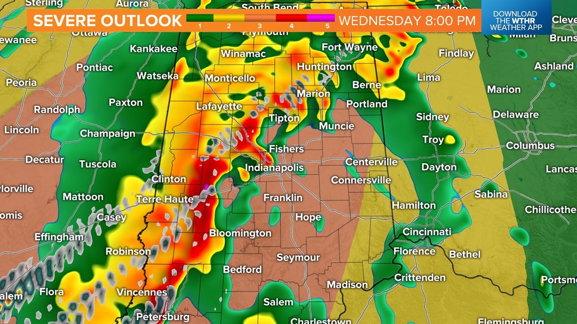
Modeled wind fields later Wednesday are robust at all levels of the atmosphere over central Indiana, which keeps significant wind gust potential in play along an expected squall line. This feature is expected to impact the state between 4 p.m. and 10 p.m., with the potential of damaging gusts and embedded tornadoes.
Gusts of 75+ mph and/or significant tornadoes are both possible based on latest model guidance. Please have your safety plan ready to go and be prepared to take action if needed.
Bottom line: Storms will be around at times from start to finish and some of them will be severe. We expect Watches and Warnings to be issued. We'll have to wait and see how early day storms evolve and adjust the mesoscale details as warranted.
Be Weather Aware Wednesday and check back for updates


