INDIANAPOLIS — Stay weather aware heading into this evening.
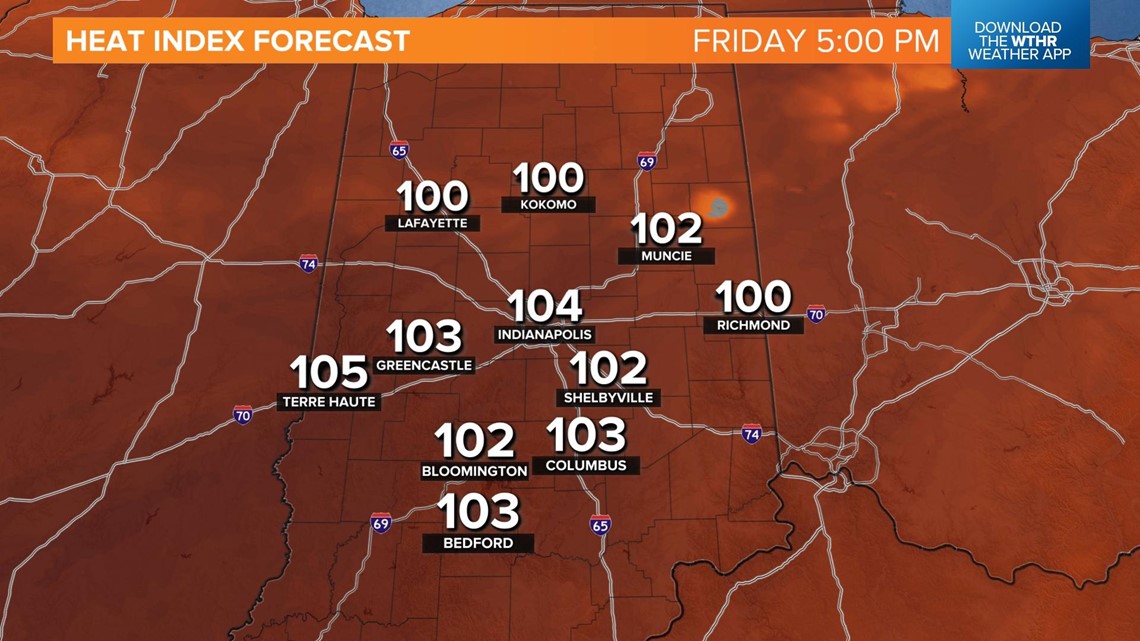
We're currently in the "recovery" period after a round of morning showers and storms. Temperatures, dew points, and the heat index are all on the upward trend for the afternoon which will only add fuel to fire storms later today. Temperatures peak in the low 90s with heat indices ranging from 100-105 through 5 p.m.

Storms will fire up after 5 p.m. with a line of storms pushing south through the central and southern part of the state through the evening.

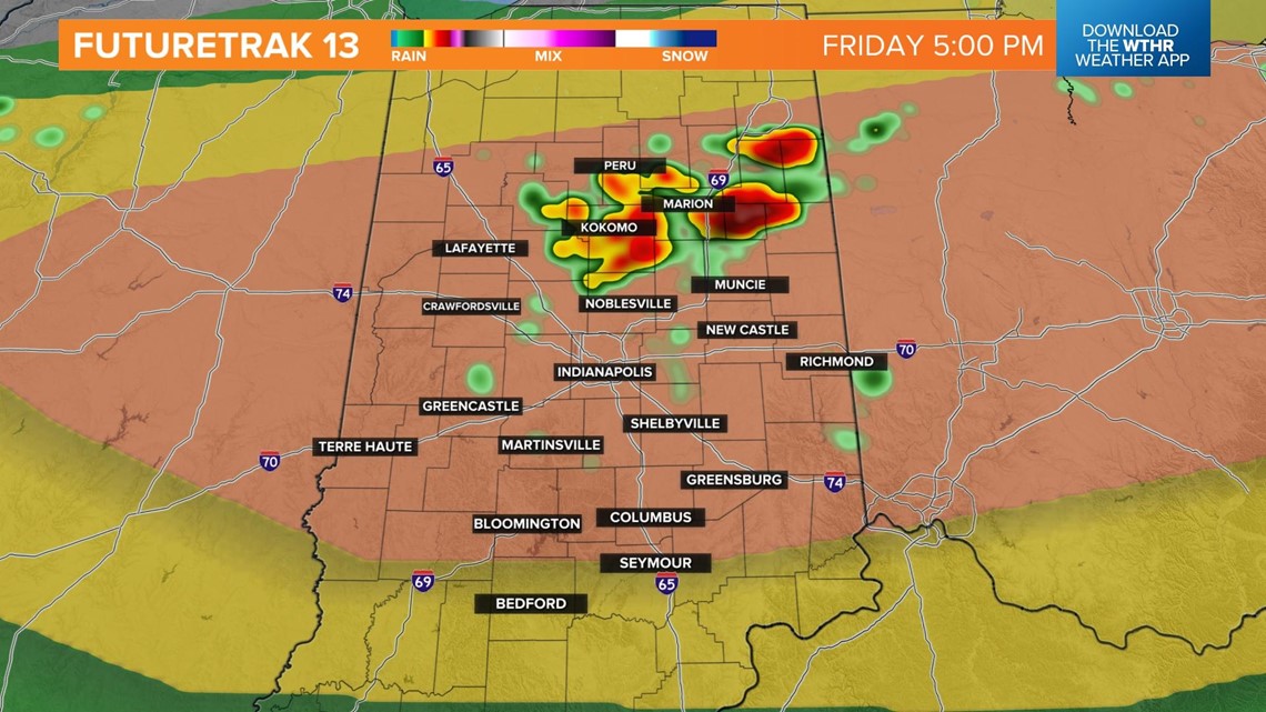

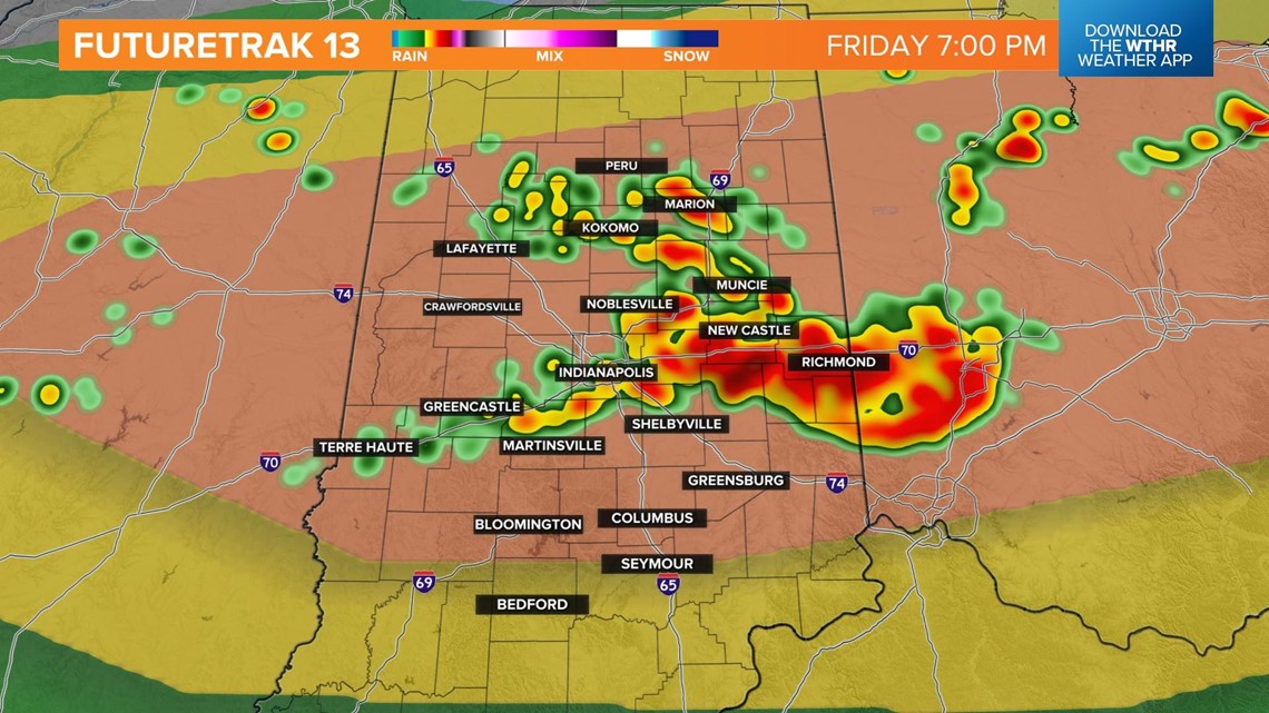

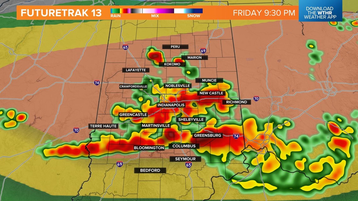

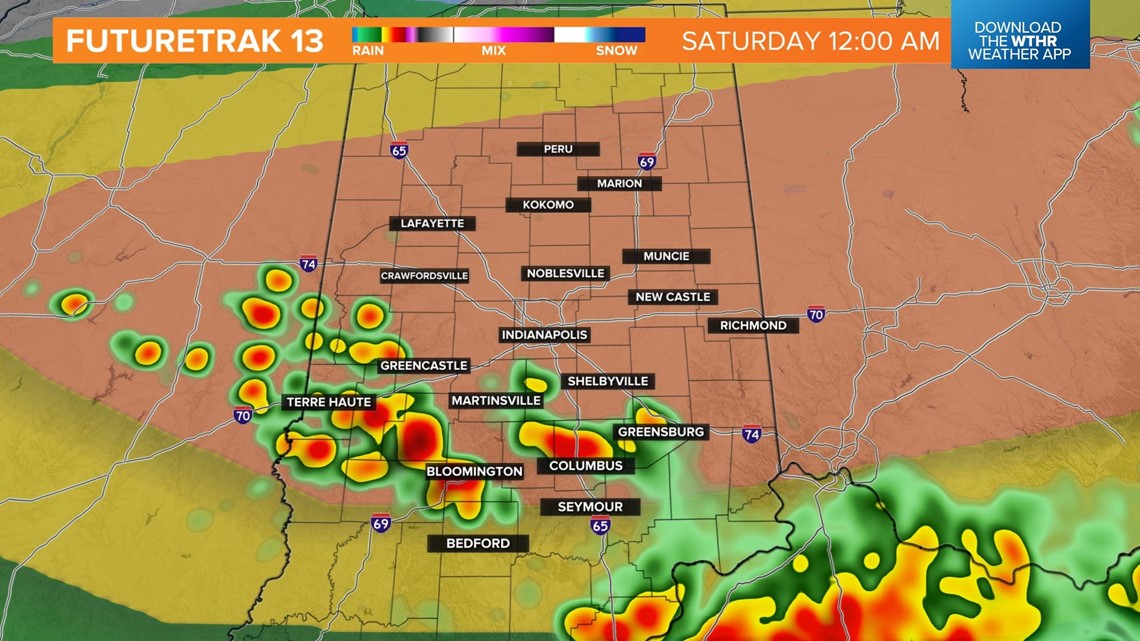
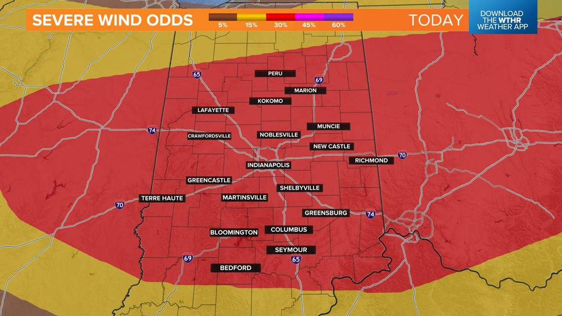
Damaging wind gusts will be the primary threat with large hail and isolated tornadoes possible. Be prepared for downed branches, trees, and power lines leading to power outages.

As the severe threat lowers later in the evening, storm motion begins to slow down and heavy rainfall will lead to areas of flooding this evening and overnight. Some storms could produce over 3" of rainfall.
Scattered storms will dissipate overnight with some dry hours to start the day on Saturday. It'll remain hot and humid with highs in the upper 80s. Another round of pop-up storms will be possible, especially after 5 p.m.

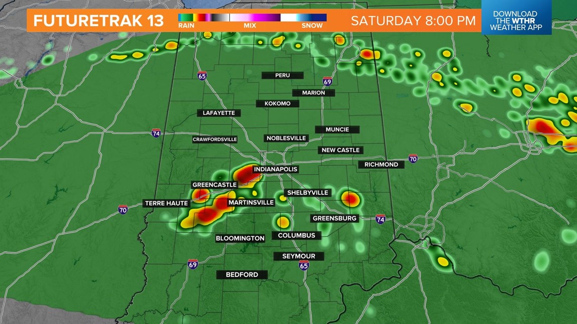
The Storm Prediction Center has placed all of Central Indiana under a level 1 of 5, meaning widespread severe storms are not expected but a few isolated storms are capable of reaching severe limits. Damaging wind gusts and brief torrential downpours are the primary threats.
This boundary wobbles back north on Sunday which means more dry time for Father's Day. It still stays hot and humid with highs again in the upper 80s but that best chance for storms will be in the northern tier of the state.


