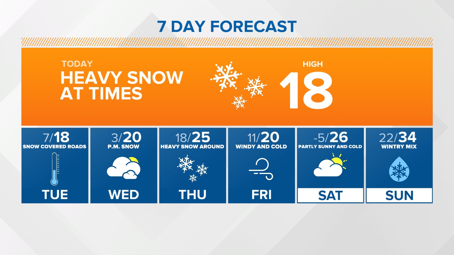
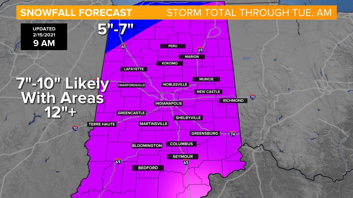
INDIANAPOLIS — We're in the midst of a winter storm system that will bring a total of 7-10" to most of central Indiana, with isolated amounts up to 12" possible.

Here's the timeline. The overnight "weaker wave" of snow is starting to wrap up with many locations reporting 1-2" of snow and slick roads, especially those that haven't been treated.

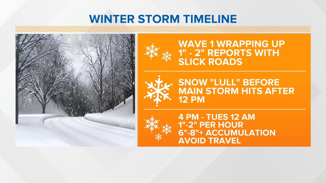
We're heading into a lull before a stronger wave of snow arrives this afternoon.

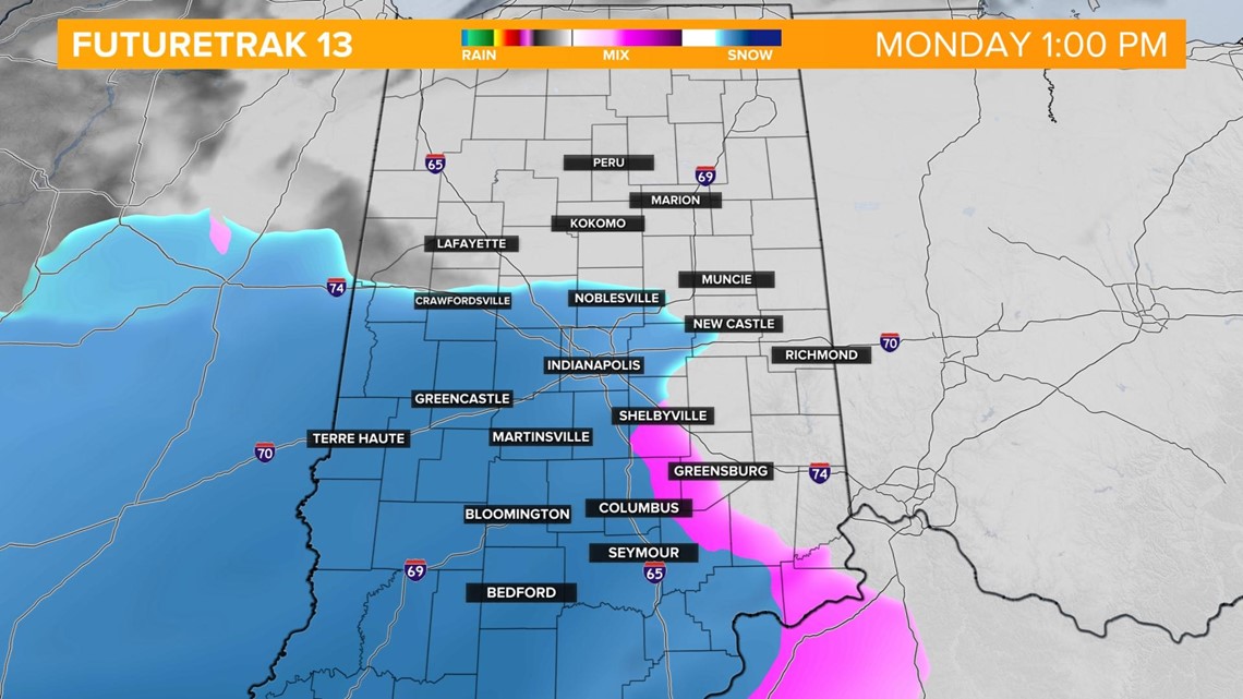
Heavy snow will set-up after 12 p.m. with snowfall rates increasing to 1-2" per hour this afternoon and evening. Travel will become dangerous and some roads could be impassable at times. We'll also be dealing with 20-30 mph wind gusts that could lead to whiteout conditions and deep drifting.

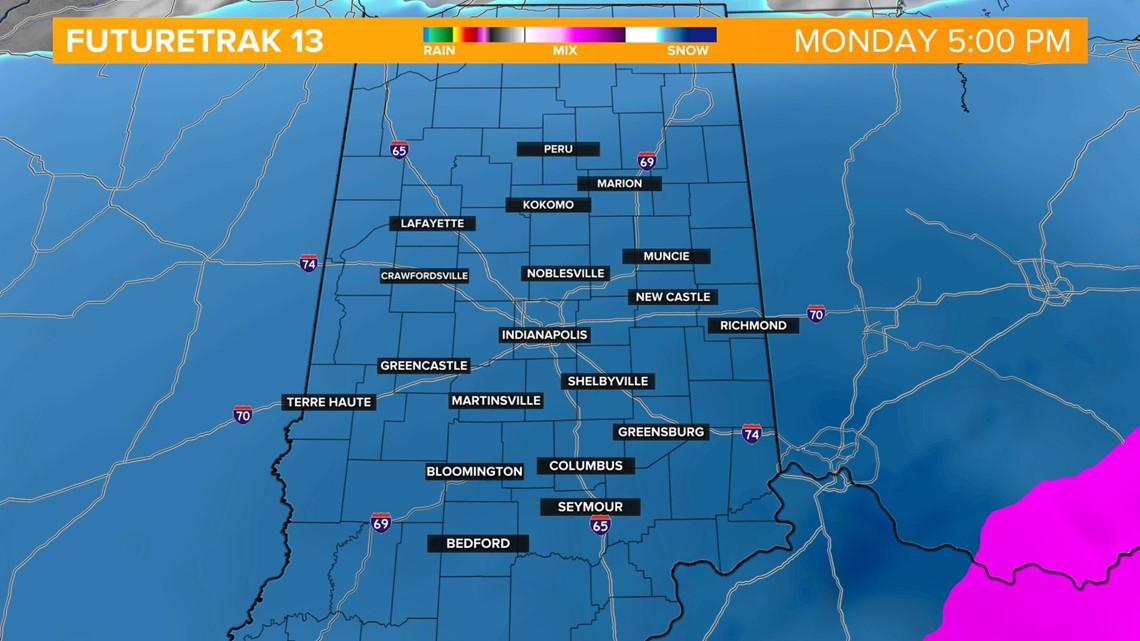
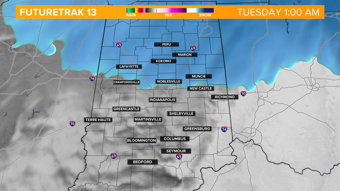
The system will exit the area after 12 a.m. early Tuesday but the clean-up effort will take a while. Because of this, we anticipate the Tuesday morning rush hour to be very difficult.