


INDIANAPOLIS — Too much, too soon.
The second round of active weather in 48 hours delivered quite the soggy punch to central Indiana. Many areas along/south of the I-70 corridor picked-up over 2" of fresh rainfall.
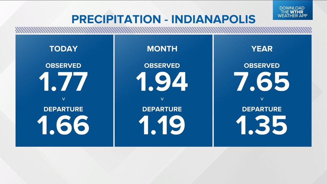
The 1.77" of rainfall at NWS Indianapolis was a daily record for March 7 and nearly half of the average monthly rainfall (3.69") for March. As a result, many areas remain under an Areal Flood Warning until 9 a.m. Tuesday morning.


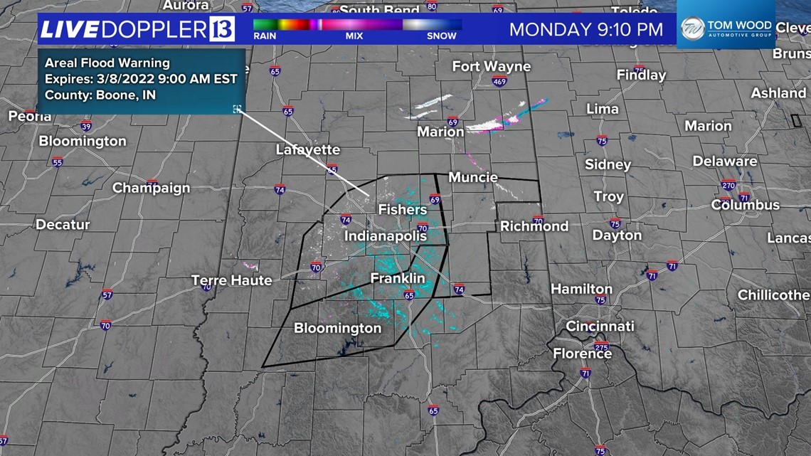
This is despite the fact that we're now seeing flurries and a few snow showers on Live Doppler 13 Radar as we've transitioned to a colder airmass. The wind of change keeps wind chills in the 20s overnight under a blanket of cloud cover. Flurries/snow showers linger Tuesday morning before a shifting wind to the southwest teams-up with a increasing sun to boost highs back into the 40s.

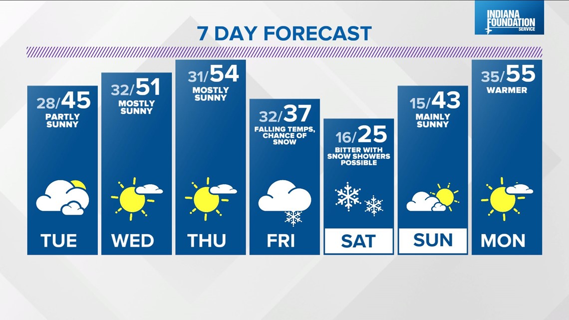
Wednesday and Thursday are the picks of the week with sunshine and highs in the 50s. We'll be monitoring a modeled weather system closely heading into Friday with the potential of some snowfall across the Ohio Valley. Track, timing, strength are all unknown at this time.
There's higher confidence on a jab of bitter air to open the weekend with wind chills possibly nearing zero Saturday morning. Check back for updates.
