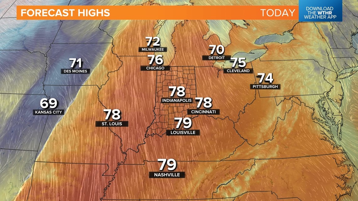
INDIANAPOLIS — For the fifth straight day, high temperatures will be well into the 70s and some 15°+ above average. This air mass is more indicative of mid-September instead of late October and comes courtesy of hazy sun and a stiff southerly wind.
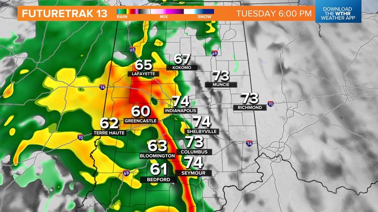
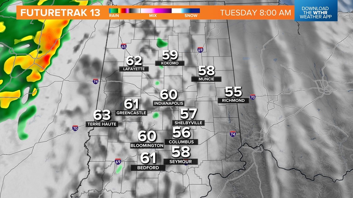
Balmy wind gusts over 25 mph can be expected before sunset, but the wind continues overnight into Tuesday. Very mild out-the-door temperatures near 60° tomorrow set the stage for another day in the 70s before an area of rain and storms expand over central Indiana.
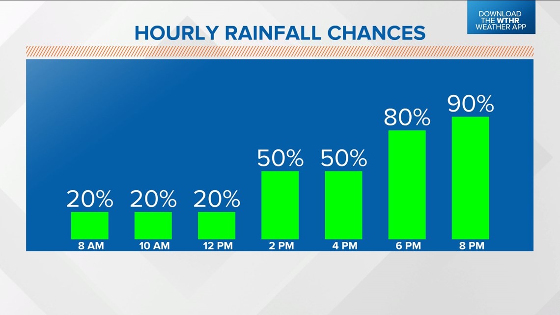
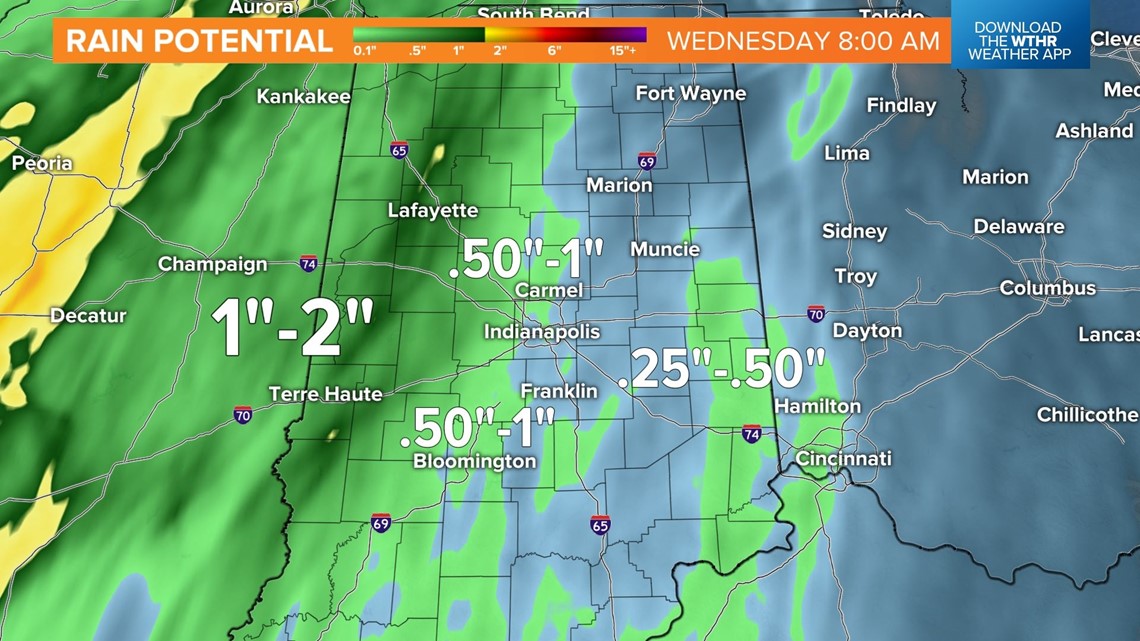
While spotty showers can't be ruled out early Tuesday, the bulk of our much-needed rain occurs between midday Tuesday and midday Wednesday. In fact, this will likely be the wettest period we've had in months with a forecast of widespread .50"-1" rainfall values during that time.



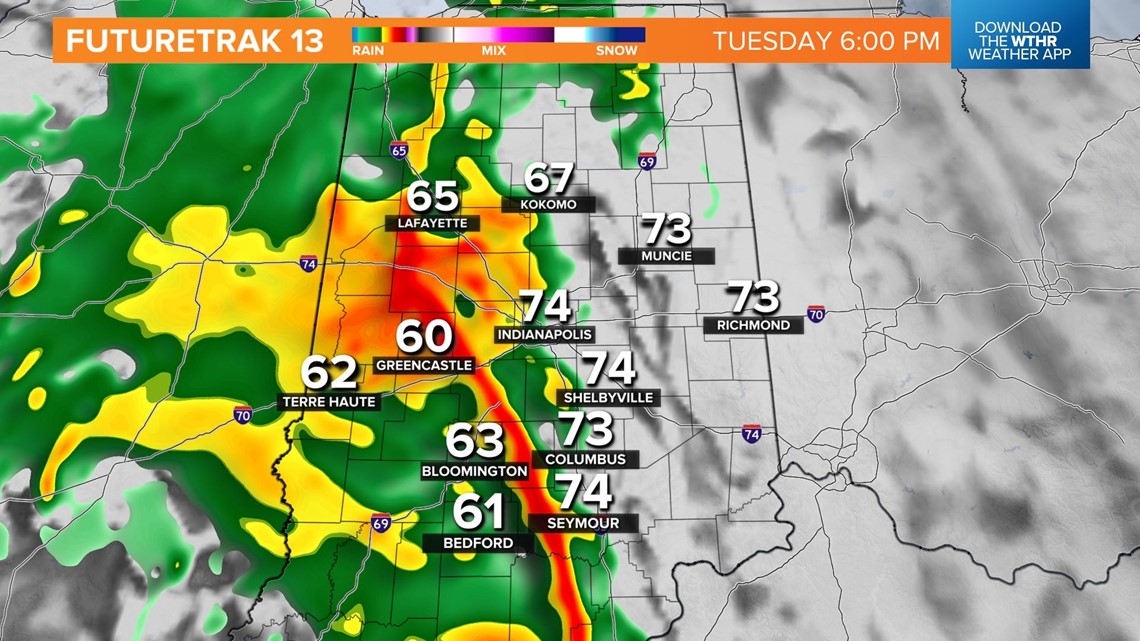
The highest rain totals are expected near the Illinois/Indiana border, where excessive rain rates are possible. Lighter, but still beneficial, amounts of a half-inch or less occur in eastern Indiana along the Ohio border.
At this time, we're not expecting any severe weather, but later updates may require that mention if enough low-level moisture and instability develop to encounter increasing wind shear.




Otherwise, it will be just what the doctor ordered for the parched landscape that has felt less than a tenth of an inch of rain since Sept. 25, marking the driest on record during that time since 1871.
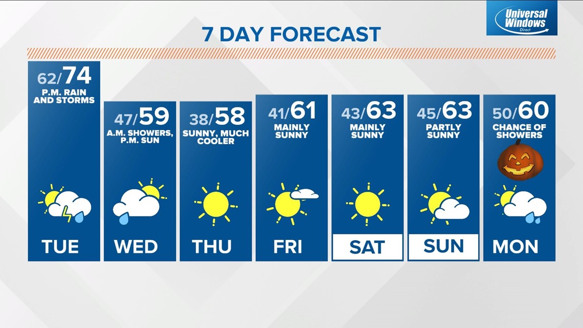
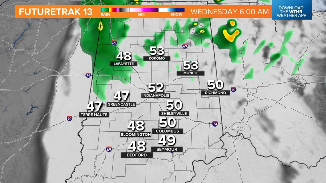
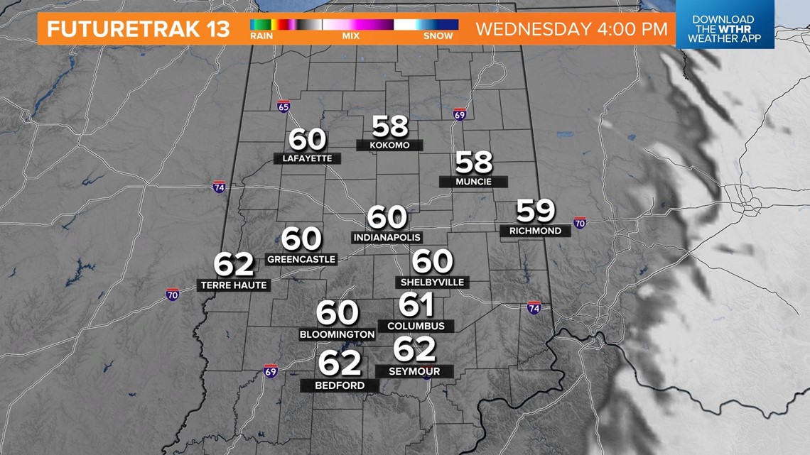
The rain comes from a cold front that eventually delivers much cooler air heading into Wednesday morning when lows drop into the 40s. The cooler temperatures are more what we expect for late-October. Morning showers give way to increasing sun Wednesday afternoon with late-day temperatures recovering to near 60°.
Another pleasant streak of fall weather takes us into this weekend.

