INDIANAPOLIS — For the fourth straight week, we enjoyed a mainly sunny Sunday with above-average temperatures. Highs in the 50s were a nice way to cap off another bright weekend.
If you're a fan of above to much above average temperatures, we suggest enjoying the mild air Monday before an expected pattern shift emerges.
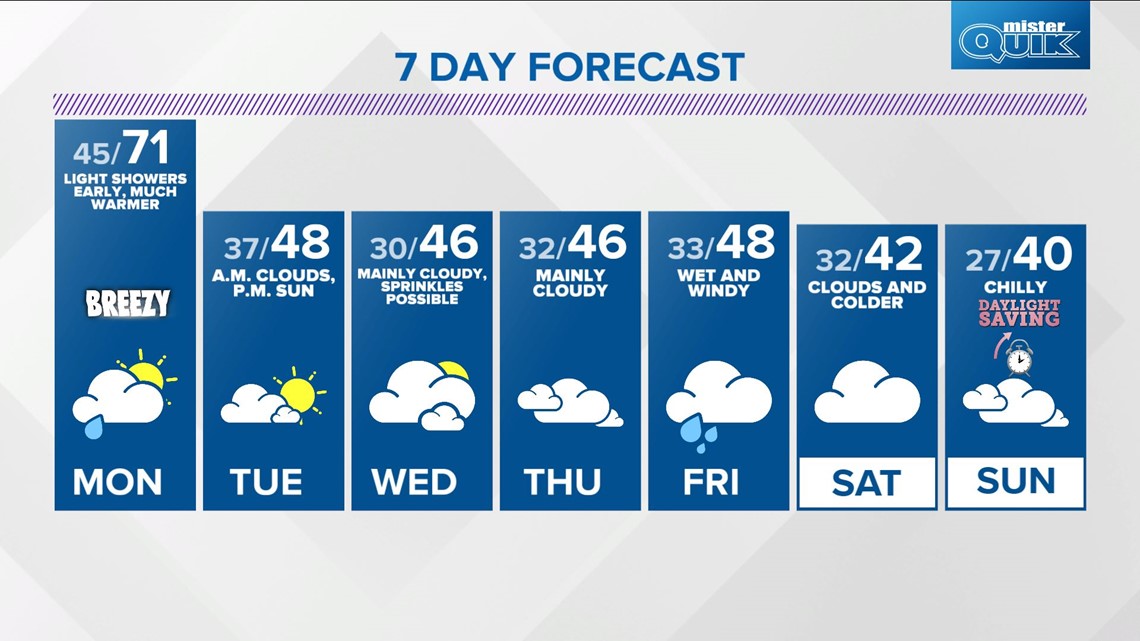
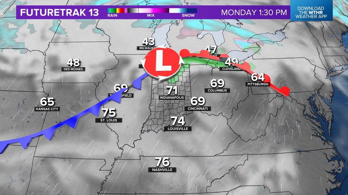
Overnight and early Monday morning, passing sprinkles and light showers are possible along an approaching warm front. These won't last long and it will be noticeably "warmer" Monday morning with lows tonight only in the 40s.
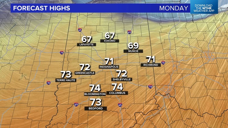
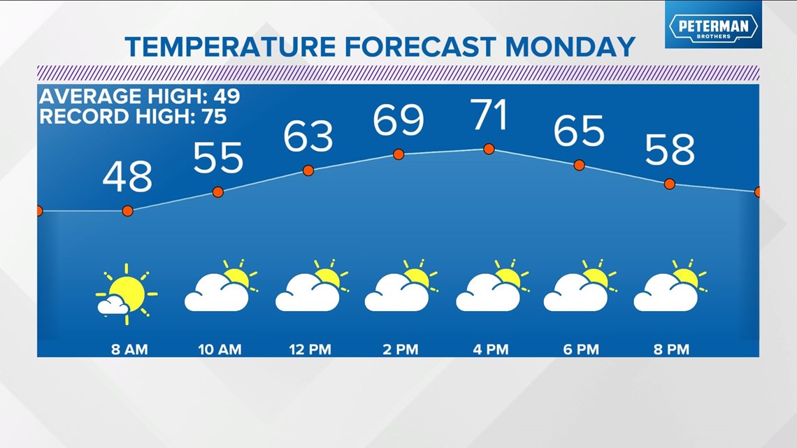
A southwesterly wind quickly stiffens and eventually high temperatures will be in the 70s for most of Monday afternoon. While the daily record high (75° set in 1973) for March 6th is safe, the forecast high of 71° will be over 20° above average for early March.

Our time in the warm sector won't last long and a cold front Monday evening could trigger widely scattered sprinkles or showers. This marks a return to seasonably cooler air.

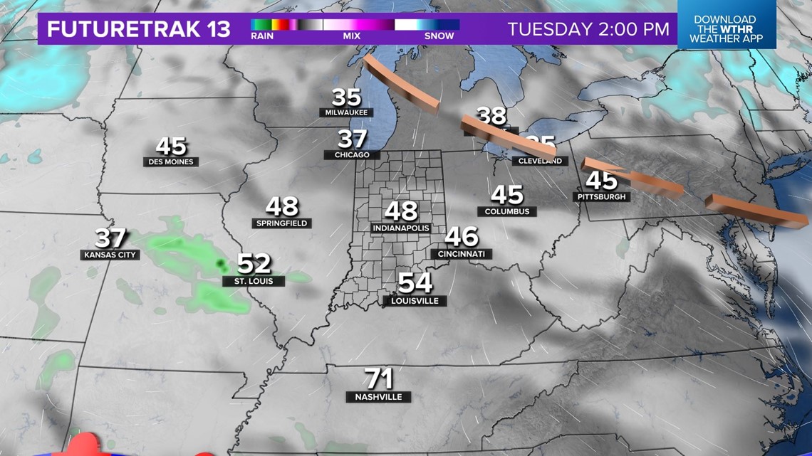
Tuesday begins rather cloudy before increasing sunshine to finish the day with highs in the 40s.

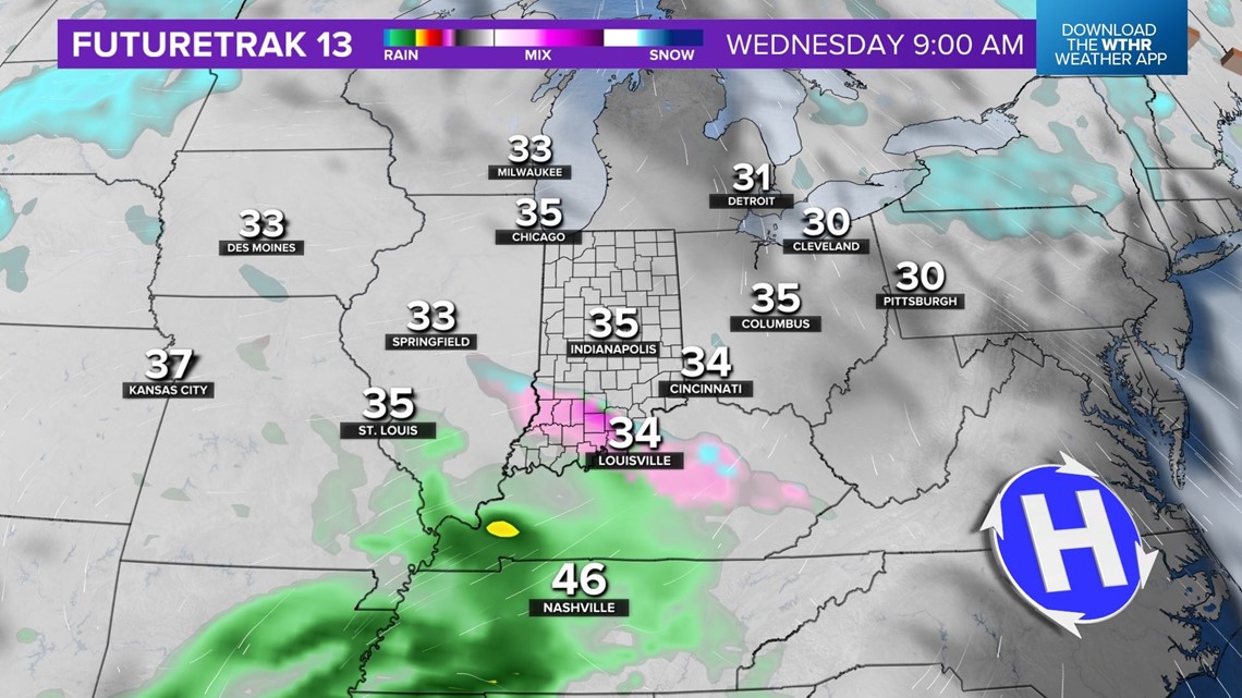
An approaching weather system on Wednesday will be moisture-starved in central Indiana.
For now, we're only expecting clouds around Indy. But we'll monitor south-southwestern Indiana where there's a chance of lighter rain/snow within a narrow corridor of lift and higher moisture.
A "juicier" system remains in play late this week but, as has been the case for most of winter, it looks wet and not white locally with wind-whipped rain around.

Next weekend looks seasonably chilly.
Don't forget we're "springing forward" to Daylight Saving Time Sunday morning at 2 a.m.

