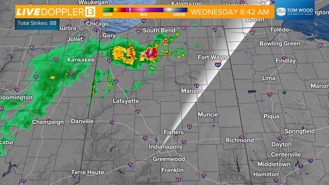
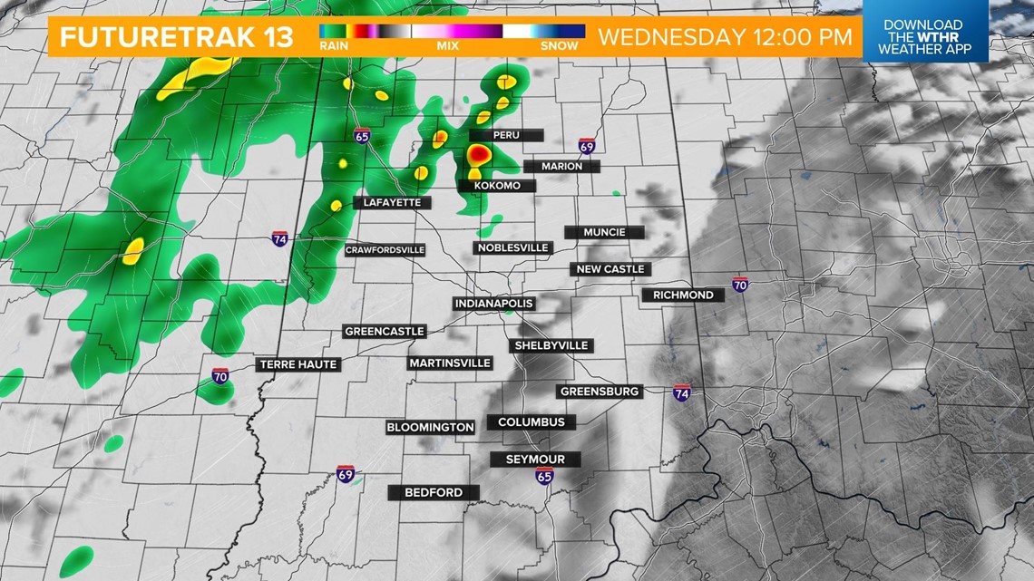
INDIANAPOLIS — An incoming cold front has prompted scattered storms that are mainly impacting the northern tier of the state this morning.

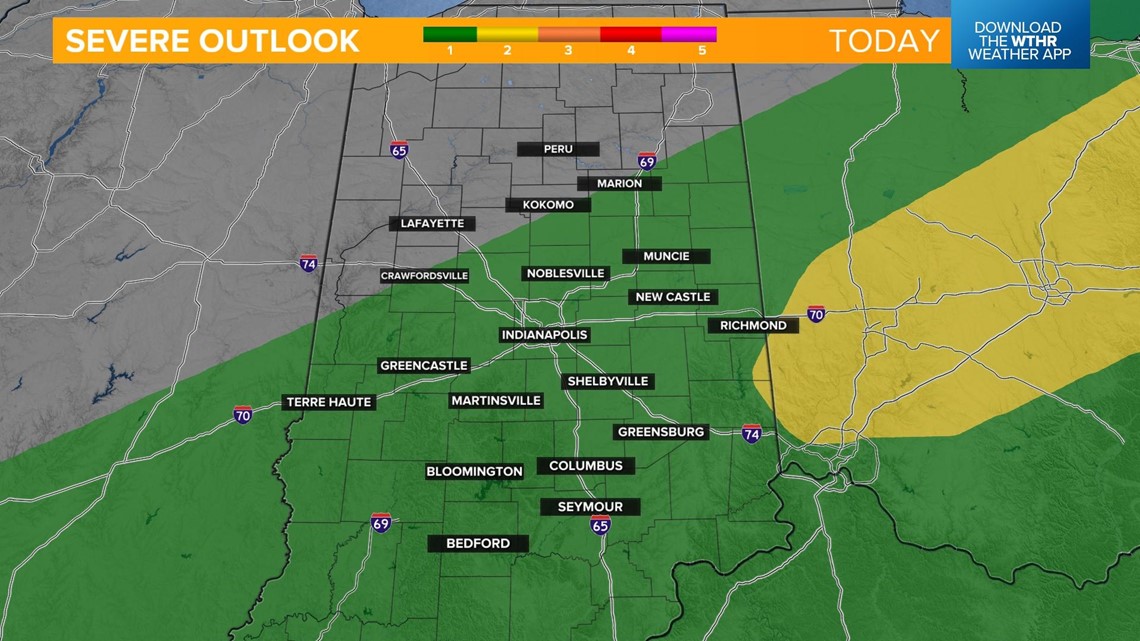
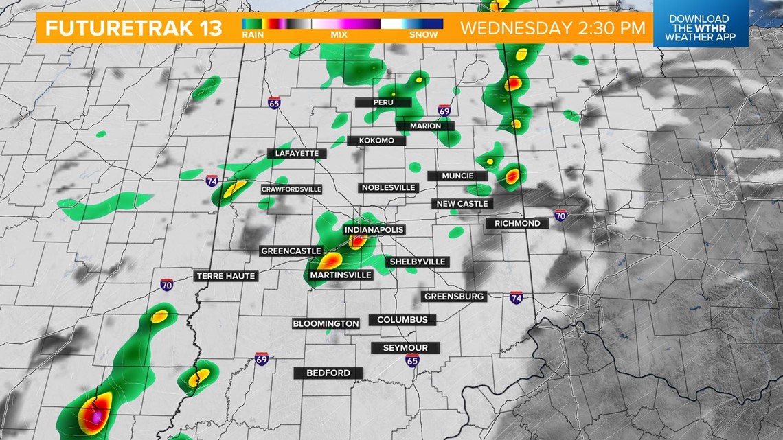
As the front tracks through central Indiana this afternoon, more storms will be triggered and some may become severe. The Storm Prediction Center has placed most of the area under a level 1 of 5 for the risk of isolated severe storms.
Primary threats today will be damaging wind gusts and severe hail. Keep in mind the timing of these storms in the late afternoon and evening, as outdoor activities could be impacted as lightning is a threat in any storm.

Storms will begin popping up through the area after the lunch hour.

More widespread storm development continues into the afternoon as the frontal boundary tracks east.

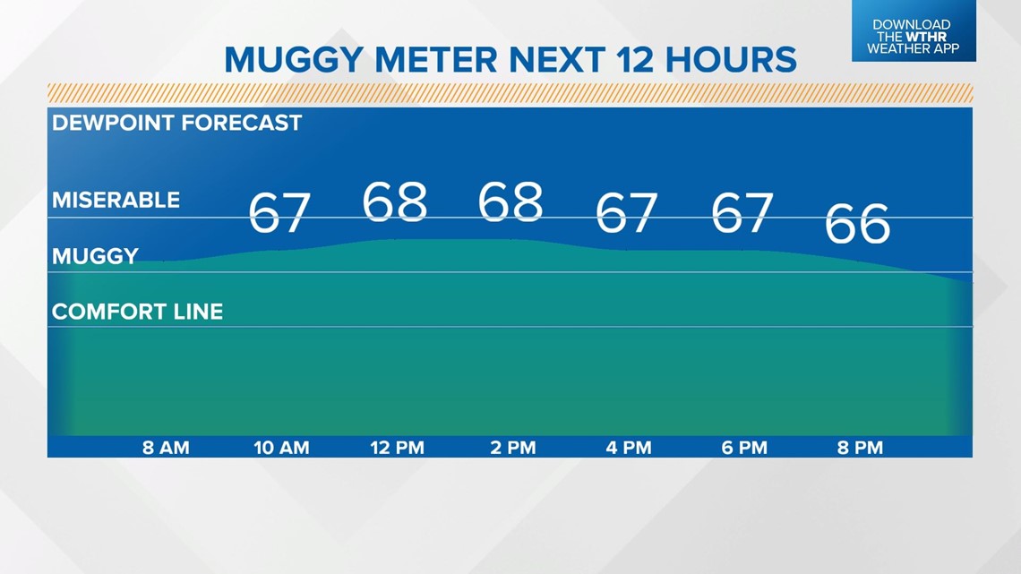
It'll still be a rather humid day as most of the area sits on the "warm side" of this weather system through the afternoon. With dew points in the upper 60s, we'll feel rather uncomfortable outside most of the day.

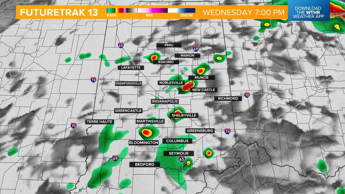
Scattered storms continue into the evening, but the severe parameters dwindle after sunset.

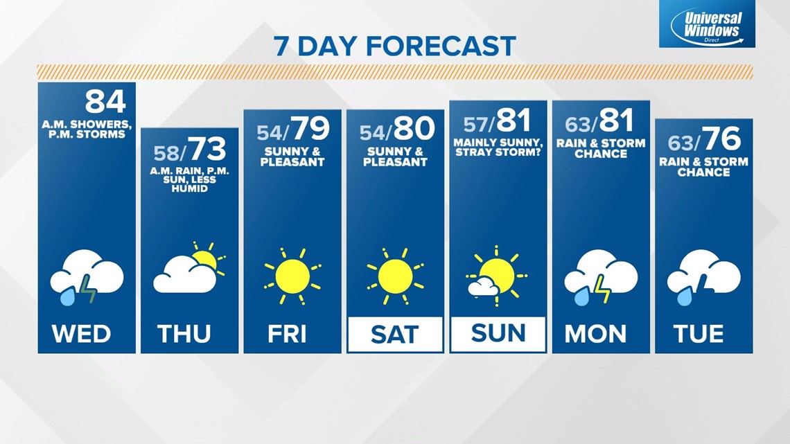
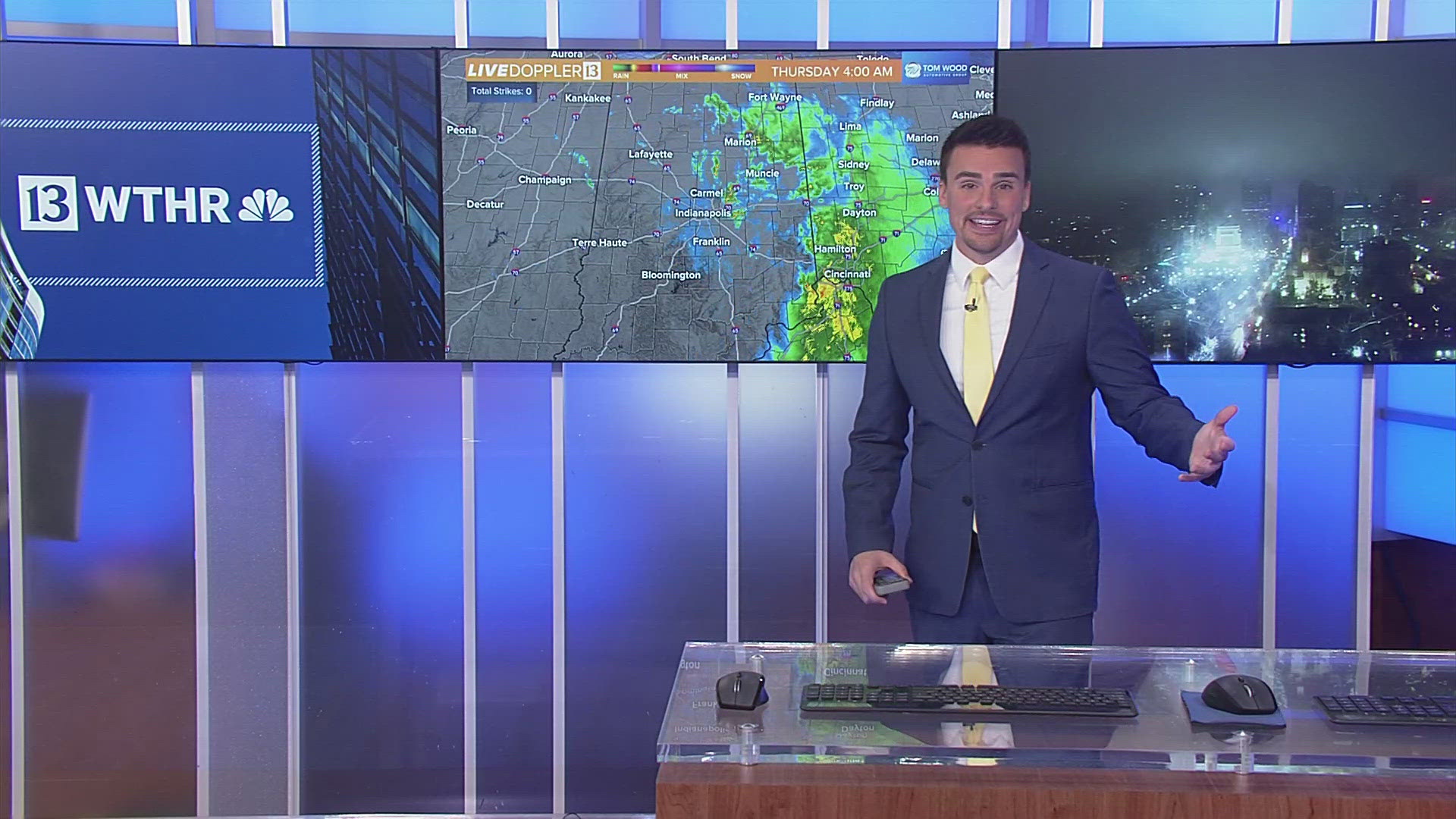
We'll see some lingering showers overnight and perhaps a rumble of thunder as this storm system continues to track east into early Thursday. Be prepared for some areas of rain around during the Thursday morning rush hour as temperatures cool back into the 50s on the backside of the cold front.

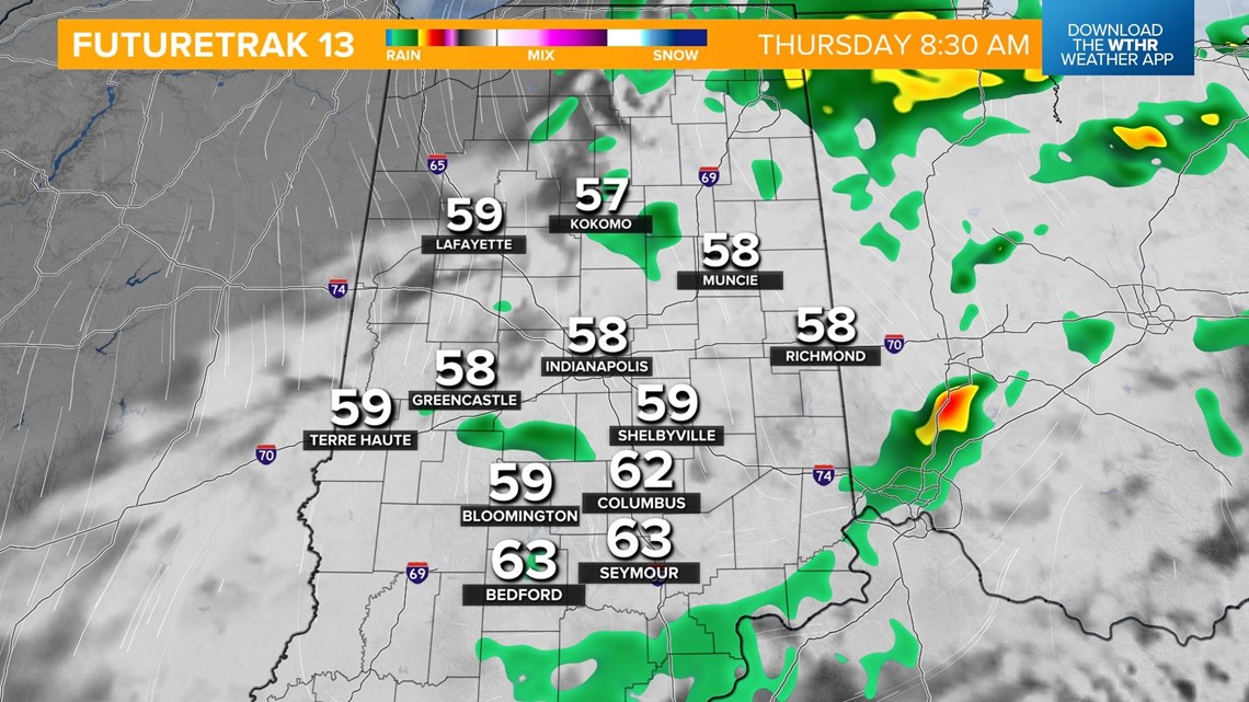
Rain wraps up in the late morning and the sky will continue to clear through the afternoon as cooler, drier air takes over. There will be much less humid and cooler tomorrow with highs in the low to mid 70s.

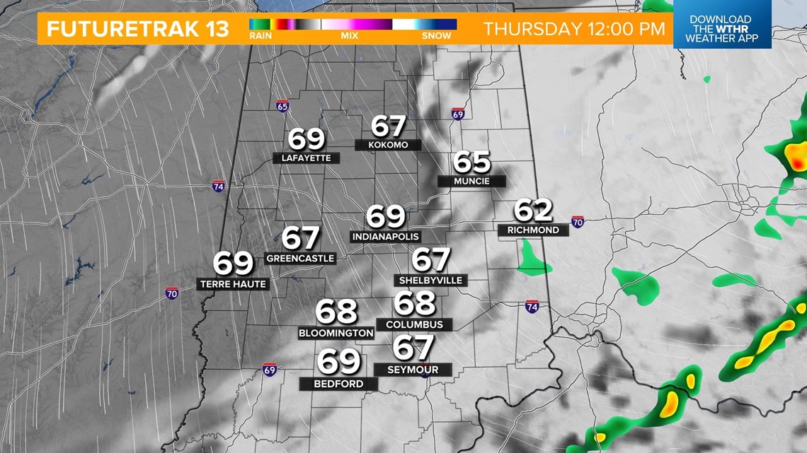
Lower humidity will rule Friday into the start of the weekend. Look for sunshine and seasonal temperatures near 80. Looking ahead, a stray shower or storm will be possible late Sunday with a more active pattern heading into the first part of next week with daily rain and storm chances.

