

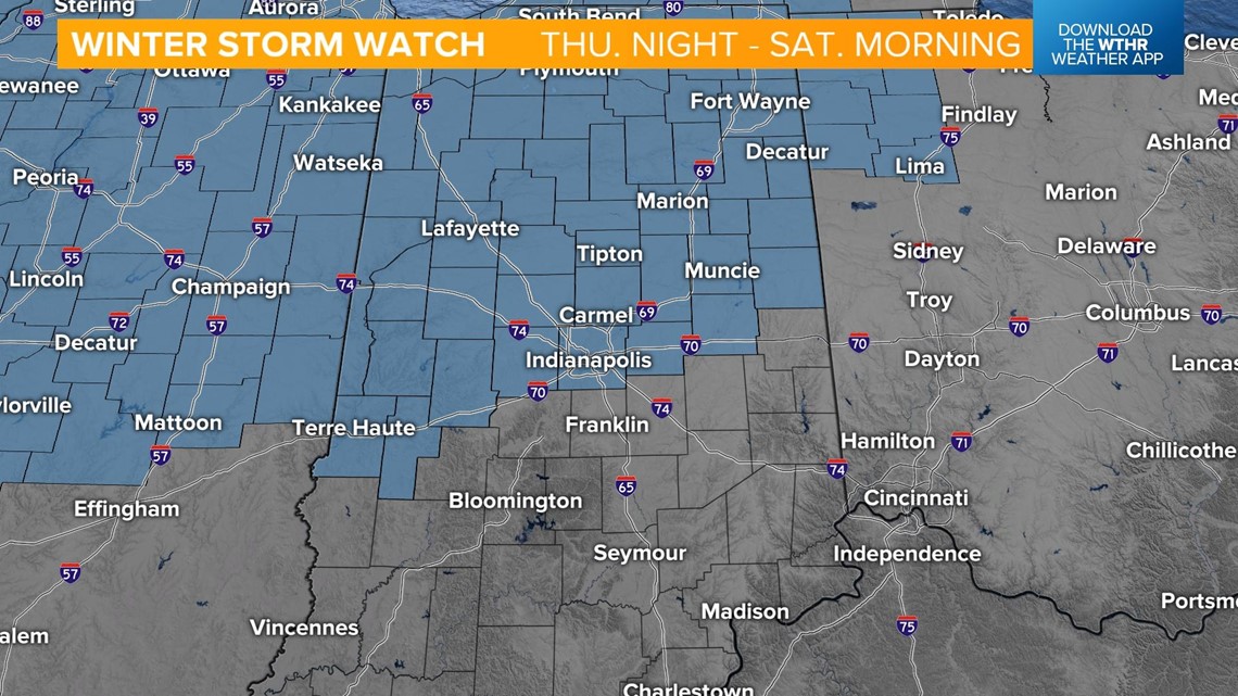
INDIANAPOLIS — Winter Storm Watch is in effect from Thursday at 7 p.m. until Saturday at 7 a.m. for most of central Indiana.

It will be "the calm before the storm" today and tomorrow. There will be some peaks of sunshine today, with highs in the upper 30s. Tomorrow will bring much of the same, with filtered sunshine and highs near 40 degrees. Wednesday is also the Winter Solstice, officially arriving at 4:48 p.m.
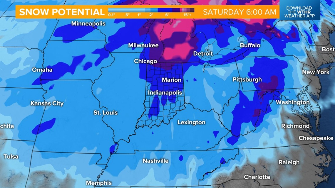
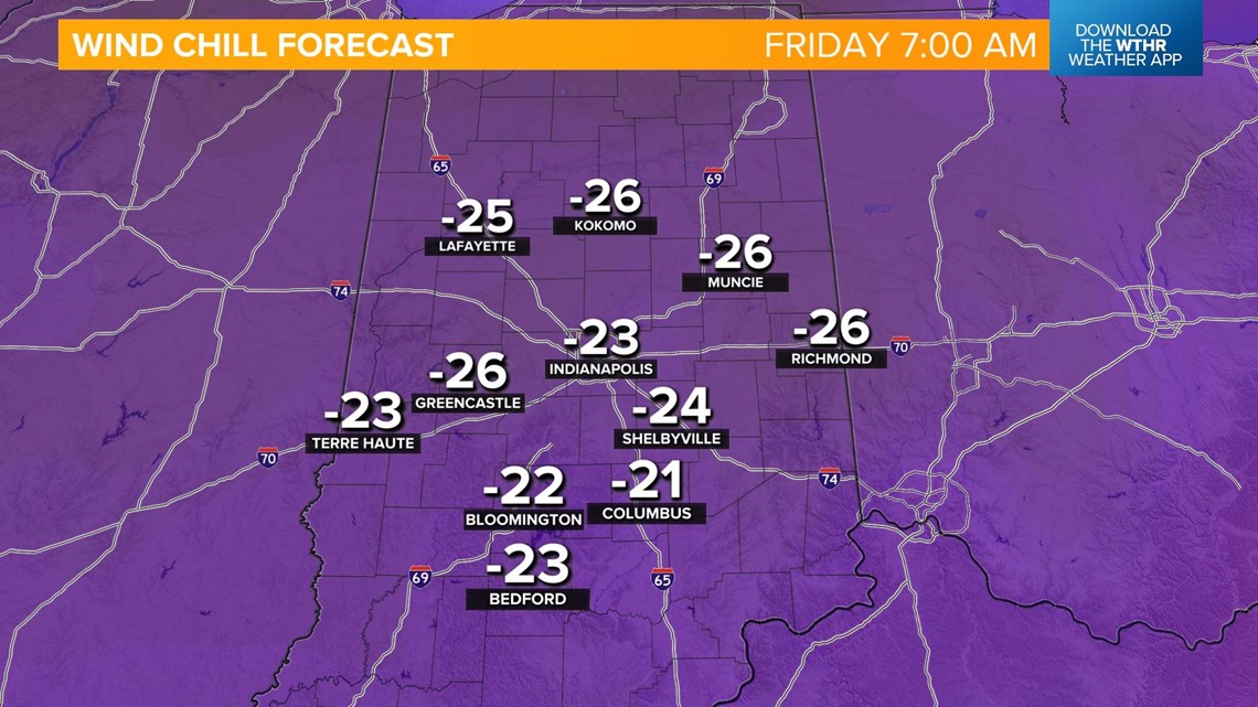
A strong area of low pressure will move over central Indiana from Thursday through the holiday weekend. While snow accumulations will be an issue, the main threats of this storm will be the bitterly cold air, gusty winds and wind chill values running 20 to 30 degrees below zero.
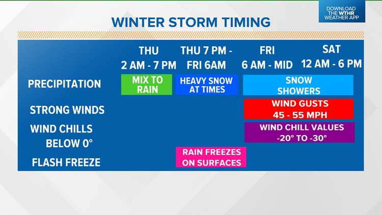
Here is the timeline of this storm:

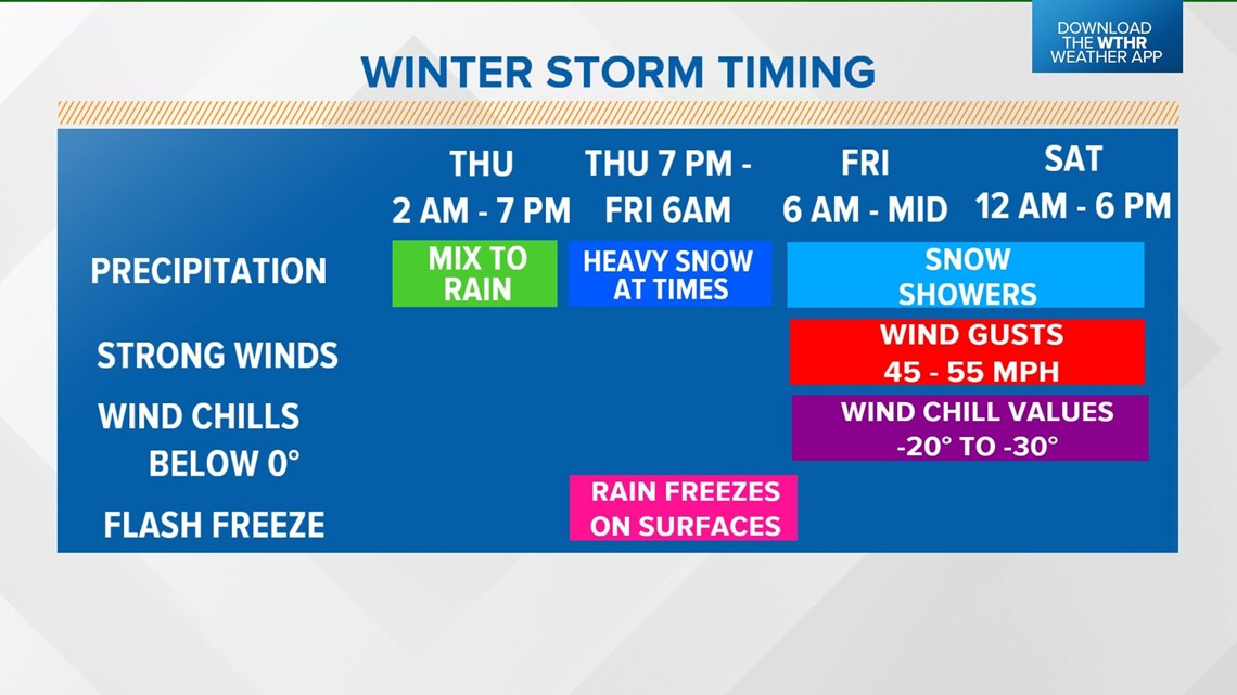
- Thursday, 2 a.m. - 7 a.m.: Mix of sleet, freezing rain and rain will be possible briefly in the morning
- Thursday, 7 a.m. - 11 p.m.: Rain will take over most of the day
- Thursday, 11 p.m.: Rain will change over to snow from west to east; snow will be heavier as the transition takes place
- Thursday, 7 p.m. - Friday, 6 a.m.: Flash freeze takes place, allowing rain to freeze on surfaces
- Friday, midnight: Snow showers on and off through the day

- Friday, 6 a.m. - weekend: Dangerous wind chill values running 20 to 30 degrees below zero

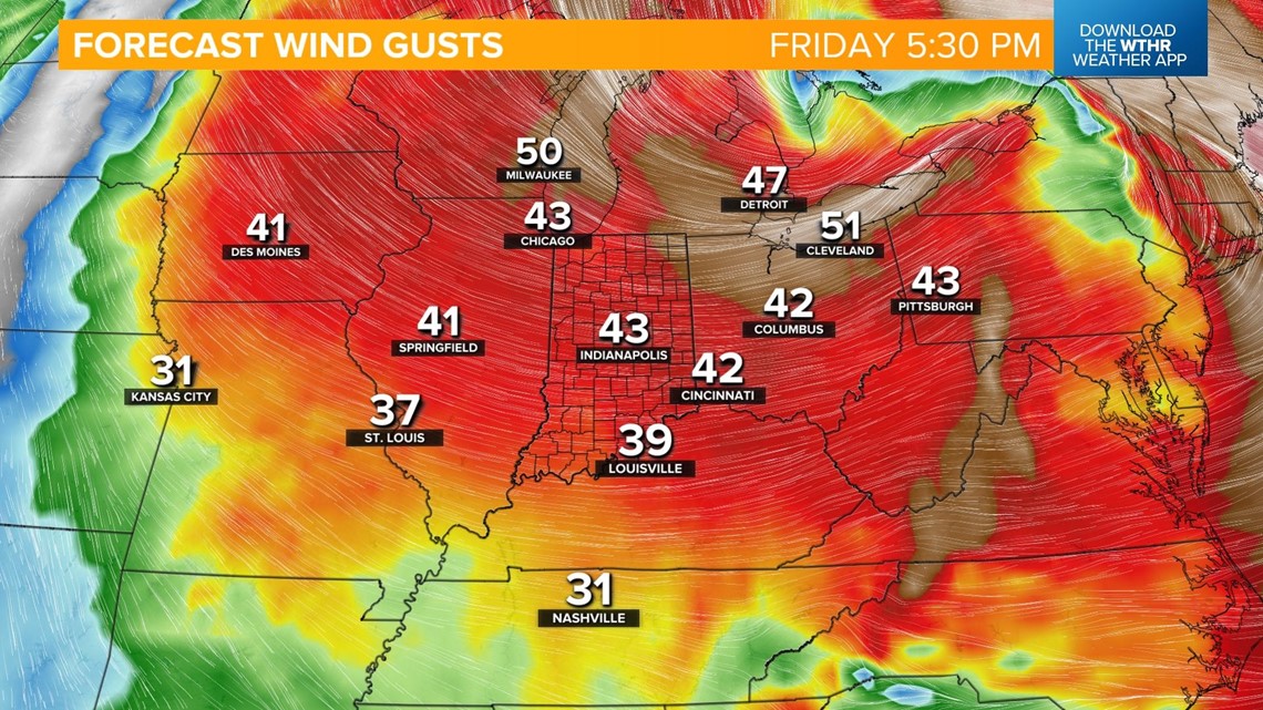
- Friday, 6 a.m. - Saturday, 6 a.m.: Strong winds with gusts around 45 to 55 mph

- Friday, 1 a.m. - midnight: Blizzard-like conditions
Please plan your travels accordingly. Power outages will be likely with this storm. Make sure you have a winter survival kit ready for your home and your car.
