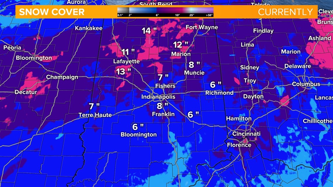
INDIANAPOLIS — The impressive winter storm has left quite the snowpack across Indiana. Parts of northern Indiana have around a foot of snow on the ground with several inches even in the southern tier of the state.


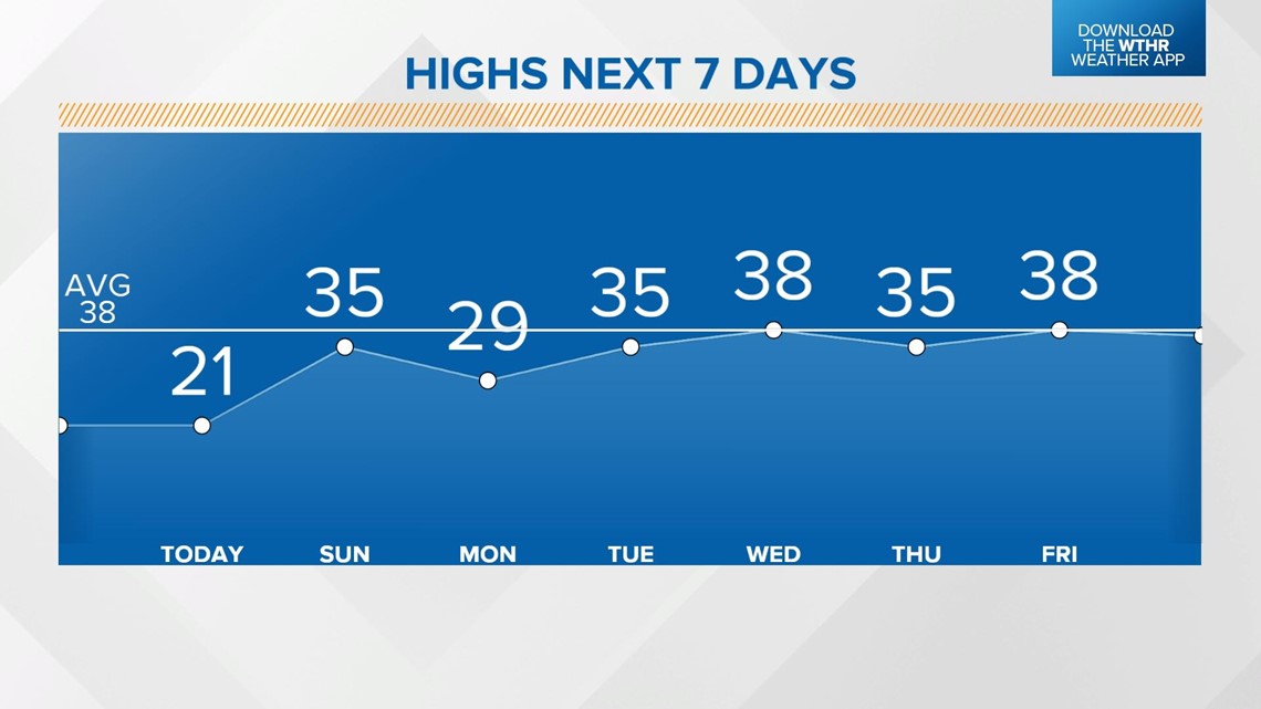
Even the sunshine Saturday will do little to melt the snowpack as a bitter cold air mass keeps high temperatures in the low 20s. After today, we will have several days next week with high temperatures above freezing.


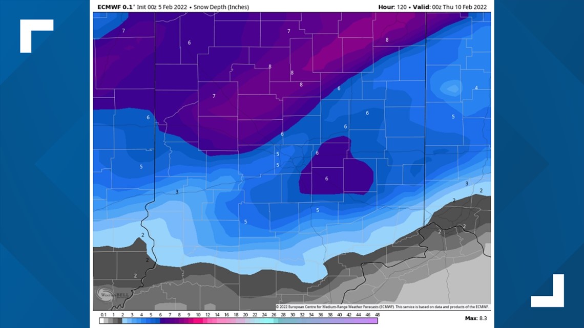
The seasonal afternoon temperatures in the mid to upper 30s starting on Tuesday will chip away at that snowpack. By Wednesday, forecast models take a few inches off our current measurements. (Weather model courtesy of WeatherBell European Model)


By Friday, daytime highs will have been above freezing for several days and no new measurable snow is anticipated, so our snowpack drops to only a few inches in metro Indianapolis.
Where temperatures will be slightly cooler still in the northern tier of the state, there will be a slower melting trend with around 6" on the ground for places like Kokomo to Marion.


