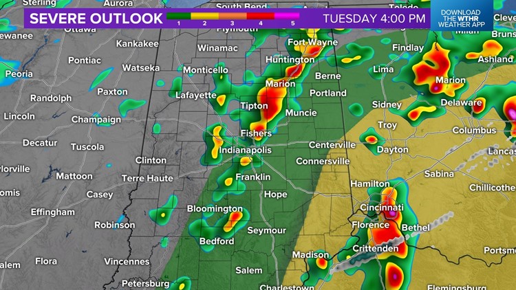
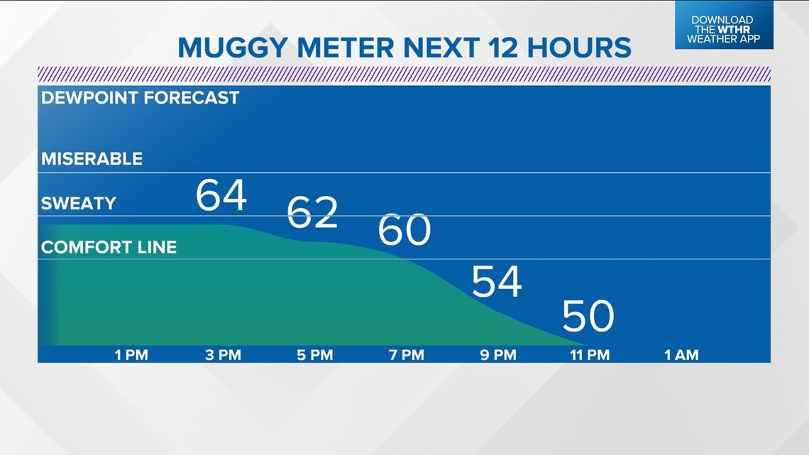
INDIANAPOLIS — You can certainly feel the Muggy Meter today with dewpoints in the mid-60s. It's almost "air you can wear" territory and will fuel scattered heavy storms crossing the state between now and 6 p.m.
The atmospheric environment in place over central Indiana supports the possibility of some storms rotating this afternoon and/or producing severe wind. Please be Weather Aware until this axis can clear the viewing area by 6 p.m.


Some areas could be placed under a Severe Thunderstorm or Tornado Warning during that time. These will be updated throughout the day.
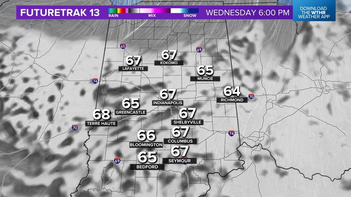
The threat of severe weather ends before sunset, and the evening should be refreshing as a wind shift to the west-northwest brings less humid air and sets the stage for a cooler Wednesday.
Wednesday looks mainly cloudy but mainly dry with highs in the 60s.
As advertised, another rain-maker arrives Thursday into Friday. However, latest guidance suggests we'll salvage many dry hours Thursday before the atmosphere moistens enough to trigger some showers Thursday evening. Some of these could impact tailgating for the Kenny Chesney concert, but it's possible the venue is missed. We'll fine-tune this in the next 48 hours.


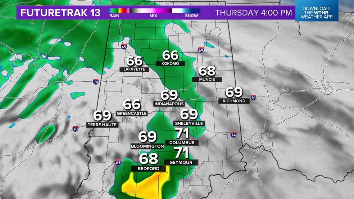
Rain becomes likely over central Indiana Thursday night into Friday as an upper-low sets up shop over the Ohio Valley. Some thunderstorms could emerge, too.
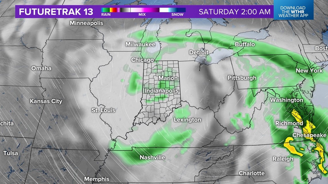
With the slower arrival of this feature, it will now have a slower departure. That means showers linger into Saturday now, especially early in the day.
For now, we're going with a 50% chance of showers for the OneAmerica 500 Festival Mini-Marathon with temperatures in the 50s and overcast. Typically, that's nice for runners, but a potential northeast wind of 10-15 mph wouldn't be ideal.

Showers diminish Saturday afternoon into the evening with highs in the 60s.
This departing system opens the gates to a breezy, milder Sunday in the 70s for Mother's Day.
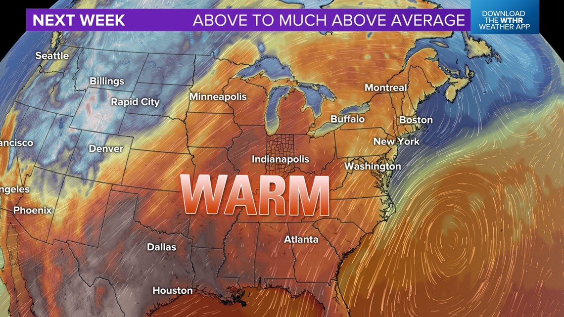
This marks the beginning of a wholesale pattern shift next week that is expected to deliver above- to much-above average temperatures with forecast highs in the 80s Monday into the latter of next week.