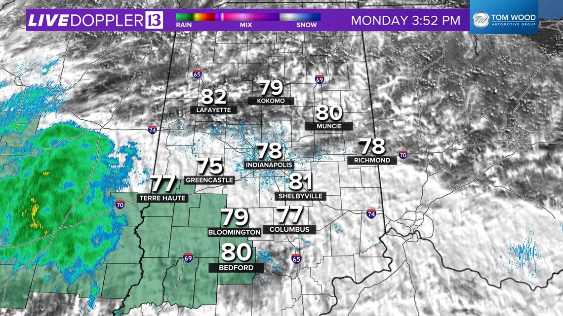
INDIANAPOLIS — As expected, clouds have had more bark than bite today in central Indiana thanks to drier flow air of from the northwest. That wind-shift has knocked-down the Muggy Meter and makes the air feel more pleasant today.
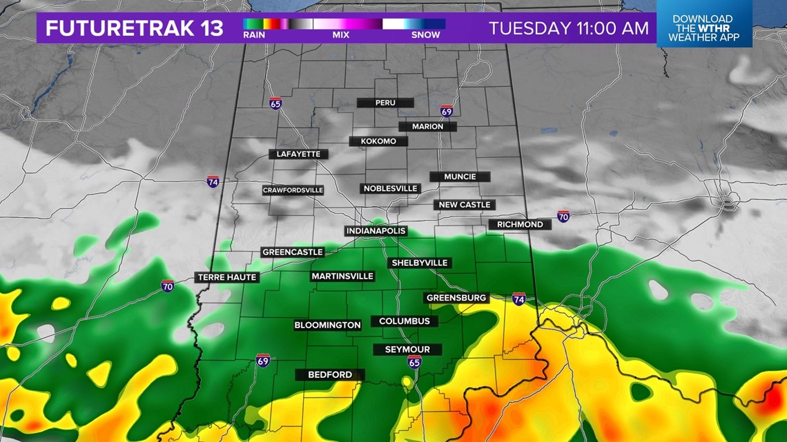
Though some sprinkles are possible this evening, we're expecting mainly dry for most, but we're watching a bigger batch of rain on deck for Tuesday. Modeling is honing-in on a heavy rain track over southwestern Indiana where Flood Watches are up.


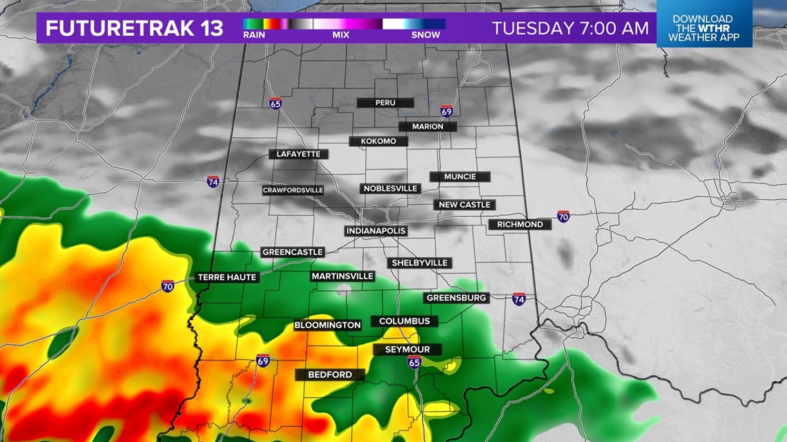
This is an area that got hit hard Sunday evening and could potentially have another swath of 2"-3"+ rainfall over the next 24 hours.
Unfortunately, it appears the heaviest will stay south of the I-70/74 corridors for those that missed-out on the weekend rainfall. Though it will likely rain (albeit lightly) around Tuesday morning into midday, heavier amounts more than likely stay south.

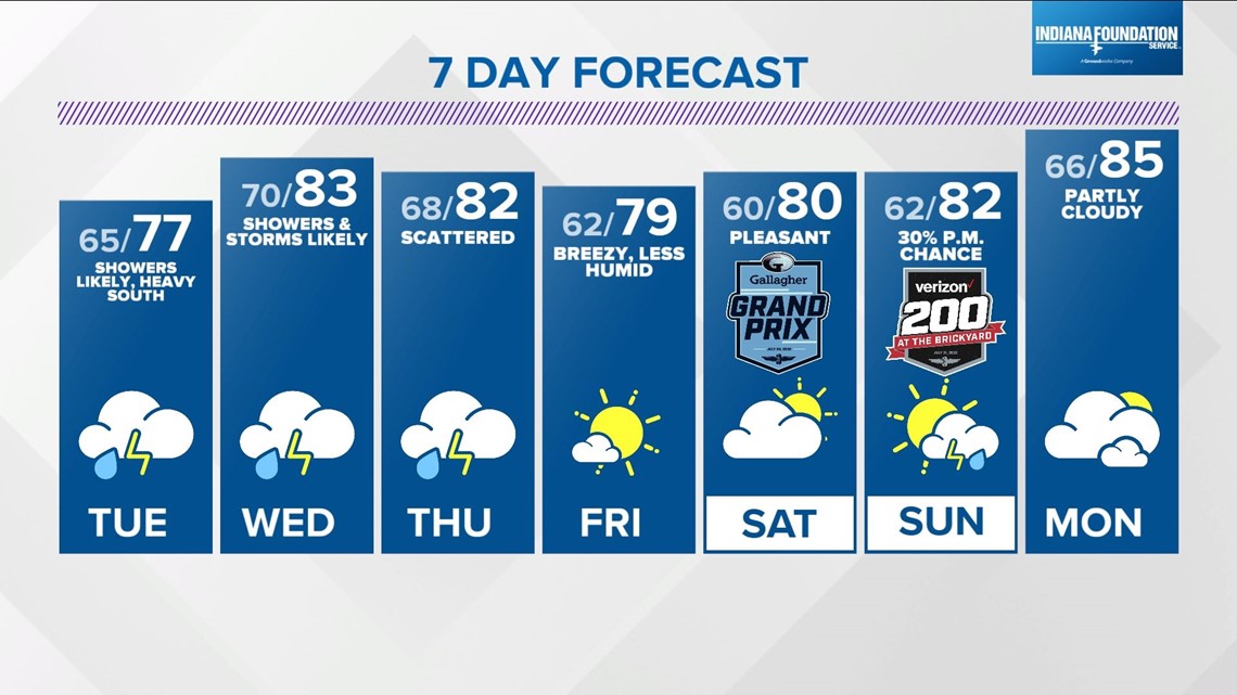
Rain departs Tuesday afternoon, but additional downpours and thunderstorms move across central Indiana from Wednesday morning into Thursday night. This precedes a pleasant weekend that features less humid air arriving just in time for the beginning of the Indiana State Fair.
For now, we only have slight afternoon rain chances Saturday and Sunday with comfortable highs near 80°. That's ideal for the Gallagher Grand Prix at IMS Saturday and the Brickyard on Sunday.