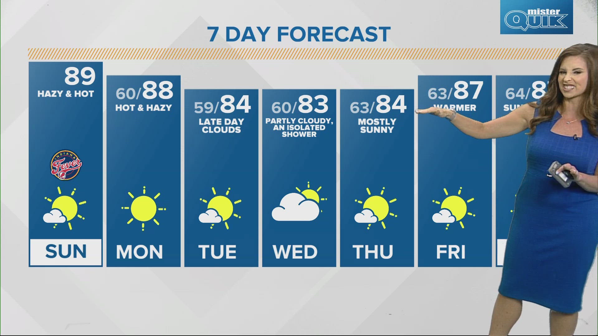
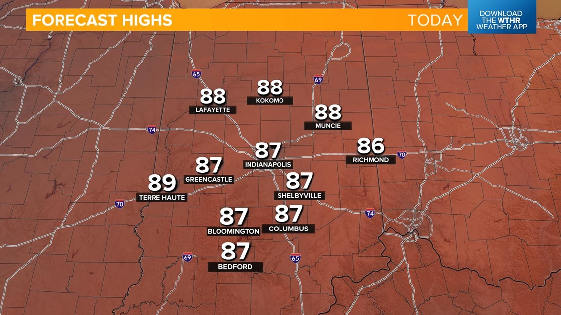
INDIANAPOLIS — Temperatures are on the upward trend starting today as highs climb back above average. We'll top out in the upper 80s this afternoon under a mostly sunny sky. The good news is humidity levels remain low.

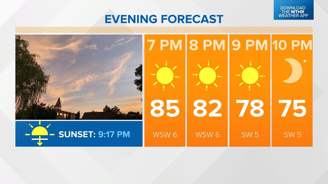
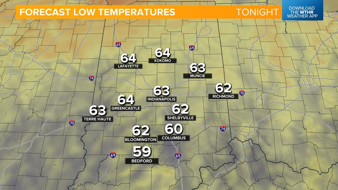
It will stay clear and mild this evening as temperatures fall back into the 70s with lows in the 60s.


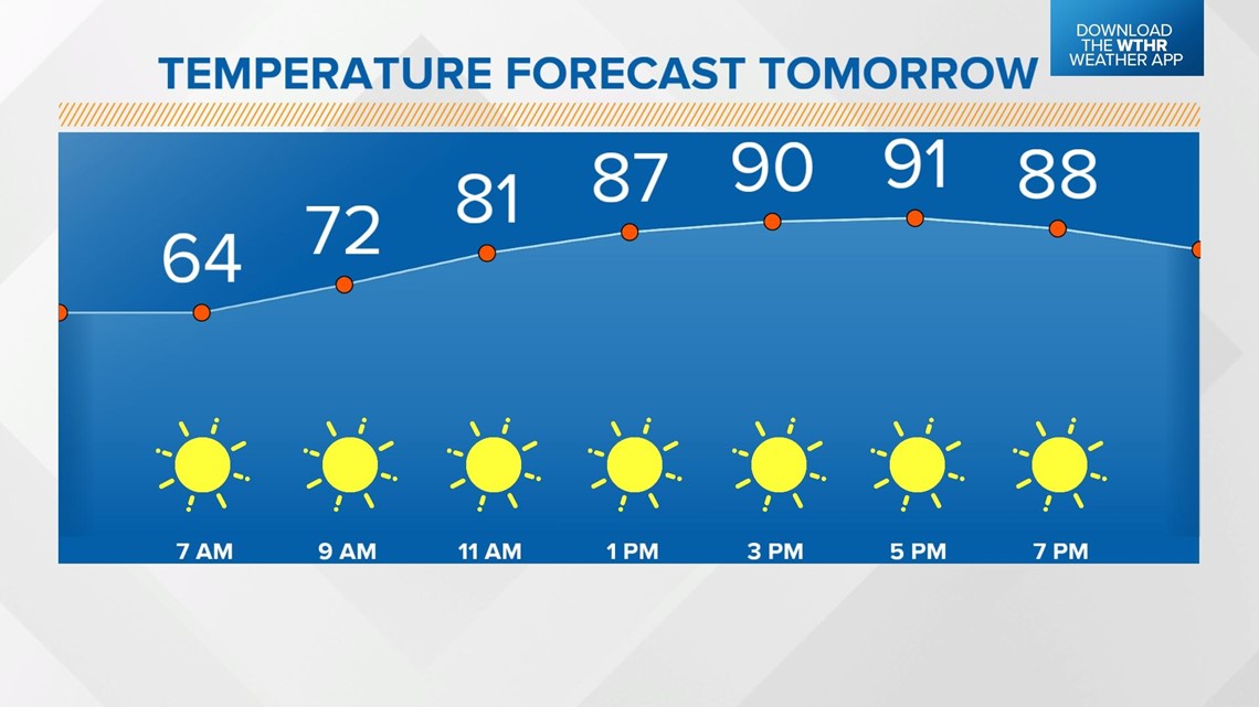
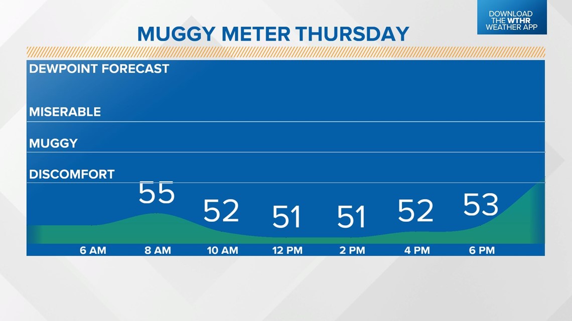
Thursday will also be a warmer day with highs back in the 90s. The air will remain dry with dew points in the 50s, so it'll still feel fairly comfortable despite the hotter temperatures.


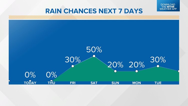
A slow-moving cold front will move through central Indiana on Friday, prompting a few scattered showers starting in the afternoon.

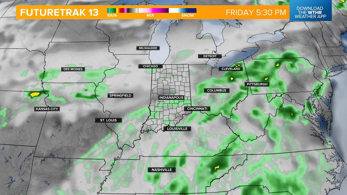
As this boundary stalls in the evening, showers and isolated storms will become slightly more widespread. The best rain and storm chance will occur during the overnight hours Friday into Saturday morning.

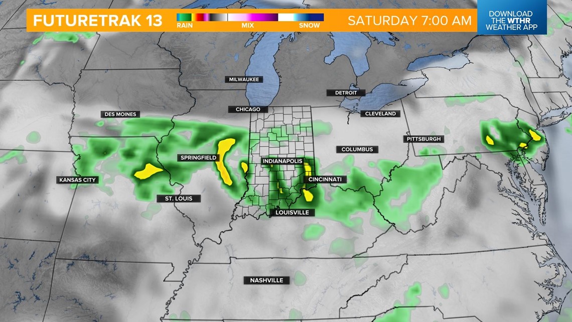
This boundary will then push south during the day Saturday, setting the southern tier of the state up for the better chance of lingering rain showers.

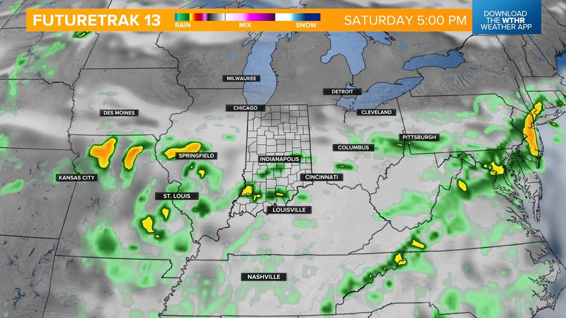
Rain chances become more uncertain for the remainder of the holiday weekend, but a more humid, summertime setup could prompt popup storms with the heat of the afternoon on Sunday and Monday.
Temperatures will top out in the mid to upper 80s as the humidity increases to more uncomfortable levels.
Check back for the latest forecast if you're planning any Fourth of July celebrations.