
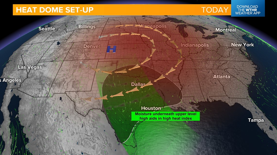
INDIANAPOLIS — A heat dome that has been building out west arrives in central Indiana today. The set-up shows this upper-level high pressure system over the central U.S. that will act as a "cap" over a surge of moisture in the lower levels from the Gulf of Mexico.
This type of set-up is what brings not only extreme heat, but miserably muggy conditions.

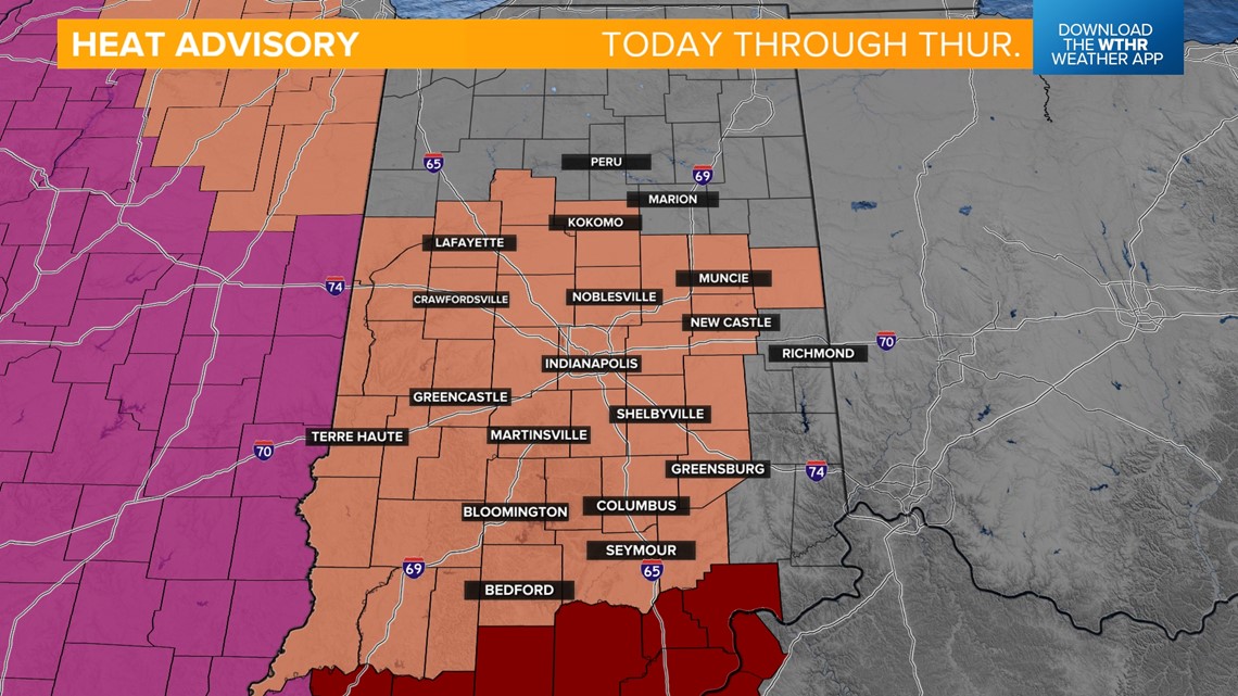
A heat advisory will go into effect starting at noon and last through Thursday.

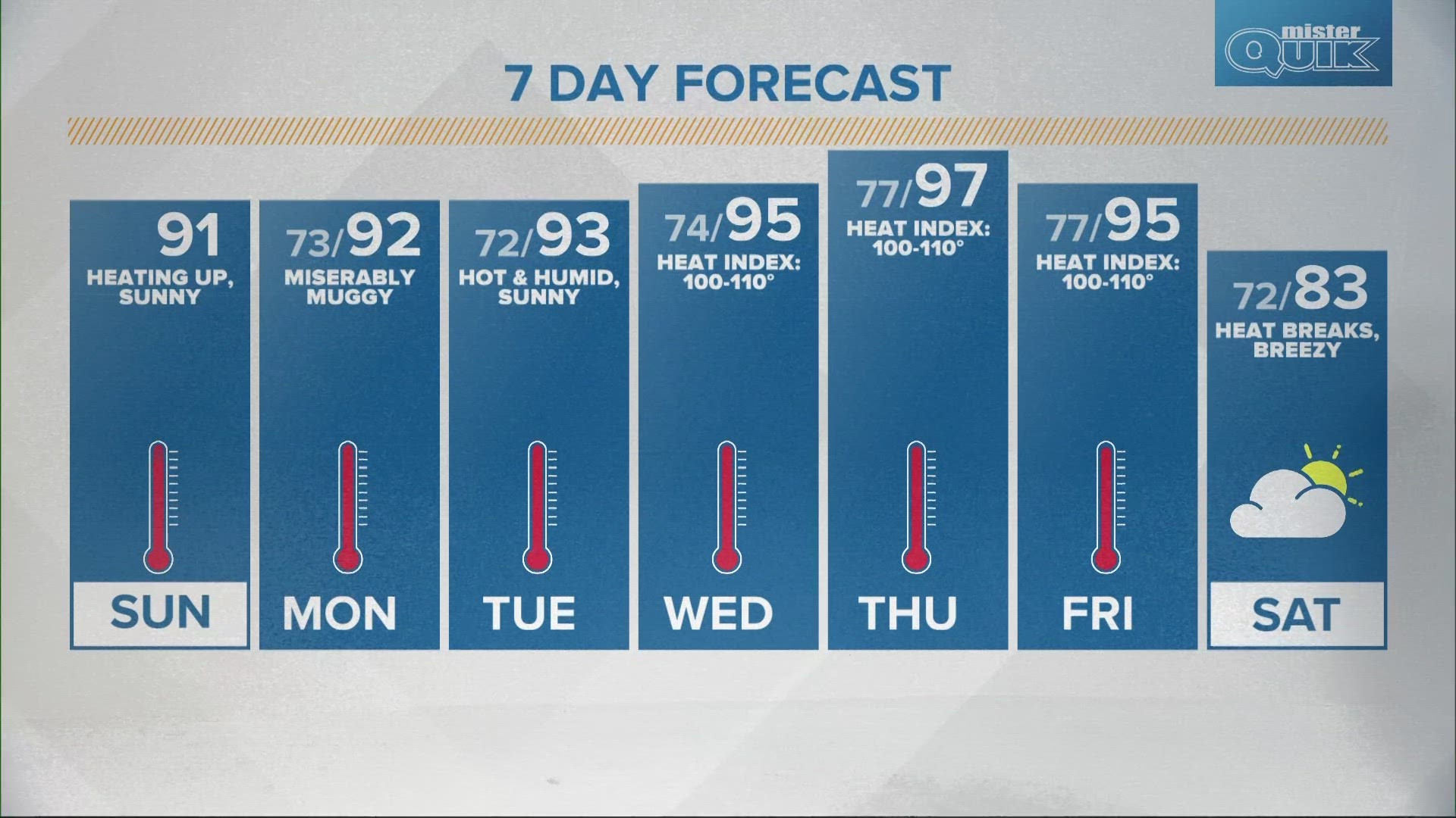
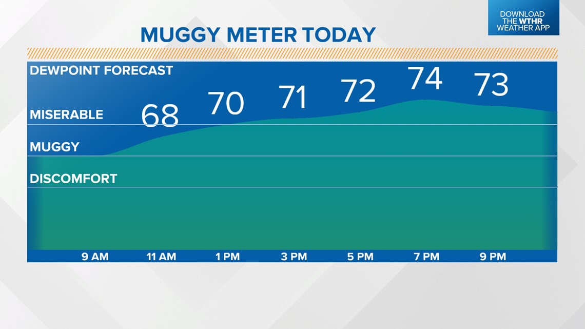
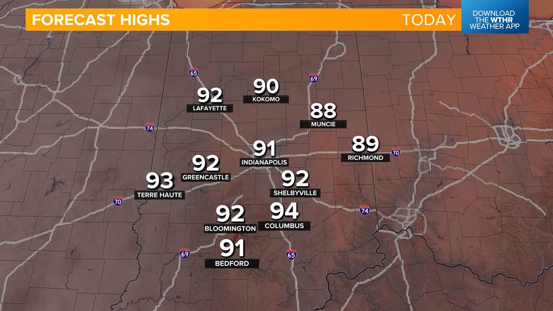
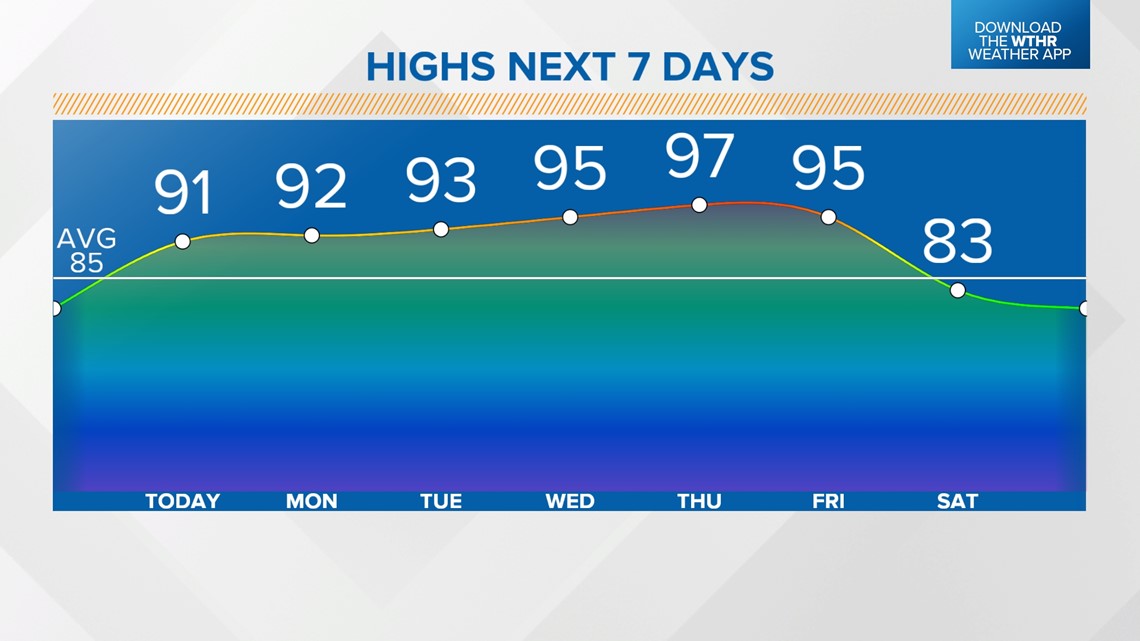
Skies remain clear today as temperatures top out in the low 90s. It will feel miserable at times as dew points climb into the low to mid 70s this afternoon.
Staying clear, warm and muggy overnight with low temperatures in the low 70s.


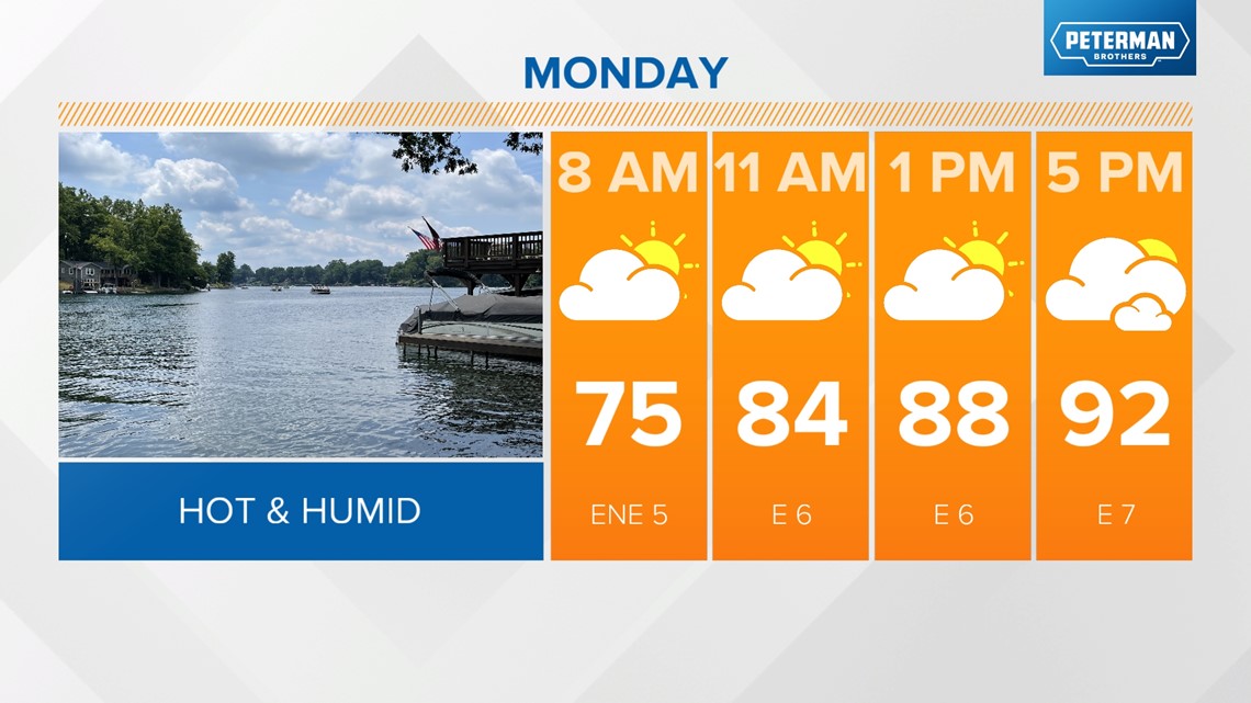
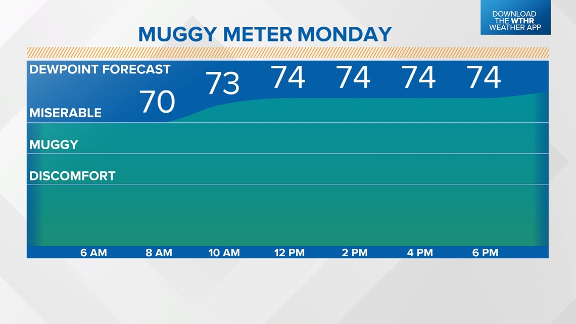
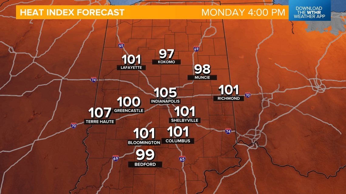
This heat streak continues through the work week. Temperatures top out in the low 90s again Monday with miserable dew points and heat indices climbing over 100 degrees.


Highs will still be in the low 90s through Tuesday and jumping into the mid to upper 90s Wednesday through Friday.
A few records are in jeopardy late in the week.
Heat indices will peak at 100-110 degrees all week long. During this time, remember to stay well hydrated, take frequent breaks, and make sure our family, friends, and pets are staying safe.

Rain chances will also be limited with no significant rain chance in the extended forecast.
Long-range weather models are hinting at this stretch of 90+ degree days coming to an end by the start of next weekend with highs dropping back into the low 80s.