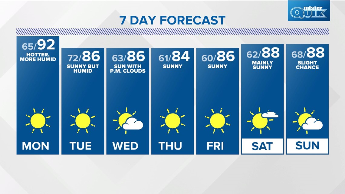
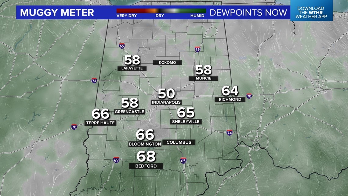
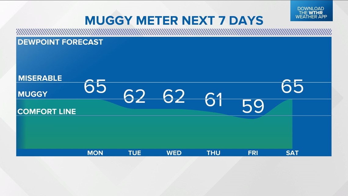
INDIANAPOLIS — We're wrapping up a pleasant Sunday in central Indiana with a Muggy Meter that is gradually climbing across southern and western Indiana. This is a hint of what's ahead in what will be a hotter, more humid Monday.
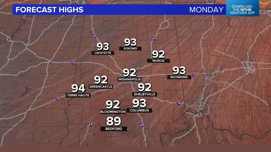
Highs in the 90s team up with higher dewpoints in the 60s as a strengthening southwest wind delivers a return to an uncomfortable Muggy Meter.


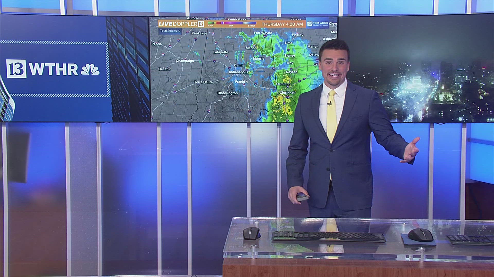
With ample sunshine, highs in the 90s, dewpoints in the 60s, and an approaching weak frontal boundary, intensifying late-evening thunderstorms are possible, but, at this time, confidence on coverage is low.
We'll be monitoring for storm initiation in Illinois/far northern Indiana along the boundary and a potential lake breeze coming off of Lake Michigan.


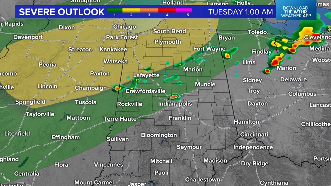
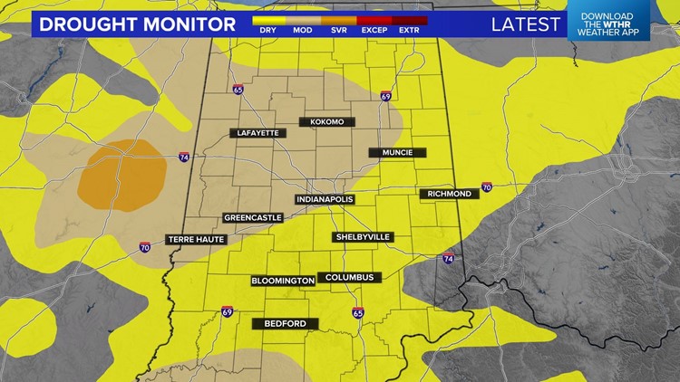
Unfortunately, widespread rain isn't anticipated and this will be our only chance of rain this week as the drought worsens in central Indiana.
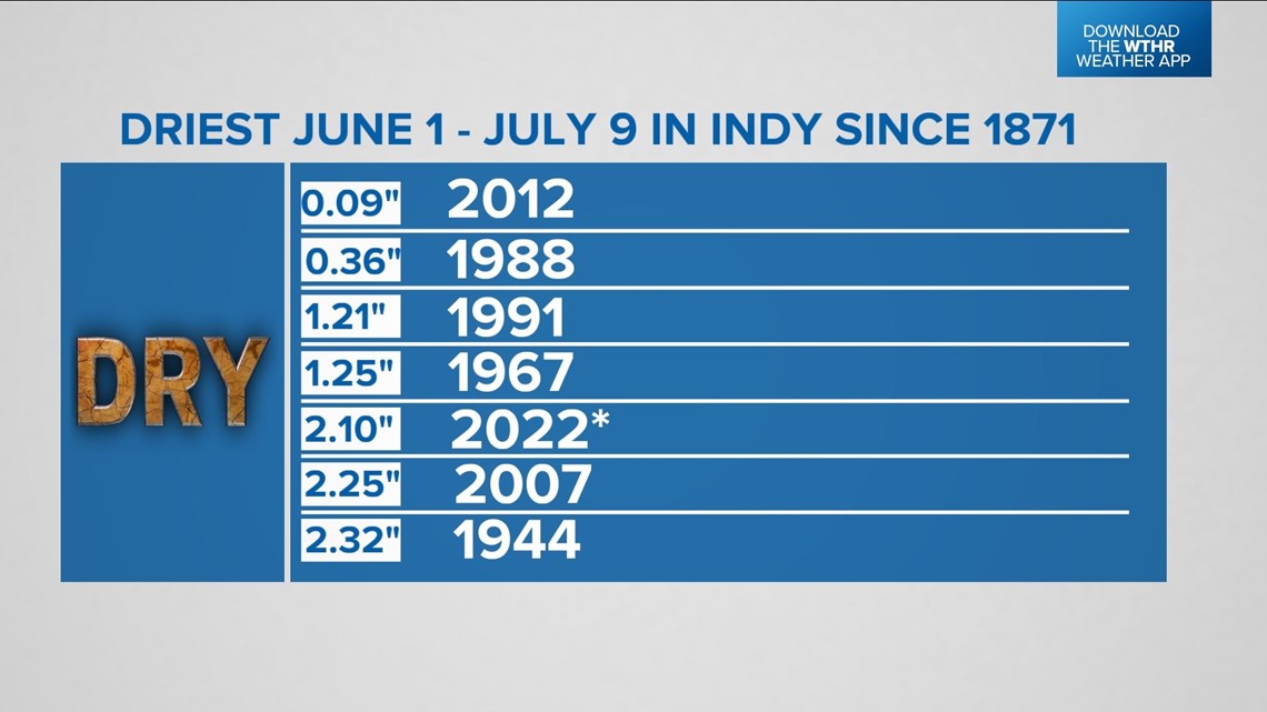
This is currently the first driest first half of the summer in Indianapolis, and many areas are well over four inches below average since June 1. Long-range prospects aren't great for organized rain this week.


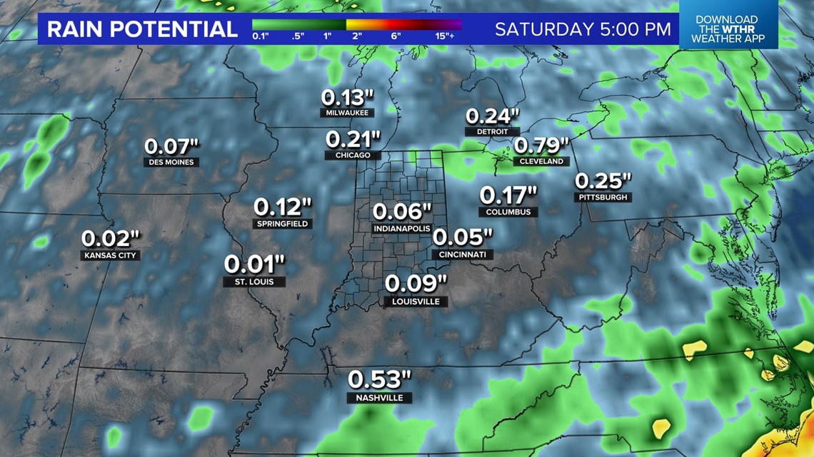


We'll be monitoring the Gulf Coast for potential tropical development, but it's likely if anything develops it may hug the coast and/or Deep South.
Locally, we'll have humid highs in the 80s Tuesday with plenty of sunshine before drier air gradually returns in the mid to latter half of the week. There will be plenty of sun this week with seasonably warm highs in the 80s, but nothing excessive this week.

