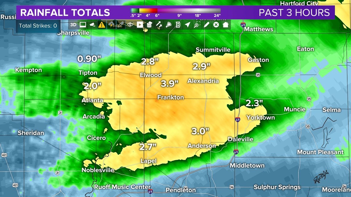
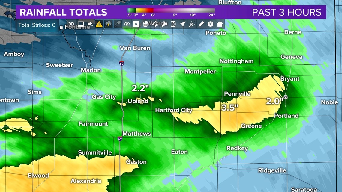
Hard to fathom after the 4th driest first half of summer in Indianapolis, but parts of central Indiana have had enough rain today to cause street flooding, and additional localized heavy rain continues this evening.
Radar rainfall estimates show the hardest hit areas being in Tipton, Madison, Delaware, northern Marion, Hamilton, Blackford, Jay, Randolph, and Wayne counties. Some locations have had over 6" of rain today with a whopping 3" in the past three hours.


This is due to a highly moist air mass in place of central Indiana that's supportive of tropical downpours that we're seeing today.
Between now and 7 p.m. expect additional localized heavy rain rates and potential of more flooding. Emergency mangers in Elwood have reported moderate flooding and have closed some city streets until it recedes.

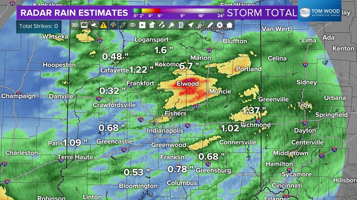
This is easily our wettest day of the summer with widespread rain. Unfortunately, too much too quickly in some areas.
Rain scatters-out later this evening to be followed by areas of fog overnight.
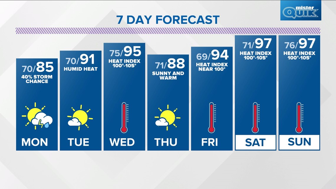
Monday will be warmer in the mid-80s and rather humid too. There's a 40% chance of scattered showers and thunderstorms.
Heat becomes a bigger focus mid to latter half of the week with Wednesday and the weekend looking like highs in the mid/upper 90s with heat indices of 100-105°. Heat Advisories and/or Excessive Heat Warnings may be required once again.