INDIANAPOLIS —
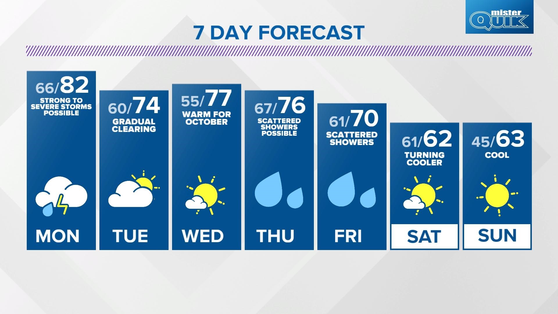
The above-normal temperatures continue again on Monday. Clouds will increase through the afternoon with winds again, out of the south, gusting around 25 to 35 mph. This will push temperatures back into the low 80s, and it will help set the stage for strong to severe storms.
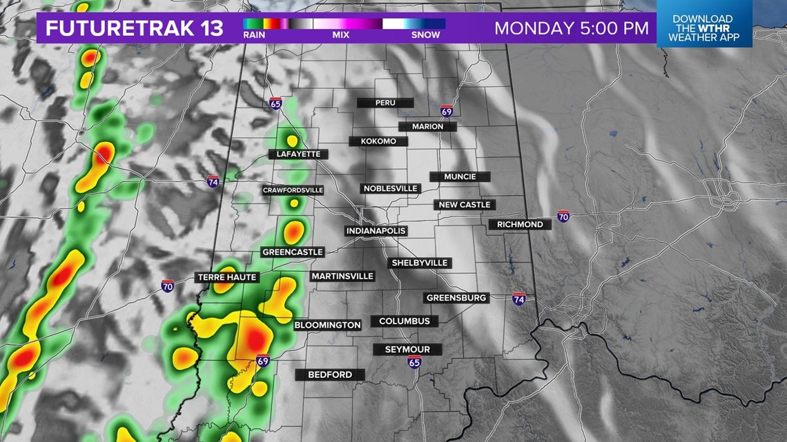
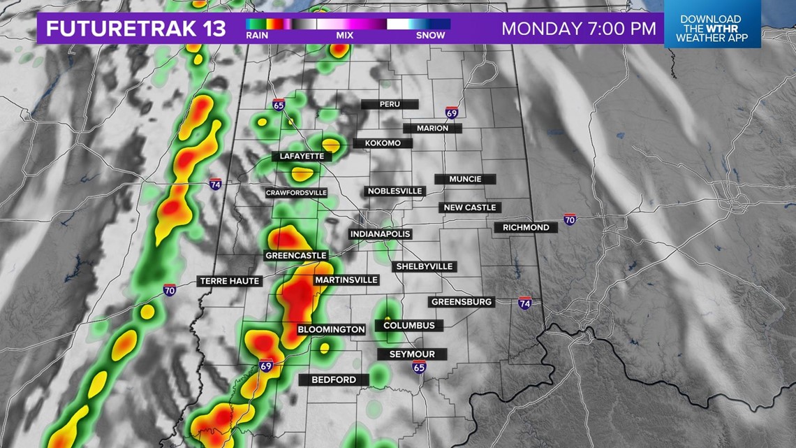
An area of low pressure with a cold front will trigger showers and thunderstorms after 5 p.m. in west central Indiana and into the metro area around 7 p.m.

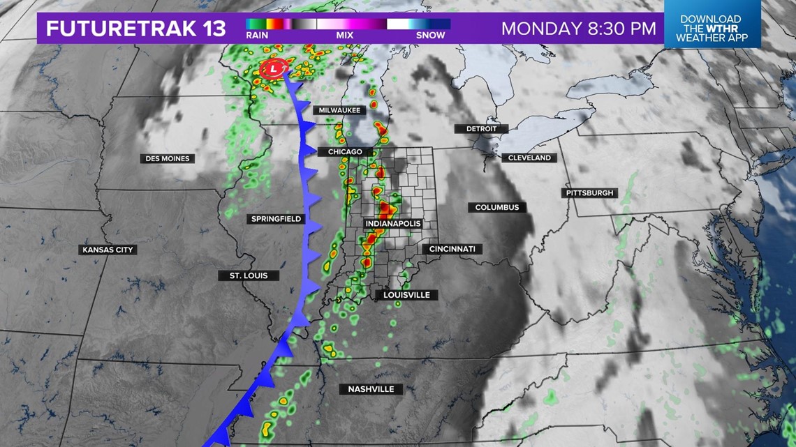
Storms will arrive in east central Indiana after 9 p.m. The Storm Prediction Center has all of central Indiana in a risk of severe weather.

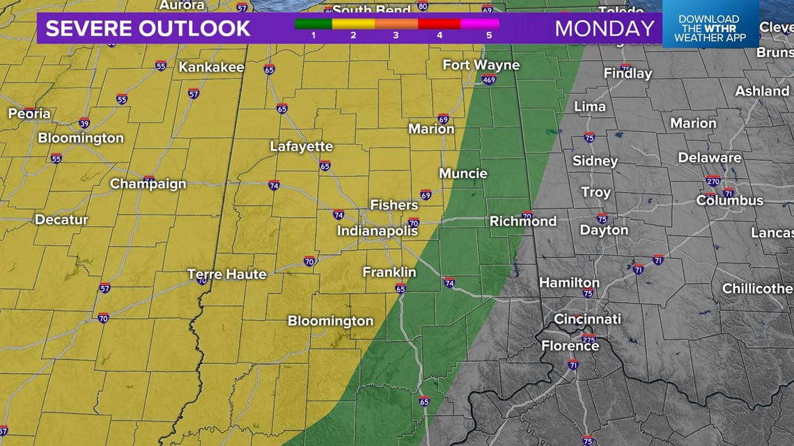
All threats are on the table for these storms, including large hail, damaging winds and isolated tornadoes.

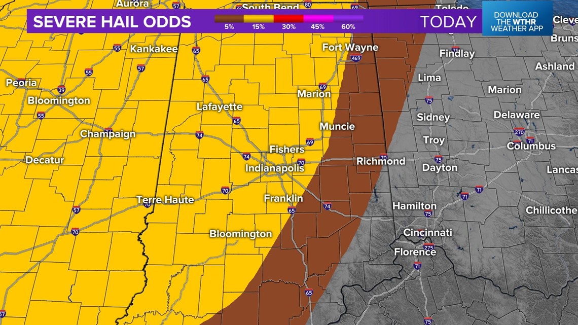


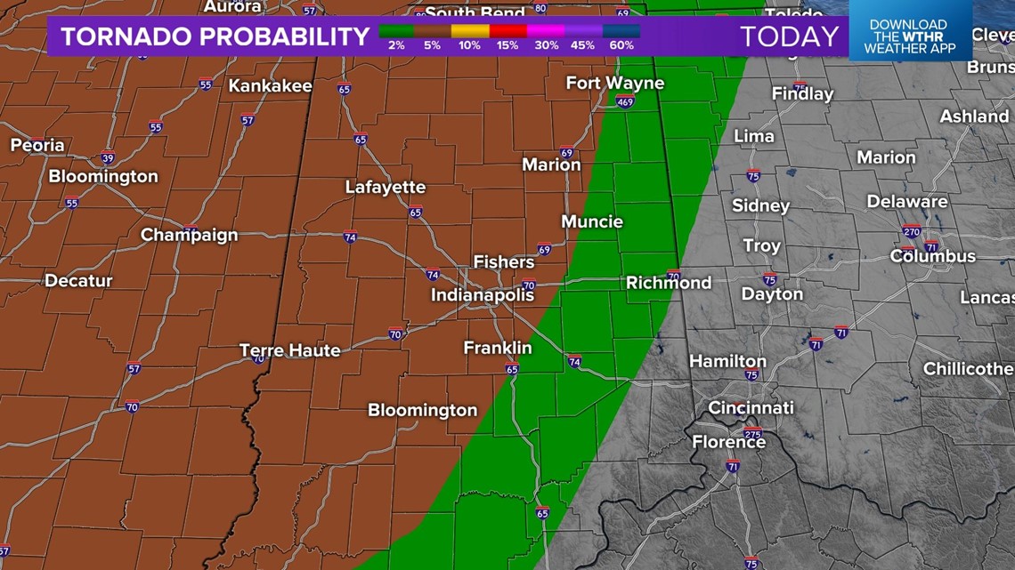
Northwest central Indiana will have the best chance for the strongest storms, as that area will have the best timing and instability.



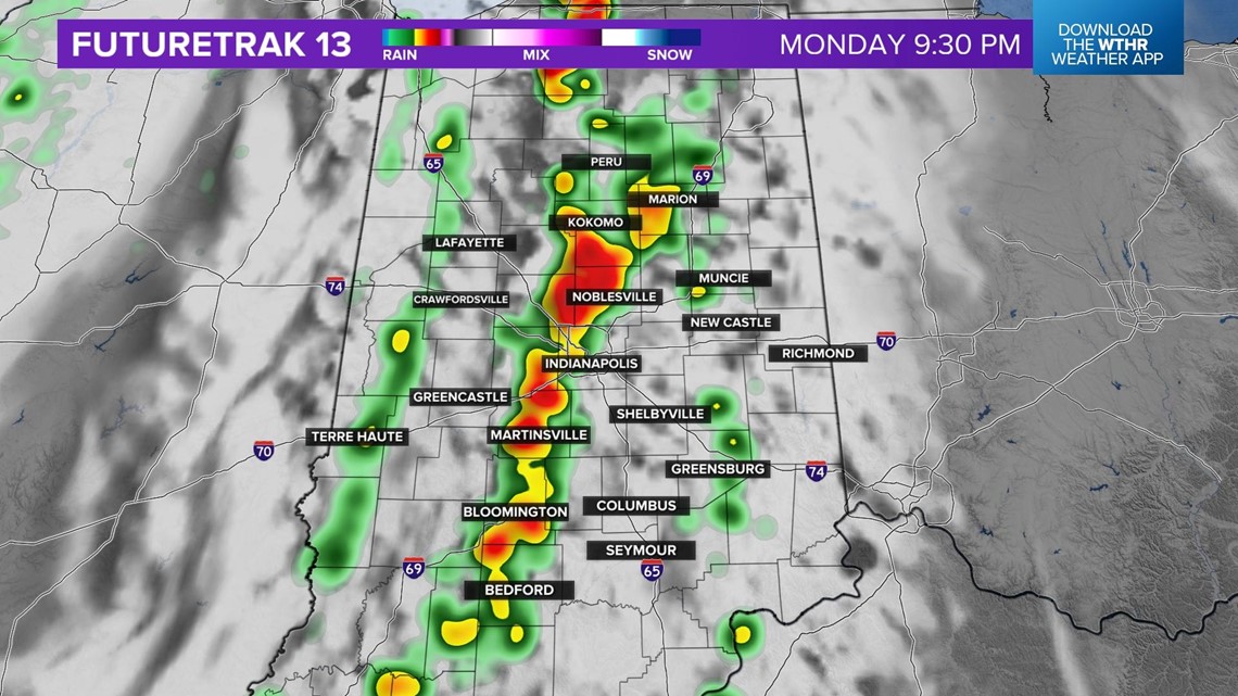
Storms will taper off after midnight Monday.

