

INDIANAPOLIS — Significant rainfall and rotating storms are among the primary threats as the remnants of Hurricane Beryl impact Indiana Tuesday and Wednesday.
The quiet before the storm locally today...
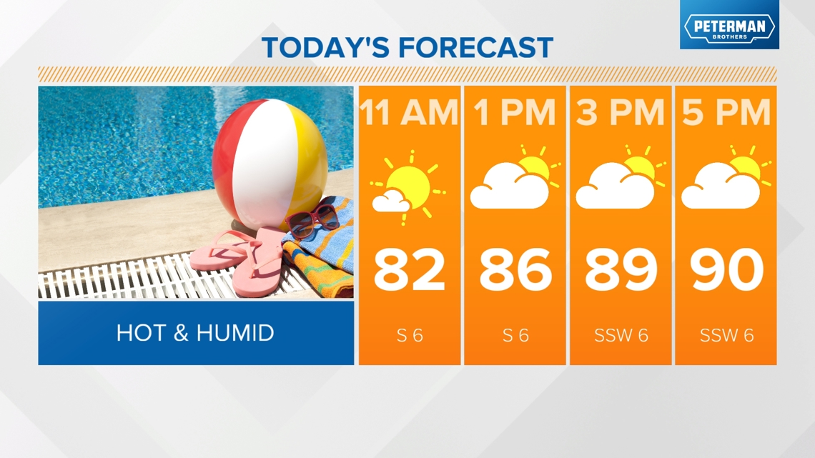
Today will be a hot and humid day with highs near 90 and miserable dew points near 70. We will stay dry throughout the day with skies becoming partly sunny.

A weak boundary will move through this evening into Tuesday morning and could spark a few stray showers or storms. It will be warmer and humid overnight with lows in the low 70s.
Latest timeline and threats from Beryl
Starting tomorrow, we'll be bracing for the remnants of Beryl, which made landfall in the U.S. overnight in southeast Texas as a Category 1 hurricane, packing sustained winds of 80 mph and gusts up to 100 mph.
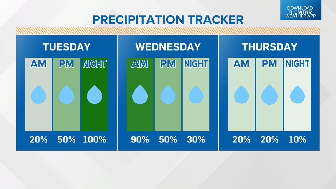
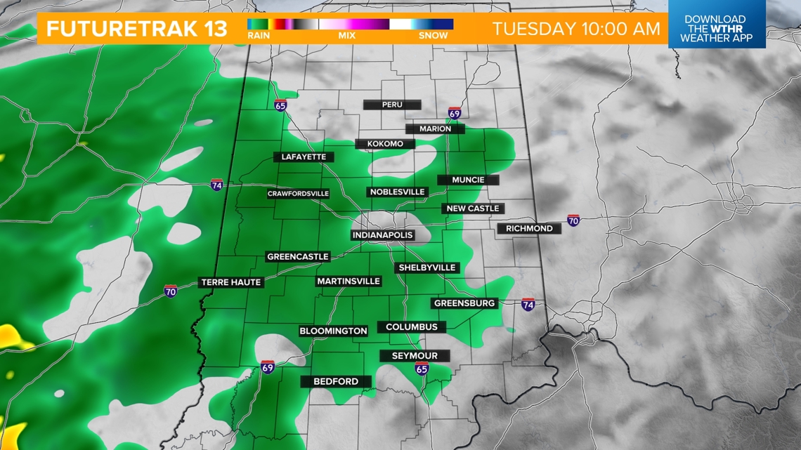
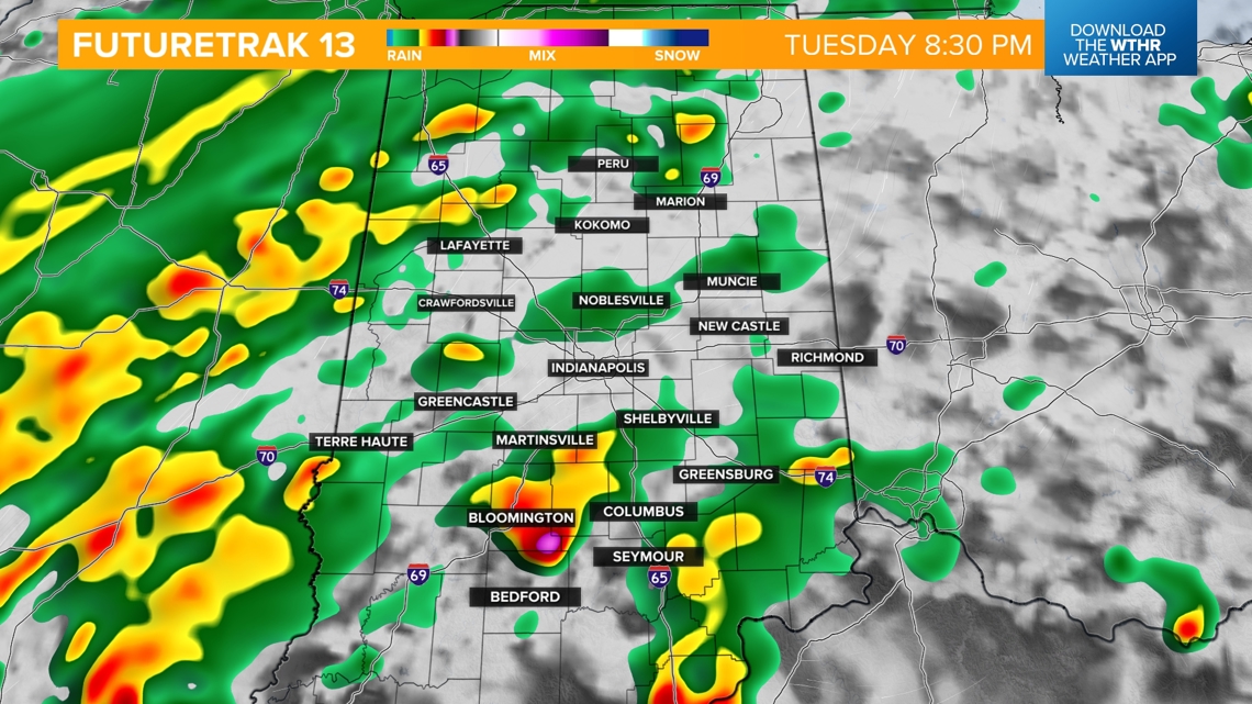
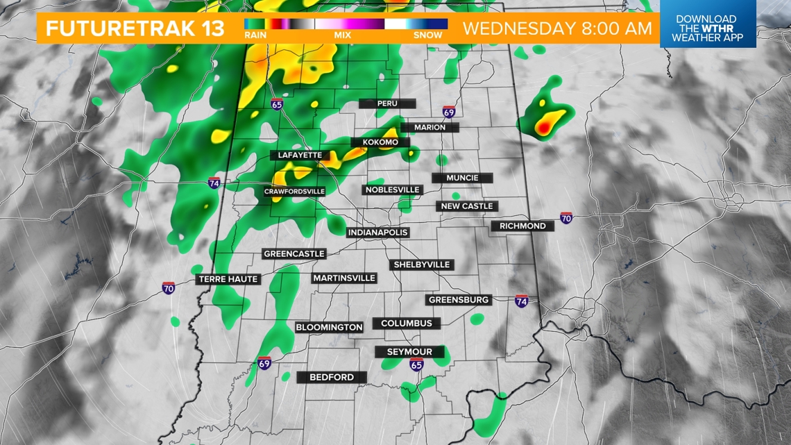
We'll likely see rain and a few thunderstorms out of this system by early Tuesday. Scattered rain and storms will become likely Tuesday afternoon. The heaviest rain/flooding threat will arrive late Tuesday evening during the overnight hours into Wednesday morning.
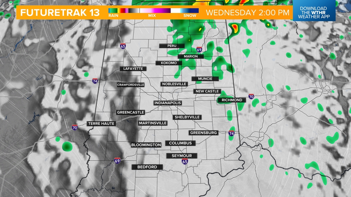
Eventually, this system will pull out of the area by Wednesday late afternoon/evening with steady rain coming to an end. A stray shower could linger through early Thursday.


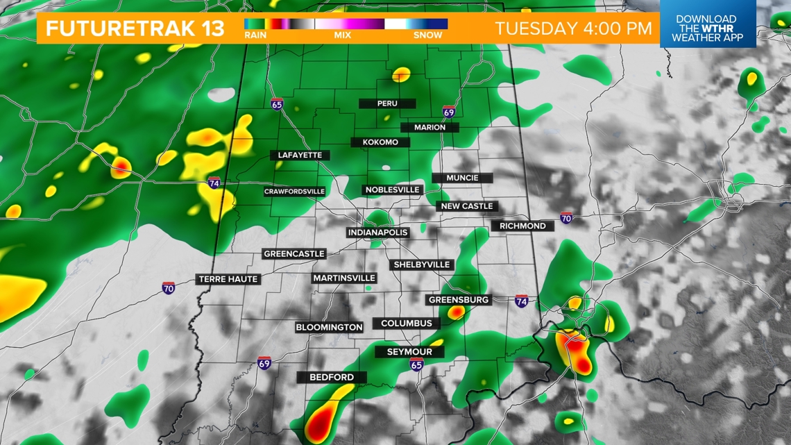
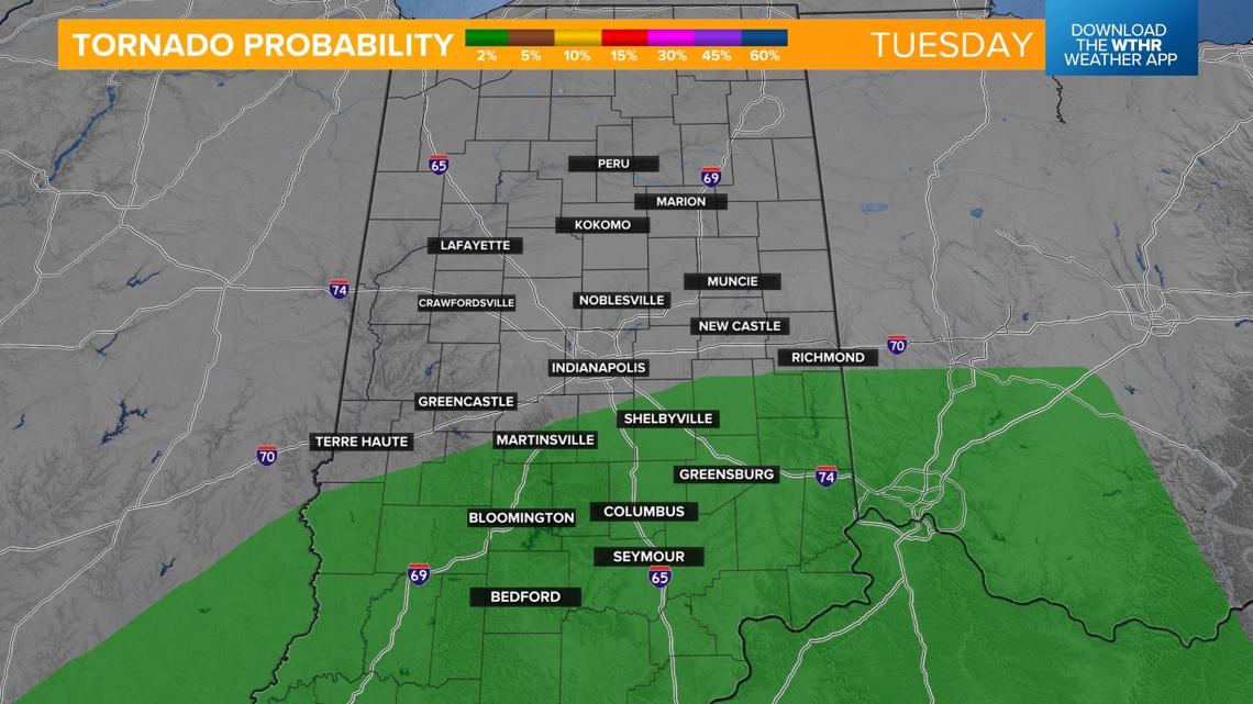
The primary threats with this storm system will first be rotating storms late Tuesday afternoon and evening, mainly south of the I-70 corridor. This is not uncommon with tropical systems, and any tornadic activity would likely be brief and weak.


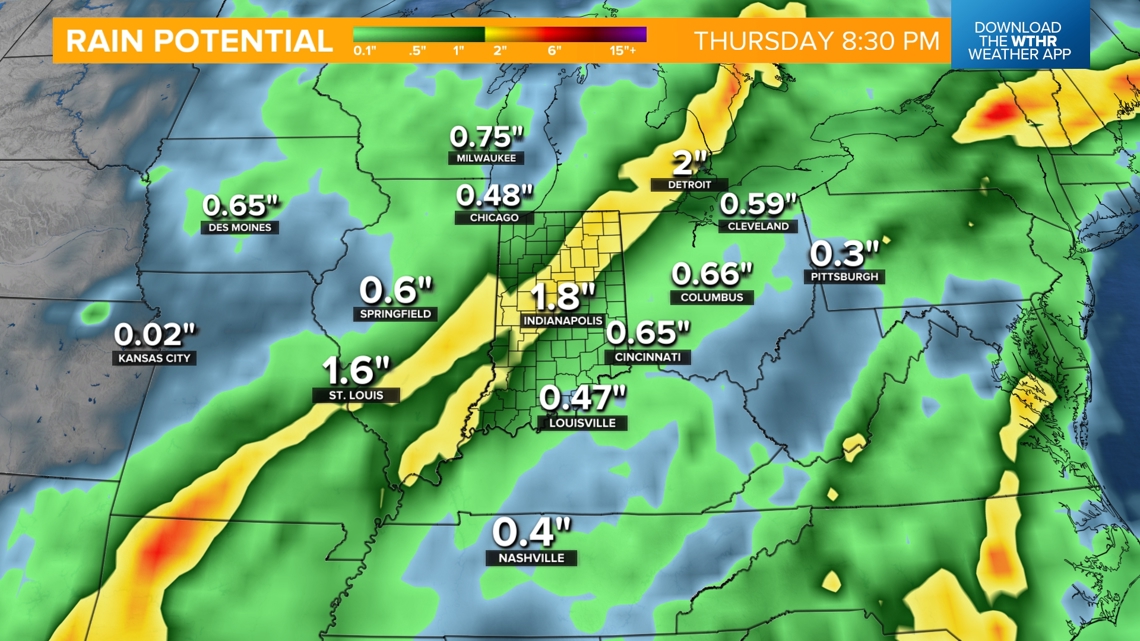
Flooding will be a secondary threat. We'll likely see a few inches of rainfall across central Indiana with a heavier swath bringing the potential of 3"+ by Wednesday evening. This heavy rain could lead to areal flooding and elevated levels along waterways.


The pattern will quiet down behind this system with clearing skies and temperatures warming back into the mid-80s Thursday and Friday, and upper 80s near 90 through next weekend.