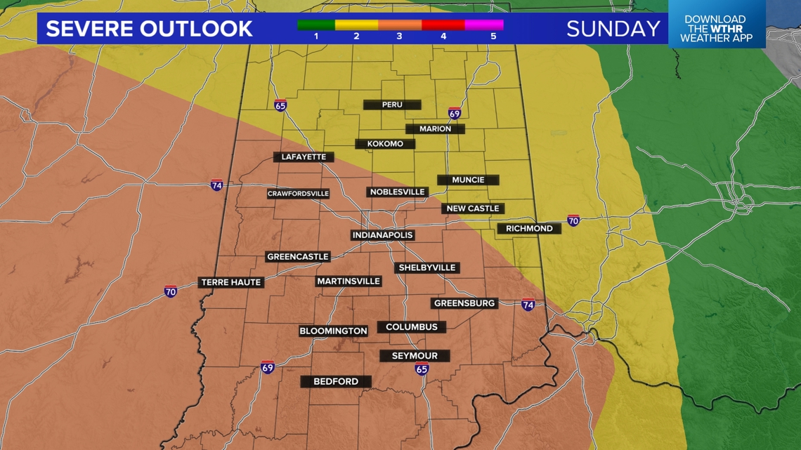
INDIANAPOLIS — Two rounds of thunderstorms are expected on Sunday. While strong to severe storms are possible with both waves, the second round is expected to be stronger.
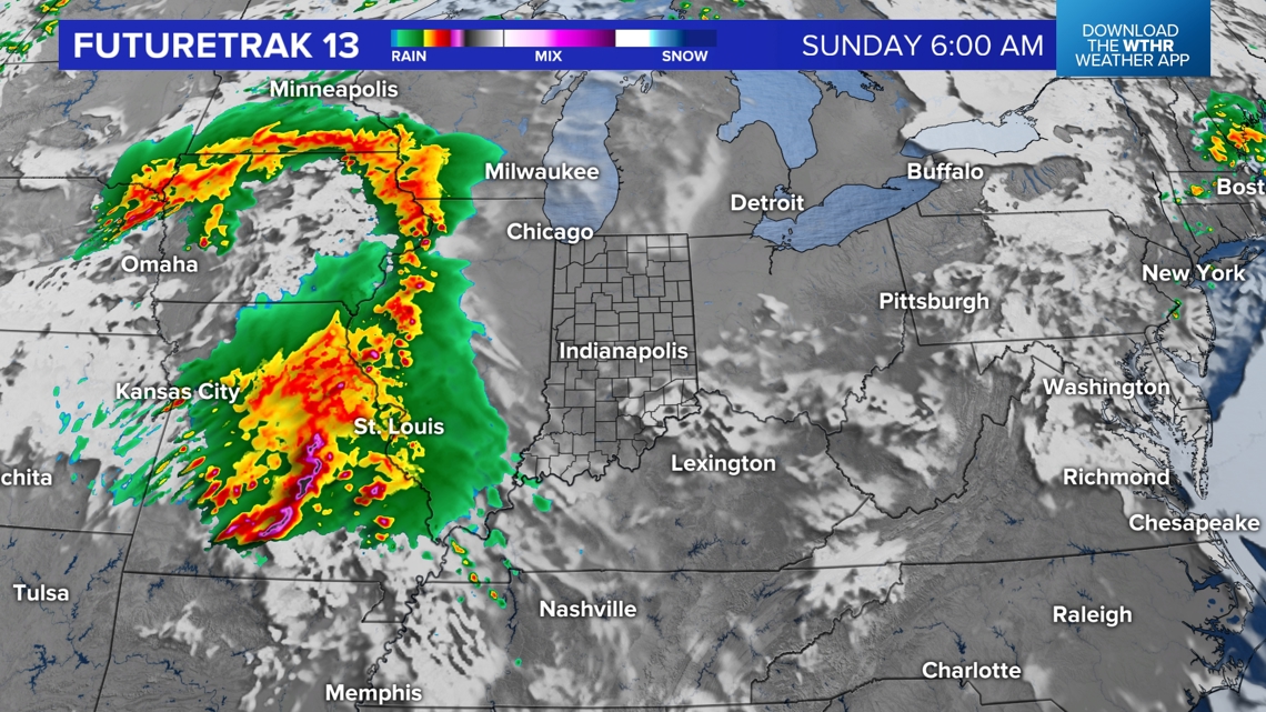
Storms early Sunday morning will be moving into Illinois, making it a dry start to Race Day.

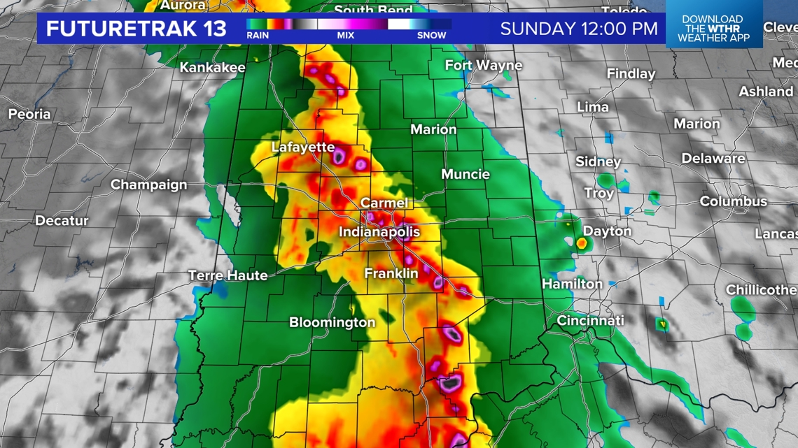
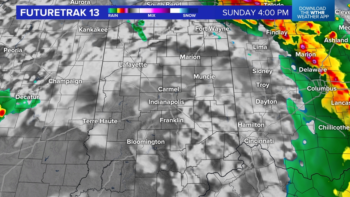
Current timing has the first round of storms impacting central Indiana late morning through early afternoon. Strong wind gusts, heavy rain, and lightning are possible.

Once the storms pass, a drier window is expected for the mid/late afternoon hours.

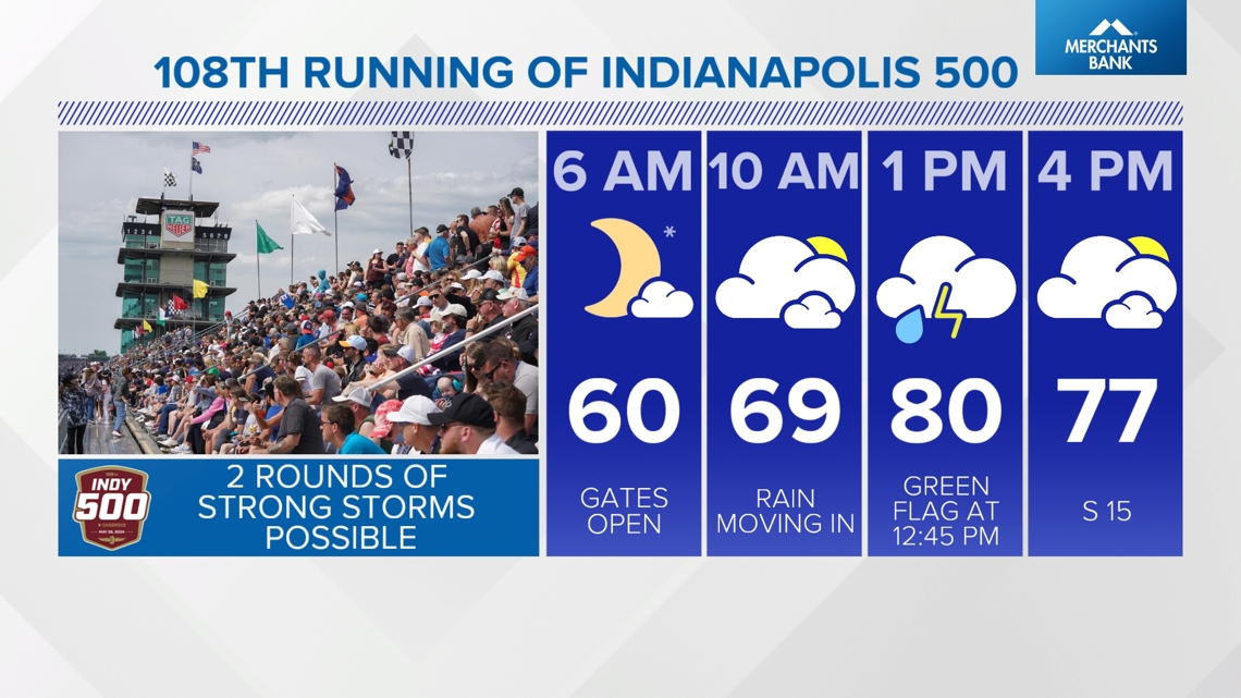
Highs will be near 80°. Temps will cool off slightly behind the first round of storms, but it will remain humid. Wind gusts will be around 25 to 30 mph out of the south.

The second round of storms is expected to track across the state after 6-7 p.m. to around 2 a.m.

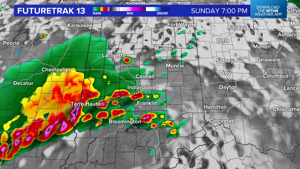

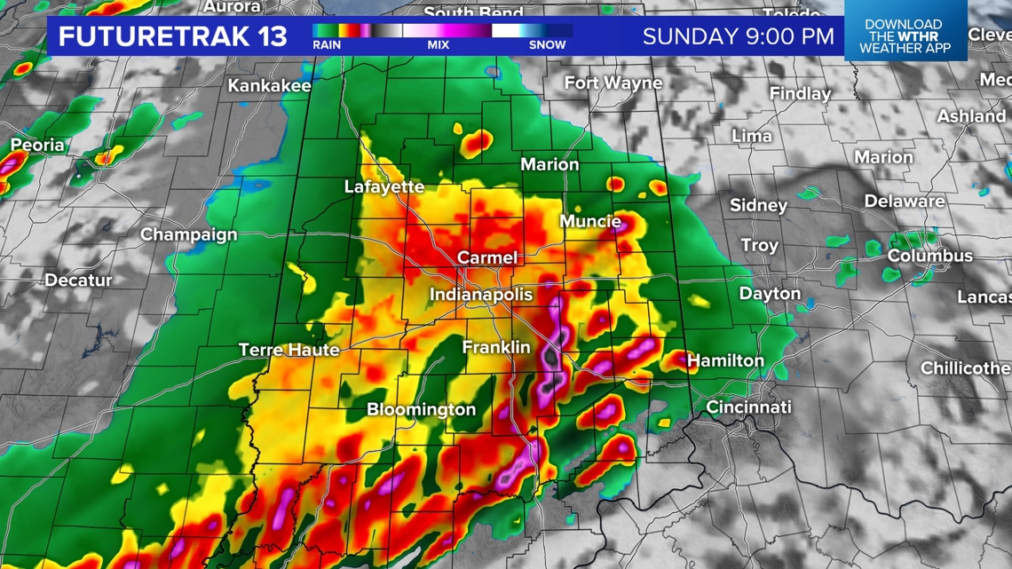
The primary threat will be damaging wind gusts. Rotating storms/tornadoes and hail are possible.