INDIANAPOLIS —
How much rain from Francine?
All week long, we warned of the potential for rain zones to shift either north or south...similar snow forecasts in the winter. In the case of the remnant rain from Francine, the trend the past 24-48 hours was shifting south-southwest. Indeed, that's what transpired.
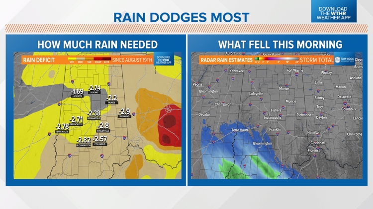
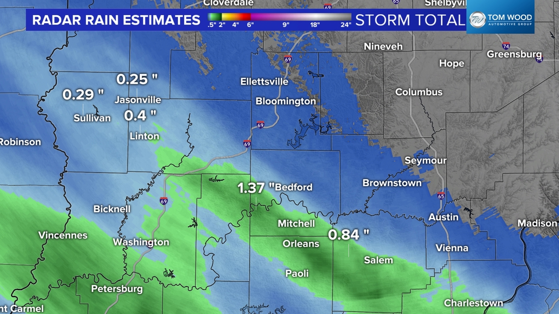
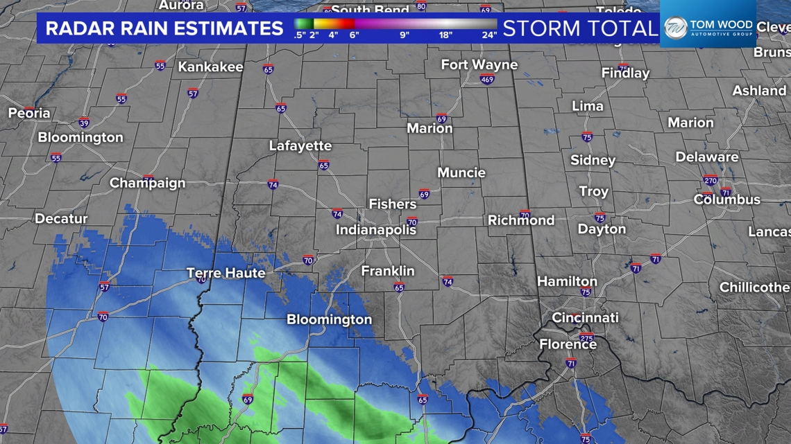
Radar rain estimates show a narrow swath of rain over southwestern Indiana, mainly from Terre Haute to Kentuckiana. Within that zone, rain ranged from a quarter to over an inch. That rain band continues to scatter out, and we're not expecting much redevelopment this afternoon and evening.


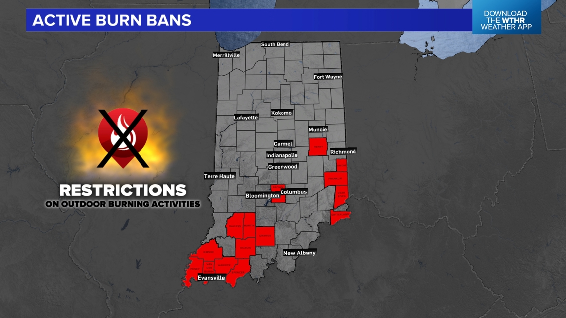
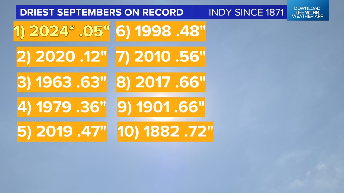
That's not what the doctor ordered for a parched landscape of worsening drought conditions in much of Indiana. In fact, new counties (Henry and Brown) were placed under Burn Bans today, and we expect numerous counties to be added by the end of next week.

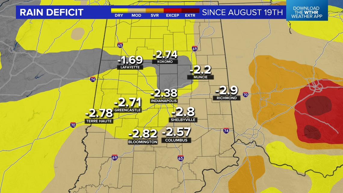
Since mid-August, rain deficits have grown to nearly 3" for much of central Indiana, and we're advertising a warm, dry spell into next weekend. Though some modeling hints of a east coast tropical system retrograding (moving east to west) into the Ohio Valley early next week, we're not very bullish on this scenario bringing rain to central Indiana.


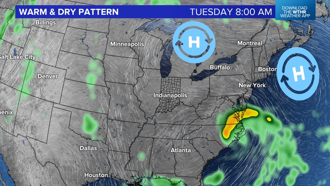
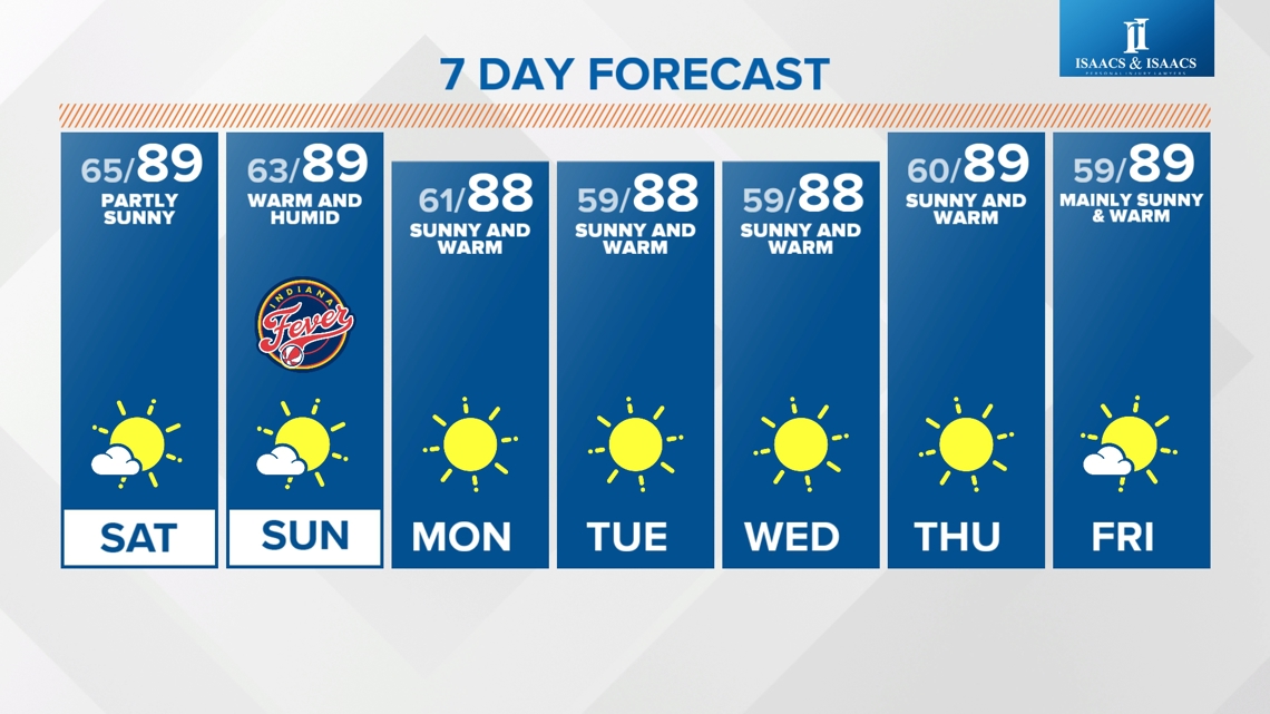
Dry and unseasonably warm pattern ahead
Upper level high pressure anchored over the northeastern United States minimizes atmospheric lift and blocks central Indiana from getting much low-level moisture for precipitation. The dry soils, drier air and abundant sunshine leads to a prolonged spell of mainly sunny and unseasonably hot days of high temperatures in the upper 80s to near 90°, lasting into next weekend.

Though the Muggy Meter does creep up a little bit today and early Saturday, it eases due to easterly wind heading into next week. This makes it more of a dry heat and almost desert-like air mass, where afternoons get hot in the sun, but evenings/overnights/mornings are comfortable and when you're in the shade.

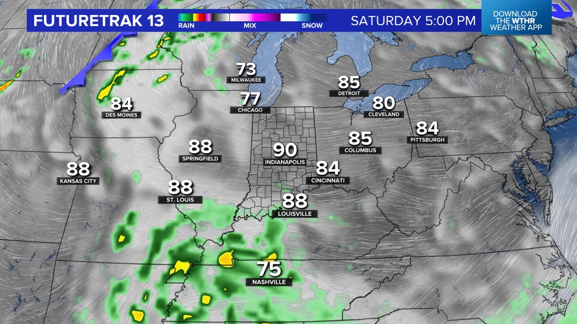

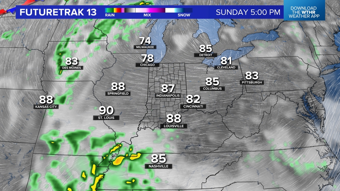
So plan on significant (nearly 30°) diurnal swings from morning lows and afternoon highs. With little change in air mass and upper level setup, there will be very little day-to-day change in our weather. This is why nearly every single day in our seven-day forecast is essentially the same — with only small changes in dewpoints.
Please be cautious if you're around dry brush as it becomes highly combustible in conditions like we're in.