INDIANAPOLIS — Drier and warmer weather is on its way to central Indiana!
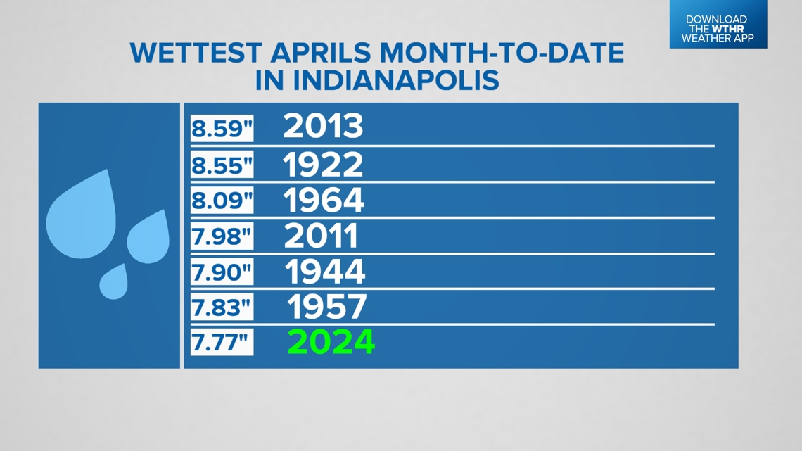
Indianapolis picked up over an inch of rainfall yesterday, taking the monthly total (through April 29) to 7.77 inches. That ranks this month the seventh wettest April on record (month-to-date).

What caused all the fog this morning?
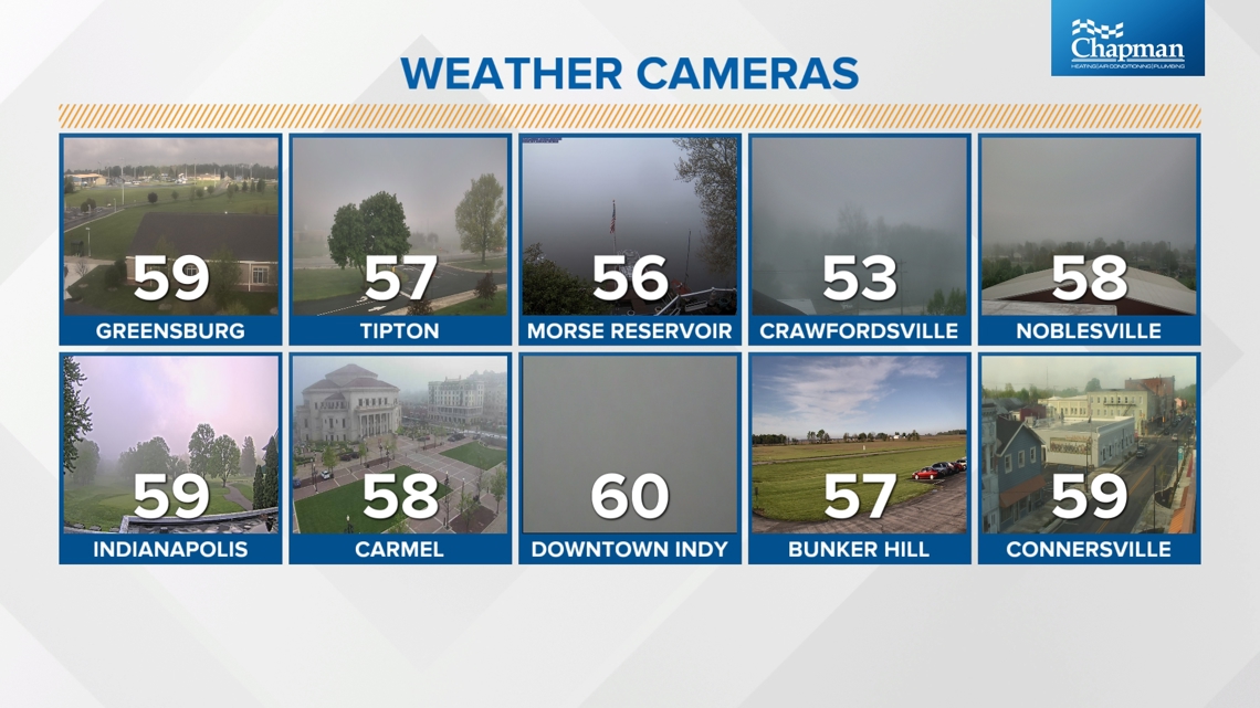
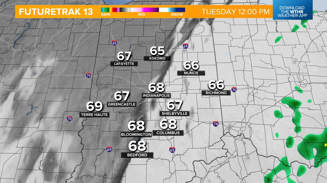
Monday's rain played a role in that. A cold front came through overnight, bringing much cooler, drier air. That type of air mass interacting with a very saturated, warm ground initiated perfect conditions for areas of dense fog to develop. After an inconvenient morning, our colliding air masses will start to mix, allowing for clearing skies this afternoon.

REST OF TODAY:
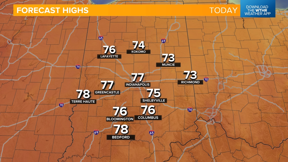
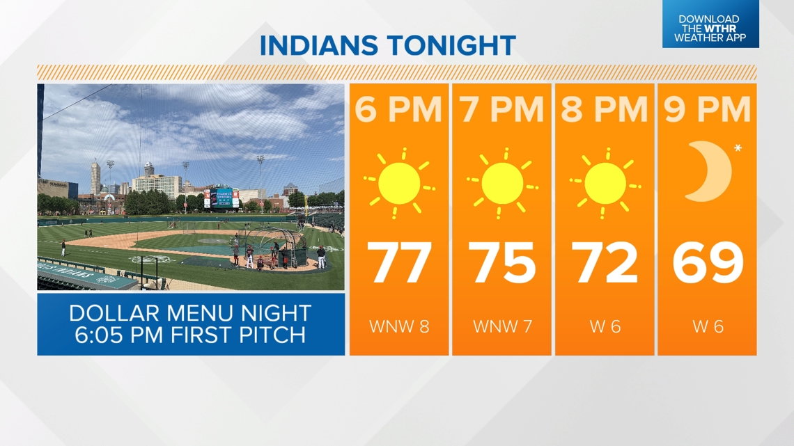
Becoming sunny with highs in the mid-70s. Pleasant tonight for the Indianapolis Indians' 6:05 p.m. first pitch.



FIRST DAY OF MAY:
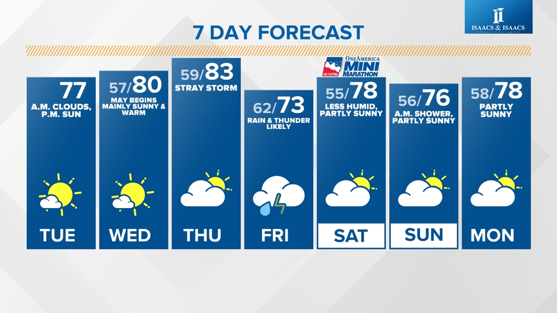
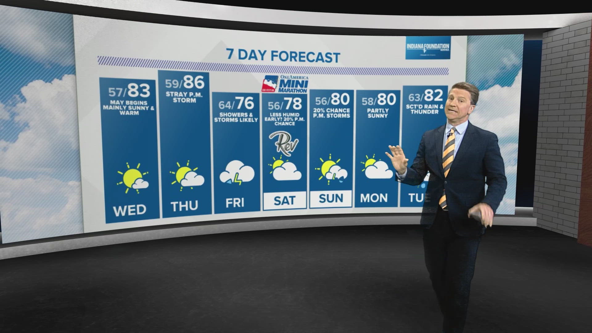
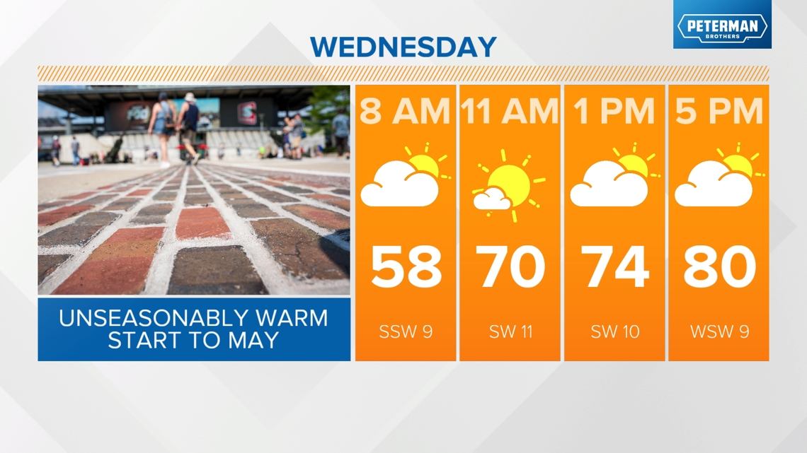
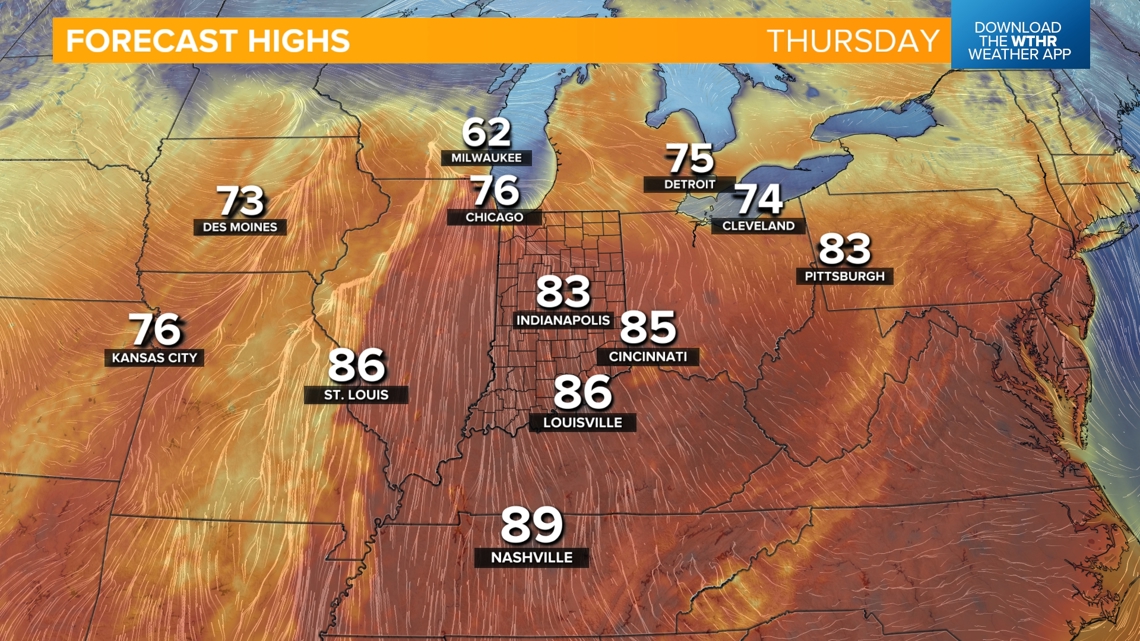
We'll kick off May tomorrow with highs near 80. That's the average high temperature of June 6 in Indianapolis. Morning clouds are possible, becoming partly sunny in the afternoon.

THURSDAY:
Even warmer with highs low 80s. A stray shower or storm will be possible as a weak wave moves through.

When will rain impact my plans next?
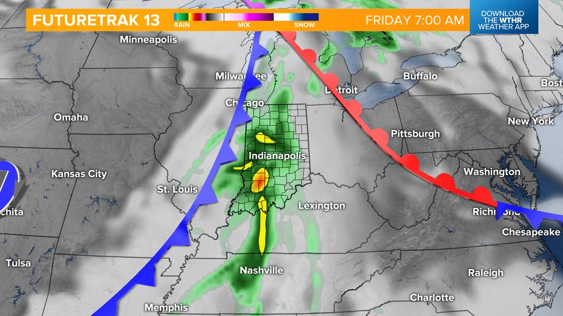
The better chance of rain and storms returns Friday along a more impactful system. Slightly cooler in the mid-70s Friday. Most rain should wrap up in the evening as this front slides east.


What is Saturday looking like for the OneAmerica 500 Festival Mini-Marathon, college graduations and Rev?
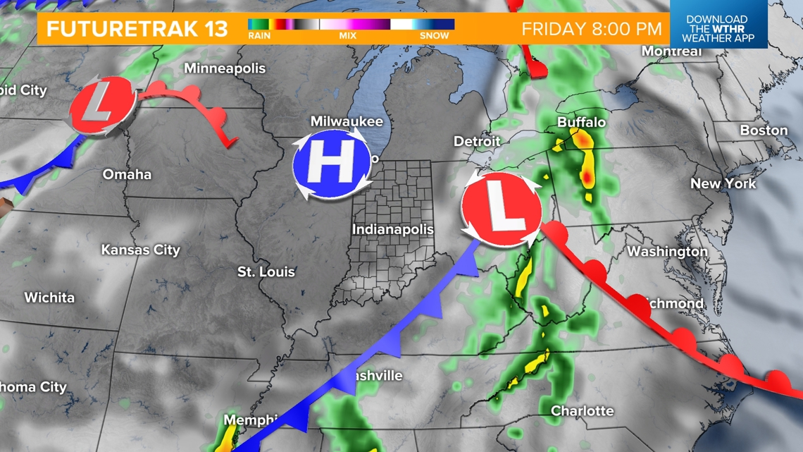
Rain looks to move out of the Indy metro by Saturday morning. We are watching the potential of a few stray showers lingering across the eastern tier of the state through Saturday morning if Friday's storm system stalls out too much. Temperatures look pleasant in the mid-50s Saturday morning for the OneAmerica 500 Festival Mini-Marathon, with highs in the upper 70s as skies clear in the afternoon.
Saturday evening will be tricky as another system tries to push in, bringing the potential of a few showers, mainly after 6-8 p.m. There is still some disagreement on the timing of this system between longer-range weather models, so make sure to check back as we get closer to the weekend.
Saturday evening's system should be out of here by daybreak Sunday. Look for partly sunny skies and highs in the mid to upper 70s to round out the weekend.

