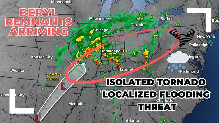
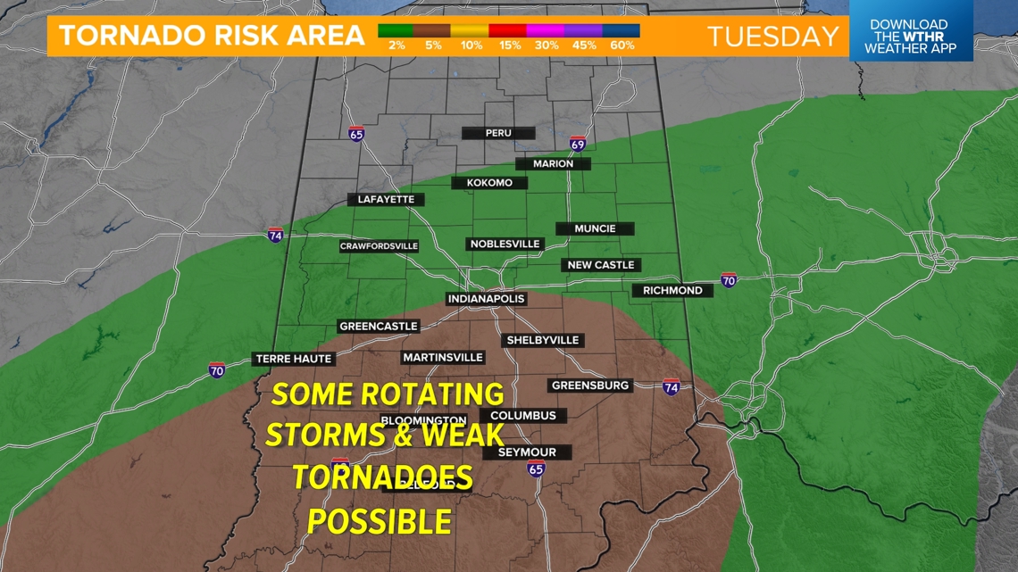
INDIANAPOLIS — The risk of brief spin-up tornadoes, heavy rain and damaging wind gusts is increasing as the remnants of Beryl – now a tropical storm – arrive in central Indiana.
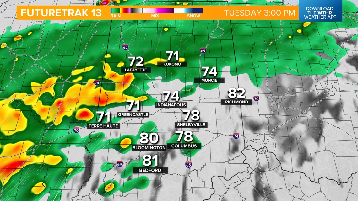
Today's rain and storm timeline
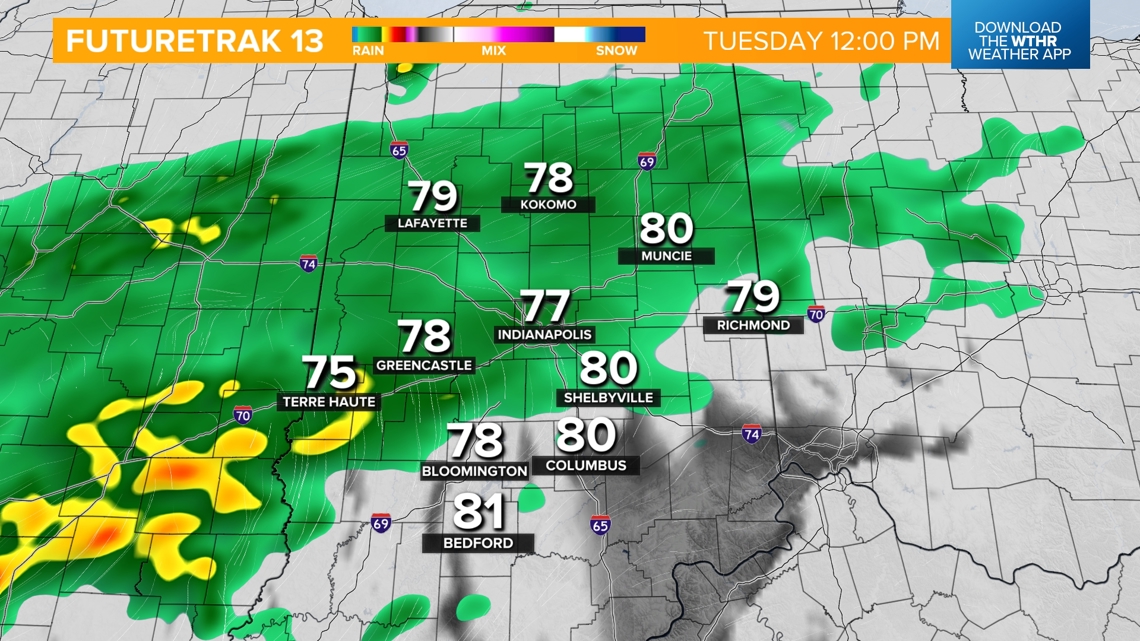
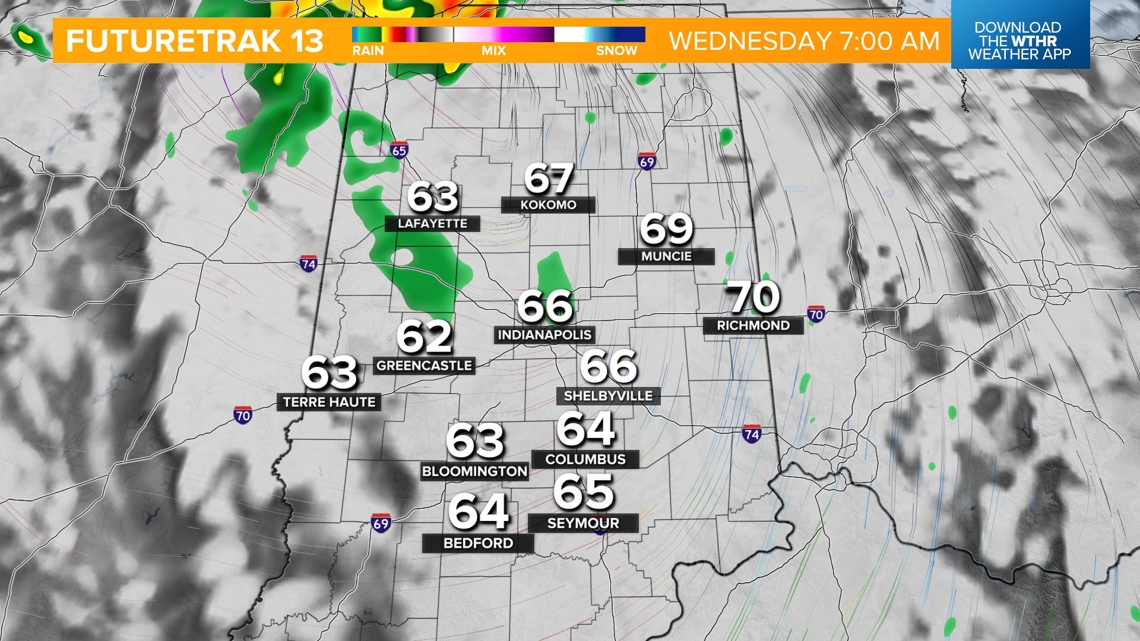
Rain will become more widespread through the first part of the day and heavy at times starting this afternoon.


Severe threats
Threat: Rotating storms, low-end spin-up tornadoes
Time: 6 p.m. today through 2 a.m. Wednesday
Location: Mainly south of the I-70 corridor
This is not uncommon with tropical systems, and any tornadic activity would likely be brief and weak. We'll also see the potential of strong wind gusts that could lead to isolated power outages.


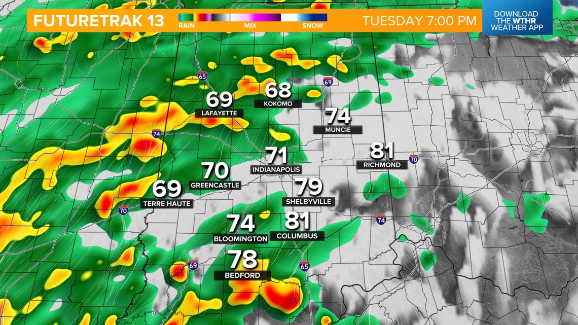

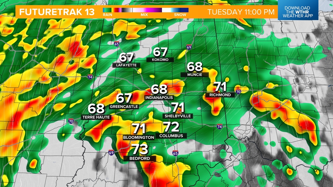
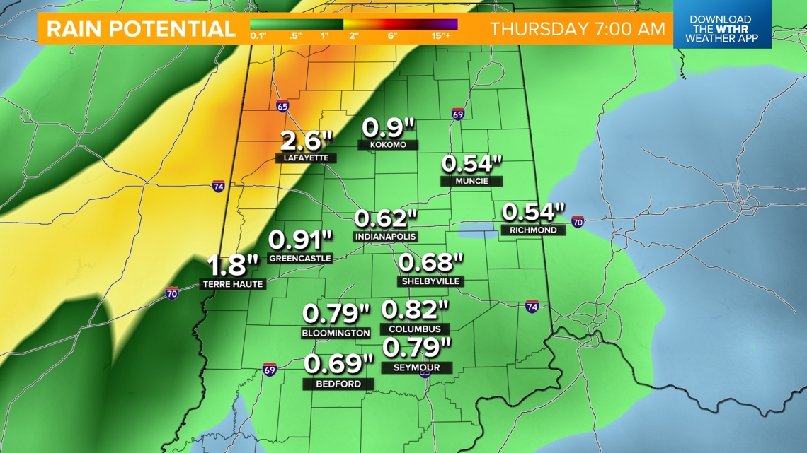
The heaviest rain will continue this evening and during the overnight hours. Eventually, this system will pull out of the area by the morning hours on Wednesday. We'll likely see a few inches of rainfall across central Indiana with a heavier swath bringing the potential of three or more inches of rain across the northwestern tier of the state. The Indy metro will see closer to an inch.


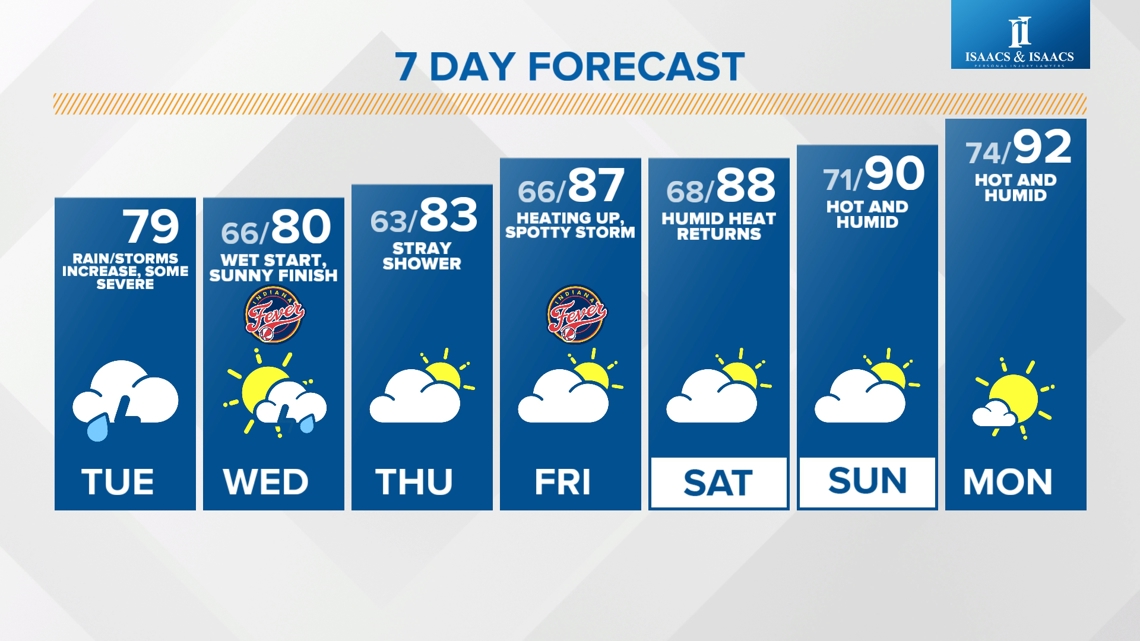
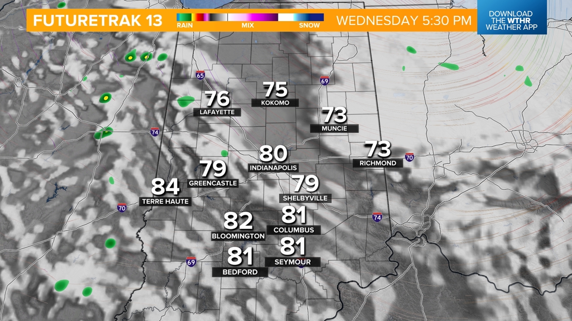
Skies will begin to clear Wednesday afternoon with a little sunshine returning and highs near 80.

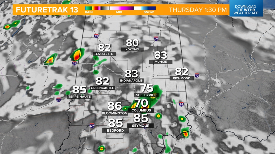
The pattern will quiet down behind this system as temperatures warm back into the low 80s Thursday and into the upper 80s by Friday, with an isolated shower or storm possible.