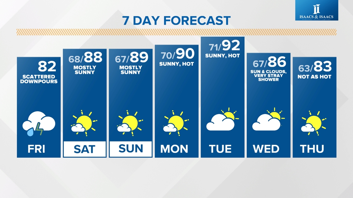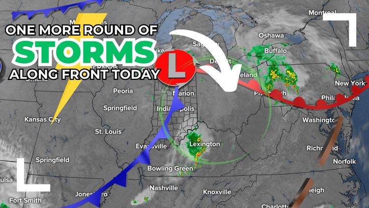
INDIANAPOLIS — Today will be a transitional day from an active, stormy pattern to a more quiet setup through early next week.

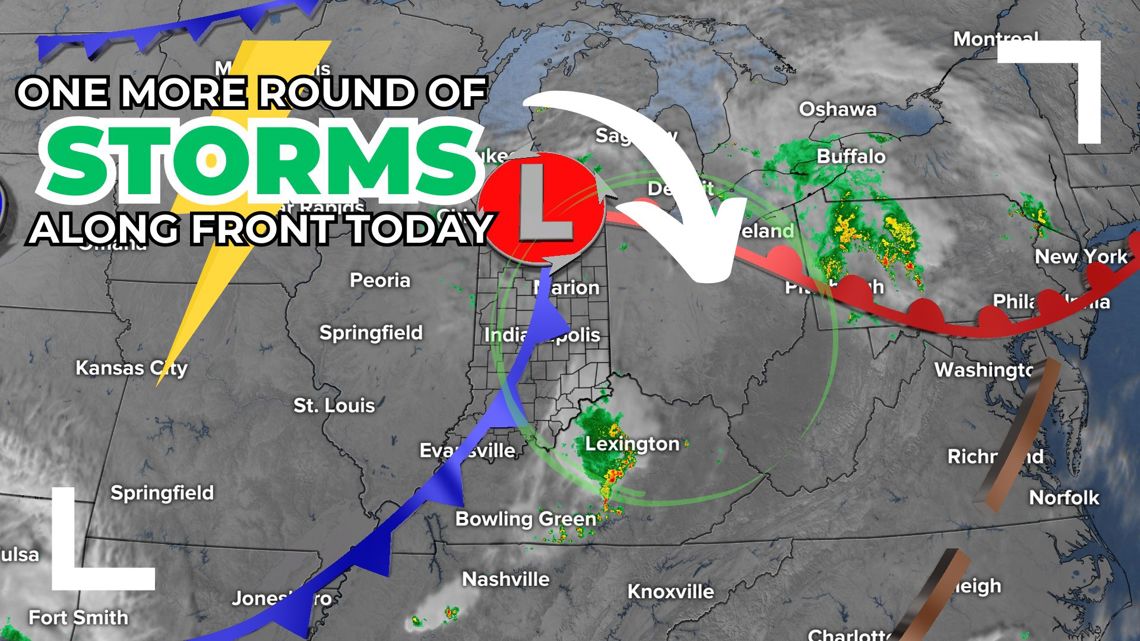
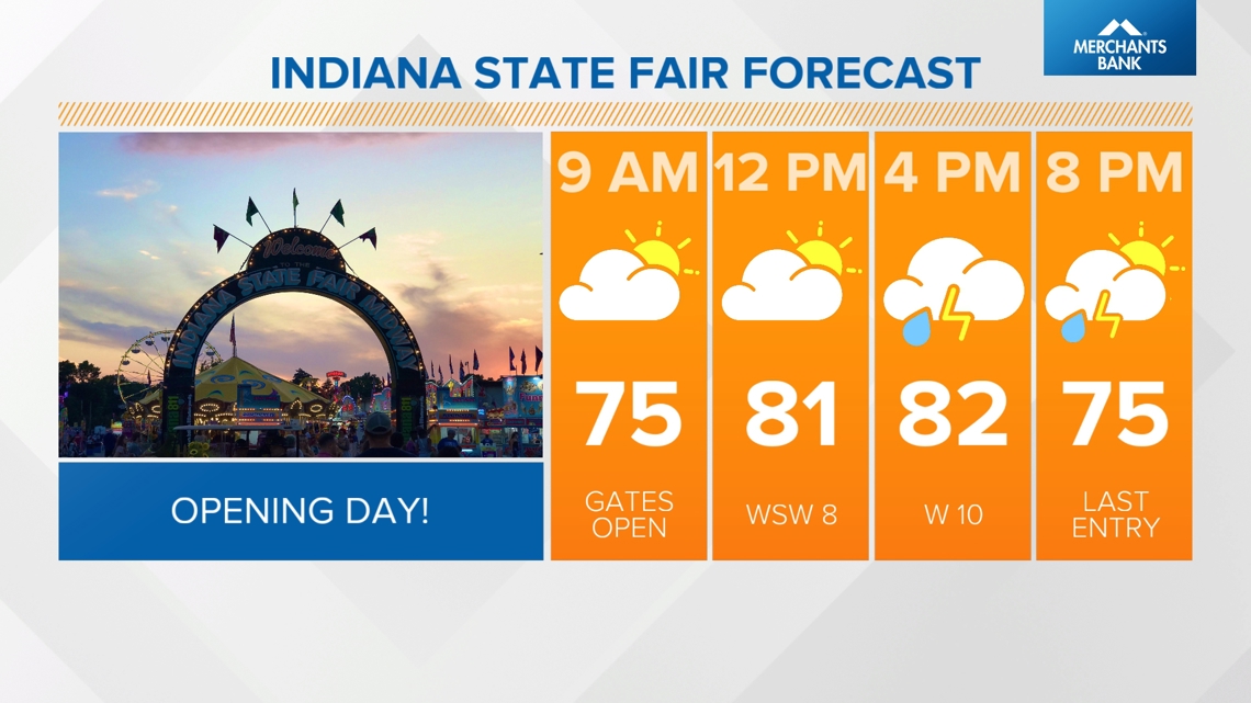
We'll see lots of dry time through the early afternoon as temperatures warm into the low 80s to kick off the Indiana State Fair. Storm chances increase this afternoon/evening.

Today's storm risk...
WHEN: 1 p.m. - 9 p.m.

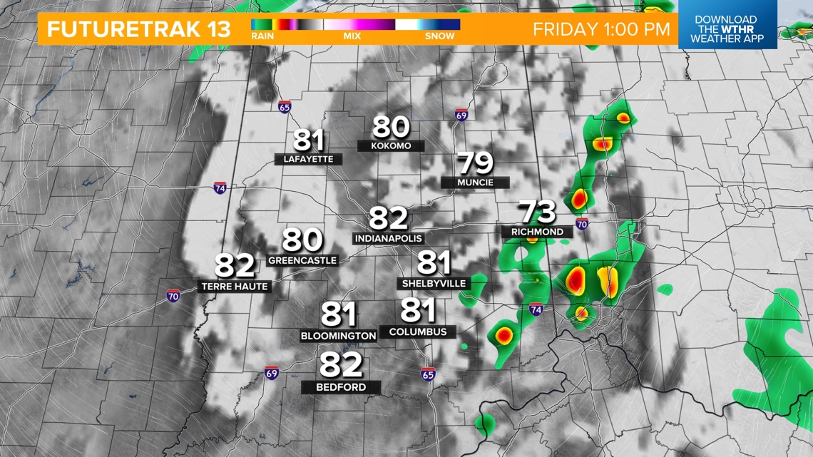

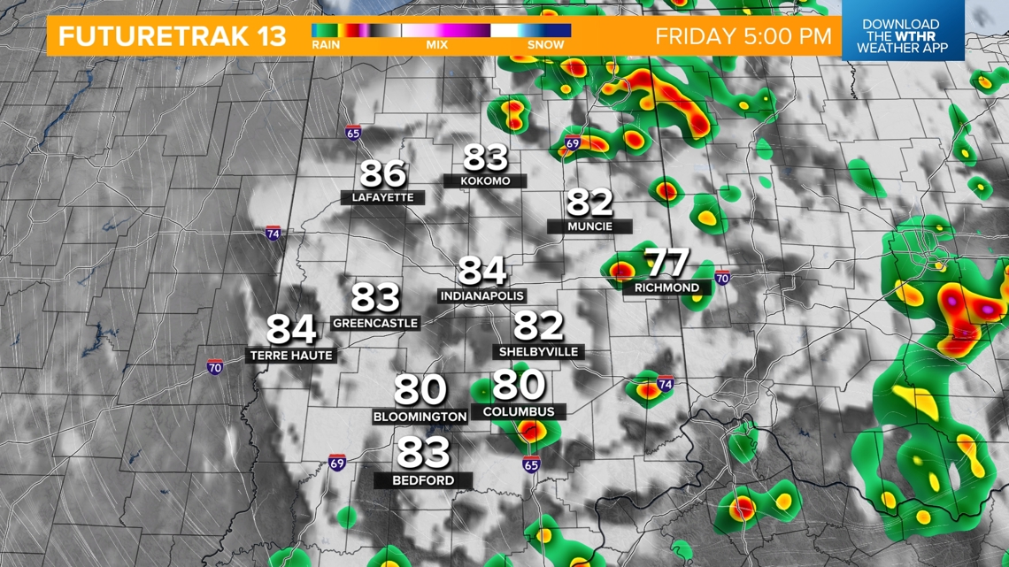

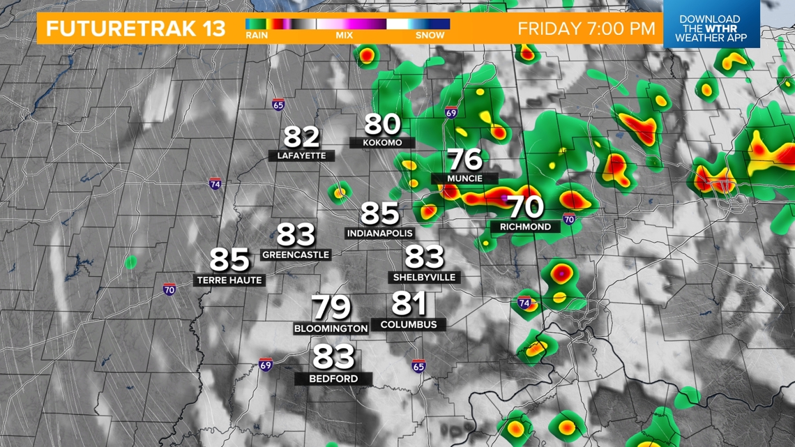

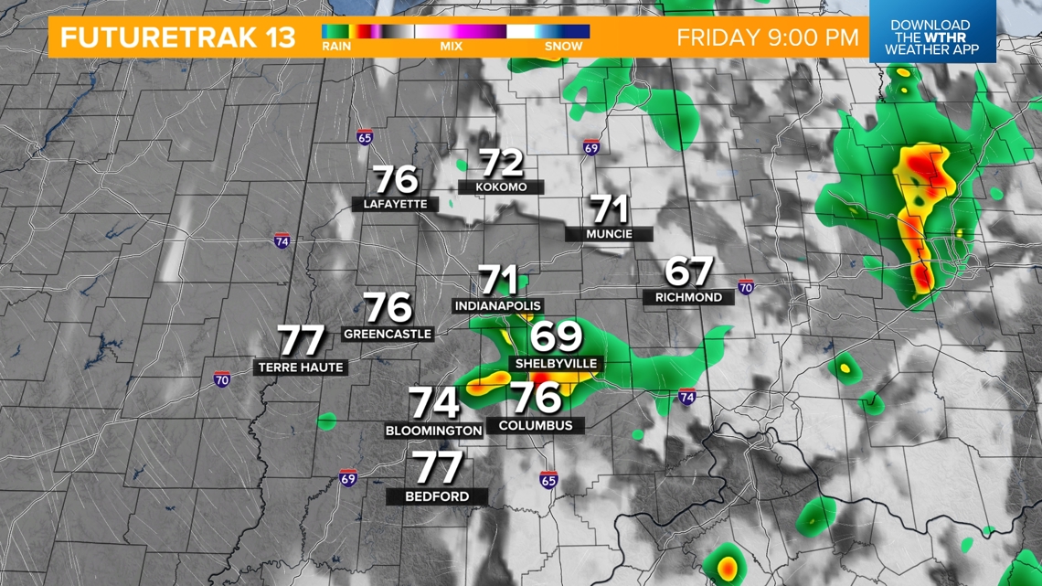
IMPACT: Widespread severe storms are not expected, but plan ahead with the threat of lightning, brief heavy rain leading to localized flooding and isolated damaging wind gusts.

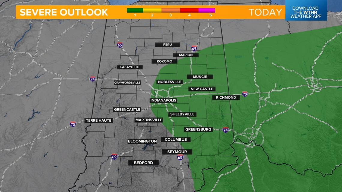
NEED: Access to radar, a plan "b" for outdoor activities
Improvements in the weekend forecast
Areas of patchy dense fog will once again be possible overnight with temperatures falling into the upper 60s.
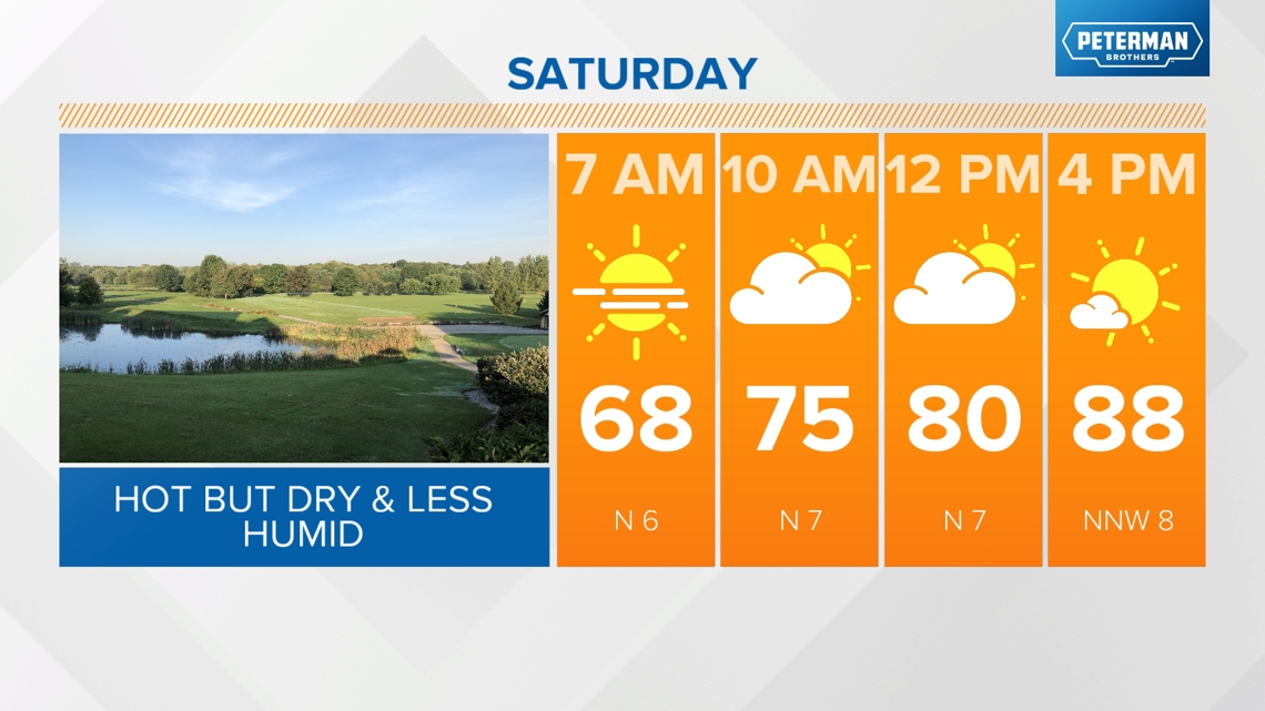
Better weather arrives this weekend with a break from the storms. It'll still be hot and a little muggy with highs in the upper 80s under mainly sunny skies both Saturday and Sunday.

Temperatures will trend back into the low 90s for highs to start next week.