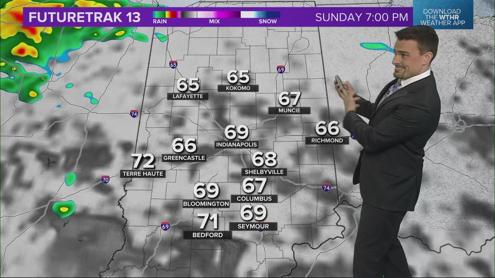
INDIANA, USA — UPDATE: New data for Easter storm threats... They've been delayed until after 8PM. Tap HERE for the most up to date information.
OLD: Our warm front was nice to us on Saturday with sunshine and 70s, but it may help bring isolated strong storms Sunday evening. Hail will be the primary risk as these hit-or-miss storms develop. Up to golf ball-sized hail is possible.
Tap HERE for our live interactive radar to track the storms when they fire up.
Much of Easter Sunday will be fine across Indiana. A stray shower is possible mainly south of Indianapolis in the morning, but the midday hours should be mostly dry across the state. After lunch, our warm front that is sitting over Indiana and Illinois will start to fire up some storms. The primary threat will be some hail. Each storm that fires will still have the possibility of some wind. A stray tornado is possible.

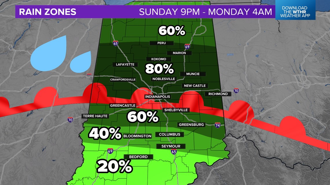
Not everyone will get a storm due to the isolated nature of the sparks of convection. Wherever the warm front is, where cooler air and warmer air are colliding, that's where the strongest hail storms will form and track along, just like railroad tracks.
The position of the warm front may change by 30 miles north or south from the current forecast.
How large will the hail be? Will I get hail?
Generally hail sizes will range from pea to golf ball sized, or up to 1.5" in diameter. The best chance for the larger hail will be in the yellow zone, mainly across the vast majority of central Indiana. The hail threat diminishes farther south (not enough upper-level support), and farther north (not enough warmth).

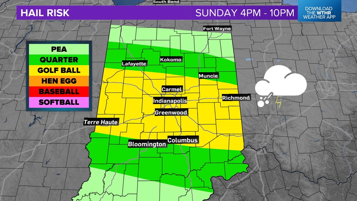
The zones of hail could shift a bit north or south, depending on where the warm front ends up by Sunday midday. Generally if you live within 50 miles of I-74, you will have a decent hail threat. The storms will fire along the front and move east along the front. Wherever the front goes, so go the hail storms. Not everyone will get a storm, but there will be some across central Indiana.
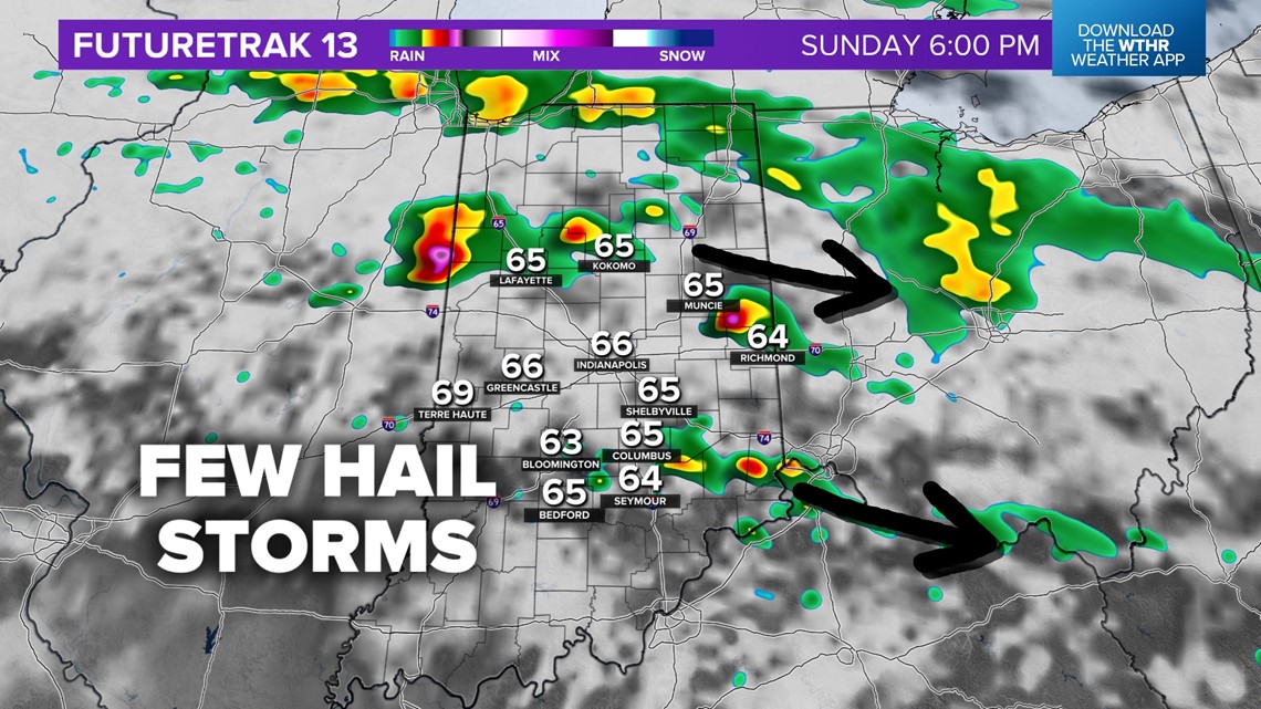
These storms will generally be moving from west to east-southeast across the state.

When will it rain on Easter?
The storms are not the only threats for rain throughout the day.
- 4 a.m. - 9a.m.: Stray rain shower, mainly south of Indianapolis.
- 4 p.m. - 10 p.m.: Isolated hail storms popping up and moving east.
- After 10 p.m.: Scattered rain and thunder is likely the rest of the night, severe chances become very low.
More storms Monday...
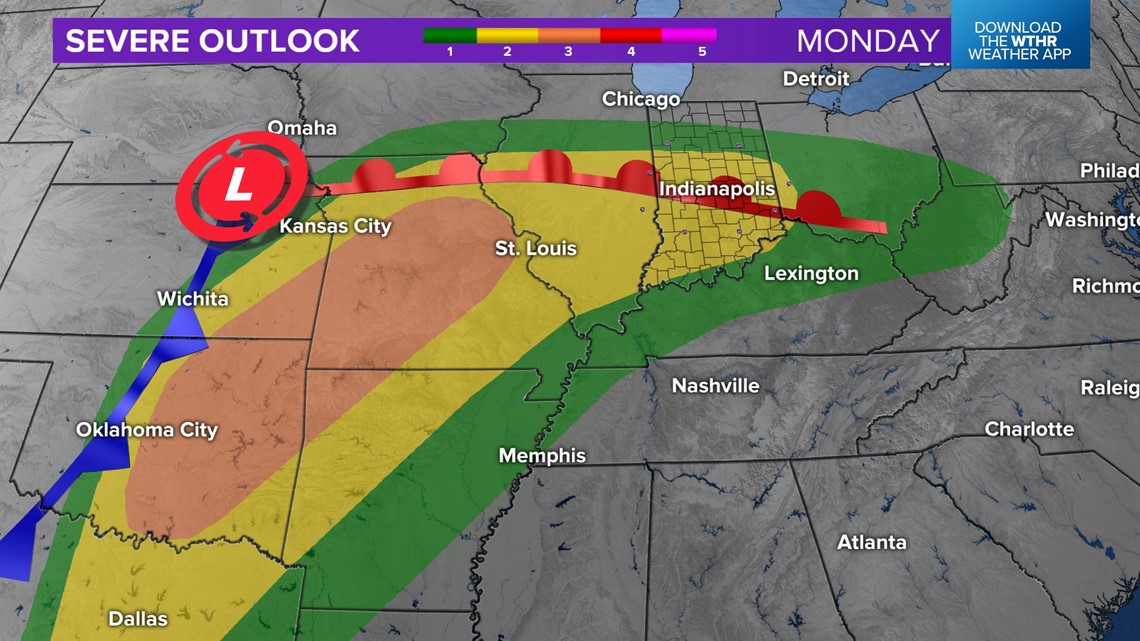
Another storm system, this one larger and more powerful, hits Monday. We will get another warm front to spark more storms. All modes of severe weather will be possible on this one, including tornadoes, hail, and wind.
Scattered rain and thunder will be possible across Indiana Monday morning, with stronger storms and some severe weather later in the afternoon and late evening.

— 13News Meteorologist Matt Standridge

