INDIANAPOLIS — Cooler air has returned today on the back side of a cold front. We're starting off the week with some dry time, but moisture will wrap around the back side of this storm system bringing scattered showers and isolated storms back to central Indiana after Sunday's lunch hour and continuing through the afternoon and evening.

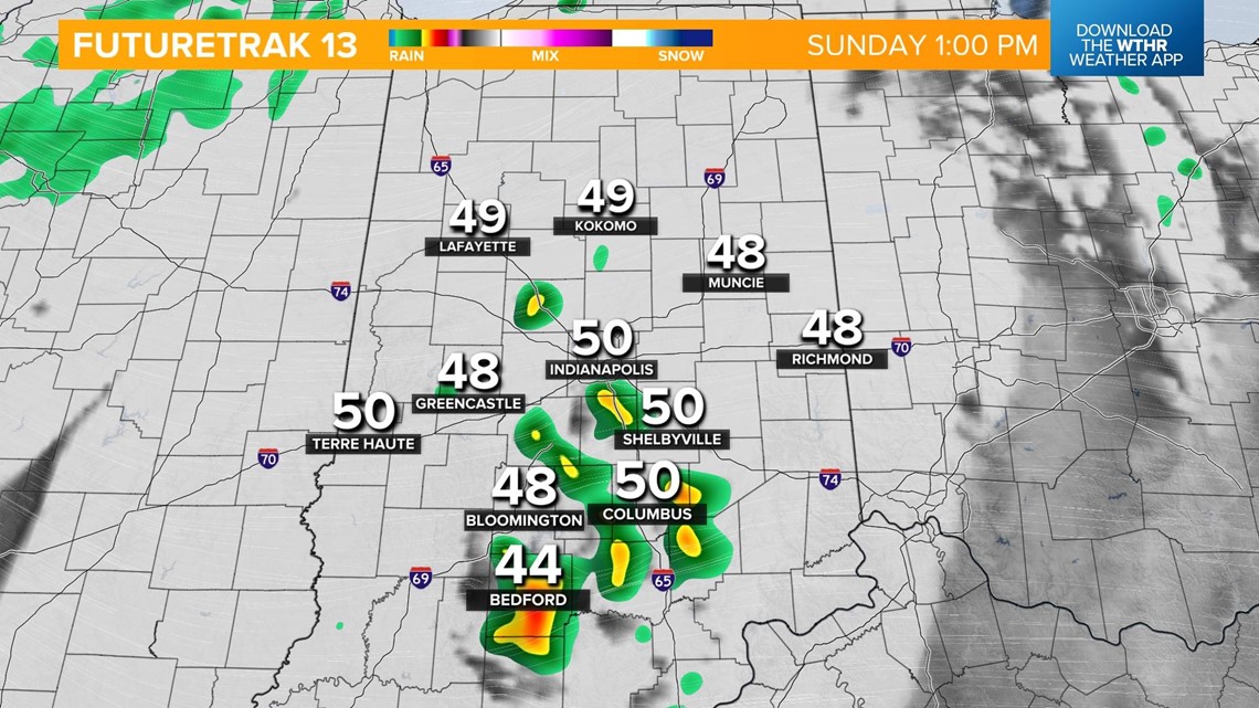

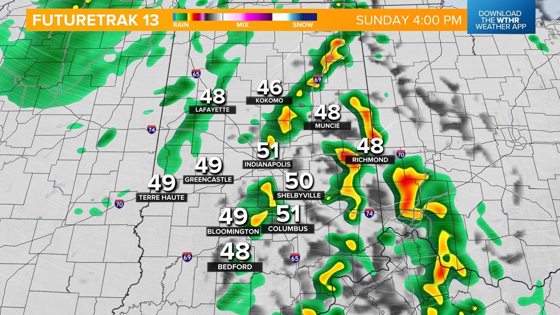
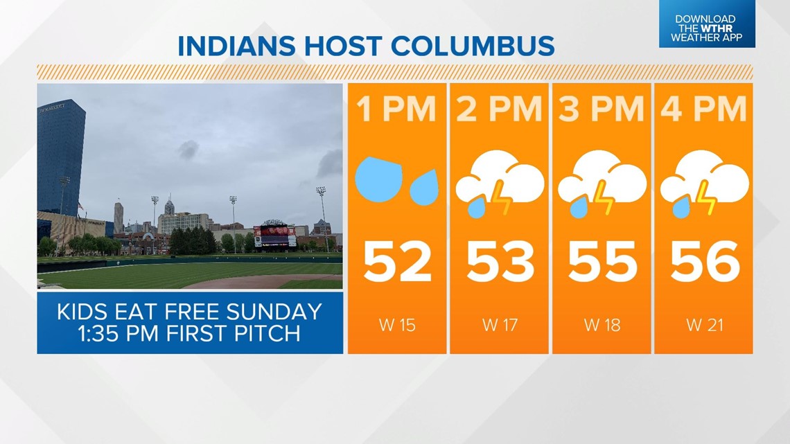
Keep the rain gear handy as well as a warmer jacket if you're headed to the Indians game. Highs will only reach the mid-50s Sunday afternoon.

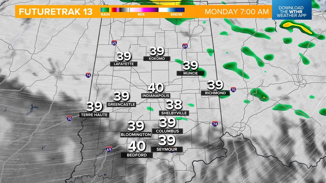
This damp and cool pattern will continue into the start of the month of May Monday. A few showers will linger overnight with low temperatures near 40.

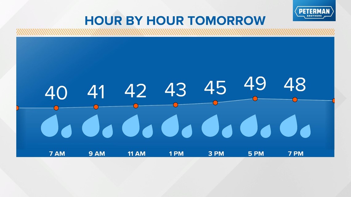
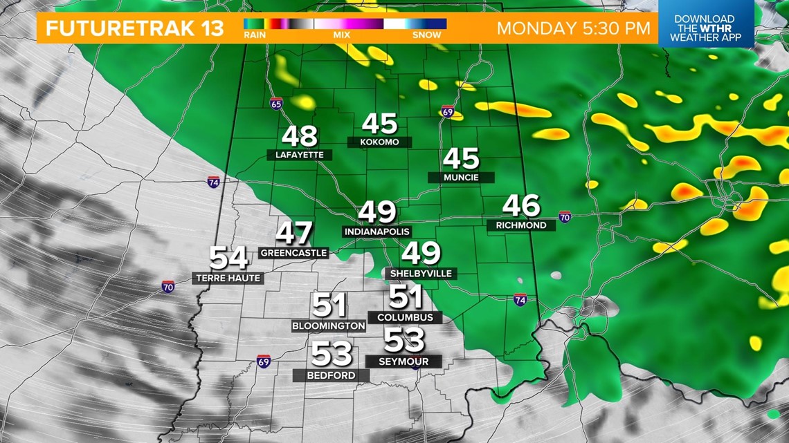
Rain showers will become more widespread in the afternoon and evening, especially across the northeastern tier of the state. High temperatures will run 20° below average for May 1, topping out in the upper 40s.


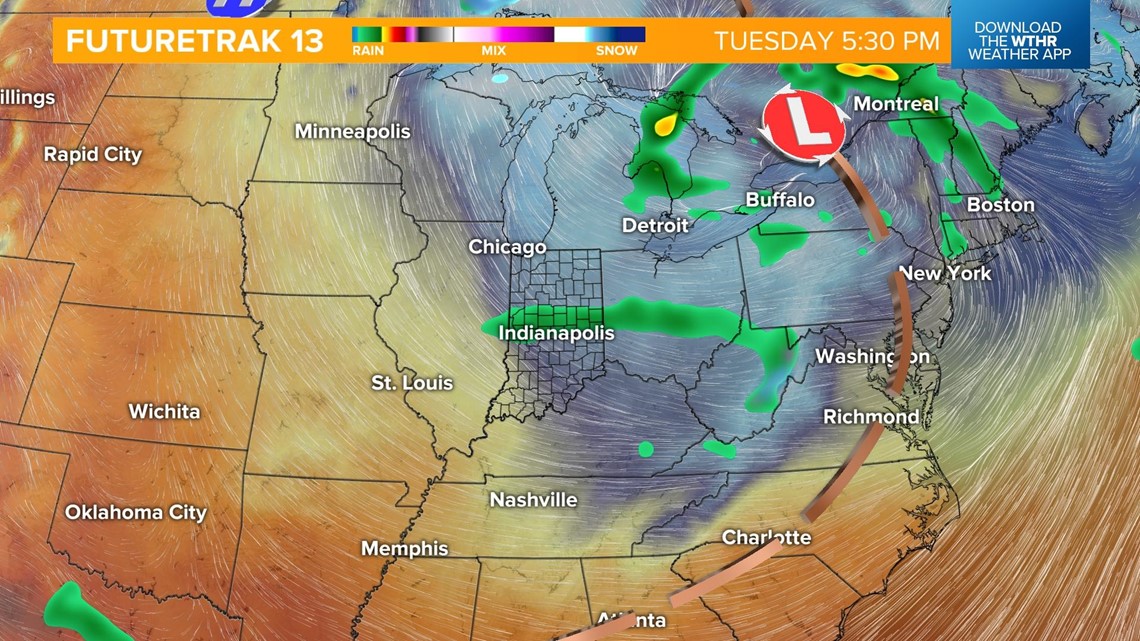
We'll see more dry time on Tuesday as an area of low pressure to our north will finally start to pull east. Temperatures stay unseasonably chilly though with highs in the low 50s.

We'll kick off a dry pattern and warming trend on Wednesday with highs near 60, then warm back into the upper 60s starting Thursday through the start of the weekend.
An early look at the 500 Festival Mini Marathon forecast shows us in the 40s, but dry. We'll be updating this all-important outlook through the week.