INDIANAPOLIS — We've strung together quite a few pleasant August days in central Indiana, all while temperatures gradually continue to warm.
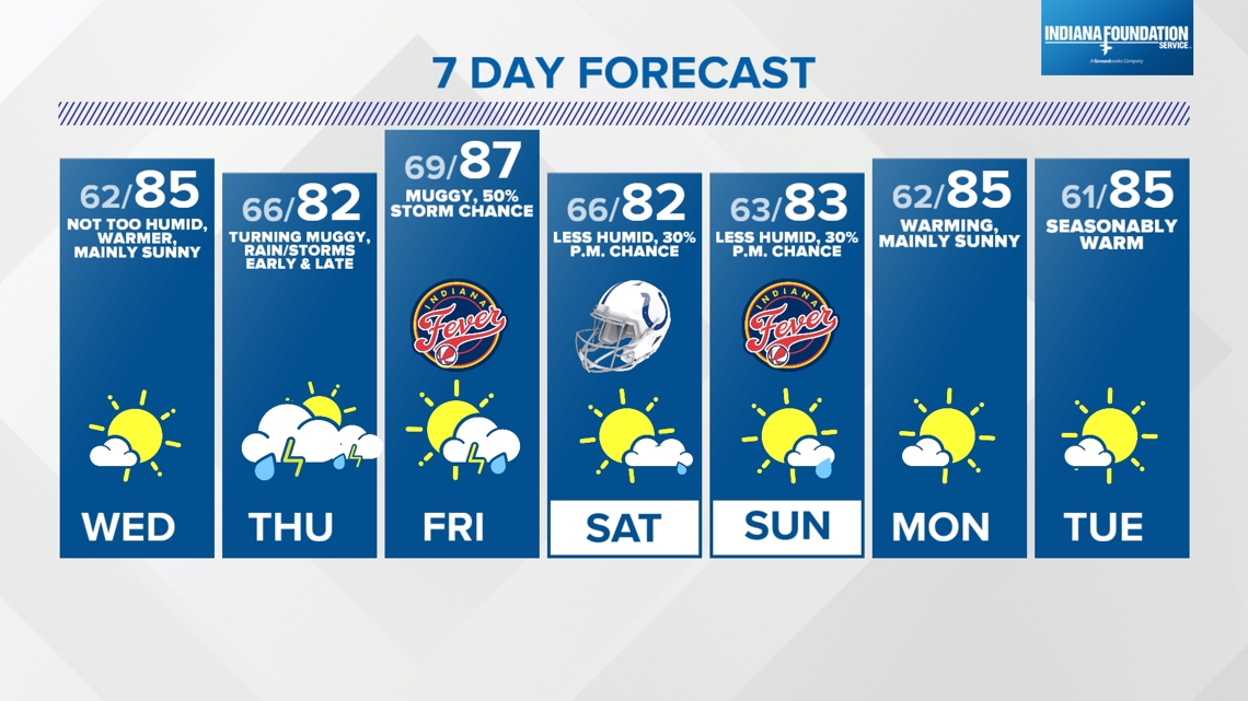
Highs Tuesday reached the mid-80s for most but with relatively comfortable air as dewpoints remain in the 50s. This sets the stage for another comfortable evening, overnight and Wednesday morning as lows drop back into the 60s.
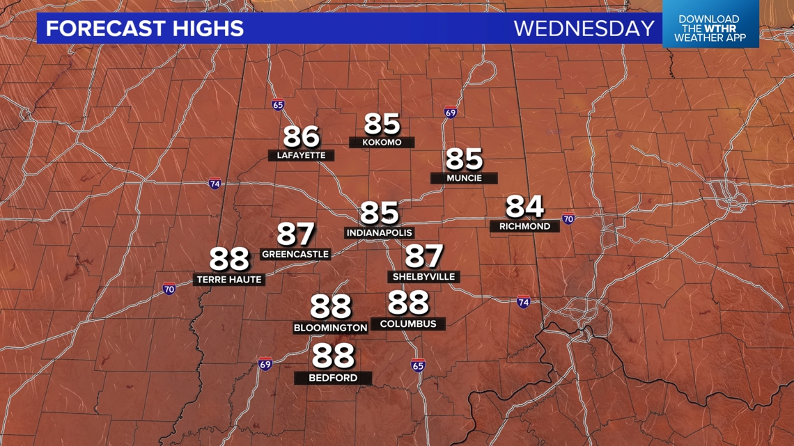
Wednesday will be seasonably (average highs in the 80s) warm with highs in the mid/upper 80s. The muggier air will remain to our southwest, and we're expecting plenty of sunshine with only scattered clouds in the afternoon.


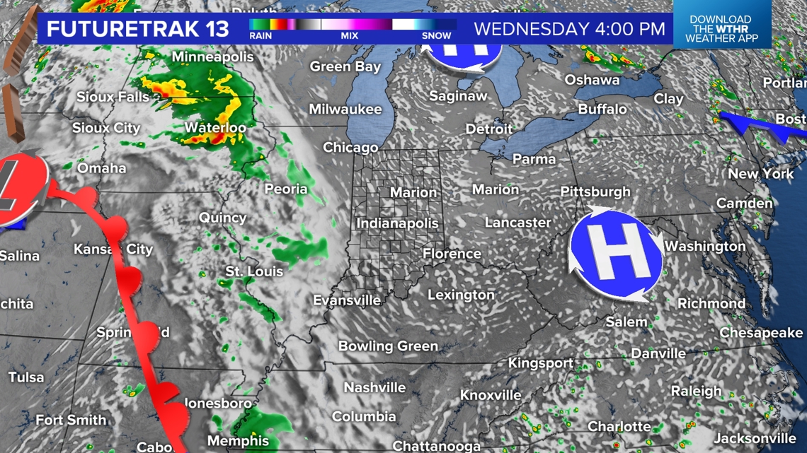

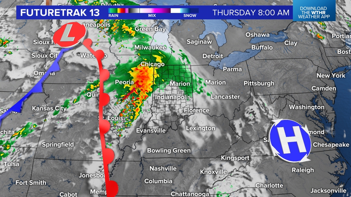
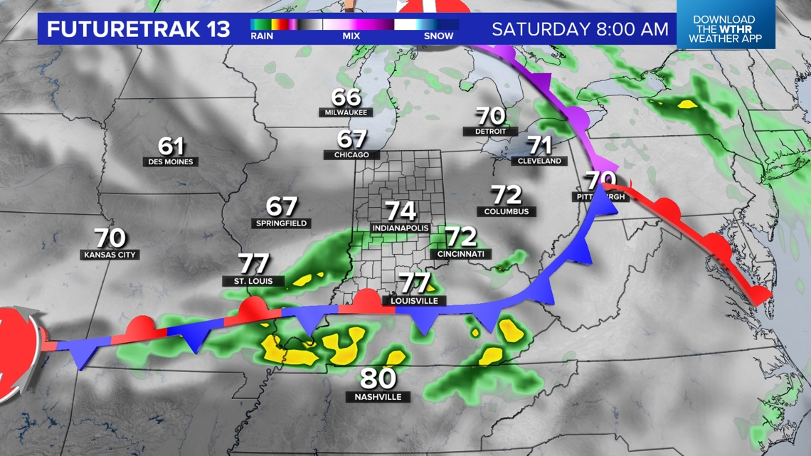
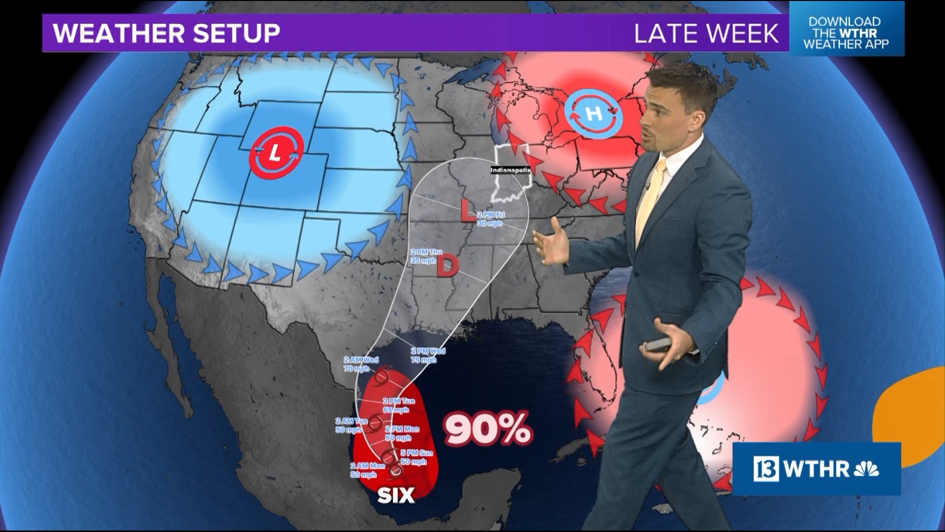
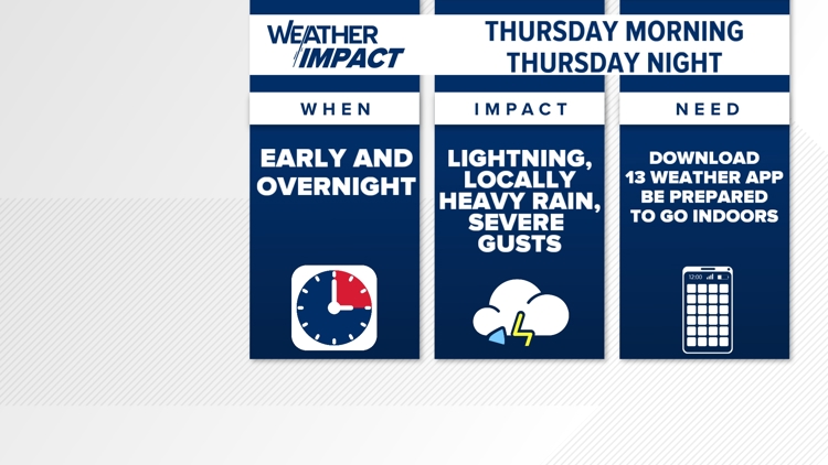
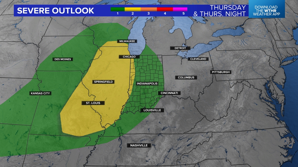
We continue to advertise much muggier air to arrive Thursday into Friday, and that coincides with the likelihood of downpours and thunderstorms, some of which could become severe. We'll fine tune timing, severity and coverage in the next 48 hours, but we want you to know there will likely be rounds of storms early Thursday, Thursday night and into early Friday morning.


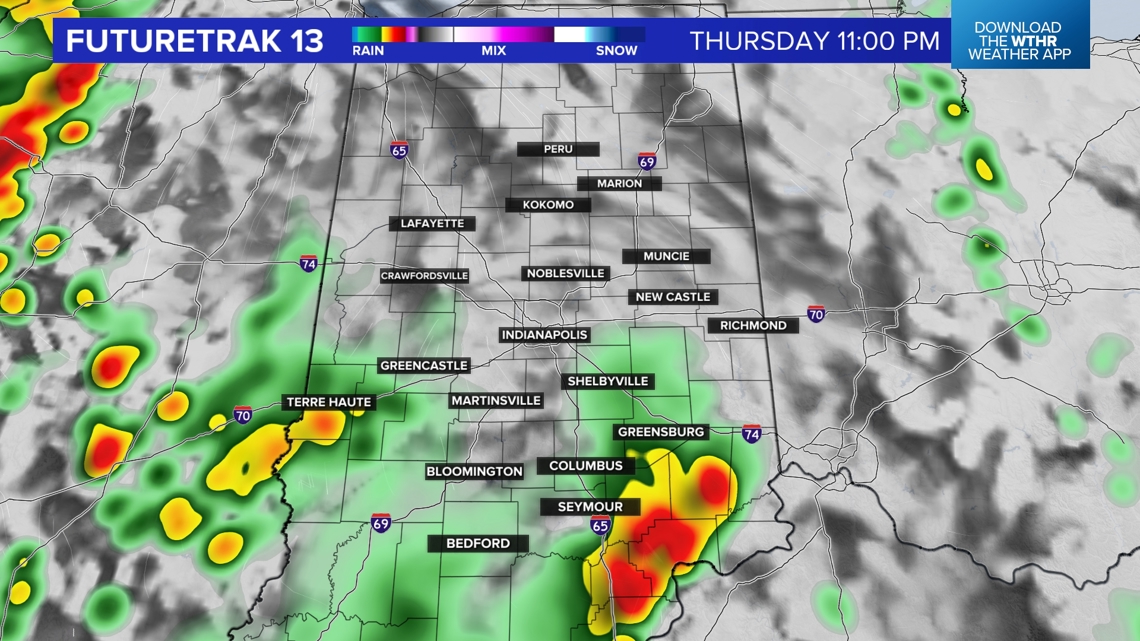
A swath of 1-3 inches of rainfall is very much in play, but we can't pinpoint where the heaviest amounts will be at this time.
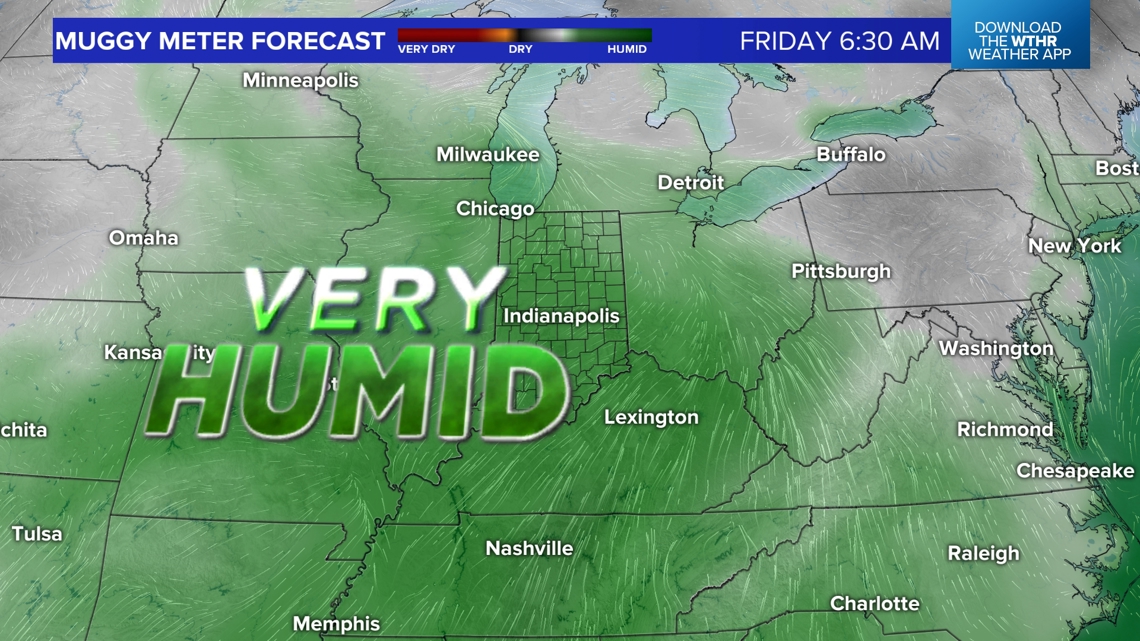
Friday will be the most miserably humid day of the week as dewpoints hang in the 70s to produce swampy heat indices in the 90s. The passage of a cool front late Friday night triggers more scattered downpours and storms, but also pushes in less humid air for the weekend.
We'll be on the cooler side of the boundary Saturday and Sunday. At this time, we're expecting plenty of sun early both days this weekend, but daytime heating and a upper disturbance triggers cumulus clouds — and possibly spotty showers.