

FLORIDA, USA —
Here's the latest on Milton (last updated 11 p.m. Oct. 9):
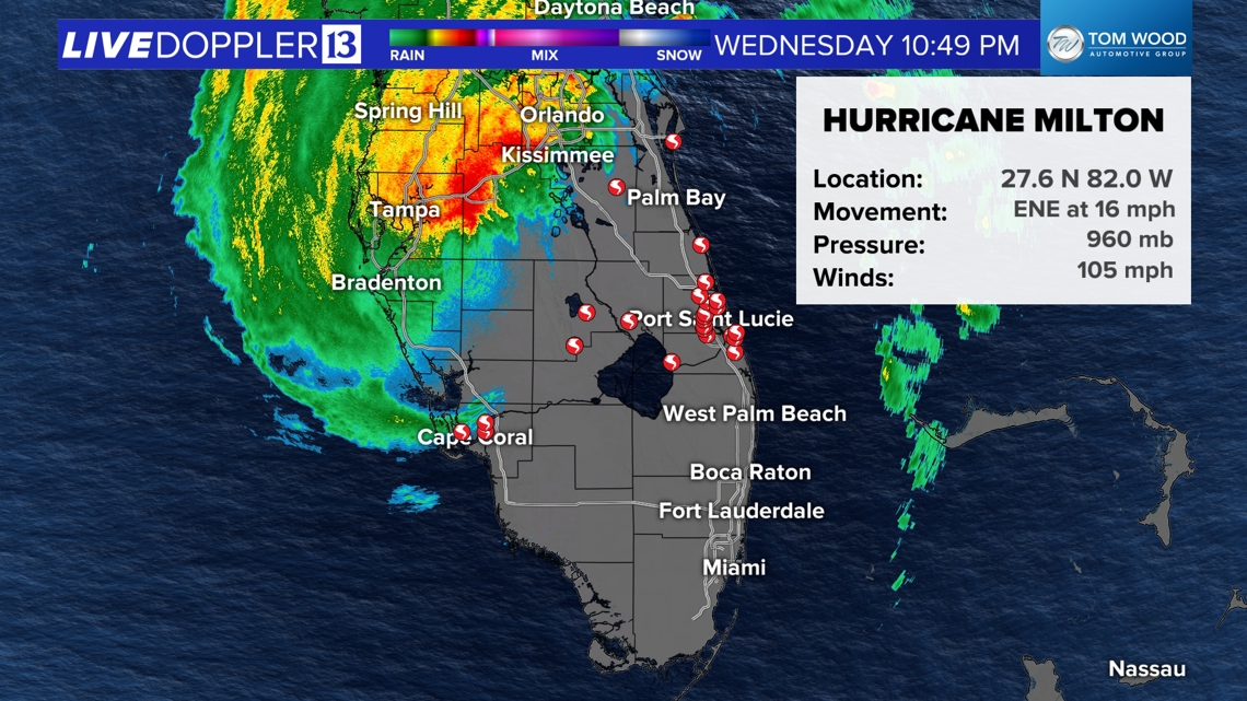
Latest on Hurricane Milton (11 PM 10/9/24 UPDATE)
- Category 2
- Max wind of 105 mph (category 2 is 96-110 mph winds)
- Pressure rising at 960 mb
- Now tracking to the ENE at 16 mph

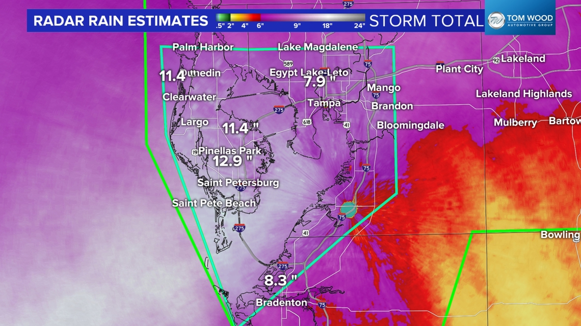
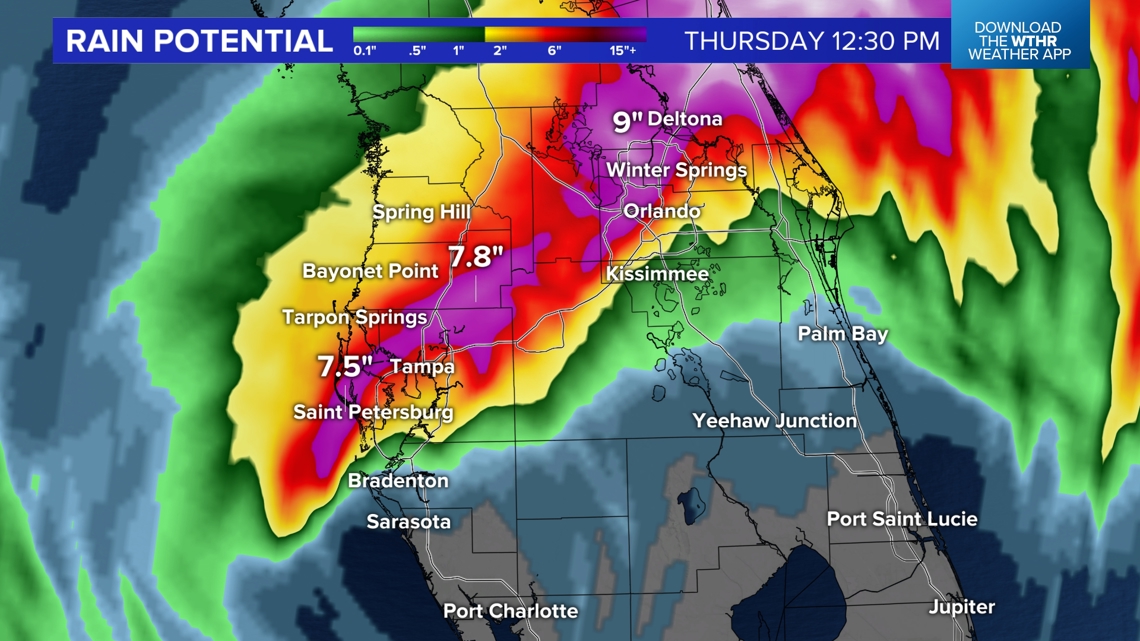
Flash Flooding For Large Area Of Central Florida
Hurricane Milton's northern and northwestern eyewall continues to pound the Tampa/St. Pete area with dangerously heavy rain and high wind.


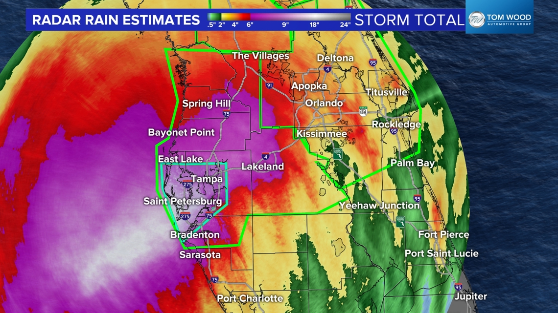
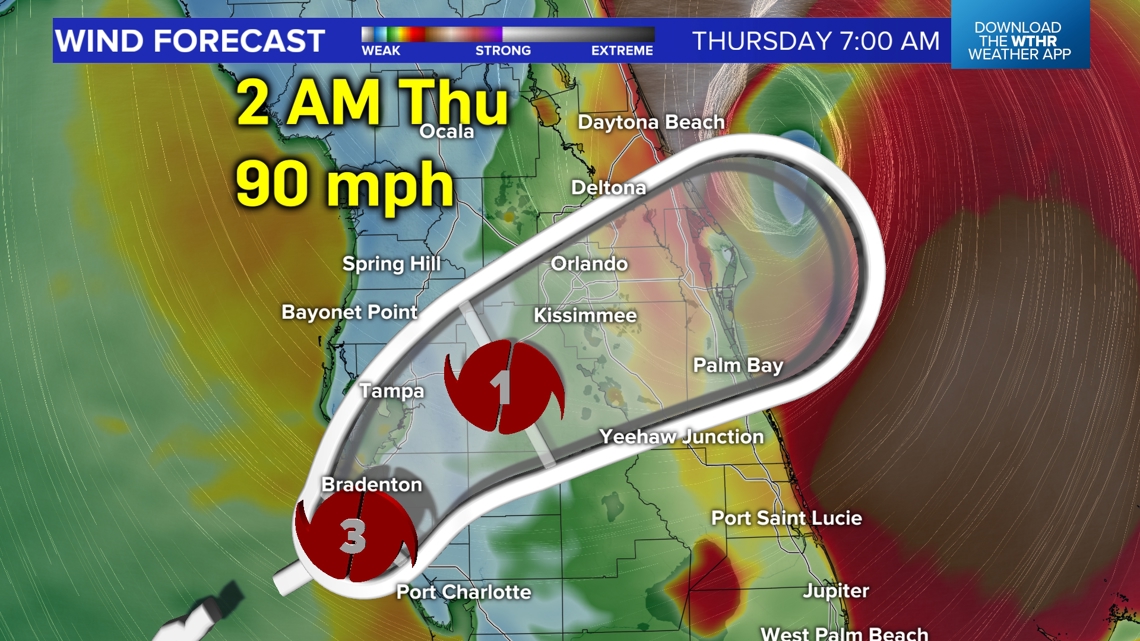
Latest on the storm track, strength, and timeline
- Milton made landfall near Siesta Key as a Category 3 hurricane at 8:30 pm
- The remainder of the night from Tampa to Orlando to eventually Daytona will be in the strongest wind and heaviest rain
- South of the eye will have hurricane force wind at times, but very little rainfall as dry air has eaten-away at southern eyewall
- The storm remains a hurricane crossing the Peninsula and the eye of Milton Thursday morning crosses near Orlando at hurricane category 1 strength with winds up to 85 mph


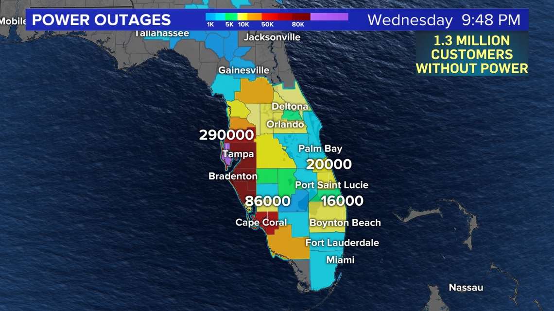
Power Outages Growing Fast
Well over 1,000,000 million customers are without power in Florida and that number exponentially grows by the hour. With a highly populated portion of the state getting inundated with strongest wind overnight...that number could very well exceed 2 million by sunrise.

Key Messages from the National Hurricane Center:
Hurricane Milton Tropical Cyclone Update
NWS National Hurricane Center Miami FL AL142024
1000 PM EDT Wed Oct 09 2024
...FLASH FLOOD EMERGENCY IN EFFECT FOR THE TAMPA BAY AREA AS
MILTON CONTINUES MOVING INLAND...
...1000 PM EDT POSITION UPDATE...
A sustained wind of 69 mph (111 km/h) and a gust of 102 mph (165
km/h) was recently reported at the Sarasota-Bradenton International
Airport. A sustained wind of 86 mph (139 km/h) and a gust of 105 mph
(169 km/h) was recently reported at a WeatherFlow station at Egmont
Channel. A sustained wind of 74 mph (119 km/h) and a gust of 98 mph
(157 km/h) was recently reported at a NOS station at Middle Tampa
Bay. A gust of 91 mph (146 km/h) was recently reported at a Citizen
Weather Observer Program station in Bartow.
A Flash Flood Emergency is in effect for the Tampa Bay area,
including the cities of Tampa, St. Petersburg, and Clearwater.
Albert Whitted Airport in St. Petersburg has received 16.61 inches
of rain so far today.
Please stay updated on the latest tropical information from the National Hurricane Center.
