

INDIANA, USA — UPDATE: High wind watches, warnings and advisories are expected from the National Weather Service across parts of Indiana.
Hurricane Helene is sprinting northward, likely making landfall around midnight along the Florida panhandle. Thursday evening, it strengthened to a Category 4 hurricane as it neared Florida's Gulf Coast.
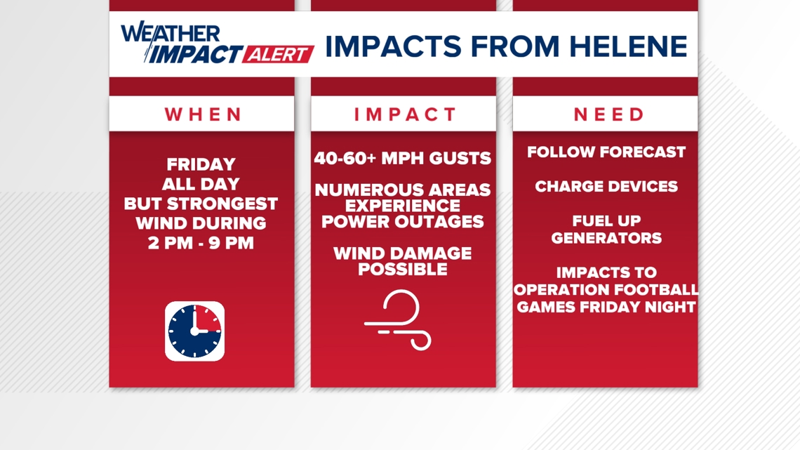
In less than 18 hours, winds will be picking up across Indiana with gusts over 30 mph. Briefly, we may get some gusts between 50 to 60 mph, likely causing damage and power outages.
Tap HERE to track Hurricane Helene with our interactive radar.
Timing the wind
It will be breezy all day across Indiana.
Morning: 25-40 mph wind gusts
Afternoon: 35-50 mph wind gusts
Evening: 40-60 mph wind gusts
Peak Wind Gusts 4-7 p.m.: 50-60 mph wind gusts over central Indiana
This map shows the peak winds we are expecting across the state. Most of central and southern Indiana will get some peak wind gusts around 50 mph. However, there will likely be a band somewhere in central Indiana that may reach speeds up to 60 mph (in orange).
(Note: Scroll down for a closer look region-by-region)

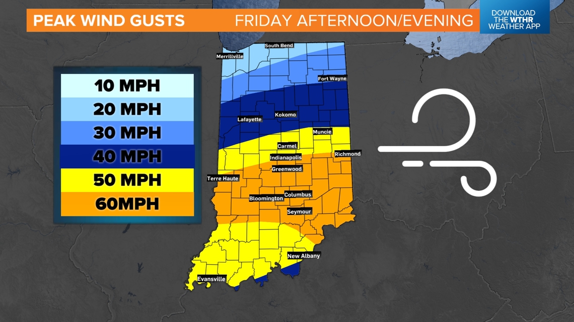
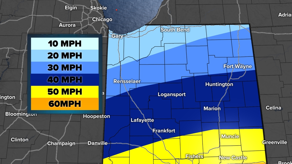
Northern Indiana
It will still be breezy up north in "the region" and Michiana. However, Hurricane Helene will not make as big of an impact. We are still expecting wind gusts between 20 to 40 mph for much of northern Indiana. That will bring some tree limbs and leaves down.

Central Indiana
Buckle up: This is where we may have the strongest wind potential from the remnants of Hurricane Helene. There will likely be a swath of up to 60 mph wind gusts near and south of I-70. This band may need to be adjusted a little more north or south, but we think this is roughly where winds will be maximized.
This will cause tree damage and power outages.

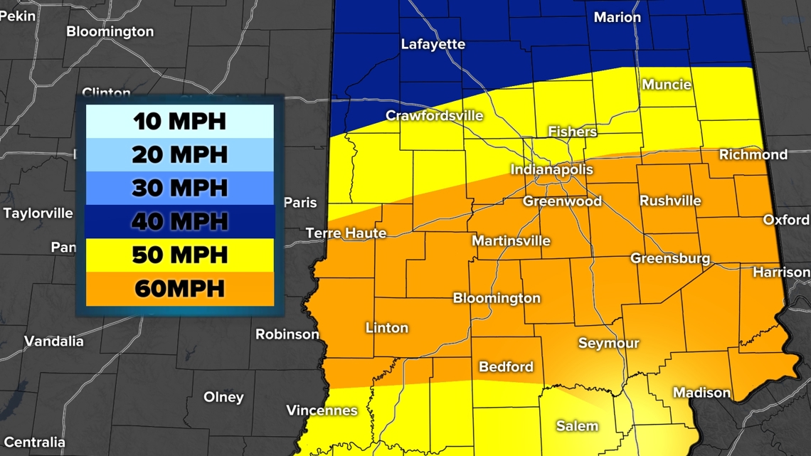
The orange zone is where we will have lots of wind, plus the highest forward movement of the storm. We have to add the storm winds and the forward movement of the low.
For example, if I give you a high five, imagine how that would feel. Totally normal. However, then imagine if I gave you a high five while running past you. It would hit your hand a lot faster.
This is similar to why the max winds are right over Indiana as Hurricane Helene makes a turn to the west.
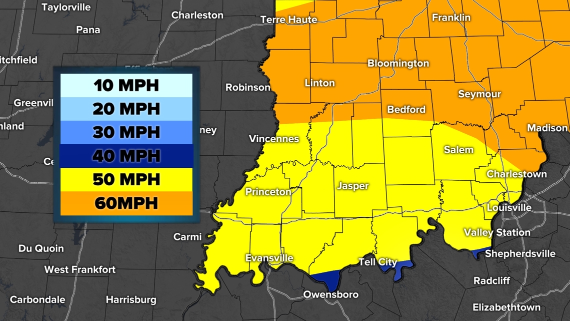
Southern Indiana
We are expecting a lot of wind and tree damage to the south. There may be some areas closer to the Ohio River near Evansville that get slightly slower wind speeds if the center of Helene moves over them. This area will be a little calmer at times, however overall, expect a lot of wind.

Wind Impacts
We won't have wind gusts at 50-60 mph all day. However, it will be very windy nonetheless all day, which will help cause more power outages and tree damage.
- 30+ mph wind gusts: 26 hours duration
- 40+ mph wind gusts: 12 hours duration
- 50+ mph wind gusts: 5 hours duration
- 60+ mph wind gusts: 2 hour duration
The worst winds will be from 4 to 7 p.m. on Friday.

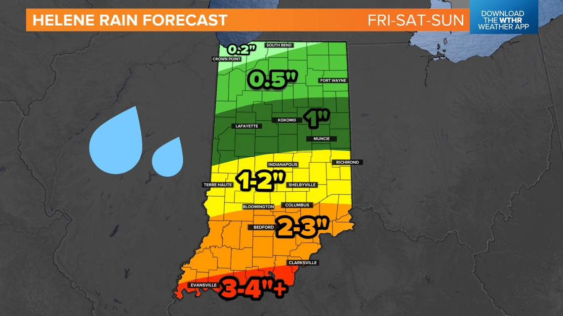
Then, of course, it's raining...
Rainfall forecasts have greatly increased across Indiana. We are expecting generally 1-2 inches of rain across central Indiana through Sunday. Some places in southern Indiana may get more than 3-4 inches of rainfall.

All day long on Friday, expect on-and-off rain with lots of wind. Driving will become hazardous at times. Taller vehicles will likely veer on the roads at times.
-13News Meteorologist Matt Standridge