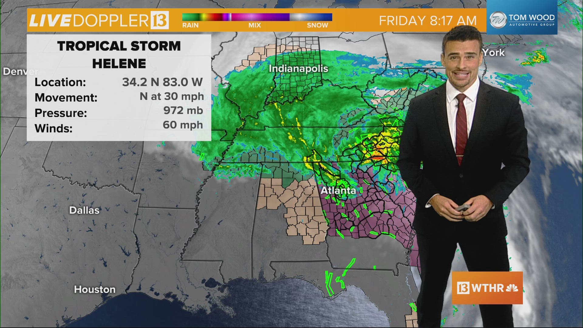
INDIANAPOLIS — Hurricane Helene strengthened to a Category 4 hurricane before making landfall.
The storm made landfall around 11:10 p.m. ET Thursday, Sept. 26 in the Big Bend region of Florida.
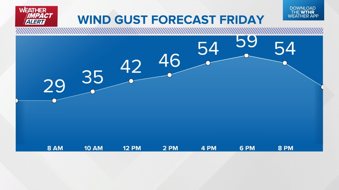
This large, high-impact storm will bring rain and a damaging wind threat to central Indiana on Friday. This is not the type of gust that lasts a few minutes. We expect the damaging wind threat to last for hours. Here is an example as we expect 40-60+ mph gusts from about noon to 9 p.m.

Friday is a Weather Impact Alert Day:
When: All day Friday, with the strongest wind gusts 40-60 mph between noon and 9 p.m.
Impact: Power outages and wind damage.
Need: Make sure outdoor items are secured, charge cellphones and battery back-ups, monitor forecast updates.
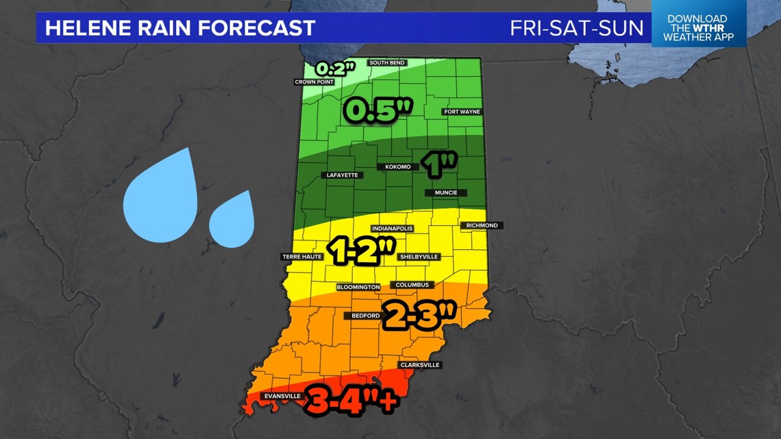
In addition to the damaging wind threat, there will be some heavy rain possible, too. Totals through the weekend will be 1-3 inches, with some higher totals south. We are not expecting widespread flooding, but isolated lowland high water is possible.

Here is the timeline of the rain on Friday. It will be heavy and wind-whipped at times.

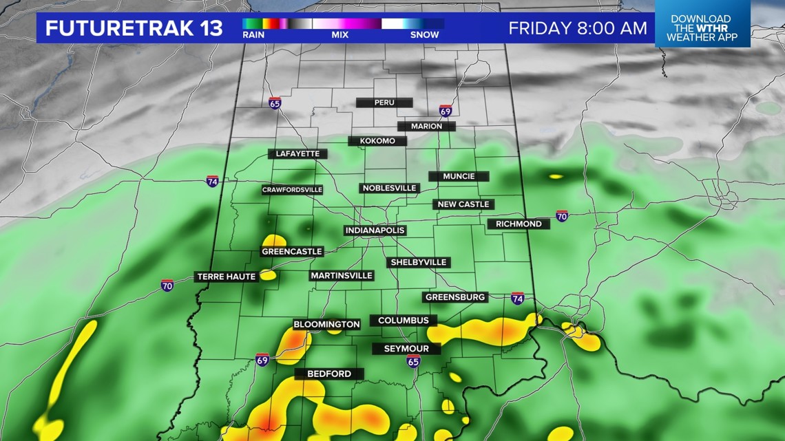

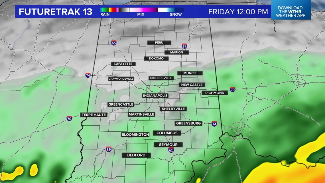

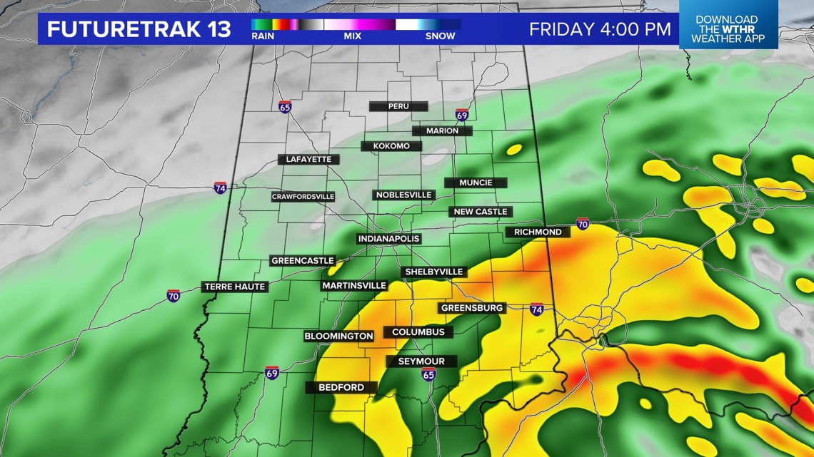

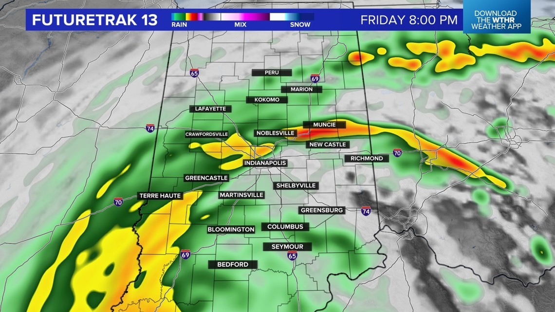
This system will slow and continue to bring rain to our area this weekend. Be sure to check Live Doppler 13 Radar before and during outdoor activities.

