

INDIANA, USA — Hurricane Helene will be in the 10% for largest hurricanes in the Gulf, bringing widespread wind, rain and storm surge impacts to the Gulf Coast, especially Florida. After Florida, it will slingshot northbound toward the Ohio River Valley, bringing nearly 50 mph wind gusts to Indiana by Friday evening.
Tap HERE to track the hurricane with our interactive radar and weather maps.
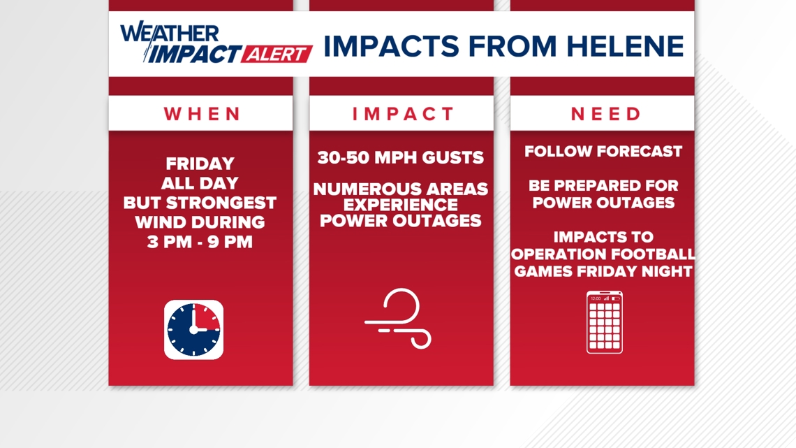
Impacts for Indiana – FRIDAY
- High winds (3-9 p.m.: 30-55 mph wind gusts)
- Scattered rain and downpours slowly moving north after 11 a.m.
- Power outages likely, especially south of I-70
- High school football games impacted (high winds and some rain)
Impacts for Indiana – SATURDAY
- Still breezy (all day: 15-30 mph wind gusts)
- Scattered showers and downpours on and off
- Lingering power outages possible

The impacts will be much higher along the Gulf Coast and deep south. However, Indiana has a higher impact than other central states because the low pressure from Helene will be quickly picked up by a larger low out west in the Ozarks. This will "slingshot" the storm west over Indiana, adding to surface wind gusts. This effect is called the Fujiwara effect: a low pressure can wrap in other low pressures, spinning them around and eventually absorbing them.
Track of Helene
This is a very "skinny" cone for Hurricane Helene. High pressure to the east and low pressure to the west will funnel the storm right into the panhandle of Florida. This storm will be so fast, it may still be technically a hurricane Thursday night as it nears Macon, Georgia, with tropical storm warnings for the Atlanta area.

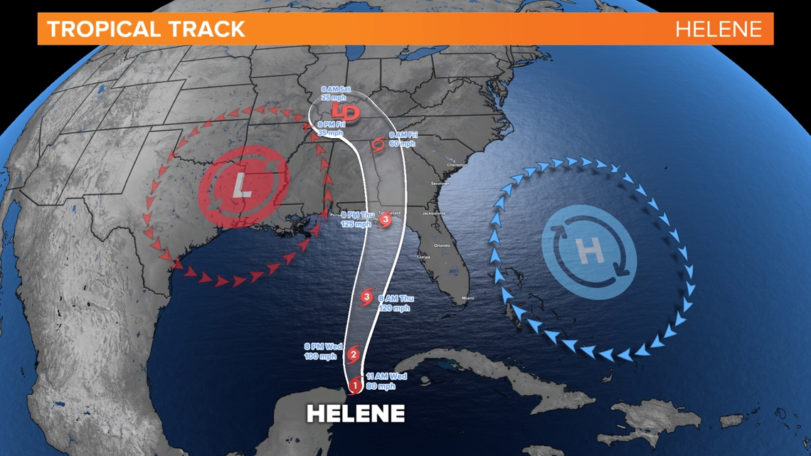
The low pressure to the west will eventually win, wrapping Helene around itself in a Fujiwara effect. This will effect will spin showers and gusty winds around the Tennessee and Ohio River Valleys for multiple days. This is increasing the chance for 1-3" across parts of Arkansas, Kentucky, Illinois, Indiana and Tennessee.
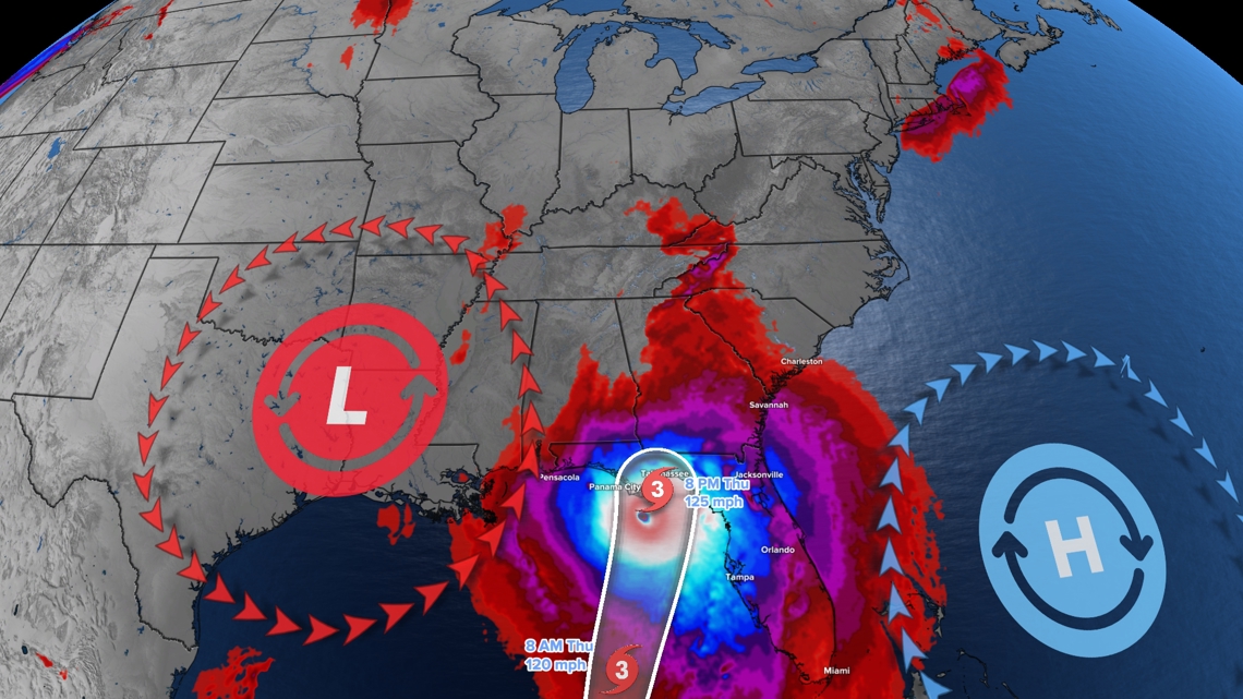
Hurricane Helene wind forecast
The reds, purples, blues and whites show wind speeds above 25 mph, that way, we can highlight mainly just Hurricane Helene.
Thursday evening (near center of Helene along the Florida coast)
- Sustained winds: 125 mph
- Wind gusts: 150+ mph

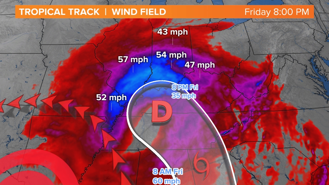
Friday evening (Indiana)
- Sustained winds: 15-30 mph
- Wind gusts: 40-55 mph (especially south of I-70)

Hurricane Helene rain forecast
The big story on Friday will be the wind. However, the rain will not be here all day. In fact, much of the morning looks dry.
We'll start to watch some rain move into southern Indiana after 9 a.m. It may not arrive into parts of central Indiana until after 1 p.m. The highest chance for rain will be to the south. Some parts of northern Indiana may not get any rain on Friday.

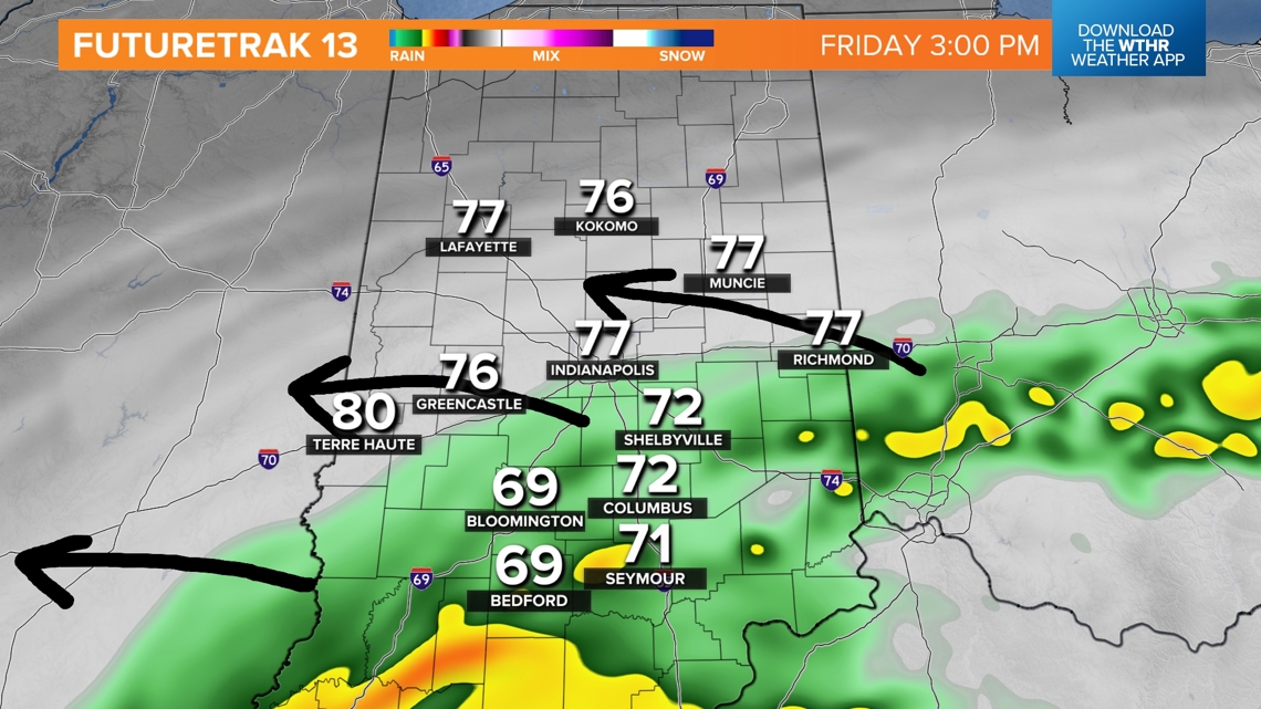
If you get rain Friday evening, the wind will be blowing it sideways. Expect a very rough evening with scattered downpours and wind gusts up to 55 mph.
After Friday, the Fujiwara effect will trap the remnants of Helene near Indiana, spinning on-and-off showers and storms Saturday and Sunday.

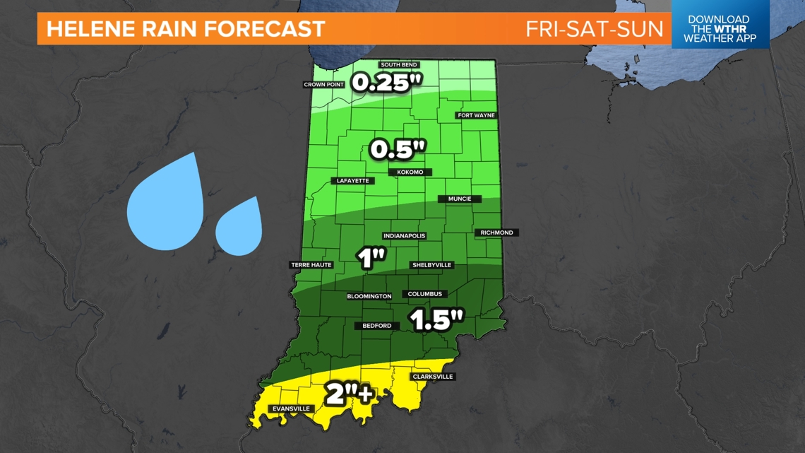
This will lead to 0.5" to 2" of rain across much of Indiana by Monday morning. The farther south you go, the higher the chance for a soaking will be.
Few more notes
- Expect trees to lose a lot of leaves. They won't all be gone, but a good amount will fall, especially in the windiest spots.
- Roads will become slick with lots of wet leaves.
- Indiana typically gets power outages with gusts over 35 mph. We may have gusts over 50 mph at times south of Indianapolis.
This is going to be a nasty storm. Expect many events to be canceled Friday evening. If an outside event continues, it will feel chilly and wet. Make sure temporary structures and tents are secure. You may also want to bring in some patio furniture that is light.