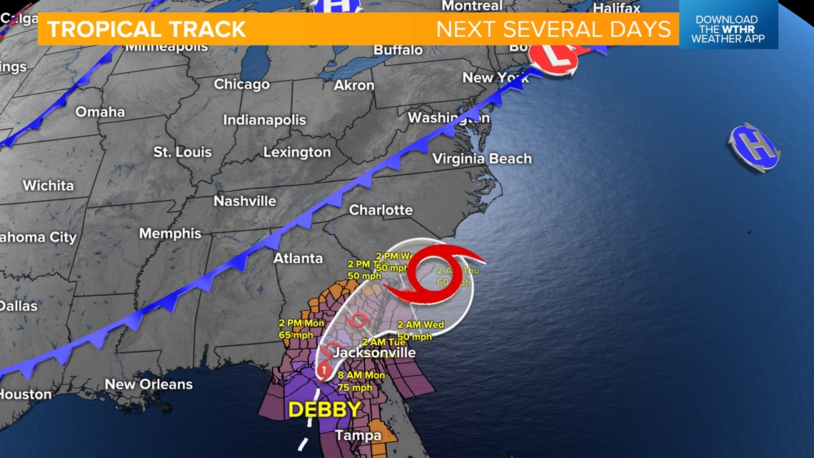
INDIANAPOLIS — Hurricane Debby made landfall just after 7 a.m. EDT today near Steinhatchee, Fla. (Big Bend area) as a category 1 storm with winds sustained near 80 mph.

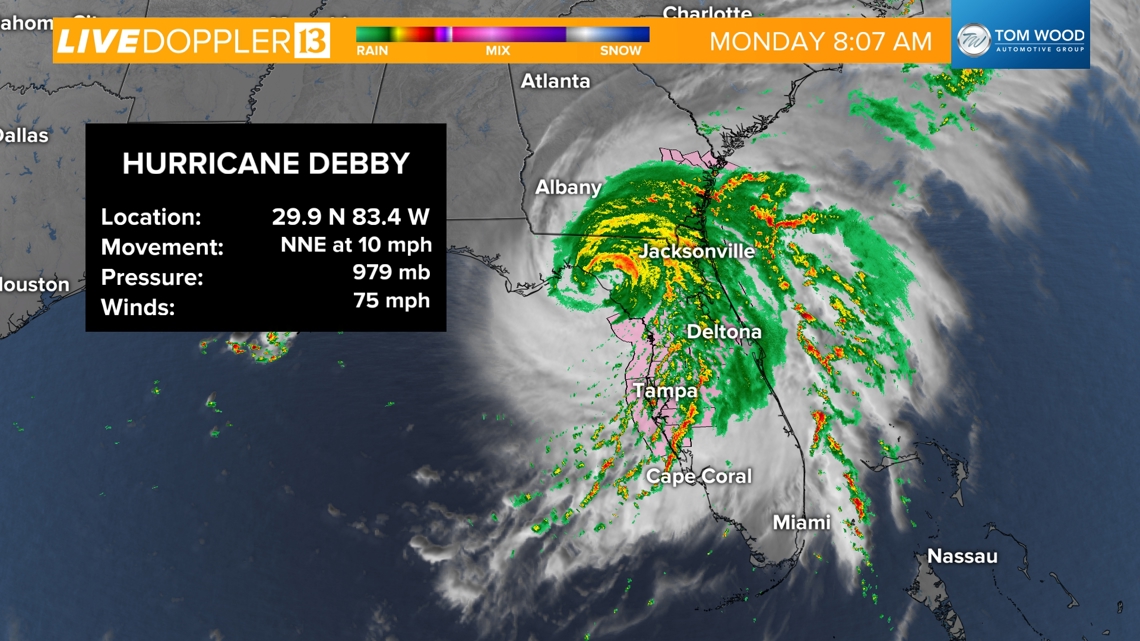
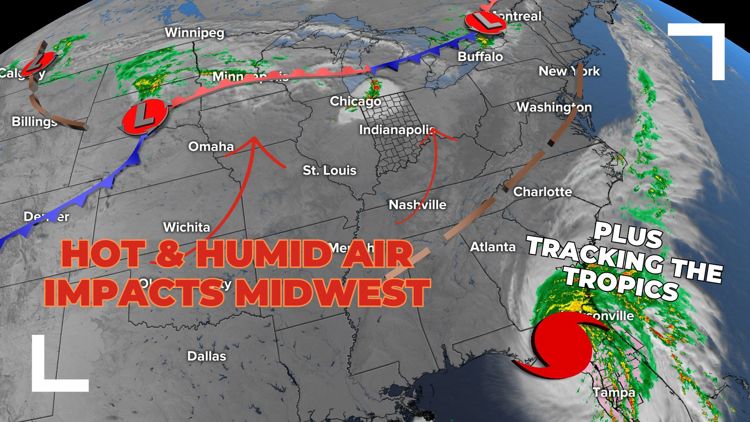
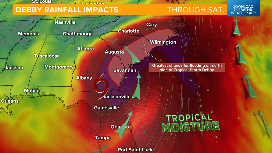
The storm will continue to track northeast but be stalled by an incoming cold front across the eastern U.S. This will create a dangerous flooding situation with portions of southeast Georgia, the coastal plain of South Carolina and up through southeast North Carolina receiving 10-20" (isolated spots up to 30") of rainfall through Saturday.


RELATED: Hurricane Debby makes landfall in Florida as Category 1 storm and threatens catastrophic flooding
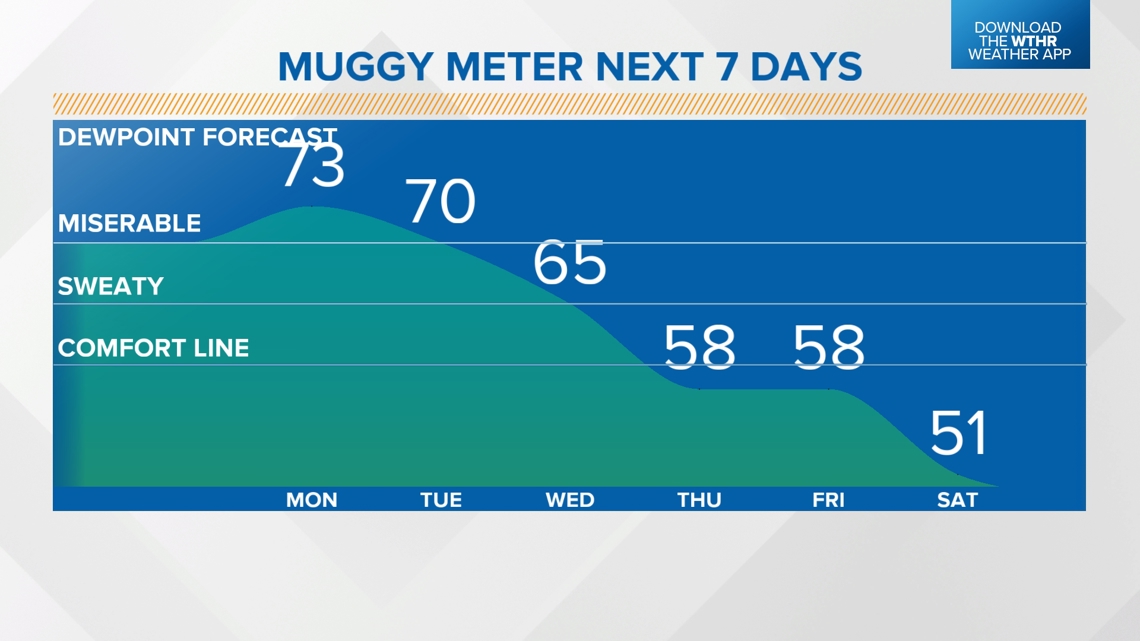
Back home it is a steamy start to the work week...
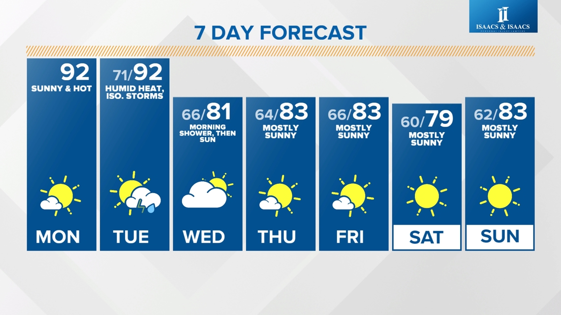
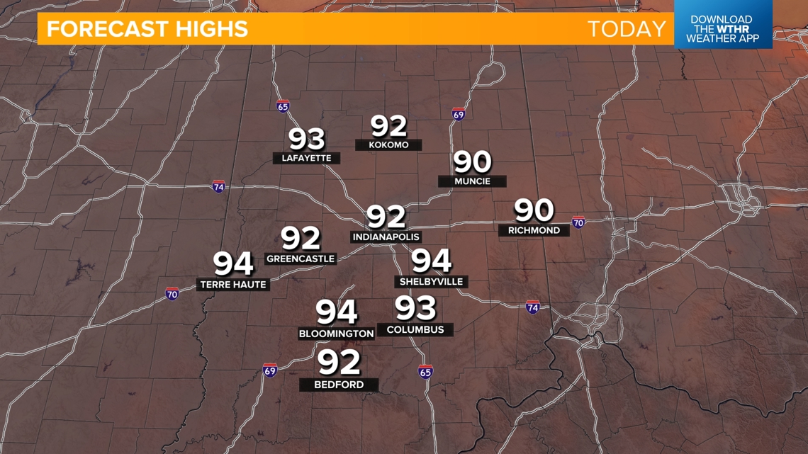
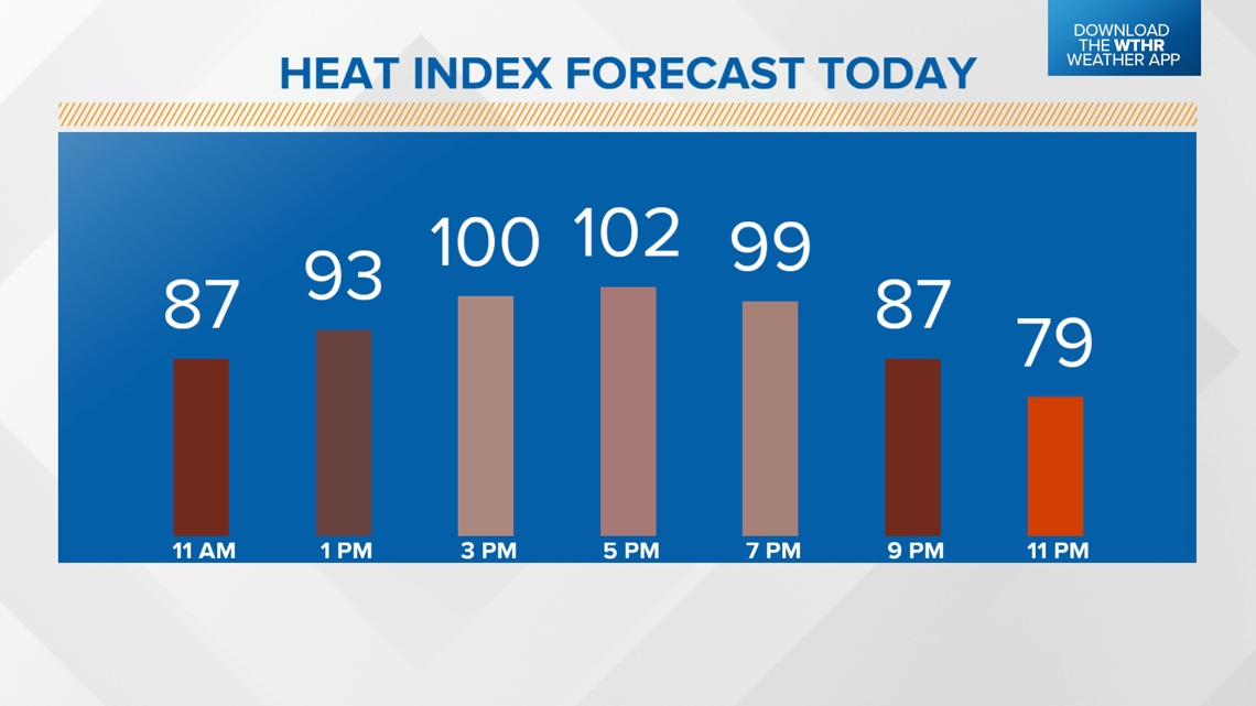
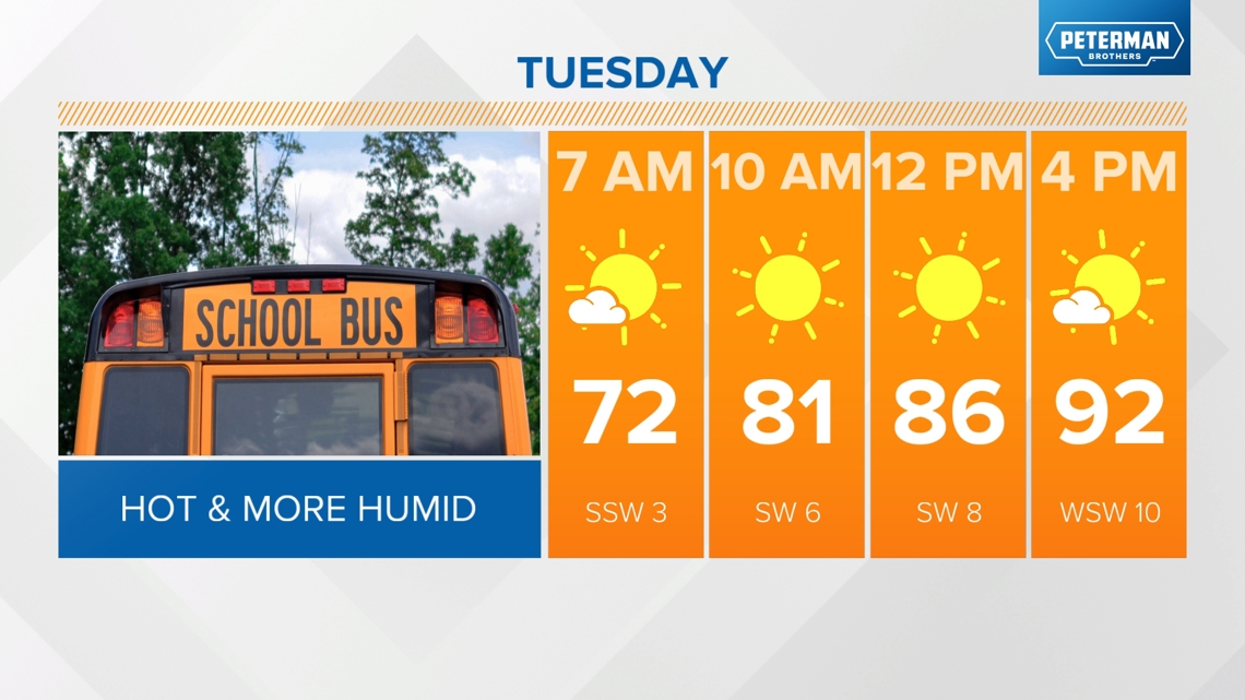
TODAY: Sunny and hot again with highs in the low 90s and a heat index of 100-105°.


When will we see some relief from this current stretch of heat?
We're watching a cold front set to arrive later in the day on Tuesday which will serve as a game-changer, bringing relief from the well above average temperatures. Ahead of the front though, we'll still see highs in the low 90s Tuesday afternoon.

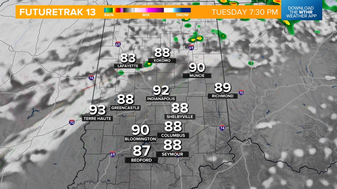
This will be a relatively dry front, but a few showers or storms will be possible Tuesday evening after 6 p.m. into the early morning hours on Wednesday. An isolated storm may be strong to severe with damaging wind gusts as the primary threat.


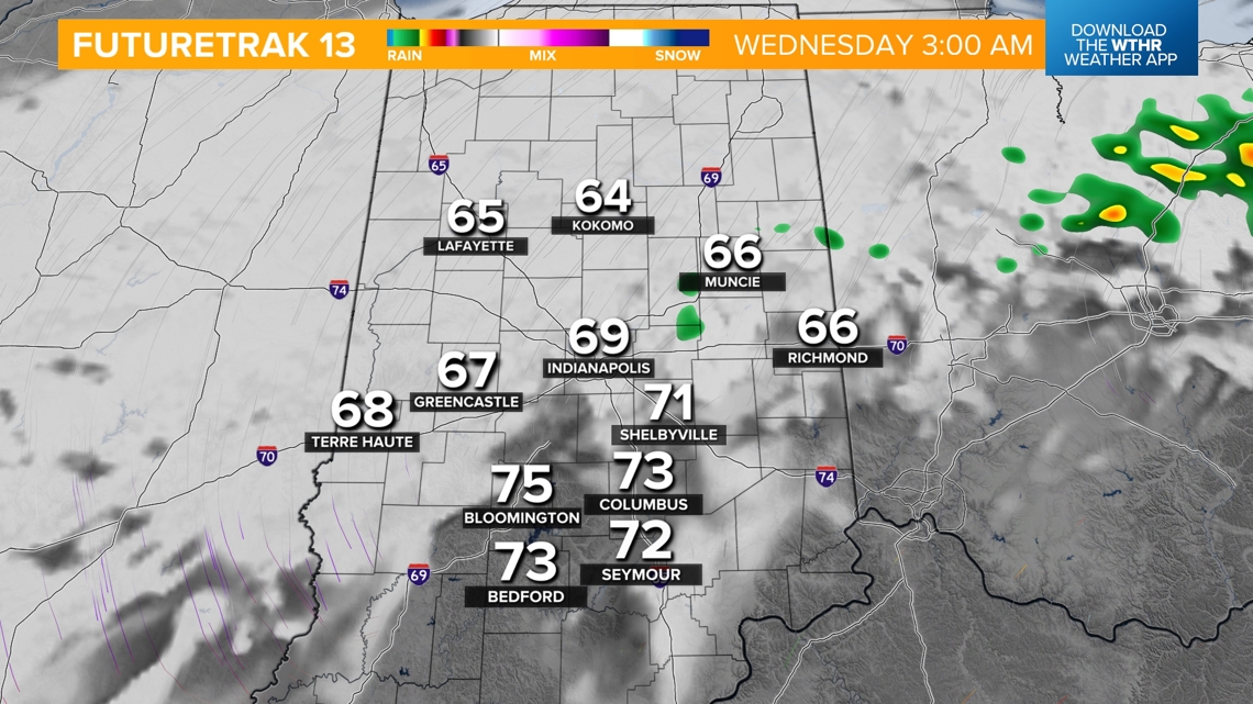

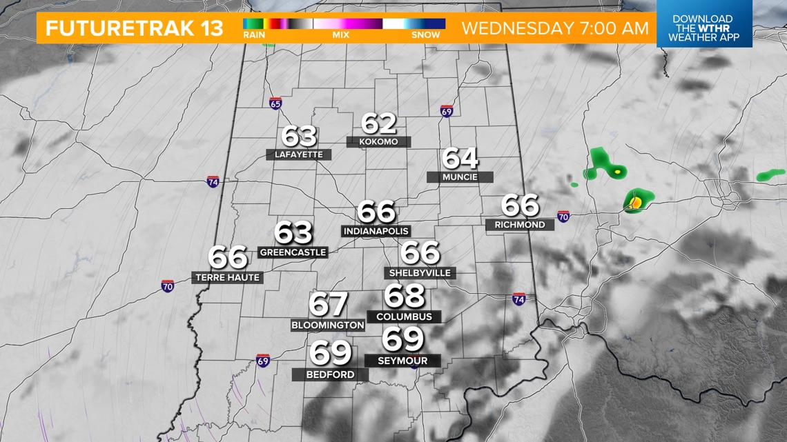
Skies will clear during the day Wednesday and it will be much more comfortable with highs near 80. The pattern will then stay mainly dry and more seasonal with highs in the low-to-mid-80s and the muggy meter in the "comfortable zone" through next weekend.

