Due to clouds and light showers... high temperatures Sunday only reached the lower to mid 70s. This is as cool as they'll be until next Saturday.
Thankfully, clouds looked worse than what actually came from them. Only a few raindrops in downtown Indy with light amounts north and south.

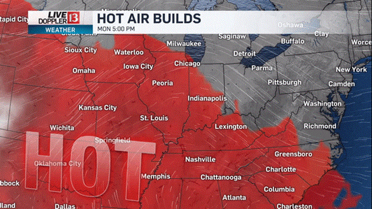
A warm front lingering to our south eventually makes a move to the north and opens the gates to much more humid air in 24 hours.

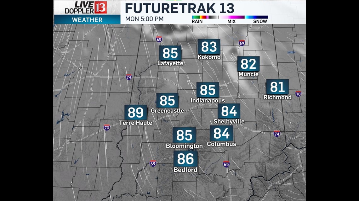
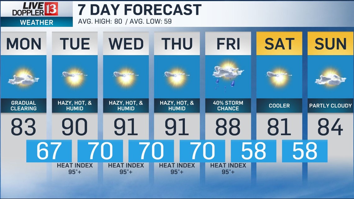
After clouds thin-out Monday afternoon, high temperatures will be a good 10° warmer and mark the beginning a heat streak in Central Indiana.

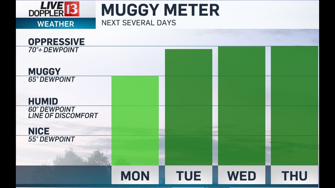
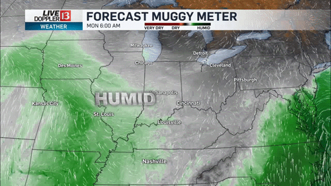
The Muggy Meter gets oppressive Monday night into Tuesday as dewpoints near/go above 70°. Air conditioners work overtime the remainder of the week and heat indices peak-out in the 95° to 100° range into Friday afternoon.

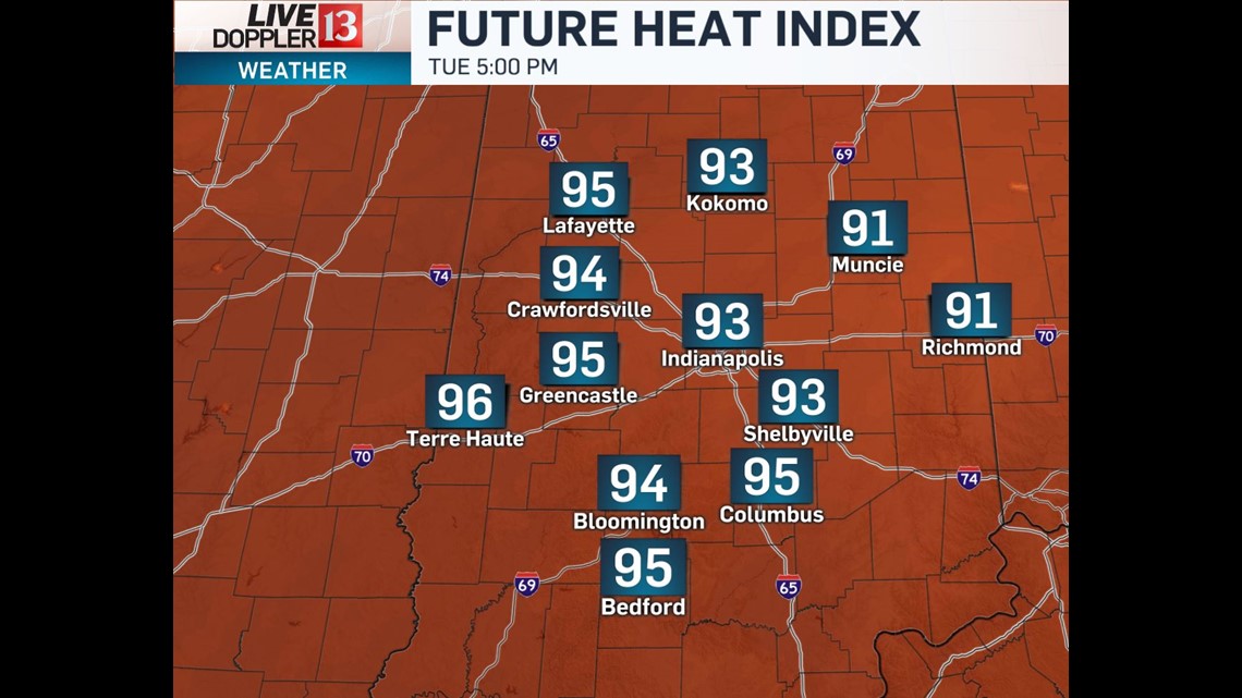


That will be our next best chance of seeing showers or storms as a cool front arrives Friday afternoon. This front is expected to settle south of Indiana next weekend which would allow for quiet conditions.

