INDIANAPOLIS — If you're a fan of fall weather, then no doubt you were absolutely loving the air and look of the sky today in central Indiana! With a steady northerly wind coming off of Lake Michigan, areas along and east of I-65 had scattered to at times numerous low level lake effect clouds. This was a result of the much colder air aloft dragging the relatively warmer lake moisture downstream.
Record-Breaking Lows For Some Tonight:
Not a surprise, that flow also delivered an afternoon of "highs" in the 60s, which was the coolest here since the middle of May. As that breeze, and cloud cover, diminish the remainder of this evening expect temperatures to drop rather quickly and bottom-out in the 30s and lower 40s area-wide Sunday morning. Several cities are likely to smash the daily record low for Sept. 8, many of which were established in 1986.
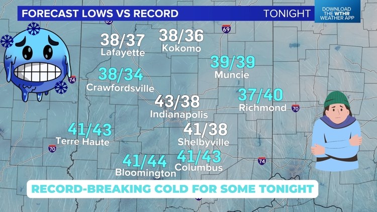
Below is a list of forecast versus record lows for Sept. 8:
Bloomington 41° / 44° (1986)
Columbus 41°/ 43° (1956)
Crawfordsville 38° / 34° (1986)
Indianapolis 43° / 38° (1986)
Kokomo 38° / 36° (1986)
Lafayette 38° / 37° (1986)
Muncie 39° / 39° (1986)
Richmond 37° / 40° (1986)
Shelbyville 41° / 38° (1920)
Terre Haute 41° / 43° (2017)


Dating back to 1871, Indianapolis has had only six days this early in the season with a low temperature of 43°, the last occurring in 1988. Any way you slice it, this will be "rare air" come tomorrow morning and not completely surprising if there are reports of frost on roofs and/or windshields in rural areas that get colder. The chilly start Sunday morning won't last long thanks to full September sunshine and shifting wind to the west.

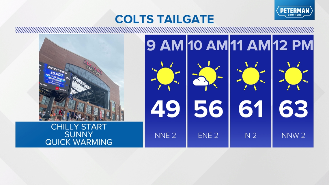

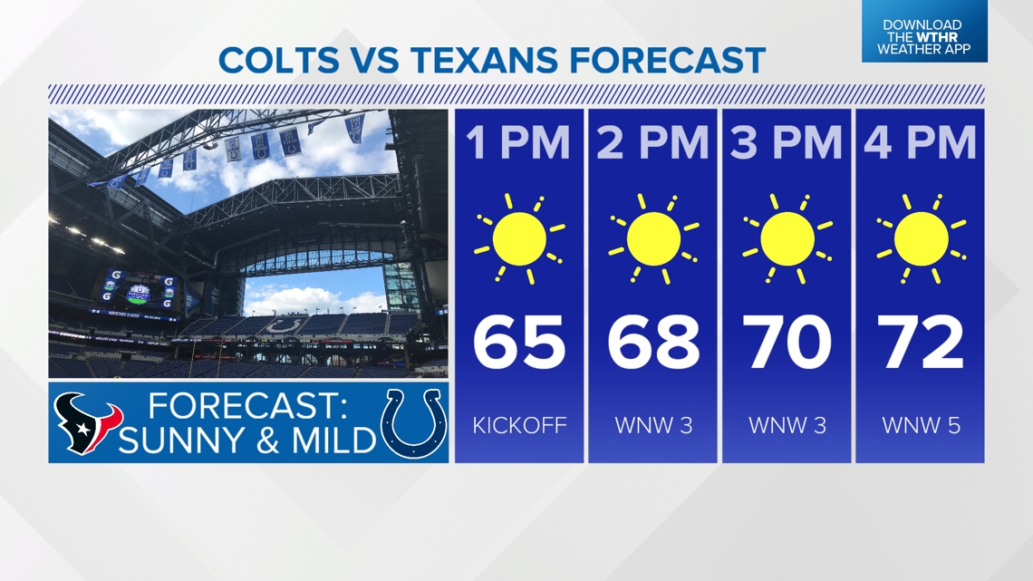

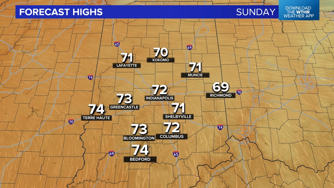
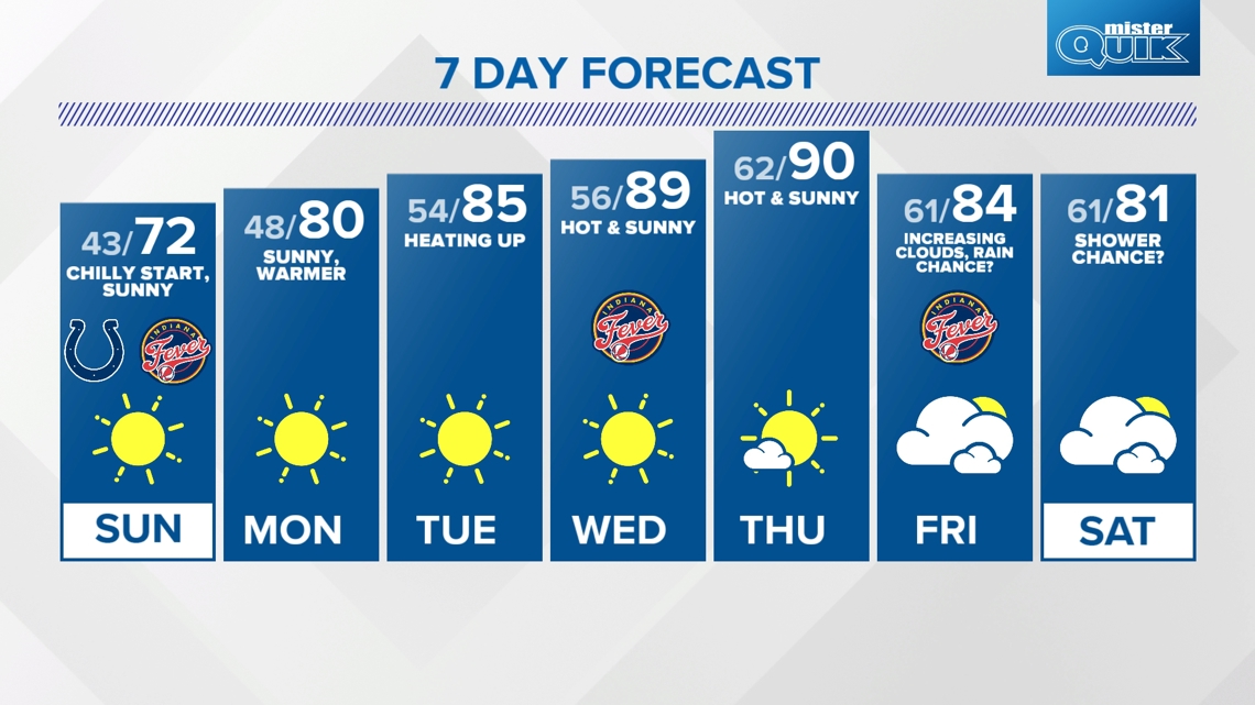
Temperatures recover quickly into the 60s by midday and reach the lower 70s in what will be the "Best Weather in the Country" Sunday afternoon. The roof will be open at Lucas Oil Stadium for good measure. Have a blast if you're going to the Colts season opener and plan to shed some layers as the morning transitions to midday.

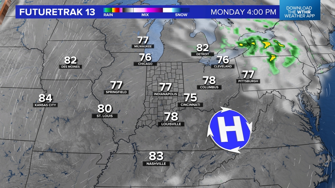

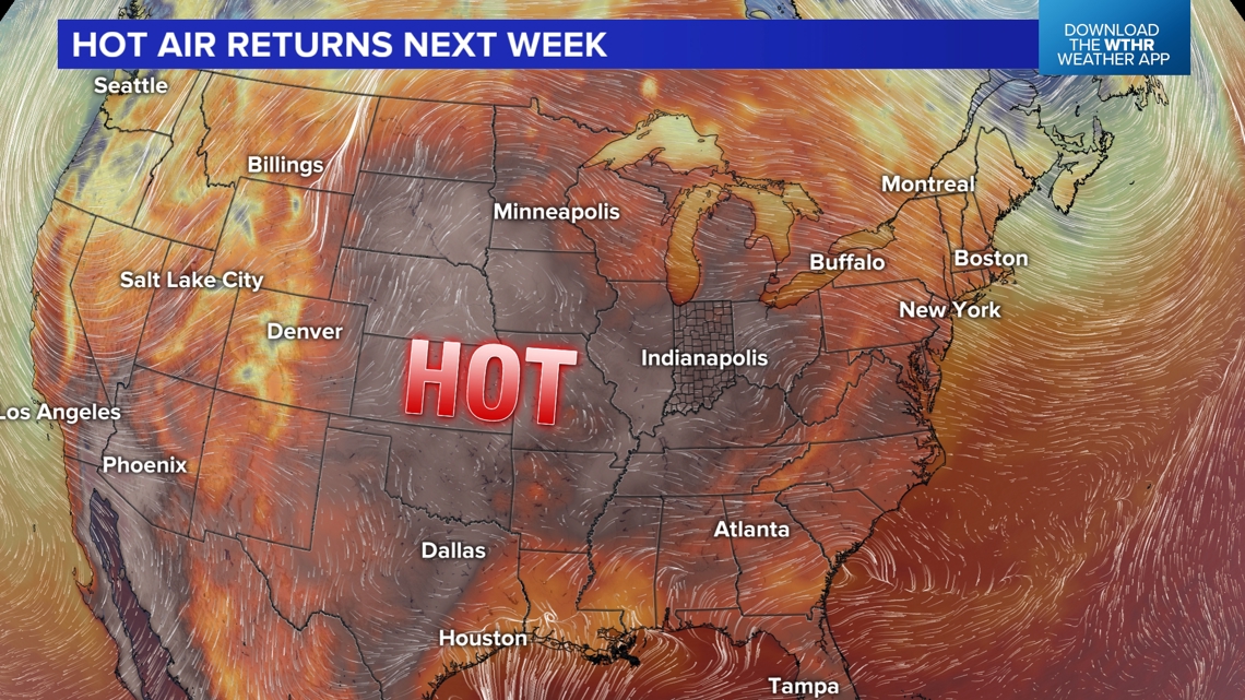
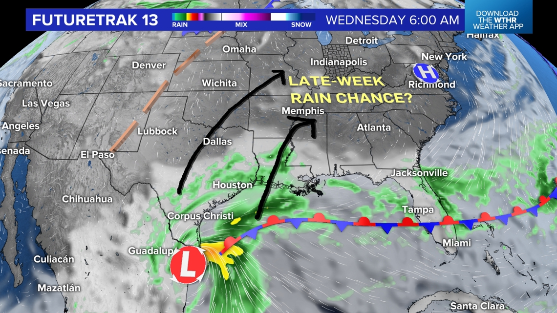
We're still on target for a quick warm-up next week that will send highs to near 80° Monday afternoon, mid-80s Tuesday, and near 90° at least Wednesday and Thursday. Something that will be interesting to follow will be the progression of a modeled disturbance in the western Gulf of Mexico.
Latest guidance today is trending the remnants of this system toward the Ohio Valley later next week. However, there will be very little upper-level steering currents to push this system around, so forecast confidence is very low that far out. We'll monitor and update as needed. With that said, remnant tropical rainfall is desperately needed here as drought conditions continue to worsen and they'll worse quickly this week due to full sun and hotter temperatures.